Fernweh: Home
ExploreGuideDestinationsMy tripsMy trip
de|en
All Places & RegionsRound tripsNight trains in EuropeAll highlightsAbout FernwehFAQPrivacy PolicyImprint
Download on the App StoreGet it on Google Play
ExploreGuideDestinationsMy tripsMy trip
    • Neighborhoods & highlights
    • Recommendations
    • Tours
    • Eat & drink
    • Culture
    • Getting around
    • Accommodation
    • Plan trip
    • Nearby
    Tai O

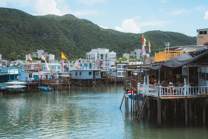
    Photo by Zonghao Feng on Pexels

    Hong Kong

    Tai O

    City

    Tai O is a fishing village on the west coast of Lantau, where the Tanka, fishing families traditionally living on and from the water, still reside in stilt houses built over the tidal channels.

    by Felix Gillen

    1. Home
    2. Destinations
    3. Hong Kong
    4. Lantau
    5. Tai O
    Tai O is a fishing village on the west coast of Lantau, where the Tanka, fishing families traditionally living on and from the water, still reside in stilt houses built over the tidal channels. These Pang Uk are connected by wooden walkways and bridges.In the village, stalls line up with dried fish and seafood; Tai O's characteristic shrimp paste dries in bamboo baskets. Temples from the 17th and 18th centuries, the old police station from 1902 (today a heritage hotel), and boat trips to the waters of the Chinese White Dolphins complete a half-day excursion, easily combinable with Ngong Ping.
    Hong Kong travel guideRound trips in Hong KongPlan a trip with Tai O

    Contents

    • Neighborhoods & highlights
    • Recommendations
    • Tours
    • Eat & drink
    • Culture
    • Getting around
    • Accommodation
    • Nearby

    Sights in Tai O

    Discover the most important sights and attractions

    Yeung Hau Temple

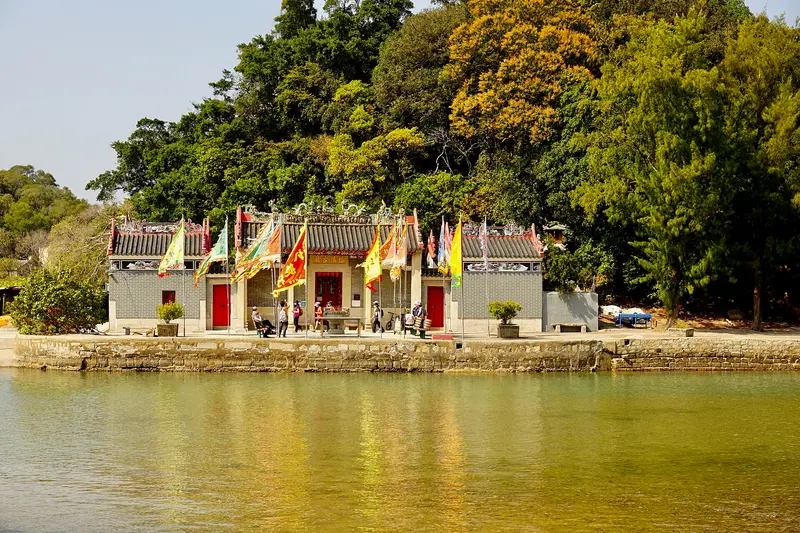
    方畢可 / Wikimedia Commons / CC0

    Place of Worship

    1Yeung Hau Temple

    One of Tai O's oldest temples, according to the Hong Kong Tourism Board, with furnishings dating back to 1699. It's located just outside the village center and accessible via a walk along the canals and stilt houses.
    Open in Google Maps
    Kwan Tai Temple

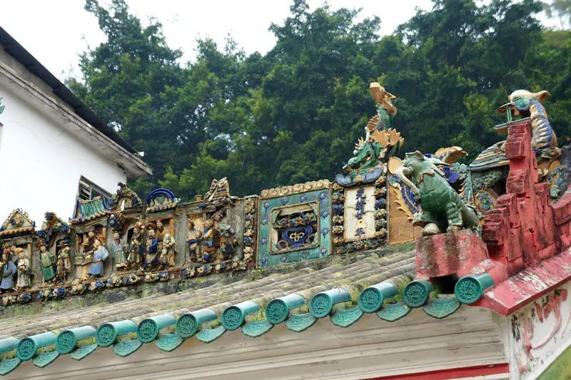
    “Kwan Tai Temple, detail of the ridge, Tai O (Hong Kong)” by Mk2010 / Wikimedia Commons / CC BY-SA 3.0, mod.

    Place of Worship

    2Kwan Tai Temple

    The temple for the War God Kwan Tai, according to Wikipedia, dates from 1741 and is located in the heart of the village on Kat Hing Back Street, just a few steps from the stilt houses. Together with the Yeung Hau, Hung Shing, and Tin Hau temples, it testifies to the fishing village's long history.
    Open in Google Maps
    Point of Interest

    3Tai O Heritage Hotel (former police station)

    Built in 1902 to deter pirates, the Tai O Police Station reopened in 2012 as a Heritage Hotel. According to the hotel, visitors can visit the grounds free of charge daily from 11 AM to 6 PM, including a small Heritage Interpretation Centre. Free guided tours of approximately 20 minutes through the watchtower and former inspectors' quarters take place daily in the afternoon and are booked via the hotel's website.
    Open in Google Maps

    Tours & experiences in Tai O

    Search tours for Tai O on GetYourGuide* (Affiliate link)On GetYourGuide, with reviews from other travellers

    * Affiliate link: if you book through it, we earn a small commission. The price stays the same for you.

    Restaurants in Tai O

    1

    Tai O Lookout

    Restaurant in a glass building at the Tai O Heritage Hotel with views over the South China Sea; Time Out highlights dishes featuring local shrimp paste. According to the hotel, it serves breakfast, lunch, afternoon tea, and dinner.
    Show on Google Maps

    Fishing Village Life

    The Tanka and Their Stilt HousesTai O is home to the Tanka, traditional boat people who live by fishing. Their houses, known as Pang Uk, stand on stilts over the tidal flats and are connected by wooden walkways and bridges. Even when the British arrived, Tai O was considered a Tanka village.Temples and HistoryAccording to Wikipedia, the Yeung Hau Temple dates from 1699, the Kwan Tai Temple from 1741, the Hung Shing Temple from 1746, and the Tin Hau Temple from 1772. The police station, built in 1902, served to combat pirates and is now a heritage hotel. Until 1996, a rope-drawn ferry connected the two banks; today, you cross the canal on a bridge.Salt, Shrimp Paste, and Dried FishIn the past, salt was also extracted in Tai O. Today, the townscape is characterized by stalls selling dried and salted fish and shrimp paste drying in the sun. Chinese White Dolphins, also known as “Pink Dolphins,” live in the waters off Tai O.

    Getting to and Around Tai O

    Bus and TaxiBus 11 from Tung Chung (MTR Tung Chung Line)Bus 21 from Ngong Ping, easily combined with the Tian Tan BuddhaBus 1 from Mui Wo (ferry from Central Pier 6)Only blue Lantau taxis operate on South Lantau Road.FerryFortune Ferry connects the piers near the bus terminal, among other places, with Tung Chung and Tuen Mun.In the VillageExplore Tai O on foot. The Tai Chung Bridge connects the two parts of the village, and from Fu Shan Viewing Point, you can look out over the village and the Pearl River Delta. By the water, boat operators offer short trips to the dolphin waters; sightings are not guaranteed.

    Accommodations in Tai O

    Find perfect stay in Tai O

    Booking.com* (Affiliate link)
    Search Hotels
    Agoda* (Affiliate link)
    Search Hotels
    Airbnb
    Vacation Rentals

    * Affiliate link: if you book through it, we earn a small commission. The price stays the same for you.

    Plan your trip to Tai O

    Save places, build a route and plan your city trip, all in one place.

    1. 1
      Sunrise over alpine peaks and a sea of clouds
      1234

      Round trip

      12 days · 4 stops

      Saved

      Pick a route

      Pick a ready-made one or save places and plan your own.

      Open bookmarks
    2. 2

      Trip to Tai O

      Live
      • 1Yeung Hau Temple3 days
      • 2Kwan Tai Temple4 days
      • 3Tai O Heritage Hotel (former police station)5 days
      Budget

      Plan your trip

      The planner sorts stops, days and budget. Plan together in real time.

      Start trip planning
    3. 3
      9:41 No signal
      Tai O
      Available offline

      Photo by Zonghao Feng on Pexels

      Use it on the road

      Download the guide to your phone and use it on site, even offline.

    Nearby

    Ngong Ping

    Ngong Ping

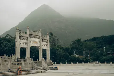
    Ngong Ping is a high plateau in western Lantau and the island's religious center. Here sits the Tian Tan Buddha, a 34-meter-tall bronze statue completed in 1993 and accessible via 268 steps. Opposite is the Po Lin Monastery, founded in 1906 by three monks from Jiangsu.Most visitors arrive via the Ngong Ping 360 cable car from Tung Chung; the journey takes around 25 minutes. At the top station is Ngong Ping Village with shops. Approximately 20 minutes' walk away stands the Wisdom Path, and hiking trails lead from the monastery to Lantau Peak.

    Christian Alder·Unsplash

    Lantau

    Lantau

    Lantau, at around 147 square kilometers, is Hong Kong's largest island, approximately twice the size of Hong Kong Island. Slightly more than half its area is covered by Country Parks, above which rises the 934-meter-high Lantau Peak, Hong Kong's second-highest summit.Most visitors come for the Tian Tan Buddha and Po Lin Monastery on the Ngong Ping plateau, which the Ngong Ping 360 cable car connects with Tung Chung. To the west lies the stilt village of Tai O, to the south the long sandy beach of Cheung Sha, and to the east the ferry port of Mui Wo. The airport on Chek Lap Kok off the north coast and the new town of Tung Chung simultaneously make Lantau the gateway to Hong Kong.

    Margarita K·Pexels

    Lamma Island

    Lamma Island

    Lamma is a car-free island southwest of Hong Kong Island, 30 ferry minutes from Central. The two main villages, Yung Shue Wan with small shops and eateries, and Sok Kwu Wan with its waterside seafood restaurants, are connected by the Family Trail, along which beaches like Hung Shing Yeh lie.

    Starcopter·CC BY-SA 4.0

    Victoria Peak

    Victoria Peak

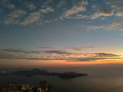
    At 552 meters, Victoria Peak, or The Peak, is Hong Kong Island's highest point. Since 1888, the Peak Tram has ascended from Central; at the top, Sky Terrace 428 on the Peak Tower and a circular path around the summit area offer views over Central, Victoria Harbour, and Kowloon.

    HONG SON·Pexels

    Sheung Wan

    Sheung Wan

    Sheung Wan, adjoining Central to the west, is one of the city's historic districts: The British landed on Possession Street in 1841, the Man Mo Temple stands on Hollywood Road, and around Des Voeux Road West, shops trade in dried seafood. In between are galleries, antique shops, and small lanes like Cat Street.

    Kamus Cheung·Pexels

    Your next steps

    Tai O is in Hong Kong. Ways to carry on from here.

    • More in Hong Kong

      Highlights, areas, routes and the best time to travel for all of Hong Kong.

      Hong Kong travel guide
    • Round trips in Hong Kong

      Ready-made routes through Hong Kong, with stops, nights and a map.

      See the routes

    Sources & method

    • Photos: Wikimedia Commons, Pexels. Each photo carries its credit.
    • Place data such as addresses and ratings comes from Google Maps.
    • The content is based on web research from public, traceable sources. How the content is made · The role of AI