Fernweh: Home
ExploreGuideDestinationsMy tripsMy trip
de|en
All Places & RegionsRound tripsNight trains in EuropeAll highlightsAbout FernwehFAQPrivacy PolicyImprint
Download on the App StoreGet it on Google Play
ExploreGuideDestinationsMy tripsMy trip
    • Tours
    • Eat & drink
    • Getting around
    • Accommodation
    • Nearby
    Vall del Madriu-Perafita-Claror

    Austral Lights / Wikimedia Commons / CC BY-SA 4.0, mod.

    Andorra

    Vall del Madriu-Perafita-Claror

    Point of Interest

    The Vall del Madriu-Perafita-Claror in southeastern Andorra is a glacial valley with high pastures, rugged cliffs, and forested slopes.

    by Felix Gillen

    1. Home
    2. Destinations
    3. Andorra
    4. Vall del Madriu-Perafita-Claror
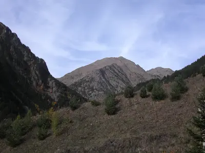
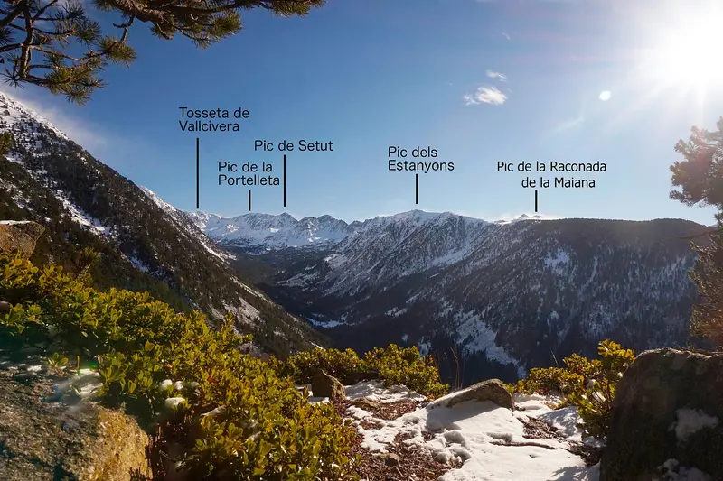
    The Vall del Madriu-Perafita-Claror in southeastern Andorra is a glacial valley with high pastures, rugged cliffs, and forested slopes. Covering 4,247 hectares, it encompasses about nine percent of the country's land area and has been a UNESCO World Heritage site since 2004. In summer, herds graze here, and shepherds use stone huts with grass roofs.The valley is only accessible on foot; there is no road. A popular starting point is the road to Engolasters near Escaldes-Engordany. The Coronallacs circular route connects four huts over approximately 90 kilometers in about five days; in total, there are five huts in the valley. For tours above 1,700 meters, late June to late September is recommended, with guided tours available from May to October.
    Andorra travel guidePlan a trip with Vall del Madriu-Perafita-Claror

    Contents

    • Tours
    • Eat & drink
    • Getting around
    • Accommodation
    • Nearby

    Tours & experiences in Vall del Madriu-Perafita-Claror

    Search tours for Vall del Madriu-Perafita-Claror on GetYourGuide* (Affiliate link)On GetYourGuide, with reviews from other travellers

    * Affiliate link: if you book through it, we earn a small commission. The price stays the same for you.

    Restaurants in Vall del Madriu-Perafita-Claror

    Getting There & Trails

    AccessThe valley is only accessible on foot. The classic starting point is in Escaldes-Engordany on the road to La Comella and La Plana, about 30 meters behind the turn-off to Engolasters (signposted). From there, an old paved path leads into the valley.The Valley HikeThe path leads past the Bordes d'Entremesaigües and Bordes de Ràmio to Fontverd hut, and further to Riu dels Orris hut until Estany de la Bova.The entire route is 13.6 kilometers long, has an elevation gain of around 1,180 meters, and is considered difficult; allow 3 to 6 hours. It will be shorter if you turn back after Bordes de Ràmio or Fontverd.Above 1,700 meters, the period from late June to late September is most favorable.

    Accommodations in Vall del Madriu-Perafita-Claror

    Find perfect stay in Vall del Madriu-Perafita-Claror

    Booking.com* (Affiliate link)
    Search Hotels
    Agoda* (Affiliate link)
    Search Hotels
    Airbnb
    Vacation Rentals

    * Affiliate link: if you book through it, we earn a small commission. The price stays the same for you.

    Campgrounds in Vall del Madriu-Perafita-Claror

    Find perfect campground in Vall del Madriu-Perafita-Claror

    Search via Google Maps
    Campgrounds nearby (15km)
    Camping.info
    Find Campgrounds
    Park4Night
    RV Parks & Camping

    Nearby

    Encamp

    Encamp

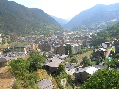
    Encamp is located on the CG-2, about a ten-minute drive above Andorra la Vella, and is the gateway to the Grandvalira ski resort: The Funicamp takes you from the village up to Solanelles in about 15 minutes. In the village, the Museu Nacional de l'Automòbil displays vehicles from the late 19th century onwards. High above the valley lies the Romanesque complex of Les Bons with the church of Sant Romà, consecrated in 1164.Pas de la Casa, on the French border, also belongs to the parish of Encamp.

    Joanjoc·public domain

    Andorra la Vella and Escaldes-Engordany

    Andorra la Vella and Escaldes-Engordany

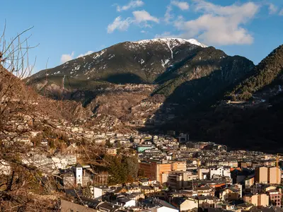
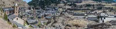
    Andorra la Vella is the capital of the principality and is located at 1,023 meters, higher than any other capital in Europe. Together with the neighboring town of Escaldes-Engordany, it has grown into a continuous urban area in the valley, a hub for shops, hotels, and restaurants.In the old town core stands the Casa de la Vall, a fortified manor from 1580, serving as the parliament's seat, the Consell General, until 2011. In Escaldes-Engordany, the glass spire of the Caldea thermal spa, 80 meters high, is Andorra's tallest building. From here, hikes can also begin into the UNESCO Madriu-Perafita-Claror Valley.

    Ermell·CC BY-SA 4.0

    La Massana with Arinsal and Pal

    La Massana with Arinsal and Pal

    The parish of La Massana includes, in addition to the main town, the villages of Arinsal, Pal, and Sispony. Here lies the Valls del Comapedrosa Natural Park with the Pic del Comapedrosa, at 2,942 meters the highest mountain in Andorra; in winter, you can ski in the Pal Arinsal ski resort, which has been part of Grandvalira Resorts since the 2022/23 season.Culturally, highlights include the Romanesque church of Sant Climent in the village of Pal, the Casa Rull Museum in Sispony about rural life in old Andorra, and the Farga Rossell forge from the mid-19th century.

    Jlmoncada·public domain

    Ordino

    Ordino

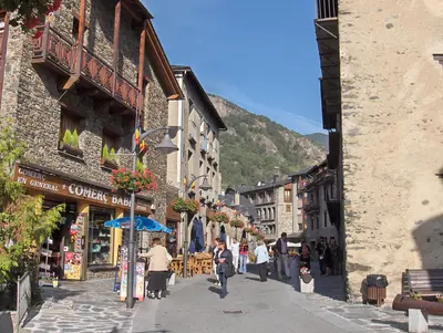
    Ordino is located in the north of Andorra and is quieter and more rural than the capital. In the village center stands the Casa d'Areny-Plandolit, Andorra's only fully preserved manor house, now a museum about the influential Areny-Plandolit family; right next to it is the National Auditorium.Further up the valley begin the Vall de Sorteny Nature Park with its species-rich mountain flora and the Ordino Arcalís ski resort, where in summer the circular trail to the three Estanys de Tristaina starts. From Ordino, the road also leads over the Coll d'Ordino to Canillo, along which is the Roc del Quer viewpoint.

    Matthew Ross·public domain

    Canillo

    Canillo

    Canillo is located in the east of Andorra on the main road towards France. The town is one of the access points to the Grandvalira ski area, which spans over 200 kilometers of slopes between Soldeu, El Tarter, Canillo, Grau Roig, Pas de la Casa, and Encamp, and is Andorra's largest ski area. The slopes are located between approximately 1,700 and 2,640 meters.At the edge of the town stands the Romanesque church of Sant Joan de Caselles, dating from the 11th to 12th century. The Roc del Quer viewing platform juts out over the valley, with a via ferrata running below it. In summer, Canillo is a starting point for hikes.

    Krzysztof Golik·CC BY-SA 4.0

    Your next steps

    Vall del Madriu-Perafita-Claror is in Andorra. Ways to carry on from here.

    • More in Andorra

      Highlights, areas, routes and the best time to travel for all of Andorra.

      Andorra travel guide
    • Plan a trip with Vall del Madriu-Perafita-Claror

      The Guide asks about season, length and who is coming, and suggests a trip with Vall del Madriu-Perafita-Claror.

      Plan the trip

    Sources & method

    • Photos: Wikimedia Commons. Each photo carries its credit.
    • The content is based on web research from public, traceable sources. How the content is made · The role of AI