Fernweh: Home
ExploreGuideDestinationsMy tripsMy trip
de|en
All Places & RegionsRound tripsNight trains in EuropeAll highlightsAbout FernwehFAQPrivacy PolicyImprint
Download on the App StoreGet it on Google Play
ExploreGuideDestinationsMy tripsMy trip
    • Tours
    • Eat & drink
    • Getting around
    • Accommodation
    • Nearby
    Sary-Chelek

    Kondephy / Wikimedia Commons / CC BY-SA 4.0, mod.

    Kyrgyzstan

    Sary-Chelek

    Point of Interest

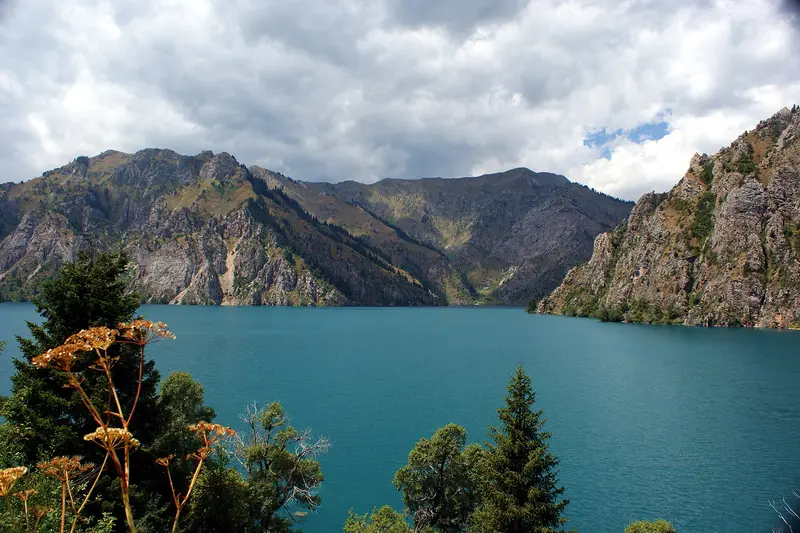
    The Sary-Tschelek is a mountain lake up to 234 m deep, located at around 1,870 m in western Kyrgyzstan. It is approximately 7.5 km long and the heart of a nature reserve founded in 1959, which has been a UNESCO Biosphere Reserve since 1978.

    by Felix Gillen

    1. Home
    2. Destinations
    3. Kyrgyzstan
    4. Kyrgyz South
    5. Sary-Chelek
    The Sary-Tschelek is a mountain lake up to 234 m deep, located at around 1,870 m in western Kyrgyzstan. It is approximately 7.5 km long and the heart of a nature reserve founded in 1959, which has been a UNESCO Biosphere Reserve since 1978. You can reach it from the village of Arkyt; no border zone permit is needed.
    Kyrgyzstan travel guideRound trips in KyrgyzstanPlan a trip with Sary-Chelek

    Contents

    • Tours
    • Eat & drink
    • Getting around
    • Accommodation
    • Nearby

    Tours & experiences in Sary-Chelek

    Search tours for Sary-Chelek on GetYourGuide* (Affiliate link)On GetYourGuide, with reviews from other travellers

    * Affiliate link: if you book through it, we earn a small commission. The price stays the same for you.

    Restaurants in Sary-Chelek

    Getting There & How-To

    The administration and the reserve gate are located in the village of Arkyt. From Dschalal-Abad, you drive 4 to 6 hours via Kerben and Tasch-Kümür; Marschrutkas operate approximately from June to September.From the gate, a roughly 17 km track leads to the lake; about four hours on foot.At the gate, you pay an entrance fee; information for foreigners varies by source, expect about 400 Som per person, and an additional fee for a car.Season is roughly May to October.

    Accommodations in Sary-Chelek

    Find perfect stay in Sary-Chelek

    Booking.com* (Affiliate link)
    Search Hotels
    Agoda* (Affiliate link)
    Search Hotels
    Airbnb
    Vacation Rentals

    * Affiliate link: if you book through it, we earn a small commission. The price stays the same for you.

    Nearby

    Arslanbob

    Arslanbob

    Arslanbob is a village at around 1,600 m in the mountains north of Dschalal-Abad, surrounded by an approximately 11,000 ha walnut forest, considered one of the largest in the world. From the CBT homestays, you hike to two waterfalls and through the forest; during the walnut harvest from late September to early October, half the village is in the forest.

    User:Kondephy·CC BY-SA 4.0

    Kyrgyz South

    Kyrgyz South

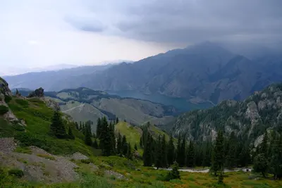
    The south on the edge of the Fergana Valley is warmer and shaped by the plov of its bazaars. Osh, the country's second city, wraps around the sacred mountain Sulaiman-Too, the only World Heritage Site lying entirely within Kyrgyzstan. In the mountains to the north lie the walnut forests of Arslanbob and the mountain lake Sary-Chelek, to the southeast the Alai Valley below Peak Lenin (7,134 m).The UK FCDO advises caution near the border with Tajikistan and warns of possible mines and unexploded ordnance in the border areas of Batken region; only use official crossing points.

    Ver vaeck·Pexels

    Osh

    Osh is Kyrgyzstan's second-largest city and the hub of the south in the Fergana Valley. In the middle of town rises the sacred mountain Sulaiman-Too, a UNESCO World Heritage Site since 2009, with pilgrim paths, rock carvings and a cave museum; UNESCO puts the city's age at more than 3,000 years.Osh lies close to the border with Uzbekistan. For current safety advice on the border areas, see the FCDO travel advice for Kyrgyzstan on gov.uk.
    Ala-Archa National Park

    Ala-Archa National Park

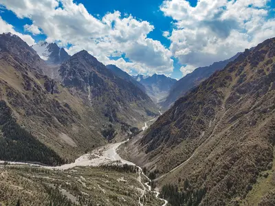
    The Ala-Artscha National Park is the high mountain valley at the gates of Bishkek, about 35 km south of the city and protected since 1976. From the Alplager at around 2,100 m, paths lead to the Ak-Sai Waterfall and to the Ratsek Hut below the Ak-Sai Glacier; above it all stands Pik Semjonow-Tjan-Schanski, the highest peak in the park.

    Nikolai Bulykin·CC BY-SA 4.0

    Bishkek

    Bishkek

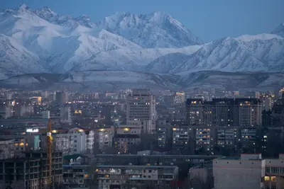
    Bishkek is the capital of Kyrgyzstan and, with around 1.36 million inhabitants, its largest city. The city center, with Ala-Too Square, parks, grand Soviet buildings, and the Osh Bazaar, is laid out in a grid pattern and easily explored on foot; to the south, the peaks of the Kyrgyz Ala-Too Mountains rise.The Pishpek fortress, built in 1825 by the Khanate of Kokand, became a Russian settlement in 1868; from 1926 to 1991, the city was called Frunze.

    Arseniy Kotov·Pexels

    Your next steps

    Sary-Chelek is in Kyrgyzstan. Ways to carry on from here.

    • More in Kyrgyzstan

      Highlights, areas, routes and the best time to travel for all of Kyrgyzstan.

      Kyrgyzstan travel guide
    • Round trips in Kyrgyzstan

      Ready-made routes through Kyrgyzstan, with stops, nights and a map.

      See the routes
    • Plan a trip with Sary-Chelek

      The Guide asks about season, length and who is coming, and suggests a trip with Sary-Chelek.

      Plan the trip

    Sources & method

    • Photos: Wikimedia Commons. Each photo carries its credit.
    • The content is based on web research from public, traceable sources. How the content is made · The role of AI