Fernweh: Home
ExploreGuideDestinationsMy tripsMy trip
de|en
All Places & RegionsRound tripsNight trains in EuropeAll highlightsAbout FernwehFAQPrivacy PolicyImprint
Download on the App StoreGet it on Google Play
ExploreGuideDestinationsMy tripsMy trip
    • Places in the region
    • Culture
    • Getting around
    • Nearby
    Kalinago Territory

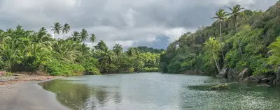
    “Carib Territory (Dominica)” by Hans Hillewaert / Wikimedia Commons / CC BY-SA 3.0, mod.

    Dominica

    Kalinago Territory

    Region

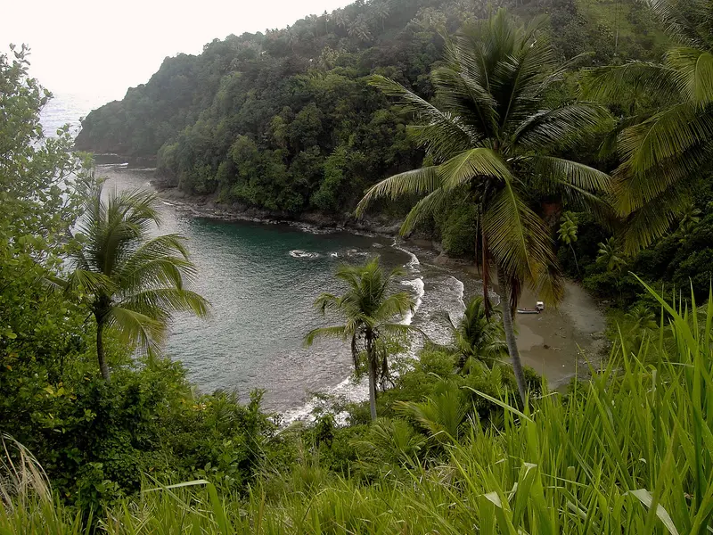
    On the Atlantic coast in northeastern Dominica lies the Kalinago Territory, some 3,700 acres of land allocated to the descendants of the indigenous people in 1903.

    by Felix Gillen

    1. Home
    2. Destinations
    3. Dominica
    4. Kalinago Territory
    On the Atlantic coast in northeastern Dominica lies the Kalinago Territory, some 3,700 acres of land allocated to the descendants of the indigenous people in 1903. In the cultural village Kalinago Barana Autê in Salybia, Kalinago daily show dance and theatre, medicinal plants, handicrafts, and the building of Gommier canoes; the Crayfish River falls here into the sea as Isulukati Falls.
    Dominica travel guideRound trips in DominicaPlan a trip with Kalinago Territory

    Contents

    • Places in the region
    • Culture
    • Getting around
    • Nearby

    Sights in Kalinago Territory

    Discover the most important sights and attractions

    Attraction

    Kalinago Barana Autê

    The Kalinago Cultural Village in Salybia presents the life of the Kalinago: daily dance and theatre in the Karbet, a herb garden, handicrafts, and the building of traditional Gommier canoes. The Crayfish River plunges into the sea here as Isulukati Falls. Inquire about admission and opening hours beforehand.
    Open in Google Maps

    The Kalinago Culture

    HistoryThe Kalinago inhabited the island, which they called Waitukubuli, long before the arrival of Europeans. In 1903, British Administrator Hesketh Bell set aside approximately 3,700 acres on the east coast for them, today's Kalinago Territory.Kalinago Barana AutêThe cultural village in Salybia features daily dance and theatre performances in the Karbet, along with an herb garden, handicrafts, and the building of Gommier canoes. In September, the Territory celebrates Kalinago Week.

    Getting Here & Tips

    DirectionsThe territory lies on the Atlantic coast in the island's northeast. For the cultural village's admission and opening hours, it's best to inquire ahead, as official details are not yet published.RespectThe territory is inhabited community land; ask for permission before photographing people.

    Nearby

    Calibishie and Northeast Coast

    Calibishie and Northeast Coast

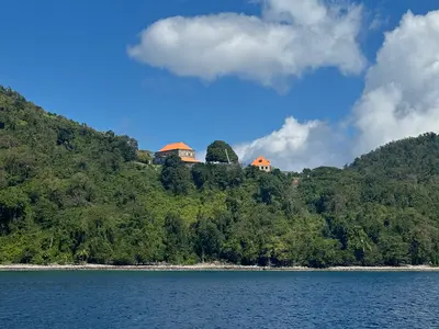
    Around the village of Calibishie on the northeast coast are the wide sandy Batibou Beach, Hampstead Beach, and the Red Rocks, rust-red, iron-rich volcanic rock along the coast. Douglas-Charles Airport is about a 20-minute drive away.

    Tournasol7·CC BY 4.0

    Morne Diablotin National Park

    Established in 2000, the Morne-Diablotin National Park protects the rainforest around Morne Diablotin, Dominica's highest peak at 1,447 meters. It's home to the island's two parrot species: the highly endangered Sisserou (national bird) and the Jaco.On the short Syndicate Nature Trail, you have a good chance of spotting the parrots; while the ascent to the summit is a long, guided tour.
    Morne Trois Pitons National Park

    Morne Trois Pitons National Park

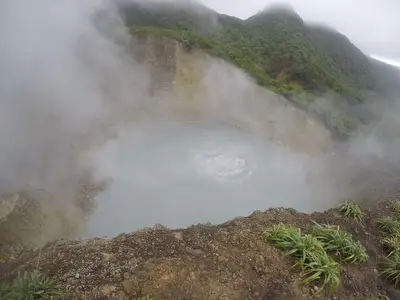
    The Morne Trois Pitons National Park in southern Dominica, a UNESCO World Heritage site since 1997, encompasses montane rainforest, fumaroles, crater lakes, and waterfalls surrounding the 1,342-meter-high Morne Trois Pitons. Its most famous destination is the Boiling Lake, a flooded fumarole whose water is 82 to 92 degrees hot at its edge, accessible via a challenging full-day hike through the Valley of Desolation.Easier to reach are the twin Trafalgar Falls with their warm springs, the Emerald Pool, and the Titou Gorge, through which you swim to a waterfall.

    Bayukjdr·CC BY-SA 4.0

    Portsmouth and Cabrits

    Portsmouth and Cabrits

    Portsmouth in northwest Dominica is the starting point for a rowboat trip on the Indian River through mangroves and for Cabrits National Park on the peninsula north of the town, where the British built Fort Shirley between 1770 and 1815.The Waitukubuli National Trail ends at Cabrits; the Morne Diablotin National Park with the Syndicate Nature Trail lies inland.

    CareAhLine·CC0

    Roseau

    Roseau

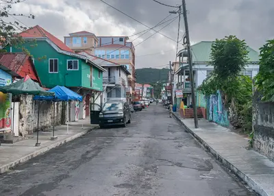
    Roseau, Dominica's small capital on the southwest coast, is easily explored on foot. Its Old Town, featuring 18th-century French-influenced architecture, stands on the site of the Kalinago village Sairi. Highlights include the Old Market Square, once a slave market and now a craft market, and the Botanical Garden, home to a Baobab tree that has rested on a school bus since Hurricane David in 1979.From the ferry terminal, boats depart for Guadeloupe, Martinique, and St. Lucia; the Trafalgar Falls are about a 20-minute drive away, and the starting point for the Boiling Lake is approximately 40 minutes away.

    Tournasol7·CC BY 4.0

    Your next steps

    Kalinago Territory is in Dominica. Ways to carry on from here.

    • More in Dominica

      Highlights, areas, routes and the best time to travel for all of Dominica.

      Dominica travel guide
    • Round trips in Dominica

      Ready-made routes through Dominica, with stops, nights and a map.

      See the routes
    • Plan a trip with Kalinago Territory

      The Guide asks about season, length and who is coming, and suggests a trip with Kalinago Territory.

      Plan the trip

    Sources & method

    • Photos: Wikimedia Commons. Each photo carries its credit.
    • Place data such as addresses and ratings comes from Google Maps.
    • The content is based on web research from public, traceable sources. How the content is made · The role of AI