Fernweh: Home
ExploreGuideDestinationsMy tripsMy trip
de|en
All Places & RegionsRound tripsNight trains in EuropeAll highlightsAbout FernwehFAQPrivacy PolicyImprint
Download on the App StoreGet it on Google Play
ExploreGuideDestinationsMy tripsMy trip
    • Neighborhoods & highlights
    • Eat & drink
    • Accommodation
    • Plan trip
    • Nearby
    Otrobanda

    Martin Falbisoner / Wikimedia Commons / CC BY-SA 4.0, mod.

    Curaçao

    Otrobanda

    CityUNESCOCulture

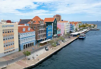
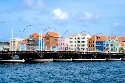
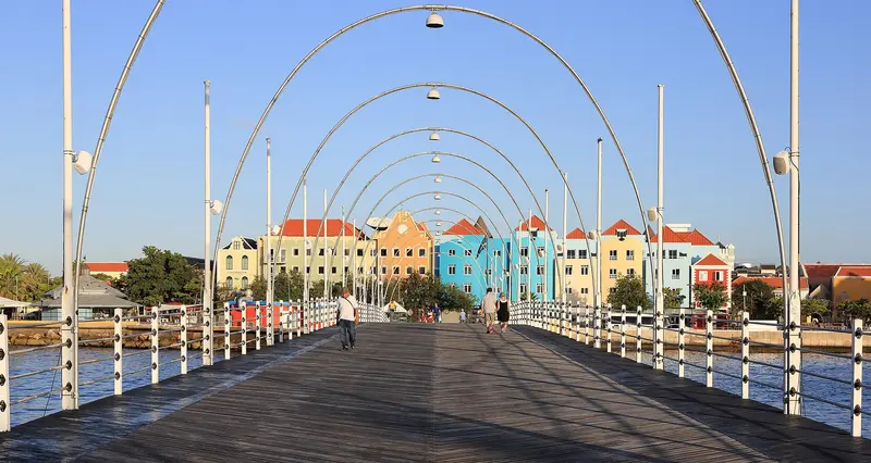
    Otrobanda, 'the other side,' lies west of Sint Anna Bay and originated in the 18th century. You can reach this district on foot from Punda via the floating Queen Emma Bridge.

    by Felix Gillen

    1. Home
    2. Destinations
    3. Curaçao
    4. Willemstad
    5. Otrobanda
    Otrobanda, 'the other side,' lies west of Sint Anna Bay and originated in the 18th century. You can reach this district on foot from Punda via the floating Queen Emma Bridge.On the waterfront stands Rif Fort, dating from the late 1820s, now part of a shopping district. At Rif, a monument commemorates Tula, leader of the 1795 slave revolt, who was executed here; and in buildings of a former slave trading post, the Museum Kura Hulanda, founded in 1999, displays over 5,000 objects.
    Curaçao travel guideRound trips in CuraçaoPlan a trip with Otrobanda

    Contents

    • Neighborhoods & highlights
    • Eat & drink
    • Accommodation
    • Nearby

    Sights in Otrobanda

    Discover the most important sights and attractions

    Rif Fort and Tula Memorial

    DDJJ / Wikimedia Commons / CC BY-SA 4.0, mod.

    1Rif Fort and Tula Memorial

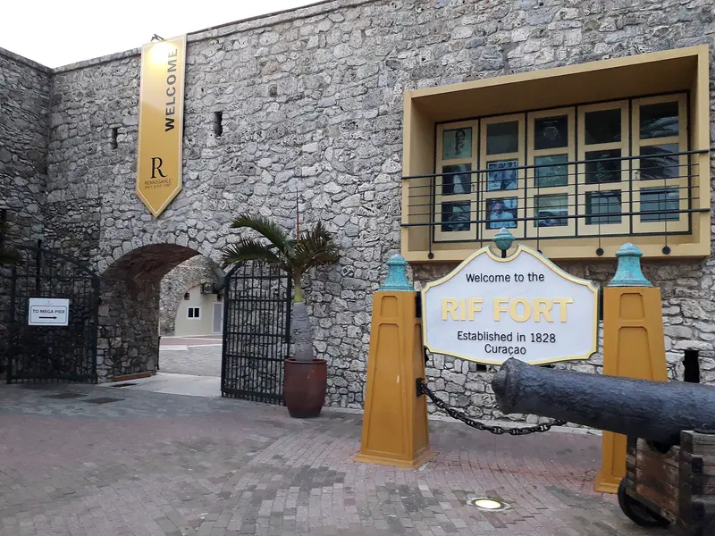
    The Rif Fort, at the harbor entrance on the Otrobanda side, dates back to the late 1820s according to UNESCO and is now part of a shopping district. At Rif, Tula, the leader of the 1795 slave revolt, was executed on October 3, 1795; a monument commemorates him there today.

    Open in Google Maps
    Museum

    2Museum Kura Hulanda

    The museum, founded in 1999 by Jacob Gelt Dekker in Otrobanda at a former slave trading post, displays over 5,000 objects on the history of the slave trade and African cultures. According to its website, it is open Mon-Sat 8 AM to 4 PM, Sun 9 AM to 2 PM; you should check in advance if operations will be regular in 2026.
    Open in Google Maps

    Restaurants in Otrobanda

    1

    Grand Café Gouverneur de Rouville

    Restaurant in a 19th-century mansion in Otrobanda, according to Fodor's with a view over the harbor.
    Show on Google Maps

    Accommodations in Otrobanda

    Find perfect stay in Otrobanda

    Booking.com* (Affiliate link)
    Search Hotels
    Agoda* (Affiliate link)
    Search Hotels
    Airbnb
    Vacation Rentals

    * Affiliate link: if you book through it, we earn a small commission. The price stays the same for you.

    Plan your trip to Otrobanda

    Save places, build a route and plan your city trip, all in one place.

    1. 1
      Sunrise over alpine peaks and a sea of clouds
      1234

      Round trip

      12 days · 4 stops

      Saved

      Pick a route

      Pick a ready-made one or save places and plan your own.

      Open bookmarks
    2. 2

      Trip to Otrobanda

      Live
      • 1Rif Fort and Tula Memorial3 days
      • 2Museum Kura Hulanda4 days
      Budget

      Plan your trip

      The planner sorts stops, days and budget. Plan together in real time.

      Start trip planning
    3. 3
      9:41 No signal
      Otrobanda
      Available offline

      Martin Falbisoner / Wikimedia Commons / CC BY-SA 4.0, mod.

      Use it on the road

      Download the guide to your phone and use it on site, even offline.

    Nearby

    Willemstad

    Willemstad

    Willemstad, the capital of Curaçao, has been on UNESCO's World Heritage List since 1997 as the "Historic Area of Willemstad, Inner City and Harbour." The Sint Anna Bay divides the city into Punda, the oldest district from the 17th century, and Otrobanda on the other side; additionally, Pietermaai and Scharloo from the 18th century.According to UNESCO, the colorful facades stem from an 1817 ban on white lime plaster facades. The two banks are connected by the floating Queen Emma Bridge from 1888 for pedestrians and the high Juliana Bridge from 1974 for cars.

    Bent Van Aeken·Unsplash

    Punda

    Punda

    Punda is Willemstad's oldest district, founded in the 17th century on the east side of the Sint Anna Bay. Colorful merchant houses line the Handelskade, while Breedestraat and Heerenstraat are the main shopping streets.Fort Amsterdam, whose construction began in 1636, now houses the Governor's Palace and the Fort Church Museum. A few alleys away stands the Mikvé Israel-Emanuel Synagogue from 1732. Along the waterfront are the Plasa Bieu Market Hall and the fruit boats from Venezuela.

    Aron Marinelli·Unsplash

    Banda Abou and Westpunt

    Banda Abou and Westpunt

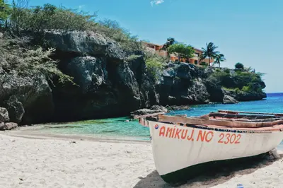
    Banda Abou is the name for Curaçao's rural west, stretching to the northwest tip at Westpunt. Here lie the island's small bathing coves, including Grote Knip, Kleine Knip, Playa Lagun, and Cas Abao, many with excellent snorkeling reefs directly from the beach.Inland rise the hills of Christoffelpark with the island's highest mountain, and on the north coast, the surf crashes into the coves of Shete Boka National Park. At Playa Piskadó, sea turtles come close to the shore in the mornings.

    Bas van der Linden·Unsplash

    Christoffel Park

    Christoffel Park

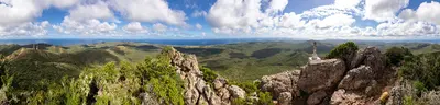
    Christoffelpark, located in the west of the island, is managed by the nature conservation organization CARMABI. The highlight is the ascent of Christoffelberg, which, at 372 m, is Curaçao's highest point (according to the Statistical Office; Fodor's cites 1,239 feet, approx. 378 m).Due to the heat, the ascent begins at 6 AM, with the last start at 10 AM; Fodor's states it takes about two hours. The park is open daily from 6 AM to 3 PM, and the ticket office closes at 1:30 PM. Admission (incl. museum) costs 15 US dollars for adults, 2 US dollars for children 6-12, and is free for under 6s.

    Aaaatu·CC BY-SA 4.0

    Little Curaçao

    Little Curaçao

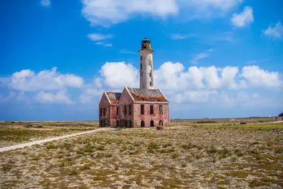
    The uninhabited island of Klein Curaçao lies, according to Lonely Planet, about 24 km off the southeast coast and is only accessible by excursion boats. The open-sea crossing is often rough, Lonely Planet states.

    Timon Cornelissen·Pexels

    Your next steps

    Otrobanda is in Curaçao. Ways to carry on from here.

    • More in Curaçao

      Highlights, areas, routes and the best time to travel for all of Curaçao.

      Curaçao travel guide
    • Round trips in Curaçao

      Ready-made routes through Curaçao, with stops, nights and a map.

      See the routes

    Sources & method

    • Photos: Wikimedia Commons. Each photo carries its credit.
    • Place data such as addresses and ratings comes from Google Maps.
    • The content is based on web research from public, traceable sources. How the content is made · The role of AI