Fernweh: Home
ExploreGuideDestinationsMy tripsMy trip
de|en
All Places & RegionsRound tripsNight trains in EuropeAll highlightsAbout FernwehFAQPrivacy PolicyImprint
Download on the App StoreGet it on Google Play
ExploreGuideDestinationsMy tripsMy trip
    • Neighborhoods & highlights
    • Recommendations
    • Tours
    • Eat & drink
    • Culture
    • Getting around
    • Accommodation
    • Plan trip
    • Round trips
    • Nearby
    Saariselkä

    Photo by fra.fb on Pexels

    Finland

    Saariselkä

    City

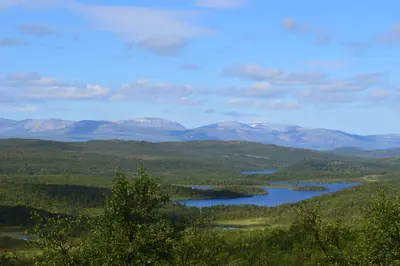
    The outdoor village in Nordlappland is nestled among open fells, forests, and the Urho-Kekkonen National Park, which starts right at its edge.

    by Felix Gillen

    1. Home
    2. Destinations
    3. Finland
    4. Lapland
    5. Saariselkä
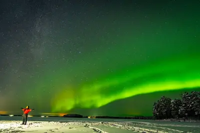
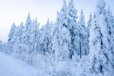
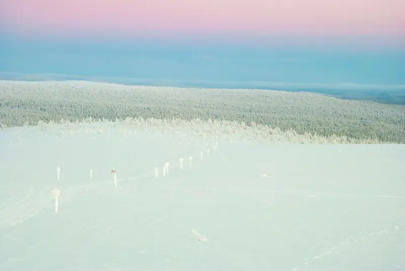
    The outdoor village in Nordlappland is nestled among open fells, forests, and the Urho-Kekkonen National Park, which starts right at its edge. In winter, Lapland North highlights around 200 kilometers of groomed cross-country trails, Finland's northernmost ski resort, and the country's longest toboggan run at Kaunispää, plus husky and reindeer safaris and the Northern Lights. In summer and during Ruska, you can hike to huts and peaks like Kiilopää. Ivalo Airport is nearby.
    Finland travel guideSee the round tripPlan a trip with Saariselkä

    Contents

    • Neighborhoods & highlights
    • Recommendations
    • Tours
    • Eat & drink
    • Culture
    • Getting around
    • Accommodation
    • Round trips
    • Nearby

    Sights in Saariselkä

    Discover the most important sights and attractions

    Urho Kekkonen National Park

    Markus Säynevirta / Wikimedia Commons / CC BY-SA 4.0, mod.

    1Urho Kekkonen National Park

    Founded in 1983, the national park starts at the village edge and reaches the Russian border: old pine, spruce, and birch forests, bare fells, aapa mires, and clear streams. It has the densest network of wilderness huts, day huts, and marked routes in Finland; starting points are Saariselkä, Kiilopää, Kakslauttanen, and Laanila, where the map marking lies. The Russian border area cannot be entered without Foreign Office permission.
    Open in Google Maps
    Kaunispää

    “Kaunispaa Inari Finland” by Argus fin / Wikimedia Commons / CC BY-SA 3.0, mod.

    2Kaunispää

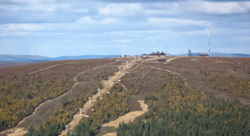
    The Fjell just north of the village is accessible on foot, by car, or by ski lift and offers expansive views over the National Park. Here lies Finland's longest toboggan run, especially popular around Laskiainen (Shrove Tuesday). At the summit, there is a panoramic restaurant.
    Open in Google Maps
    Kiilopää

    Antti Leppänen / Wikimedia Commons / CC BY 4.0, mod.

    3Kiilopää

    One of the region's highest peaks, south of Saariselkä on the edge of the national park. Year-round marked trails lead up and reward with panoramic views over the Fjells; at its foot, day trips and multi-day trekking routes into the park begin.
    Open in Google Maps
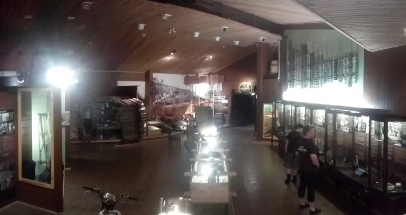
    Gold Museum Tankavaara

    Usm / Wikimedia Commons / CC BY-SA 4.0, mod.

    Museum

    4Gold Museum Tankavaara

    The museum in Tankavaara, south of Saariselkä, tells the story of gold panning in Lapland. It complements the Gold Route around Laanila and the historic Kultala gold digger station, and is a year-round destination, even in bad weather.
    Open in Google Maps

    Tours & experiences in Saariselkä

    Search tours for Saariselkä on GetYourGuide* (Affiliate link)On GetYourGuide, with reviews from other travellers

    * Affiliate link: if you book through it, we earn a small commission. The price stays the same for you.

    Restaurants in Saariselkä

    1

    Laanilan Kievari

    The guesthouse in Laanila, once a stop for gold prospectors, cooks with local Lappish ingredients, according to Lapland North, blending French and Karelian influences, plus an extensive wine list. A fireplace and rag rugs in the historic building create atmosphere; adjacent offers a sauna, outdoor hot tub, and ice swimming.
    Show on Google Maps
    2

    Kaunispää's Summit

    The Panorama Restaurant on the summit of Kaunispää serves local dishes with one of the widest views in Finnish Lapland. It also features a café and souvenir shop. Reachable on foot, by car, or via ski lift.
    Show on Google Maps
    3

    Kieppi Kitchen & Bar

    A modern, relaxed eatery right in the village on Raitopolku. Lapland North notes it offers Lappish cuisine with local ingredients, alongside steaks, pasta, burgers, and pan pizza; lunch served daily, à la carte in the evenings. Great for families and après-ski.
    Show on Google Maps

    Wilds, Gold, Northern Lights

    Urho-Kekkonen National ParkThe park was founded in 1983 and stretches from Saariselkä eastward to the Russian border. To the north lies untouched wilderness with fells over 500 meters, deep valleys, and clear rivers; the park boasts Finland's densest network of wilderness huts, day huts, and marked routes. Lonely Planet rates it among the best areas for wildlife viewing; with luck, you might spot elk, reindeer, willow ptarmigan, arctic foxes, or golden eagles. Important: According to the Foreign Office, the border area with Russia may not be entered without official permission.Gold Prospecting HistoryAround Laanila and at the historical gold prospecting station Kultala, a Gold Route commemorates the era of gold seekers; the Gold Museum in Tankavaara tells the story of gold panning in Lapland.Eight SeasonsLocals speak of eight Arctic seasons. In winter, skiing, snowshoeing, husky and reindeer safaris, and the Northern Lights dominate, while summer brings hiking, mountain biking, paddling, and berry picking; autumn features the Ruska.

    Getting There & Around

    Getting HereBy Air: Ivalo Airport is the main gateway to Saariselkä, with year-round flights via Helsinki and direct winter flights from Europe. An airport bus runs primarily in winter, coinciding with every Finnair arrival, to Saariselkä and Kiilopää; tickets are available on the bus.By Train and Bus: Take the train to Rovaniemi, then continue by long-distance bus for approximately three hours.By Car: Via the E75; it's 260 kilometers from Rovaniemi.Getting AroundMany places in the village are within walking distance. Local buses connect Ivalo, Saariselkä, Kiilopää, and Inari, and in winter, an additional ski bus operates between hotels, cross-country ski trails, and activity centers; schedules vary by season.

    Accommodations in Saariselkä

    Find perfect stay in Saariselkä

    Booking.com* (Affiliate link)
    Search Hotels
    Agoda* (Affiliate link)
    Search Hotels
    Airbnb
    Vacation Rentals

    * Affiliate link: if you book through it, we earn a small commission. The price stays the same for you.

    Campgrounds in Saariselkä

    Find perfect campground in Saariselkä

    Search via Google Maps
    Campgrounds nearby (15km)
    Camping.info
    Find Campgrounds
    Park4Night
    RV Parks & Camping

    Plan your trip to Saariselkä

    Save places, build a route and plan your city trip, all in one place.

    1. 1
      Sunrise over alpine peaks and a sea of clouds
      1234

      Round trip

      12 days · 4 stops

      Saved

      Pick a route

      Pick a ready-made one or save places and plan your own.

      Open bookmarks
    2. 2

      Trip to Saariselkä

      Live
      • 1Urho Kekkonen National Park3 days
      • 2Kaunispää4 days
      • 3Kiilopää5 days
      Budget

      Plan your trip

      The planner sorts stops, days and budget. Plan together in real time.

      Start trip planning
    3. 3
      9:41 No signal
      Saariselkä
      Available offline

      Photo by fra.fb on Pexels

      Use it on the road

      Download the guide to your phone and use it on site, even offline.

    Round trips with Saariselkä

    By night train to Lapland: Rovaniemi and Saariselkä

    By night train to Lapland: Rovaniemi and Saariselkä

    A week in Lapland without your own car: With the night train, you travel from Helsinki to the Arctic Circle in Rovaniemi, visit Arktikum and Santa Claus Village, and go aurora hunting in the evening. Afterwards, a long-distance bus takes you in about three hours to Saariselkä in the Urho-Kekkonen National Park, with ski tracks, fells, and dark skies. Return by flight from Ivalo.

    7 Days
    2 stops
    Open jaw

    Fatih Turan·Pexels

    Nearby

    Lapland

    Lapland

    Finnish Lapland is the north beyond the Arctic Circle: fells, bogs, ancient forests and reindeer, in summer the midnight sun, in winter the polar night, snow and the Northern Lights. Rovaniemi on the Arctic Circle is the administrative center and main gateway, further north are Saariselkä by the Urho-Kekkonen National Park and Inari, the center of Sámi culture in Finland.

    Julias Torten und Törtchen·Pexels

    Kirkenes

    Kirkenes

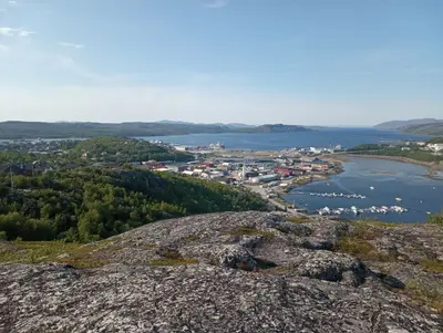
    Kirkenes is located in the far east of Finnmark, near the borders with Finland and Russia, and is the terminus for the Hurtigruten and Havila coastal ships. You come here for its border location, wartime history, and the Snowhotel.Kirkenes experienced over 320 air raids during World War II, commemorated by the Andersgrotta Bunker Museum. Today, Kirkenes is a port for king crabs. The Snowhotel outside the town is open year-round, with inside temperatures of approx. -4°C.Entry to Russia is only possible via the Storskog border crossing and only with a visa. Before travelling, check the current travel advice from the FCDO.

    ArtemMitinIvanovich·CC BY 4.0

    Finnmark

    Finnmark

    Finnmark is Norway's northernmost county, situated between the North Cape on Magerøya island and the borders with Finland and Russia. You come here for the North Cape, the rock art of Alta, and the vastness of the Arctic, with Northern Lights in winter and the Midnight Sun in summer.Key places include Alta, home to its UNESCO World Heritage site; Hammerfest, featuring the Meridian Column of the Struve Geodetic Arc; Honningsvåg, a gateway to the North Cape; and Kirkenes, near the Russian border, the final stop for the Hurtigruten and Havila coastal voyages.

    Maris Uuetoa·Pexels

    Rovaniemi

    Rovaniemi

    Lapland's capital is located just south of the Arctic Circle on the Kemijoki River. About eight kilometers north of the center, Santa Claus awaits at Santa Claus Village directly on the Arctic Circle; at the Arktikum Museum, discover the nature, climate, and culture of the North. Rovaniemi: husky, reindeer, snowmobile tours, Northern Lights searches. Summer/Ruska: local hikes.

    Fatih Turan·Pexels

    Alta

    Alta

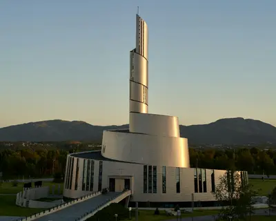
    Alta is a city located on the Altafjord in Finnmark, in the far north of Norway. People come here for the rock carvings, which are a UNESCO World Heritage site, for the Northern Lights Cathedral in the city center, and in winter, for the Northern Lights.Thousands of carvings and paintings from around 4200 to 500 BC are preserved at 45 sites around the fjord. They were discovered in 1973 and are exhibited at the Alta Museum in Hjemmeluft. In the city center stands the Northern Lights Cathedral, featuring a bronze figure of Christ.Just outside the city, the Sorrisniva Igloo Hotel is rebuilt every winter from the ice of the Alta River, opening only during the cold season. Since 1981, Alta has been the starting point for the Finnmarksløpet dog sled race.

    Barnabas Davoti·Unsplash

    Your next steps

    Saariselkä is in Finland. Ways to carry on from here.

    • More in Finland

      Highlights, areas, routes and the best time to travel for all of Finland.

      Finland travel guide
    • Round trips with Saariselkä

      One route passes through Saariselkä, with stops, nights and a map.

      See the round trip

    Sources & method

    • Photos: Wikimedia Commons, Pexels. Each photo carries its credit.
    • Place data such as addresses and ratings comes from Google Maps.
    • The content is based on web research from public, traceable sources. How the content is made · The role of AI