Fernweh: Home
    ExploreTravel GuidesPlan a tripMy tripLast visited
    de|en
    All Places & RegionsAll highlightsAbout FernwehFAQPrivacy PolicyImprint
    ExploreTravel GuidesPlan a tripMy tripLast visited
    Mount Longonot National Park
    Baldfatchris / Wikimedia Commons / CC BY-SA 4.0

    Kenya

    Mount Longonot National Park

    Point of Interest

    Mount Longonot is a 2,776 m high volcano southeast of Lake Naivasha, approximately 60 km northwest of Nairobi, and a classic day trip destination for hikers from Nairobi.

    by Felix Gillen

    1. Home
    2. Destinations
    3. Kenya
    4. Great Rift Valley
    5. Mount Longonot National Park
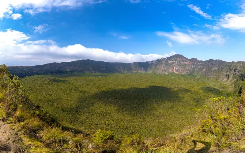
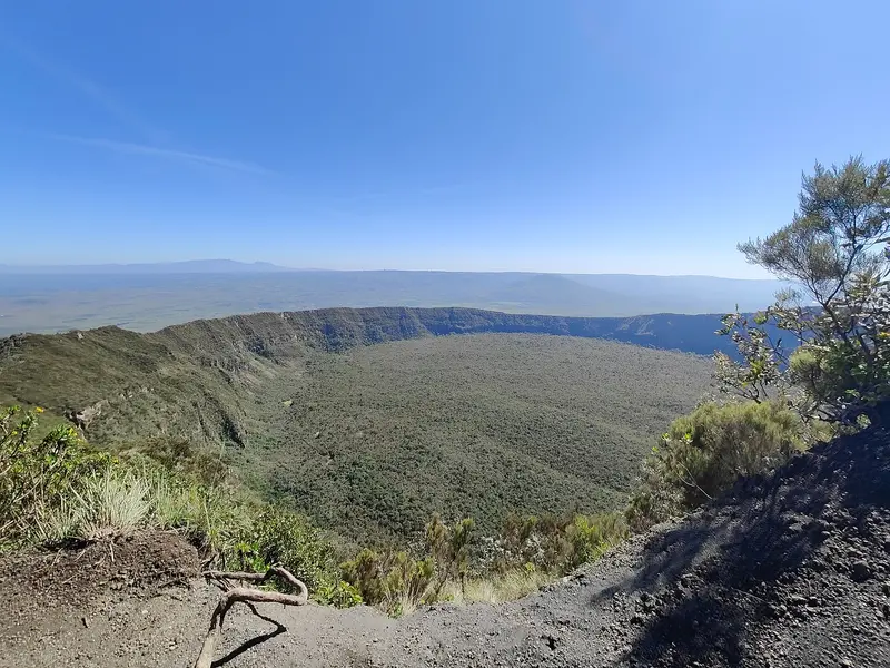
    Mount Longonot is a 2,776 m high volcano southeast of Lake Naivasha, approximately 60 km northwest of Nairobi, and a classic day trip destination for hikers from Nairobi. From the park entrance, you ascend to the crater rim in about one to one and a half hours, looking into the crater and over the Rift Valley, which the volcano towers over by approximately 1,000 m.Those who circumnavigate the entire crater rim will be on the move for a total of about five to six hours from the gate.

    Sights in Mount Longonot National Park

    Discover the most important sights and attractions

    Crater rim of Mount Longonot
    Attraction

    1Crater rim of Mount Longonot

    The summit crater measures approximately 1.8 km in diameter. From the gate, you reach the crater rim at 2,545 m in about one to one and a half hours, the circuit to the highest point at 2,776 m and back takes a total of five to six hours.
    Open in Google Maps

    Restaurants in Mount Longonot National Park

    Volcano and Name

    Mountain of Many RidgesThe name derives from the Maasai word Olongongot, meaning 'Mountain of Many Spurs' or 'Steep Ridges'.A Young VolcanoIts summit cone sits within a large caldera measuring approximately 8 by 12 km and features a crater about 1.8 km in diameter. The last eruption is dated to the 1860s.

    Hiking and practical information

    The RouteFrom the park entrance to the crater rim (2,545 m), the ascent takes about 1 to 1.5 hours; the path is steep.The complete circuit of the crater rim to the highest point (2,776 m) and back to the gate takes a total of about five to six hours.Take sufficient water and sun protection and plan enough time for the return journey.EntryThe park is managed by the Kenya Wildlife Service; payment is cashless via eCitizen.As of October 1, 2025, according to the KWS tariff, an entry fee of 50 US dollars per person per 24 hours applies to non-resident adults. Check the current tariff before your visit.Getting ThereThe park is located about 60 km northwest of Nairobi; many hikers come as a day trip from the capital or combine the ascent with a night at Lake Naivasha.

    Accommodations in Mount Longonot National Park

    Find perfect stay in Mount Longonot National Park

    Booking.com* (Affiliate link)
    Search Hotels
    Agoda* (Affiliate link)
    Search Hotels
    Airbnb
    Vacation Rentals

    * Affiliate link: if you book through it, we earn a small commission. The price stays the same for you.

    Nearby

    Hell's Gate National Park

    Hell's Gate National Park

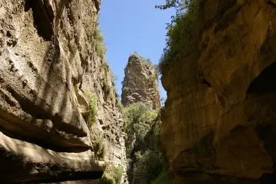
    Hell's Gate National Park lies south of Lake Naivasha, around 90 km from Nairobi, and is one of Kenya's few parks where you can explore on foot or by bike among zebras, buffaloes, and antelopes. Red cliffs, the volcanic plugs Fischer's Tower and Central Tower, and a narrow gorge define the mere 68 km² landscape.The scenery served as inspiration for the animated film "The Lion King" (1994); among other productions, "Lara Croft: Tomb Raider: The Cradle of Life" was filmed here.
    Naivasha

    Naivasha

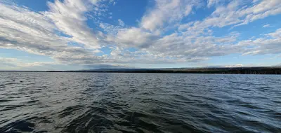
    Naivasha is located approximately 93 road kilometers northwest of Nairobi on the freshwater lake of the same name. Hippos, over 400 bird species, and its proximity to Hell's Gate and Mount Longonot make the lake a popular weekend destination and the first leg of many safaris through the Rift Valley.The town itself is a bustling agricultural center, with accommodations and restaurants primarily lining Moi South Lake Road on the southern shore.
    Great Rift Valley

    Great Rift Valley

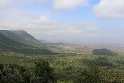
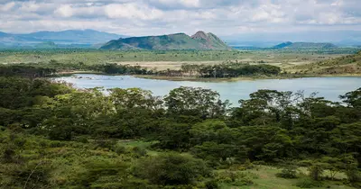
    Northwest and southwest of Nairobi, the land drops steeply into the East African Rift Valley: a chain of lakes, extinct volcanoes, and gorges, which you can reach from the capital in one to two hours by car. Lake Naivasha, Hell's Gate, Mount Longonot, and Lake Nakuru are situated close together here, making them ideal for a first safari leg or for hiking and cycling.Three of the soda lakes – Nakuru, Elmenteita, and Bogoria – have been part of the UNESCO World Heritage "Kenya Lake System in the Great Rift Valley" since 2011, one of the most important feeding grounds for the lesser flamingo worldwide.
    Karen

    Karen

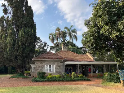
    Karen is a green, sprawling suburb in the southwest of Nairobi, at the foot of the Ngong Hills. Here, in close proximity, are three Nairobi-day classics: the Karen Blixen Farmhouse, the Giraffe Centre, and the Kazuri Bead Workshop.Large plots, many trees, and sparse development characterize the district, complemented by garden restaurants and shopping centers like The Hub.
    Lake Elmenteita

    Lake Elmenteita

    Lake Elmenteita is a small soda lake between Naivasha and Nakuru, about 120 km northwest of Nairobi near the Nairobi-Nakuru-Highway. The lake is part of the UNESCO World Heritage Site of the Kenyan Rift Valley Lakes, attracts large flamingo flocks depending on water levels, and is the last remaining breeding ground for pelicans in Kenya.Two-thirds of its shoreline belong to the Soysambu Conservancy, a private ranch owned by the Delamere family, featuring zebras, giraffes, and gazelles.

    Sources & method

    • Photos: Wikimedia Commons, Google Maps. Each photo carries its credit.
    • Place data such as addresses and ratings comes from Google Maps.
    • The content is based on web research from public, traceable sources. How the content is made · The role of AI