Fernweh: Home
ExploreGuideDestinationsMy tripsMy trip
de|en
All Places & RegionsRound tripsNight trains in EuropeAll highlightsAbout FernwehFAQPrivacy PolicyImprint
Download on the App StoreGet it on Google Play
ExploreGuideDestinationsMy tripsMy trip
    • Neighborhoods & highlights
    • Eat & drink
    • Culture
    • Getting around
    • Accommodation
    • Plan trip
    • Nearby
    Cilaos

    Patrick Portes / Wikimedia Commons / CC BY-SA 4.0, mod.

    La Réunion

    Cilaos

    City

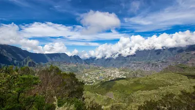
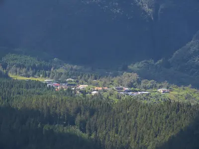
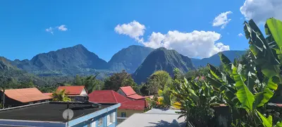
    Cilaos is the main town of the caldera of the same name in the south of the island, situated at an altitude of approximately 1,200 m.

    by Felix Gillen

    1. Home
    2. Destinations
    3. La Réunion
    4. Cirque de Cilaos
    5. Cilaos
    Cilaos is the main town of the caldera of the same name in the south of the island, situated at an altitude of approximately 1,200 m. It serves as a starting point for hikes and canyoning in the Cirque and for the ascent to Piton des Neiges; access is via the Route de Cilaos, known as the "Road of 400 Curves". In 2023, the municipality had about 5,040 inhabitants.The name derives from the Malagasy Tsilaosa, meaning "the place one does not leave". The first documented settlement and a thermal spa were established around 1850, and Cilaos has been an independent municipality since 1965. On January 7th and 8th, 1966, 1,825 mm of rain fell here in 24 hours, a world record. Today, the main street is partly a pedestrian zone, and a market is held on Sunday mornings.
    La Réunion travel guideRound trips in La RéunionPlan a trip with Cilaos

    Contents

    • Neighborhoods & highlights
    • Eat & drink
    • Culture
    • Getting around
    • Accommodation
    • Nearby

    Sights in Cilaos

    Discover the most important sights and attractions

    Church

    1Our Lady of the Snows Church

    The reinforced concrete church in the town center was built from around 1932 to 1940 according to plans by Francis Huet and renovated in 2006. It is protected as a Monument historique and its tower shapes the townscape against the rock faces of the valley basin.
    Open in Google Maps
    Natural Feature

    2Mare à Joncs

    The pond, at around 1,200 m in the village center, is 2 ha and Cilaos' largest body of water. No swimming; you can pedal boat or stroll the promenade around the water, reflecting the peaks.
    Open in Google Maps
    Point of Interest

    3Thermes de Cilaos (Irénée Accot Thermal Establishment)

    The thermal spa on Route de Bras-Sec, established in 1987, is fed by springs with temperatures of 30 to 37 °C. It offers a whirlpool, sauna, steam bath, massages, and treatments. Open daily year-round, except between Christmas and New Year, it's an ideal recovery after a long hike.
    Open in Google Maps
    Museum

    4Maison de la Broderie

    Here's the "jours de Cilaos" openwork embroidery, typically white-on-white, developed in the village. A club preserves the technique since 1983, showing works in the small central house.
    Open in Google Maps

    Restaurants in Cilaos

    Lentils, Wine and Embroidery

    Products from the CirqueMost local restaurants offer Cilaos lentils and wine. Vines grow on terraces between 800 and 1,200 m elevation, harvested in January and February. The Chai de Cilaos cooperative was founded in 1992; red wine is made from Pinot Noir and Malbec, white from Chenin.Jours de CilaosThe “Jours de Cilaos” embroidery originated in the early 20th century and was mainly passed down by nuns. In the town center, you'll find artisans and shops.

    Arrival and on the go

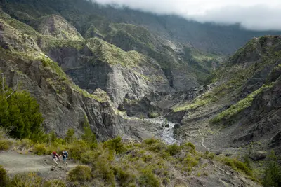
    Route de CilaosThe road begins in Saint-Louis on the southwest coast and leads up to Cilaos; it was opened in 1932. At Gros Morne de Gueule Rouge, you drive through two tunnels; the Tunnel Gueule Rouge is single-lane.On Foot and by BusFrom the village, buses go to Bras-Sec and Îlet à Cordes and stop at several hiking trailheads. You can reach the Bras Rouge waterfall in about 2.5 hours round trip, and the Col du Taïbit (2,090 m) takes about 5 hours round trip. The paths are slippery when it rains; check the ONF list of closed trails beforehand.

    Accommodations in Cilaos

    Find perfect stay in Cilaos

    Booking.com* (Affiliate link)
    Search Hotels
    Agoda* (Affiliate link)
    Search Hotels
    Airbnb
    Vacation Rentals

    * Affiliate link: if you book through it, we earn a small commission. The price stays the same for you.

    Plan your trip to Cilaos

    Save places, build a route and plan your city trip, all in one place.

    1. 1
      Sunrise over alpine peaks and a sea of clouds
      1234

      Round trip

      12 days · 4 stops

      Saved

      Pick a route

      Pick a ready-made one or save places and plan your own.

      Open bookmarks
    2. 2

      Trip to Cilaos

      Live
      • 1Our Lady of the Snows Church3 days
      • 2Mare à Joncs4 days
      • 3Thermes de Cilaos (Irénée Accot Thermal Establishment)5 days
      Budget

      Plan your trip

      The planner sorts stops, days and budget. Plan together in real time.

      Start trip planning
    3. 3
      9:41 No signal
      Cilaos
      Available offline

      Patrick Portes / Wikimedia Commons / CC BY-SA 4.0, mod.

      Use it on the road

      Download the guide to your phone and use it on site, even offline.

    Nearby

    Cirque de Cilaos

    Cirque de Cilaos

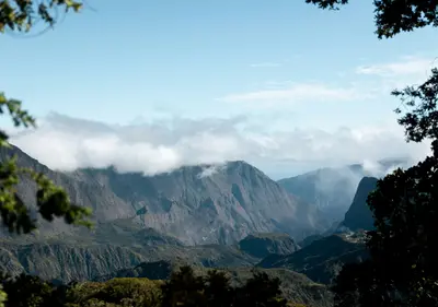
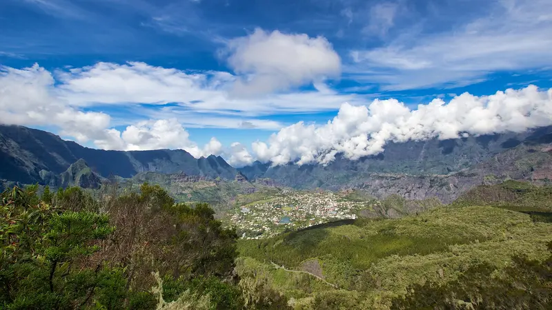
    The Cirque de Cilaos is the southernmost of the three cirques in the island's interior, enclosed by the steep walls of the Piton des Neiges. You go there for the mountain road with over 400 bends, for the ascent to Piton des Neiges, the island's highest point, and for a mountain village with thermal springs, lentil fields, and its own embroidery tradition.The village of Cilaos lies at around 1,200 m altitude. From here, you can reach the hamlets of Bras-Sec and Îlet à Cordes, the small lake Mare à Joncs, and hiking trails leading into the neighboring cirque of Mafate. Wine is grown on the steep slopes. The cirque is part of the UNESCO World Heritage site „Pitons, cirques et remparts“.

    Patrick Portes·CC BY-SA 4.0

    Bras-Sec

    Bras-Sec

    Bras-Sec is a predominantly agricultural Îlet in the northeast of the Cirque de Cilaos, 4.5 km from the main town. You come here if you want to experience tranquil mountain village life or set off for the Piton des Neiges; the Le Bloc hiking trailhead is located on the access road.A few hundred people live in the village; rock faces such as the Bonnet de Prêtre tower above Bras-Sec. The Sainte-Anne Church and a primary school stand in the village.

    Rémih·CC BY-SA 4.0

    Cirque de Mafate

    Cirque de Mafate

    The Cirque de Mafate is the westernmost of the three cirques in the island's interior and is only accessible on foot or by helicopter; there is no road. You come here to hike between remote hamlets, known as Îlets, where a few hundred people live and where you can stay in gîtes.The cirque is about 14 km long and 7 km wide, ranging from around 250 m at Deux-Bras up to 3,019 m at Gros Morne. It lies within the inhabited core of the National Park, founded in 2007, and is part of the UNESCO World Heritage site. Most Îlets have a school, a shop, and several gîtes; they are supplied by helicopter. You get the best view from above from Maïdo.

    Louis Paulin·Unsplash

    Îlets of Mafate: La Nouvelle, Marla, Roche Plate, Aurère

    Îlets of Mafate: La Nouvelle, Marla, Roche Plate, Aurère

    La Nouvelle, Marla, Roche Plate, Aurère, and Îlet à Malheur are hamlets in the Cirque de Mafate, accessible only on foot. You stay overnight here in gîtes when you traverse the cirque on a multi-day tour; La Nouvelle is the largest îlet and is located two to three hours' walk from the Col des Bœufs.Mafate was settled by escaped slaves. Îlet à Malheur is named after a 1829 raid in which approximately forty refugees were killed. Aurère was almost abandoned in the 1960s due to water scarcity; only the Canalisation Augustave, a 5 km long water pipeline built in 1977, restored supply.

    Louis Paulin·Unsplash

    Hell-Bourg

    Hell-Bourg

    Hell-Bourg is a former spa town in the Cirque de Salazie at the foot of Piton d'Anchaing and Piton des Neiges. You come for its 19th-century Creole houses; since 1999, it has been one of the "Plus beaux villages de France", the only member outside mainland France.The village was named after Governor Anne Chrétien Louis de Hell in 1841; its thermal baths opened in 1852. Villas followed, as affluent coastal families came to the heights for recreation. In 1948, a cyclone buried the springs, ending the spa's operation.

    Guallendra·CC0

    Your next steps

    Cilaos is in La Réunion. Ways to carry on from here.

    • More in La Réunion

      Highlights, areas, routes and the best time to travel for all of La Réunion.

      La Réunion travel guide
    • Round trips in La Réunion

      Ready-made routes through La Réunion, with stops, nights and a map.

      See the routes

    Sources & method

    • Photos: Wikimedia Commons. Each photo carries its credit.
    • Place data such as addresses and ratings comes from Google Maps.
    • The content is based on web research from public, traceable sources. How the content is made · The role of AI