Fernweh: Home
ExploreGuideDestinationsMy tripsMy trip
de|en
All Places & RegionsRound tripsNight trains in EuropeAll highlightsAbout FernwehFAQPrivacy PolicyImprint
Download on the App StoreGet it on Google Play
ExploreGuideDestinationsMy tripsMy trip
    • Places in the region
    • Eat & drink
    • Culture
    • Getting around
    • Round trips
    • Nearby
    Carriacou

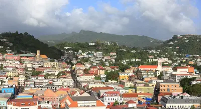
    Photo by Hugh Whyte on Unsplash

    Grenada

    Carriacou

    Region

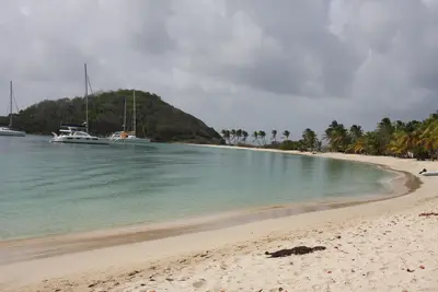
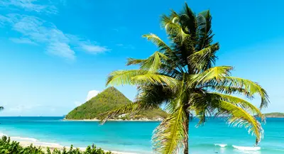
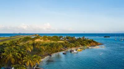
    Carriacou is the largest of Grenada's Grenadine islands, located about 90 minutes by ferry north of the main island. The island is known for Paradise Beach, the Sandy Island sandbank, and traditional wooden boat building in Windward.

    by Felix Gillen

    1. Home
    2. Destinations
    3. Grenada
    4. Carriacou
    Carriacou is the largest of Grenada's Grenadine islands, located about 90 minutes by ferry north of the main island. The island is known for Paradise Beach, the Sandy Island sandbank, and traditional wooden boat building in Windward.After Hurricane BerylHurricane Beryl severely impacted Carriacou and Petite Martinique on July 1, 2024. Since 2025, beach bars, dive shops, transport, and stores are largely back in operation, but some accommodations remain closed. Before booking, inquire whether the property and establishment are open.
    Grenada travel guideSee the round tripPlan a trip with Carriacou

    Contents

    • Places in the region
    • Eat & drink
    • Culture
    • Getting around
    • Round trips
    • Nearby

    Sights in Carriacou

    Discover the most important sights and attractions

    Beach

    Paradise Beach

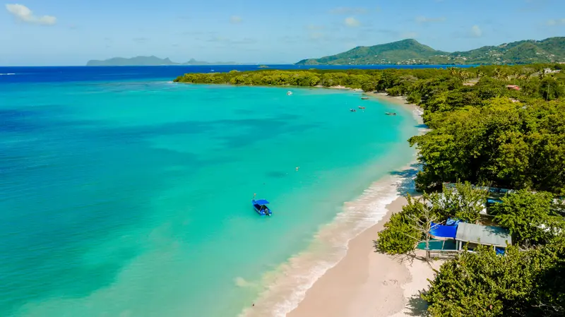
    The sandy beach on the west coast near L'Esterre is Carriacou's most famous beach and a starting point for boat trips to Sandy Island. After Hurricane Beryl, some beach bars have reopened; ask locally for the current status.
    Open in Google Maps
    Attraction

    Sandy Island

    The uninhabited sand island off Paradise Beach is part of the Sandy Island/Oyster Bed Marine Protected Area, which since 2010 protects approximately 659 hectares including beaches, mangroves, and three small islands. Snorkel over corals around the island; turtles are a common sight. Boats will take you across from Paradise Beach or Tyrrel Bay.
    Open in Google Maps
    Point of Interest

    Hillsborough

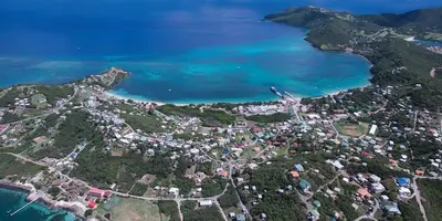
    Carriacou's main town is on the west coast. From here, a boat runs Monday to Saturday to Petite Martinique. The ferry from St. George's, however, docks in Tyrrel Bay in the southwest, where you also clear immigration and customs.
    Open in Google Maps

    Restaurants in Carriacou

    1

    Paradise Beach Club

    Beach bar on Paradise Beach, which has reopened after Hurricane Beryl (Caribbean Journal, October 2026). From here, boats depart for Sandy Island.
    Show on Google Maps

    Boats, Regatta and Carnival

    Boatbuilding in WindwardIn Windward village in the northeast, artisans traditionally build wooden sailboats; the workshops are being rebuilt after Hurricane Beryl.FestivalsCarriacou Carnival before Lent, featuring the Shakespeare Mas: Masked participants recite Shakespearean verses in a contest; those who falter receive a stick beat.Carriacou Regatta early August, since 1965, featuring races of traditional wooden sloops, donkey races, and a greasy pole climbing competition.

    Travel and Border Crossing

    From GrenadaExpress ferry from the Carenage in St. George's to Tyrrel Bay, Monday to Saturday, approx. 90 minutes, no Sunday service. Timetables differ by source; verify locally.Small planes fly in approx. 20 minutes from Maurice Bishop International Airport to Lauriston Airport (CRU).To Petite MartiniqueA boat commutes between Hillsborough and Petite Martinique Monday to Saturday.To Union Island (St. Vincent and the Grenadines)There is no public ferry, only a small scheduled boat on specific weekdays (cash, approx. 90 minutes) or a charter boat.You complete your Grenada exit formalities with Customs and Immigration in Tyrrel Bay, Monday to Friday, and pay the Embarkation Tax of EC$20 per person there.Entry to St. Vincent and the Grenadines is handled in Clifton on Union Island.

    Round trips through this region

    Grenada and Carriacou: Spice Isle and Grenadines

    Grenada and Carriacou: Spice Isle and Grenadines

    Ten days on Grenada and Carriacou: capital and beach in the southwest, rainforest and spice villages in the island's interior and north, then by fast ferry to Carriacou.

    10 Days
    3 stops

    Martin Falbisoner·CC BY-SA 4.0

    Nearby

    Union Island

    Union Island

    Union Island is the southernmost inhabited island of St. Vincent and the Grenadines, approximately 5 km long, with the towns of Clifton and Ashton. Clifton, with its airport, ferry terminal, and port, is the gateway to the Tobago Cays and the border crossing towards Carriacou and Grenada.After Hurricane BerylHurricane Beryl damaged most of the buildings in July 2024. Clifton is rebuilding; the new ferry terminal was handed over in October 2025, and beach bars in Chatham Bay are still partly operating provisionally. Before traveling, check which accommodations are open.

    Stefan Schäfer·CC BY-SA 4.0

    Mayreau

    Mayreau

    Mayreau is a small island without an airfield, situated between Canouan and Union Island, home to the single village of Old Wall and around 300 inhabitants. Its eastern side belongs to the Tobago Cays Marine Park.What to expectSalt Whistle Bay in the north is a popular anchorage with a sandy beach, while Saline Bay in the southwest boasts a long white beach. Following Hurricane Beryl, around three-quarters of the houses have been rebuilt; the church on the hill still lacked a roof in mid-2026.

    Ashbox451·CC BY-SA 4.0

    Tobago Cays Marine Park

    The Tobago Cays Marine Park protects five uninhabited islands and their reefs in the Southern Grenadines, east of Mayreau. Four of the Cays are situated within the approximately 4 km long Horseshoe Reef, where you can snorkel over seagrass and corals in the shallow lagoon.What to expectOff Baradal, you can observe Green Sea Turtles in a buoy-marked zone. The Cays are accessible only by boat, either as a day trip from Union Island, Mayreau, or Canouan, or with your own yacht. Park fees and strict rules apply: no fishing, no anchoring in coral or seagrass, maximum five knots.
    Canouan

    Canouan

    Canouan is located approximately 40 km south of St. Vincent, about 5.5 km long, with its main town Charlestown and its own airport. The northern part of the island is private property of a luxury resort with a golf course.What to expectOn the windward side, a long barrier reef protects the coast. Canouan is a stop for scheduled ferries between Kingstown and Union Island; the new jetty opened in July 2025. According to the government (July 2026), the island still requires significant rebuilding efforts after Hurricane Beryl.

    Not specified.·CC BY-SA 4.0

    The North: Spice Coast and Sauteurs

    The North: Spice Coast and Sauteurs

    The north of Grenada is the land of nutmeg, cocoa, and rum. From Gouyave on the west coast, through Sauteurs at the northern tip, to the east coast, are processing stations, historic plantations, and a rum distillery with a waterwheel.What to expectIn Gouyave, you'll see nutmeg sorted and packaged; at Belmont Estate, you'll learn all about cocoa. At Sauteurs, Leapers' Hill recalls the Kalinago. Levera National Park and Bathway Beach boast long beaches with offshore island views.

    Hugh Whyte·Unsplash

    Your next steps

    Carriacou is in Grenada. Ways to carry on from here.

    • More in Grenada

      Highlights, areas, routes and the best time to travel for all of Grenada.

      Grenada travel guide
    • Round trips with Carriacou

      One route passes through Carriacou, with stops, nights and a map.

      See the round trip
    • Plan a trip with Carriacou

      The Guide asks about season, length and who is coming, and suggests a trip with Carriacou.

      Plan the trip
    Sources & method

    • Photos: Unsplash. Each photo carries its credit.
    • Place data such as addresses and ratings comes from Google Maps.
    • The content is based on web research from public, traceable sources. How the content is made · The role of AI