Fernweh: Home
ExploreGuideDestinationsMy tripsMy trip
de|en
All Places & RegionsRound tripsNight trains in EuropeAll highlightsAbout FernwehFAQPrivacy PolicyImprint
Download on the App StoreGet it on Google Play
ExploreGuideDestinationsMy tripsMy trip
    • Neighborhoods & highlights
    • Recommendations
    • Eat & drink
    • Culture
    • Getting around
    • Accommodation
    • Plan trip
    • Nearby
    Manaus

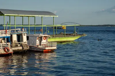
    Photo by K on Pexels

    Brazil

    Manaus

    City

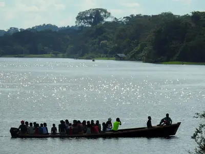
    Manaus is located in the heart of the rainforest on the Rio Negro, shortly before its confluence with the Solimões.

    by Felix Gillen

    1. Home
    2. Destinations
    3. Brazil
    4. Amazonas
    5. Manaus
    Manaus is located in the heart of the rainforest on the Rio Negro, shortly before its confluence with the Solimões. The rubber boom of the late 19th century made the city wealthy; its most magnificent legacy is the Teatro Amazonas, opened in 1896, which has been a UNESCO World Heritage site since 2026, together with the theatre in Belém. From here, boat trips depart to the Encontro das Águas and the Anavilhanas archipelago.
    Brazil travel guideRound trips in BrazilPlan a trip with Manaus

    Contents

    • Neighborhoods & highlights
    • Recommendations
    • Eat & drink
    • Culture
    • Getting around
    • Accommodation
    • Nearby

    Sights in Manaus

    Discover the most important sights and attractions

    Attraction

    1Teatro Amazonas

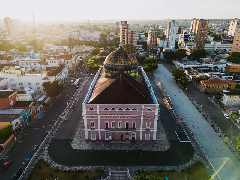
    The Opera House, a relic of the rubber boom, opened on December 31, 1896. Its dome is covered with around 36,000 ceramic pieces from Alsace in national colours; inside are 701 seats and 198 chandeliers. Since July 2026, it's been a UNESCO World Heritage site alongside the Theatro da Paz in Belém; the Opera Festival is held here in spring.

    Open in Google Maps
    Natural Feature

    2Encontro das Águas

    Below Manaus, the dark Rio Negro (around 28 degrees) and the clay-colored Solimões (around 22 degrees) flow for about six kilometers side-by-side without mixing. This section has been under national heritage protection since 2010. Excursion boats depart daily from the port in the center.
    Open in Google Maps
    Market

    3Mercado Municipal Adolpho Lisboa

    The Market Hall at the port downtown was founded in 1882 and is the city's oldest market. Rua dos Barés 46, Centro.
    Open in Google Maps

    Restaurants in Manaus

    1

    Banzeiro

    Chef Felipe Schaedler's restaurant in Manaus, opened in 2009. Rua Libertador.
    Show on Google Maps

    Rubber, Opera and Folklore

    Rubber BoomIn the late 19th century, Manaus was the center of the rubber trade; the boom ended when seeds were smuggled to Southeast Asia, and plantations emerged there. From this era date the Teatro Amazonas and the Adolpho Lisboa Market Hall from 1882.FestivalsFestival Amazonas de Ópera: Opera festival at the Teatro Amazonas, most recently from mid-April to mid-May.Festival de Parintins: three nights on the last weekend of June on the Amazon island of Parintins, in 2027 from June 25; the Boi-Bumbá groups Garantido (red) and Caprichoso (blue) compete against each other. Advance ticket sales for 2027 start online on November 28, 2026.

    Arrival and Travel Time

    ArrivalsEduardo Gomes Airport (MAO) is approx. 14 km north of the center. GOL and LATAM fly direct to São Paulo Guarulhos (approx. 4 hours) and Rio Galeão.By RiverThe port is in the city center on the Rio Negro; excursion boats leave daily for the Encontro das Águas.Travel SeasonDriest from July to September (56-79 mm rain/month); January-April see ~300 mm/month. From August, the river drops and beaches emerge.

    Accommodations in Manaus

    Find perfect stay in Manaus

    Booking.com* (Affiliate link)
    Search Hotels
    Agoda* (Affiliate link)
    Search Hotels
    Airbnb
    Vacation Rentals

    * Affiliate link: if you book through it, we earn a small commission. The price stays the same for you.

    Plan your trip to Manaus

    Save places, build a route and plan your city trip, all in one place.

    1. 1
      Sunrise over alpine peaks and a sea of clouds
      1234

      Round trip

      12 days · 4 stops

      Saved

      Pick a route

      Pick a ready-made one or save places and plan your own.

      Open bookmarks
    2. 2

      Trip to Manaus

      Live
      • 1Teatro Amazonas3 days
      • 2Encontro das Águas4 days
      • 3Mercado Municipal Adolpho Lisboa5 days
      Budget

      Plan your trip

      The planner sorts stops, days and budget. Plan together in real time.

      Start trip planning
    3. 3
      9:41 No signal
      Manaus
      Available offline

      Photo by K on Pexels

      Use it on the road

      Download the guide to your phone and use it on site, even offline.

    Nearby

    Amazonas

    Amazonas

    Amazonas state is the core region of Brazil's rainforest. Manaus, center of the late 19th-century rubber boom, is the river's gateway; surrounding it, the Central Amazon Conservation Complex with Jaú, Anavilhanas, Amanã and Mamirauá, a UNESCO World Heritage site since 2000 and 2003, protects over six million hectares of forest and river landscape.The British FCDO advises against all non-essential travel to river areas in western Amazonas state; before tours outside Manaus, check the German Foreign Office's latest advice.

    Daniel Magalhães·Pexels

    Anavilhanas National Park

    Anavilhanas National Park

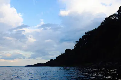
    In the Rio Negro, northwest of Manaus, lies the Anavilhanas archipelago: The National Park protects over 400 islands on 350,000 hectares in Manaus and Novo Airão municipalities. Founded as an ecological station in 1981, it became a National Park in 2008 and has been part of the UNESCO World Heritage Site Central Amazon Conservation Complex since 2003.

    Karen Mohrstedt Badin·CC BY-SA 4.0

    Gran Sabana and Roraima

    Gran Sabana and Roraima

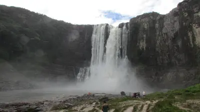
    The FCDO advises against all travel to parts of this region. Check the FCDO travel advice, linked on the country page, before planning.The Gran Sabana in Venezuela's far south-east is an upland at around 1,000 m with savannas, waterfalls and table mountains, above which Mount Roraima rises at the tri-border point with Brazil and Guyana. It forms the eastern part of Canaima National Park and is the land of the Pemón.The paved Troncal 10 runs through the Gran Sabana to the Brazilian border at Santa Elena de Uairén, the largest town and the starting point for Roraima.

    Wilfredor·CC0

    Canaima National Park and Angel Falls

    Canaima National Park and Angel Falls

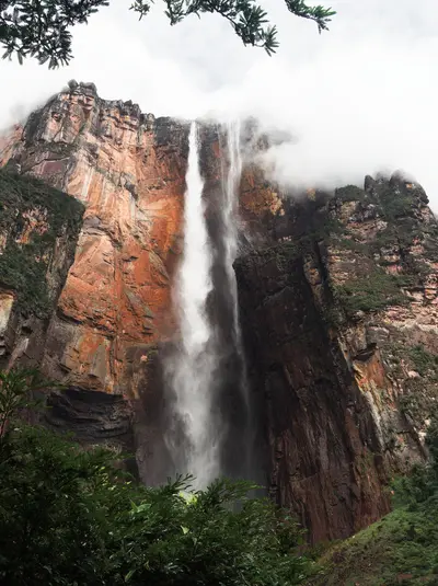
    The FCDO advises against all travel to parts of this region. Check the FCDO travel advice, linked on the country page, before planning.In Canaima National Park in south-eastern Venezuela, Angel Falls plunges 979 m from the Auyán-tepui table mountain; Guinness and Britannica list it as the highest waterfall on Earth. The park and its tepuis have been a UNESCO World Heritage Site since 1994 and cover around 30,000 km².There is no road to Canaima: visitors fly from Ciudad Bolívar or Puerto Ordaz to the village on the Laguna de Canaima. In 2009 the then president Hugo Chávez suggested naming the falls after the Pemón name Kerepakupai Merú; they were not renamed by decree.

    Stratokumulus·CC BY 4.0

    Leticia

    Leticia

    Leticia is the capital of the Amazonas Department and Colombia's gateway to the Amazon, approximately 2 flight hours southeast of Bogotá. From here, boat tours embark for Isla de los Micos, Puerto Nariño, and Amacayacu National Park. This small town, with around 48,000 inhabitants (2018 Census), sits directly on the border with Brazilian Tabatinga, while Peru begins on the opposite riverbank. In the evenings, the town congregates at Parque Santander, as thousands of parakeets fly in to roost.

    Gatocalvo·CC BY-SA 4.0

    Your next steps

    Manaus is in Brazil. Ways to carry on from here.

    • More in Brazil

      Highlights, areas, routes and the best time to travel for all of Brazil.

      Brazil travel guide
    • Round trips in Brazil

      Ready-made routes through Brazil, with stops, nights and a map.

      See the routes

    Sources & method

    • Photos: Pexels. Each photo carries its credit.
    • Place data such as addresses and ratings comes from Google Maps.
    • The content is based on web research from public, traceable sources. How the content is made · The role of AI