Fernweh: Home
ExploreGuideDestinationsMy tripsMy trip
de|en
All Places & RegionsRound tripsNight trains in EuropeAll highlightsAbout FernwehFAQPrivacy PolicyImprint
Download on the App StoreGet it on Google Play
ExploreGuideDestinationsMy tripsMy trip
    • Places & highlights
    • Tours
    • Eat & drink
    • Culture
    • Getting around
    • Accommodation
    • Nearby
    Lake Skadar (Skadarsko jezero)

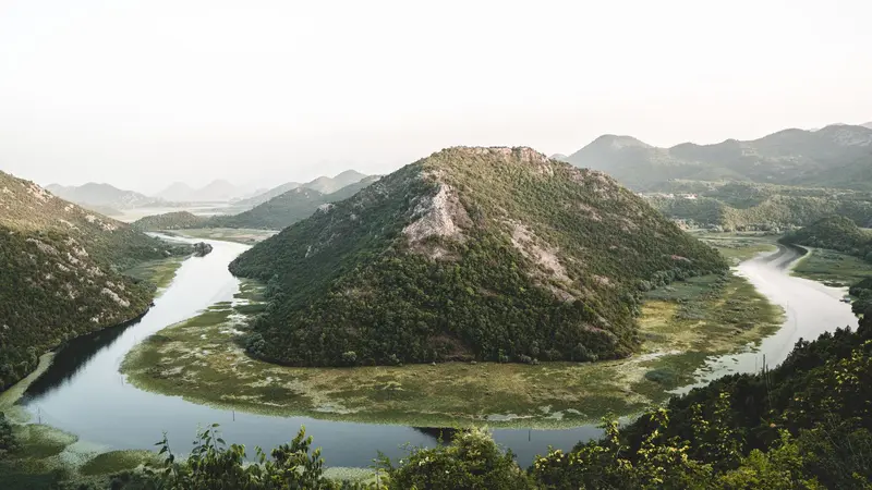
    Photo by Artūras Kokorevas on Pexels

    Montenegro

    Lake Skadar (Skadarsko jezero)

    Point of Interest

    Lake Skadar, on the border with Albania, is the largest lake on the Balkan Peninsula; covering 370 to 530 square kilometers depending on the season, approximately two-thirds of which lies in Montenegro.

    by Felix Gillen

    1. Home
    2. Destinations
    3. Montenegro
    4. Lake Skadar (Skadarsko jezero)
    Lake Skadar, on the border with Albania, is the largest lake on the Balkan Peninsula; covering 370 to 530 square kilometers depending on the season, approximately two-thirds of which lies in Montenegro. The Montenegrin part has been a National Park since 1983.With approximately 280 bird species, the lake is one of Europe's largest bird reserves, home to some of the continent's last pelicans. Two churches stand on Beška Island, while the former fortress of Grmožur is located in the southwest.
    Montenegro travel guidePlan a trip with Lake Skadar (Skadarsko jezero)

    Contents

    • Places & highlights
    • Tours
    • Eat & drink
    • Culture
    • Getting around
    • Accommodation
    • Nearby

    Sights in Lake Skadar (Skadarsko jezero)

    Discover the most important sights and attractions

    Attraction

    1Fortress Besac and Virpazar

    Virpazar is the most visited spot on the Montenegrin shore of Lake Skadar: this is where excursion boats depart, and you can rent boats and kayaks. Besac Fortress looms above the village, built by the Ottomans in 1478 and serving as a prison for the Italian occupiers during World War II. After its restoration, there's a viewing terrace and a small wine museum at the top, reached by a footpath from the village. Virpazar has a train stop on the Belgrade–Bar line.
    Open in Google Maps
    Attraction

    2Rijeka Crnojevića and Stone Bridge

    The village on the eponymous river, which flows into Lake Skadar, was in the late 15th century, known as Obod and the seat of the Crnojević princes; their printing press produced the first books of Southeast Europe. Prince Danilo had the arched stone bridge built in 1853 in memory of his father; it replaced a wooden bridge. Today, the place is a tranquil starting point for boat trips on the river.
    Open in Google Maps
    Attraction

    3Pavlova Strana Viewpoint

    From the Pavlova Strana viewpoint on the road above Rijeka Crnojevića, you gaze upon the narrow river bend winding through reeds to Skadar Lake. It's one of the park's most iconic photo spots and pairs well with a stop in Rijeka Crnojevića village.
    Open in Google Maps
    Historic Landmark

    4Fortress Žabljak Crnojevića

    The ruin of the Žabljak Crnojevića fortress stands on a hill in the plain on the north shore of the lake. Walls up to 15 meters high and six towers are preserved, the masonry showing Ottoman and Venetian alterations. The castle was the seat of the Crnojević until, after its fall in 1478, they moved their seat to Obod, today's Rijeka Crnojevića.
    Open in Google Maps

    Tours & experiences in Lake Skadar (Skadarsko jezero)

    Search tours for Lake Skadar (Skadarsko jezero) on GetYourGuide* (Affiliate link)On GetYourGuide, with reviews from other travellers

    * Affiliate link: if you book through it, we earn a small commission. The price stays the same for you.

    Restaurants in Lake Skadar (Skadarsko jezero)

    Lake Bird Paradise

    National ParkThe Montenegrin part of Lake Skadar has been a national park since 1983 and a Ramsar wetland since 1995. The lake is the largest freshwater body in the Balkans.Birds and KayakingAround 280 bird species have been recorded here, and the pelican is the park's symbol. Kayak tours start in Virpazar.

    Arrival and on the way

    Getting ThereVirpazar on the west shore has a train stop on the Belgrade–Bar line and is the lake's most popular spot. Excursion boats leave from here, and you can rent boats and kayaks.Rijeka Crnojevića and the Pavlova Strana viewpoint are situated at the lake's northwest end and are best accessed by car.On the LakeBoat trips visit small islands with monasteries and fortresses, such as the island fortress Grmožur.Birdwatching platforms are available in Stanaj, Žabljačke Livade, Plavnica, and Raduš. The best time for this is autumn and winter.

    Accommodations in Lake Skadar (Skadarsko jezero)

    Find perfect stay in Lake Skadar (Skadarsko jezero)

    Booking.com* (Affiliate link)
    Search Hotels
    Agoda* (Affiliate link)
    Search Hotels
    Airbnb
    Vacation Rentals

    * Affiliate link: if you book through it, we earn a small commission. The price stays the same for you.

    Campgrounds in Lake Skadar (Skadarsko jezero)

    Find perfect campground in Lake Skadar (Skadarsko jezero)

    Search via Google Maps
    Campgrounds nearby (15km)
    Camping.info
    Find Campgrounds
    Park4Night
    RV Parks & Camping

    Nearby

    Cetinje and Lovćen

    Cetinje and Lovćen

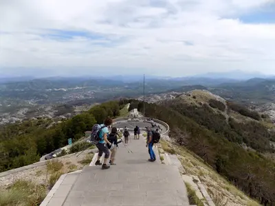
    Cetinje, Montenegro's historic royal capital, lies in a karst plain at the foot of Lovćen, about an hour from the Bay of Kotor. Ivan Crnojević moved the capital here in 1482 and founded the Cetinje Monastery in 1484; its many former embassies recall its royal past. Dominating the city is Lovćen National Park, with the Mausoleum of poet prince Njegoš on Jezerski vrh.

    Milica Buha·CC BY-SA 4.0

    Budva

    Budva

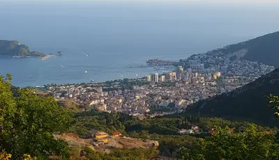
    Budva is the best-known coastal resort on Montenegro's Adriatic coast, located approximately 20 kilometers from Tivat Airport and 65 kilometers from Podgorica Airport. The town was first mentioned in the 5th century BC.The car-free Old Town is entirely surrounded by walls with towers and gates, with most buildings dating back to the Venetian era. Following the severe earthquake on April 15, 1979, it was reconstructed by 1987, and today, the damage is barely visible. From the Old Town, a path along the cliffs leads to the approximately 350-meter-long Mogren Beach. South of Budva lies Sveti Stefan.

    Duesseljan·CC0

    Kotor

    Kotor

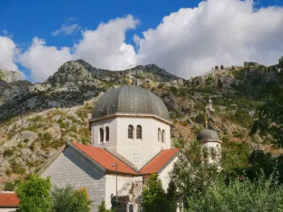
    Kotor's Old Town is nestled at the innermost end of the bay, squeezed between water and rock. Four centuries of Venetian rule from 1420 to 1797 shaped its narrow streets and squares, centered around the Cathedral of Saint Tryphon from 1166. About 4.5 kilometers of city walls climb the mountain to San Giovanni Fortress; from its top, you overlook the whole bay. Kotor is also known for its many cats.

    Lena Netkach·Pexels

    Ulcinj and Velika Plaža

    Ulcinj and Velika Plaža

    Ulcinj is the southernmost city on Montenegro's coast, close to the Albanian border. Believed to have been founded in the 5th century BC, it was long known as a pirate stronghold. To its southeast begins Velika Plaža, at 12 kilometers the country's longest sandy beach, reaching to the mouth of the Bojana. Ulcinj's Salina is a resting place for over 200 migratory bird species.

    Albinfo·CC BY-SA 4.0

    Tivat

    Tivat

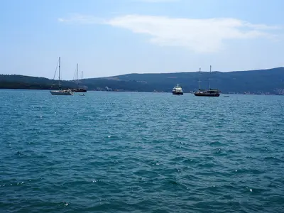
    The youngest city in the Bay of Kotor is centrally located, its airport just three kilometers from the center. A former naval shipyard, founded by Austria in 1889, is now Porto Montenegro, a luxury yacht marina and resort. Off the coast are the Island of Flowers and Sveti Marko Island.

    Oktoober·CC BY-SA 4.0

    Your next steps

    Lake Skadar (Skadarsko jezero) is in Montenegro. Ways to carry on from here.

    • More in Montenegro

      Highlights, areas, routes and the best time to travel for all of Montenegro.

      Montenegro travel guide
    • Plan a trip with Lake Skadar (Skadarsko jezero)

      The Guide asks about season, length and who is coming, and suggests a trip with Lake Skadar (Skadarsko jezero).

      Plan the trip

    Sources & method

    • Photos: Pexels. Each photo carries its credit.
    • Place data such as addresses and ratings comes from Google Maps.
    • The content is based on web research from public, traceable sources. How the content is made · The role of AI