Fernweh: Home
ExploreGuideDestinationsMy tripsMy trip
de|en
All Places & RegionsRound tripsNight trains in EuropeAll highlightsAbout FernwehFAQPrivacy PolicyImprint
Download on the App StoreGet it on Google Play
ExploreGuideDestinationsMy tripsMy trip
    Khövsgöl Lake

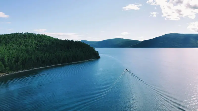
    Photo by Sodo Sane on Unsplash

    Mongolia

    Khövsgöl Lake

    Region

    Khövsgöl Lake in northern Mongolia is 136 kilometers long, lies at an altitude of 1,645 meters, and stores almost 70 percent of the country's fresh water.

    by Felix Gillen

    1. Home
    2. Destinations
    3. Mongolia
    4. Khövsgöl Lake
    Khövsgöl Lake in northern Mongolia is 136 kilometers long, lies at an altitude of 1,645 meters, and stores almost 70 percent of the country's fresh water. Since 1992, a national park of approximately 8,400 square kilometers protects the lake and its forested shores; admission is charged at the gate near Khatgal, the town where most travelers arrive.Peak season is June to August. From approximately November to May, the lake is frozen, and driving cars onto the ice is forbidden. In February or March, an ice festival takes place on the ice near Khatgal.
    Mongolia travel guideRound trips in MongoliaPlan a trip with Khövsgöl Lake

    Getting Here & Tips

    Getting ThereFlight from Ulaanbaatar to Mörön takes approx. 1.5 hours, usually only during the season from May to September and a few times per week.From Mörön to Khatgal, it's about 100 kilometers on asphalt, approx. two hours drive.By bus, the journey from Ulaanbaatar to Mörön takes approx. twelve hours.PracticalitiesAn entrance fee is charged at the national park gate near Khatgal.Driving on the frozen lake is prohibited; numerous vehicles have broken through over the years.Visiting the TsaatanThe reindeer herders live in the taiga in the Tsagaannuur region; a permit is required for the border zone. From Mörön, you drive nine to twelve hours to Tsagaannuur and then ride for several more hours.Clarify beforehand how much money reaches the families, ask before taking photos, and do not bring alcohol or cigarettes as gifts. Lonely Planet recommends organizing a guide and horses through the visitor center in Tsagaannuur.

    Nearby
    Terkhiin Tsagaan Nuur

    Terkhiin Tsagaan Nuur

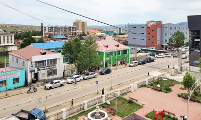
    Lake Terkhiin Tsagaan Nuur lies in the west of Arkhangai Aimag at about 2,060 meters altitude. Dammed by lava flows, it is approximately 16 kilometers long and 4 to 6 kilometers wide; the small island Noriin Dund Tolgoi is in the lake.From Tariat village, it's about six kilometers to the northeast corner of the lake, where most ger camps and shops are. The road between Khorgo and Avgaldai is paved for approximately 61 kilometers.

    Bernard Gagnon·CC0

    Tsetserleg and Tsenkher

    Tsetserleg and Tsenkher

    Tsetserleg is the main town of the Arkhangai Aimag, located on the edge of the Khangai Mountains. Within the Zayain Gegeenii Süm temple complex, the Aimag Museum has showcased regional exhibits across six halls since 1947. The town serves as a stopover on the route from the Orkhon Valley to Lake Terkhiin Tsagaan Nuur.Approximately 27 kilometers to the south, at an elevation of about 1,850 meters, lie the Tsenkher hot springs. Their very hot water is channeled into the pools of the surrounding ger camps, so a natural bathing experience is not what you'll find.

    Bernard Gagnon·CC0

    Amarbayasgalant Abbey

    Amarbayasgalant Abbey

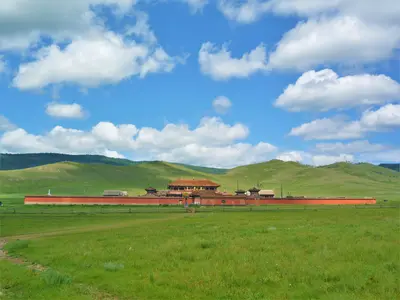
    Amarbayasgalant Monastery, located in the Iven Valley in Selenge Aimag, was built between 1727 and 1736 at the command of Emperor Yongzheng and completed under Qianlong. It was intended as Zanabazar's final resting place, whose remains were transferred here in 1779, and is dedicated to Maitreya.From Ulaanbaatar, it's about 360 kilometers, mostly on asphalt via Darkhan, with the final 35 kilometers on a dirt track north of the Darkhan-Erdenet road. Expect five to seven hours of driving; after rain, the track becomes significantly worse.

    Bogomolov.PL·public domain

    Kharkhorin (Karakorum)

    Kharkhorin (Karakorum)

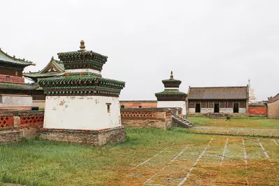
    Kharkhorin is located near the remains of Karakorum, which Ögedei, son of Chinggis Khaan, began to develop into the capital of the Mongol Empire from 1235 with walls and a palace. Little remains of the city, but next to it stands Erdene Zuu Monastery, founded in 1585 and, according to UNESCO, the oldest surviving Buddhist monastery in Mongolia. The Karakorum Museum displays finds and a model of the city around 1250.The site is the most important stop in the Orkhon Valley World Heritage Site and is about 360 kilometers from Ulaanbaatar, a good six to seven-hour drive, mostly on asphalt.

    Bernard Gagnon·CC0

    Orkhon Valley

    Orkhon Valley

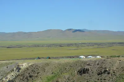
    The Orkhon Valley Cultural Landscape has been a UNESCO World Heritage site since 2004. Spread across approximately 1,220 square kilometers of grassland along the Orkhon River are Turkic memorial sites from the 6th and 7th centuries, the Uighur capital of Khar Balgas, the remains of the imperial capital Karakorum, the Erdene Zuu Monastery, and the Tövkhön Hermitage. The valley begins approximately 360 kilometers southwest of Ulaanbaatar.The starting point is the town of Kharkhorin, which you can reach mostly on asphalt roads. To reach the Orkhon Waterfall and Tövkhön, you will need a 4x4 vehicle, as the tracks become muddy after rainfall in July and August.

    Jonashtand·CC BY-SA 4.0

    Your next steps

    Khövsgöl Lake is in Mongolia. Ways to carry on from here.

    • More in Mongolia

      Highlights, areas, routes and the best time to travel for all of Mongolia.

      Mongolia travel guide
    • Round trips in Mongolia

      Ready-made routes through Mongolia, with stops, nights and a map.

      See the routes
    • Plan a trip with Khövsgöl Lake

      The Guide asks about season, length and who is coming, and suggests a trip with Khövsgöl Lake.

      Plan the trip

    Sources & method

    • Photos: Unsplash. Each photo carries its credit.
    • The content is based on web research from public, traceable sources. How the content is made · The role of AI