Fernweh: Home
ExploreGuideDestinationsMy tripsMy trip
de|en
All Places & RegionsRound tripsNight trains in EuropeAll highlightsAbout FernwehFAQPrivacy PolicyImprint
Download on the App StoreGet it on Google Play
ExploreGuideDestinationsMy tripsMy trip
    • Places in the region
    • Best travel time
    • Culture
    • Getting around
    • Nearby
    North

    Clémenceau Lauret / Wikimedia Commons / CC BY-SA 4.0, mod.

    La Réunion

    North

    Region

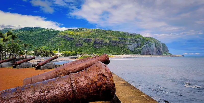
    The north of La Réunion is the coast surrounding the capital Saint-Denis and where almost all travelers arrive: Roland Garros Airport is located in Sainte-Marie, just east of the capital.

    by Felix Gillen

    1. Home
    2. Destinations
    3. La Réunion
    4. North
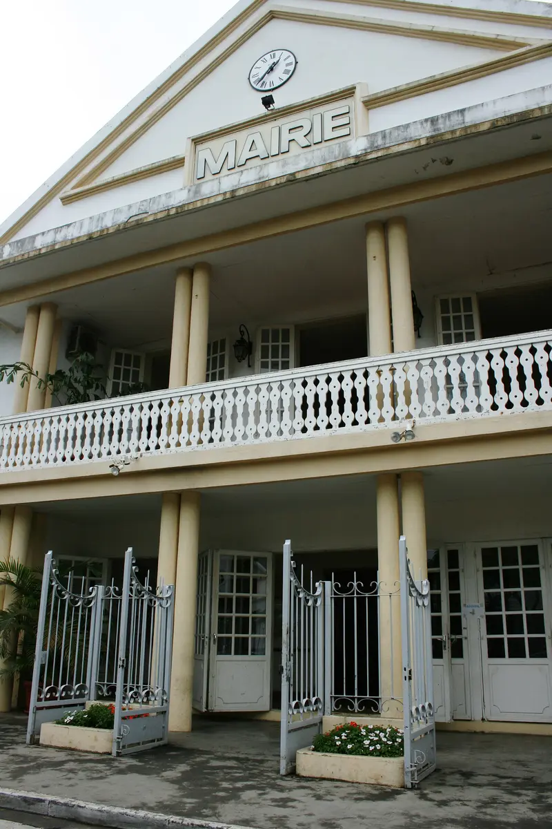
    The north of La Réunion is the coast surrounding the capital Saint-Denis and where almost all travelers arrive: Roland Garros Airport is located in Sainte-Marie, just east of the capital. This is where every island tour starts, with its Creole old town, waterfront promenade, and initial excursions into nature.East of Saint-Denis, Sainte-Marie and Sainte-Suzanne follow with sugarcane fields, the Cascade Niagara, and the Bel-Air lighthouse. It was in Sainte-Suzanne that Edmond Albius discovered the hand pollination of vanilla in 1841.
    La Réunion travel guideRound trips in La RéunionPlan a trip with North

    Contents

    • Places in the region
    • Best travel time
    • Culture
    • Getting around
    • Nearby
    Sainte-Suzanne and Sainte-Marie

    Thierry Caro / Wikimedia Commons / CC BY-SA 4.0, mod.
    Place 1 of 2

    Sainte-Suzanne and Sainte-Marie

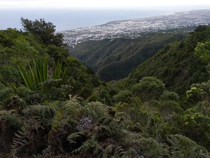
    Sainte-Suzanne is a municipality on the northeast coast, east of Saint-Denis and Roland Garros Airport in Sainte-Marie.

    Discover
    Saint-Denis

    Oeneis / Wikimedia Commons / CC BY-SA 4.0, mod.

    Place 2 of 2

    Saint-Denis

    Saint-Denis is the capital of La Réunion and is located on the north coast, a few kilometers from Roland Garros International Airport.

    Discover

    Best Time to Visit

    When is the best time for your trip?

    May
    June
    July
    August
    September
    October
    November
    22–25°C·44–97 mm(moderate rain)
    The north coast's dry season runs from May to November: Gillot then receives 44 to 97 mm of rain monthly, with over 250 mm monthly from January to March. December to April is hot and humid; cyclones can disrupt travel plans.
    The monthly values apply to the station Saint-Denis-Gillot at Roland Garros Airport (climate normal values for 1991 to 2020 from CLIMAT messages to the World Meteorological Organization (WMO), retrieved via ClimatView from the Japan Meteorological Agency (JMA)). It is warmest in February, averaging 26.9 °C, and coolest in July and August at 21.6 °C. No values are available for sunshine hours.

    Seasons

    Jan
    Feb
    Mar
    Apr
    May
    Jun
    Jul
    Aug
    Sep
    Oct
    Nov
    Dec
    Hot Monsoon and Cyclone Season
    Cooler dry season
    Best Time to Visit
    ▶Show detailed monthly data
    MonthTemp (°C)Rain (mm)
    January26.8258
    February26.9257
    March26.5265
    April25.6130
    May24.097
    June22.468
    July21.645
    August21.653
    September22.244
    October23.344
    November24.650
    December26.0126

    Capital and Vanilla

    Saint-DenisSaint-Denis was founded in 1669 and has been the island's capital since 1738. On Rue de Paris, you'll find Creole villas from the colonial era, and the Grande Mosquée Noor-e-Islam was completed in 1905.Sainte-SuzanneIn Sainte-Suzanne, Edmond Albius discovered the hand-pollination of vanilla in 1841, a technique still used worldwide today.

    Getting there & around

    AirportRoland Garros Airport is located in Sainte-Marie a few kilometers east of Saint-Denis. From the airport's bus station, Car Jaune buses run to Saint-Denis and along the coast.By RoadThe RN2 connects Saint-Denis with Sainte-Marie, Sainte-Suzanne, and the east coast; to the west, the Route du Littoral leads towards La Possession. During peak hours, traffic gets congested at the city exits.

    Nearby
    Saint-André

    Saint-André

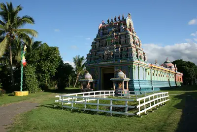
    Saint-André is located on the northeast coast between Saint-Denis and Saint-Benoît and is considered the center of Tamil culture on the island. You come for the Hindu temples, the Dipavali festival of lights in November, and the Creole houses; it's also where the road to the Cirque de Salazie begins. In 2023, the municipality had 58,885 inhabitants.In the 19th century, sugarcane, sugar factories, and vanilla defined the area. After the abolition of slavery in 1848, many indentured laborers arrived from South India. Parc du Colosse by the sea was developed on former sugarcane fields.

    Thierry Caro·CC BY-SA 4.0

    Grand Îlet

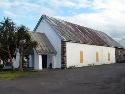
    Grand Îlet is a mountain village at approximately 1,100 m altitude in the west of the Cirque de Salazie. You come here because above the village lies the Col des Bœufs, the easiest access to the Cirque de Mafate; the village bears the 'Village Créole' label.Grand Îlet includes the hamlets of Le Bélier and Mare à Martin. The village is particularly cyclone-prone: During Cyclone Gamede, 3,240 mm of rain fell here in three days. The main attraction is the wooden church of Saint-Martin.
    Bras-Panon

    Bras-Panon

    Bras-Panon is a municipality on the east coast between Saint-André and Saint-Benoît and is considered the cradle of Bourbon vanilla. You come for the Provanille vanilla cooperative and the bathing pools of the Rivière des Roches. In 2023, Bras-Panon had a population of 13,012.The municipality is bordered by the Rivière du Mât to the north and the Rivière des Roches to the south. Bras-Panon has been an independent municipality since February 24, 1882; before that, it belonged to Saint-Benoît.

    WCOMFR Mireille GRUMBERG·CC BY-SA 4.0

    Cirque de Salazie and Hell-Bourg

    Cirque de Salazie and Hell-Bourg

    The Cirque de Salazie is the easternmost of the island's three central calderas and the most easily accessible. You go there for the waterfalls on the green cliffs and for Hell-Bourg, the only village outside mainland France to bear the "Plus beaux villages de France" label.Salazie is the rainiest of the three calderas. The water feeds dense vegetation, Chouchou fields, and numerous cascades such as the Voile de la Mariée. Besides Hell-Bourg, the municipality includes the localities of Grand Îlet and Mare à Vieille Place. Hiking paths go to Piton d'Anchaing, Bélouve Forest, and via Col des Bœufs to Mafate.

    Guallendra·CC0

    Hell-Bourg

    Hell-Bourg

    Hell-Bourg is a former spa town in the Cirque de Salazie at the foot of Piton d'Anchaing and Piton des Neiges. You come for its 19th-century Creole houses; since 1999, it has been one of the "Plus beaux villages de France", the only member outside mainland France.The village was named after Governor Anne Chrétien Louis de Hell in 1841; its thermal baths opened in 1852. Villas followed, as affluent coastal families came to the heights for recreation. In 1948, a cyclone buried the springs, ending the spa's operation.

    Guallendra·CC0

    Your next steps

    North is in La Réunion. Ways to carry on from here.

    • More in La Réunion

      Highlights, areas, routes and the best time to travel for all of La Réunion.

      La Réunion travel guide
    • Round trips in La Réunion

      Ready-made routes through La Réunion, with stops, nights and a map.

      See the routes
    • Plan a trip with North

      The Guide asks about season, length and who is coming, and suggests a trip with North.

      Plan the trip

    Sources & method

    • Photos: Wikimedia Commons. Each photo carries its credit.
    • The content is based on web research from public, traceable sources. How the content is made · The role of AI