Fernweh: Home
ExploreGuideDestinationsMy tripsMy trip
de|en
All Places & RegionsRound tripsNight trains in EuropeAll highlightsAbout FernwehFAQPrivacy PolicyImprint
Download on the App StoreGet it on Google Play
ExploreGuideDestinationsMy tripsMy trip
    • Places in the region
    • Eat & drink
    • Culture
    • Getting around
    • Nearby
    Snæfellsnes

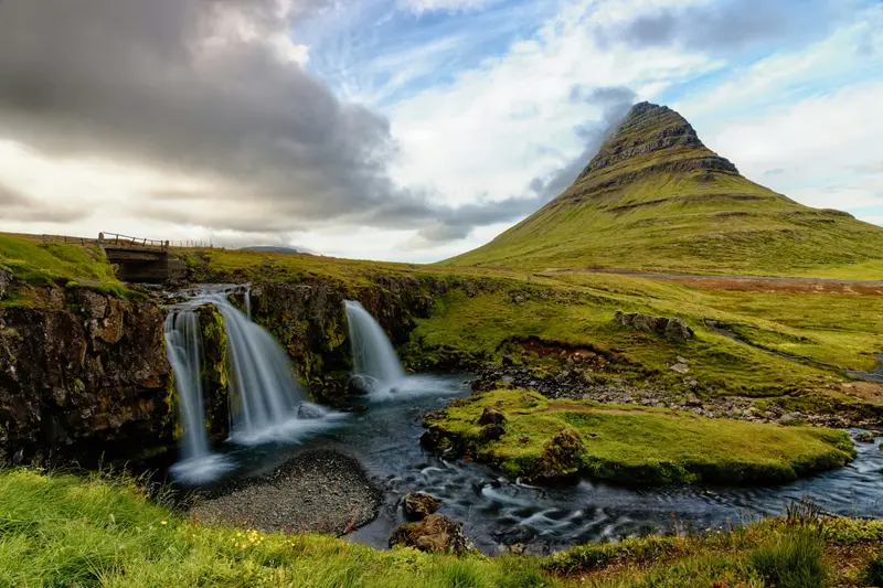
    Photo by Yves Alarie on Unsplash

    Iceland

    Snæfellsnes

    Region

    The Snæfellsnes Peninsula in West Iceland features Mount Kirkjufell near Grundarfjörður, lava caves, basalt coast at Arnarstapi, seal beaches, and at its tip, the 1,446 m high glacier volcano Snæfellsjökull.

    by Felix Gillen

    1. Home
    2. Destinations
    3. Iceland
    4. Snæfellsnes
    The Snæfellsnes Peninsula in West Iceland features Mount Kirkjufell near Grundarfjörður, lava caves, basalt coast at Arnarstapi, seal beaches, and at its tip, the 1,446 m high glacier volcano Snæfellsjökull. Snæfellsjökull National Park was established in 2001 and extends to the sea.The largest town is Stykkishólmur on the north coast, about a 2 hour 15 minute drive from Reykjavík.
    Iceland travel guideRound trips in IcelandPlan a trip with Snæfellsnes

    Contents

    • Places in the region
    • Eat & drink
    • Culture
    • Getting around
    • Nearby

    Sights in Snæfellsnes

    Discover the most important sights and attractions

    Attraction

    Kirkjufell and Kirkjufellsfoss

    The 463 m tall Kirkjufell lies about two minutes' drive west of Grundarfjörður; the classic view of the mountain is best seen from the three-tiered Kirkjufellsfoss waterfall beyond the pedestrian bridge. Do not climb the peak alone: The ascent is steep and dangerous; there were injuries and deaths. A parking fee applies at the waterfall.
    Open in Google Maps
    Attraction

    Djúpalónssandur

    Bay in Snæfellsjökull National Park, its beach home to the remains of the ship Epine, stranded in 1948.
    Open in Google Maps
    National Park

    Snæfellsjökull National Park

    The National Park, founded in 2001 at the tip of the peninsula, stretches from the 1,446 m high glacier volcano Snæfellsjökull to the sea. The visitor center is located in Malarrif (daily 11 am to 4 pm), and the park is accessible year-round.
    Open in Google Maps
    Attraction

    Lóndrangar

    Two rock stacks on the national park's south coast, considered remnants of a crater. Sea eagles have nested here since the early 20th century.
    Open in Google Maps
    Attraction

    Vatnshellir

    Lava cave on Road 574 north of Malarrif, opened to visitors in 2010 and only accessible with a guided tour. You'll find restrooms at the Malarrif Visitor Center, about a five-minute drive away.
    Open in Google Maps
    Attraction

    Arnarstapi

    Small harbor with basalt columns, expanded in 1933, and the stone sculpture of the legendary hero Bárður Snæfellsás by Ragnar Kjartansson. A coastal path leads to Hellnar with its church built in 1945.
    Open in Google Maps

    Restaurants in Snæfellsnes

    1

    Narfeyrarstofa

    Restaurant in the old town of Stykkishólmur, operating since 2000, with fish, lamb, and mussels on the menu. Recommended by Westiceland and Lonely Planet.
    Show on Google Maps
    2

    Bjargarsteinn Mathús

    Restaurant in Grundarfjörður, in an offset 1908 house, open since 2015, with seasonal fish cuisine and views of Kirkjufell. Recommended by Fodor's and Lonely Planet.
    Show on Google Maps

    Culture & Legends

    The Bárður SagaMany places on the peninsula are linked to the saga of Bárður Snæfellsás, such as the Rauðfeldsgjá gorge. In Arnarstapi, a stone sculpture by Ragnar Kjartansson commemorates the saga hero.StykkishólmurIn the peninsula's largest town stands the Norska Húsið from 1832, now a regional museum. Artist Roni Horn's Library of Water features 24 glass columns filled with glacier water.

    Local explorations

    Getting ThereFrom Reykjavík to Stykkishólmur, you drive around 2 hours 15 minutes via the Ring Road and the continuously paved Road 54. The peninsula can be explored on a scenic drive via Grundarfjörður, the National Park, and Arnarstapi.Ferry to the WestfjordsFrom Stykkishólmur, the Baldur ferry sails daily via Flatey Island to Brjánslækur in the Westfjords, twice a day in summer. You should reserve car spaces in advance.National ParkThe National Park Visitor Centre is located in Malarrif and is open daily from 11 AM to 4 PM. The Vatnshellir lava cave is only accessible with a guided tour; the summit of Kirkjufell is only recommended with a local mountain guide.

    Nearby

    Westfjords

    Westfjords

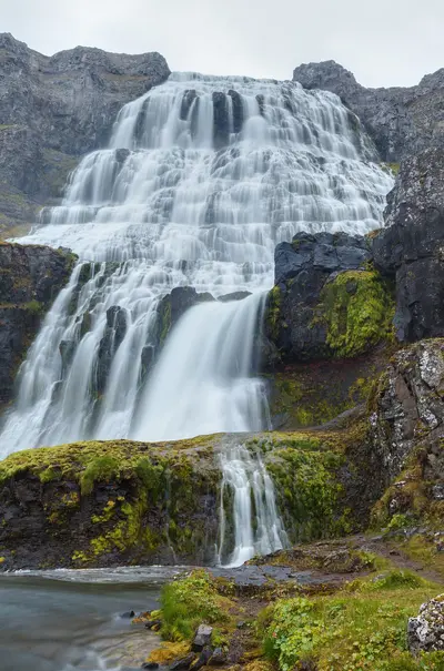
    The Westfjords are the most remote region in northwest Iceland, with deep fjords, bird cliffs, and few settlements. Ísafjörður is the main town. Highlights include the approximately 100 m high Dynjandi waterfall, the Látrabjarg bird cliff, which rises up to 441 m, and the uninhabited Hornstrandir nature reserve.The Westfjords Way route covers approximately 950 km through the region.

    Diego Delso·CC BY-SA 4.0

    Reykjavík

    Reykjavík

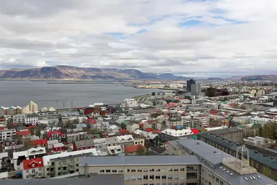
    With around 139,000 inhabitants, Reykjavík is the capital of Iceland and the center of a capital region where nearly two-thirds of the population lives. Its landmark is the Hallgrímskirkja, built between 1945 and 1986; at the harbor stands the Harpa concert hall, completed in 2011, whose glass façade was created in collaboration with Ólafur Elíasson.The city center, encompassing the Laugavegur shopping street, the Old Harbor, and Tjörnin pond, is easily explored on foot. Reykjavík serves as the starting point for the Golden Circle and the South Coast.

    Jakub Hałun·CC BY-SA 4.0

    Golden Circle

    Golden Circle

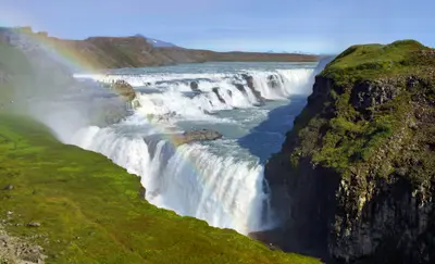
    The Golden Circle is Iceland's most famous tour: From Reykjavík, it links Þingvellir National Park, the Haukadalur geothermal area with Geysir and Strokkur, and the two-tiered Gullfoss waterfall. This circuit is around 250-300 km long, depending on the route.In Þingvellir, the Althing first convened in 930. The National Park has been a UNESCO World Heritage site since 2004 and lies in the rift between the North American and Eurasian plates.

    Martti Salmi·Unsplash

    South Coast

    South Coast

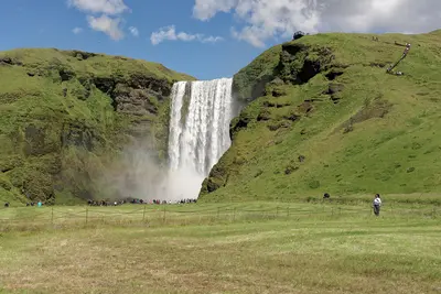
    Along the South Coast, lining the Ring Road, are the waterfalls Seljalandsfoss and Skógafoss, the black sand beach Reynisfjara near Vík, the Skaftafell section of Vatnajökull National Park, and the Jökulsárlón glacier lagoon. From Reykjavík to Vík, it's approximately 187 km or two and a half hours' drive.Many destinations are directly on the road and accessible via short paths; fees are charged at most parking lots.

    Jakub Hałun·CC BY 4.0

    Akureyri

    Akureyri

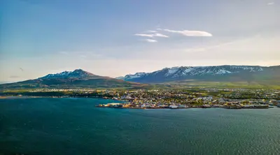
    Akureyri ist mit rund 20.000 Einwohnern die größte Gemeinde außerhalb der Hauptstadtregion und das Zentrum Nordislands. Über der Innenstadt steht die 1940 erbaute Akureyrarkirkja, außerdem findest du den Botanischen Garten Lystigarðurinn, das Kulturhaus Hof und eine Fußgängerzone.Der Wasserfall Goðafoss liegt rund 35 km entfernt, der Mývatn rund 100 km.

    Ed Wingate·Unsplash

    Your next steps

    Snæfellsnes is in Iceland. Ways to carry on from here.

    • More in Iceland

      Highlights, areas, routes and the best time to travel for all of Iceland.

      Iceland travel guide
    • Round trips in Iceland

      Ready-made routes through Iceland, with stops, nights and a map.

      See the routes
    • Plan a trip with Snæfellsnes

      The Guide asks about season, length and who is coming, and suggests a trip with Snæfellsnes.

      Plan the trip

    Sources & method

    • Photos: Unsplash. Each photo carries its credit.
    • Place data such as addresses and ratings comes from Google Maps.
    • The content is based on web research from public, traceable sources. How the content is made · The role of AI