Fernweh: Home
ExploreGuideDestinationsMy tripsMy trip
de|en
All Places & RegionsRound tripsNight trains in EuropeAll highlightsAbout FernwehFAQPrivacy PolicyImprint
Download on the App StoreGet it on Google Play
ExploreGuideDestinationsMy tripsMy trip
    • Neighborhoods & highlights
    • Eat & drink
    • Culture
    • Getting around
    • Accommodation
    • Plan trip
    • Round trips
    • Nearby
    Port Angeles

    Gordon Leggett / Wikimedia Commons / CC BY 4.0, mod.

    United States

    Port Angeles

    City

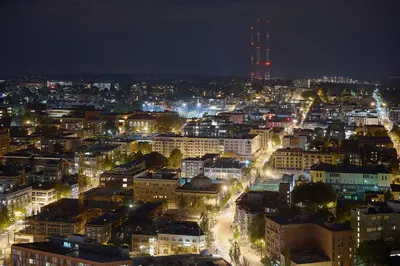
    Port Angeles is located on the north coast of the Olympic Peninsula, on the Strait of Juan de Fuca, opposite Victoria in Canada, to which the Coho ferry sails.

    by Felix Gillen

    1. Home
    2. Destinations
    3. United States
    4. Washington (State)
    5. Port Angeles
    Port Angeles is located on the north coast of the Olympic Peninsula, on the Strait of Juan de Fuca, opposite Victoria in Canada, to which the Coho ferry sails. The city is the gateway to Olympic National Park, with its visitor center on the city's outskirts.From here, a mountain road leads approximately 27 kilometers up to Hurricane Ridge, offering views over the Olympic Mountains, and west of the city lies the deep blue Lake Crescent.
    United States travel guideSee the round tripPlan a trip with Port Angeles

    Contents

    • Neighborhoods & highlights
    • Eat & drink
    • Culture
    • Getting around
    • Accommodation
    • Round trips
    • Nearby

    Sights in Port Angeles

    Discover the most important sights and attractions

    Natural Feature

    1Lake Crescent and Marymere Falls

    The lake, up to 190 meters deep, is located west of Port Angeles on Highway 101. From the shore, a trail of about 1.4 kilometers one way leads to the 27-meter-high Marymere Falls; the Mount Storm King Trail is steeper, with approximately 600 meters of elevation gain. The area is open (as of November 2026).
    Open in Google Maps
    Attraction

    2Olympic National Park Visitor Center

    On the outskirts of Port Angeles, you can get the latest information on roads and closures in the park. Admission to the National Park costs 30 US dollars per private vehicle for seven days; there is no surcharge for foreigners here.
    Open in Google Maps

    3Hurricane Ridge

    Die Bergstraße führt 17 Meilen (rund 27 Kilometer) von Port Angeles hinauf zum Aussichtspunkt über die Olympic Mountains. Die Day Lodge oben brannte im Mai 2023 ab, ein Neubau ist frühestens ab 2028 geplant; Trinkwasser gibt es oben nicht. Im Winter ist die Straße planmäßig freitags bis sonntags und an Feiertagsmontagen offen, wetterabhängig und mit Schneekettenpflicht. Der Shuttle ab Port Angeles fährt erst wieder im Sommer 2027.
    Open in Google Maps

    Restaurants in Port Angeles

    Wilds

    Three Landscapes in One ParkOlympic National Park combines high mountains, rainforest, and Pacific coast. West of the mountains, 3.7 to 4.3 meters of rain fall annually; on the Port Angeles side, it is significantly drier.Hurricane Ridge After the FireThe Day Lodge at Hurricane Ridge burned down in May 2023; reconstruction is being planned, with construction potentially starting no earlier than 2028.

    On the Go

    Olympic National ParkAdmission $30 per vehicle for seven days, no foreign visitor surcharge; information on closures available at the visitor center on the outskirts of town and at nps.gov/olym.Hurricane Ridge: 17-mile mountain road, in winter typically open only Friday to Sunday and on holiday Mondays, snow chains required. The Clallam Transit shuttle ($1, from Gateway Transit Center) will resume service in summer 2027.Lake Crescent: west of town on Highway 101, currently open.The Hoh Rain Forest and access to Rialto Beach on the west side are closed as of November 2026.

    Accommodations in Port Angeles

    Find perfect stay in Port Angeles

    Booking.com* (Affiliate link)
    Search Hotels
    Agoda* (Affiliate link)
    Search Hotels
    Airbnb
    Vacation Rentals

    * Affiliate link: if you book through it, we earn a small commission. The price stays the same for you.

    Campgrounds in Port Angeles

    Find perfect campground in Port Angeles

    Search via Google Maps
    Campgrounds nearby (15km)
    Camping.info
    Find Campgrounds
    Park4Night
    RV Parks & Camping

    Plan your trip to Port Angeles

    Save places, build a route and plan your city trip, all in one place.

    1. 1
      Sunrise over alpine peaks and a sea of clouds
      1234

      Round trip

      12 days · 4 stops

      Saved

      Pick a route

      Pick a ready-made one or save places and plan your own.

      Open bookmarks
    2. 2

      Trip to Port Angeles

      Live
      • 1Lake Crescent and Marymere Falls3 days
      • 2Olympic National Park Visitor Center4 days
      • 3Hurricane Ridge5 days
      Budget

      Plan your trip

      The planner sorts stops, days and budget. Plan together in real time.

      Start trip planning
    3. 3
      9:41 No signal
      Port Angeles
      Available offline

      Gordon Leggett / Wikimedia Commons / CC BY 4.0, mod.

      Use it on the road

      Download the guide to your phone and use it on site, even offline.

    Round trips with Port Angeles

    Pacific Northwest: Rainforest, Coast, and Volcanoes

    Pacific Northwest: Rainforest, Coast, and Volcanoes

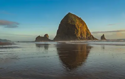
    From Seattle you take the ferry across to Bainbridge Island and drive on to the Olympic Peninsula: Hurricane Ridge, Lake Crescent, the Hoh Rain Forest and the Pacific beaches of Olympic National Park. On US 101 the route continues via Astoria to Cannon Beach on the Oregon coast and then inland to Portland. From there the loop leads into the Columbia River Gorge and onto the Mount Hood Scenic Byway around the volcano, before you drive back to Seattle. At the Hoh Rain Forest the wait at the entrance can be up to two hours in summer; the park service recommends arriving before 8 a.m. or after 5 p.m. For the parking lot at Multnomah Falls on I-84 (Exit 31) you need a timed-use permit via recreation.gov in the summer season; the dates are set anew every year. If you have two to three days more, add Crater Lake in southern Oregon: the Rim Drive is usually only fully open from mid-July and closes with the first heavy snow, on 1 November at the latest.

    15 Days
    7 stops

    Christian Clado·Pexels

    Nearby

    Victoria

    Victoria

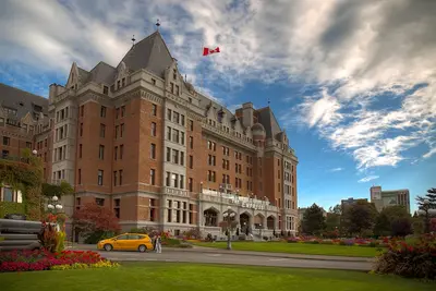
    Victoria, the capital of British Columbia, is located at the southern tip of Vancouver Island. Around the Inner Harbour are the Parliament and the Fairmont Empress; plus gardens, a compact old town with Chinatown, and Canada's mildest climate.

    Unsplash

    Forks

    Forks

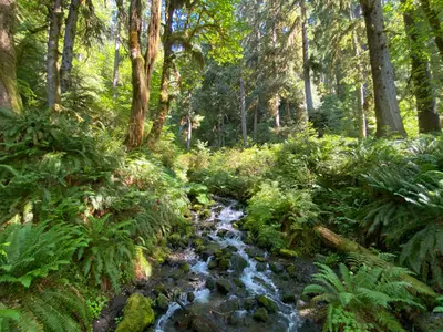
    Forks is a small former logging town on the west side of the Olympic Peninsula. West of the Olympic Mountains, the area receives 3.7 to 4.3 meters of rain annually, making it a base for the Hoh Rain Forest with its moss-covered woods along the Hall of Mosses Trail and for the wild beaches of the Pacific coast.As of November 2026, the Hoh Rain Forest area, including trails and parking lots, is closed, as is access to Rialto Beach. Before your visit, check current alerts for Olympic National Park at nps.gov/olym.

    Hayg Balis·Pexels

    Ballard

    Ballard

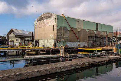
    Ballard is the old Scandinavian fishing and sawmill neighborhood in northwest Seattle, on Salmon Bay and Puget Sound, about half an hour by bus from downtown. Come for the brick blocks of Ballard Avenue with their restaurants, bars and breweries, the National Nordic Museum, and sunset on the beach at Golden Gardens.The Ballard Locks sit on the neighborhood's southern edge (see the Seattle page), so it's easy to pair the two in one day. On Sunday mornings Ballard Avenue is closed to cars for the farmers market and gets busy. On weekend evenings, tables along Ballard Avenue and Market Street go fast, and many places don't take reservations.

    Guywelch2000·CC BY 4.0

    Capitol Hill

    Capitol Hill

    Capitol Hill is Seattle's nightlife neighborhood, on the hill just east of downtown and three minutes from Westlake on Link light rail. Come for the bars, clubs and restaurants along Broadway, Pike and Pine, and for Volunteer Park at the north end, with its conservatory, Asian art museum and water tower.By day the neighborhood is low-key and full of students; from late afternoon Pike and Pine fill up, and on weekends things stay busy past midnight. Give the park, a museum and an evening out half a day to a full day. The streets are steep: from Broadway to Volunteer Park is a good 20-minute walk uphill.

    Dllu·CC BY-SA 4.0

    Seattle

    Seattle

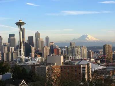
    Seattle is the largest city in Washington state, set between Puget Sound and Lake Washington with Mount Rainier on the horizon. Come for Pike Place Market, the Space Needle, the music and coffee scene, and the fact that Mount Rainier and the Olympic Peninsula are just a few hours' drive away.The city is hilly and shaped by water: ferries leave right from the waterfront, the Ballard Locks link the lakes to the Sound, and from Kerry Park you get the skyline, the bay and the volcano in one frame.NeighborhoodsDowntown and Pike Place: the market, the waterfront and the Colman Dock ferry terminal.Pioneer Square and Chinatown-International District: brick buildings from after the 1889 fire, the Klondike museum, Smith Tower and the city's oldest Asian restaurants (own page).Seattle Center and Queen Anne: Space Needle, Chihuly, MoPOP, Kerry Park.Capitol Hill: bars, clubs and cafés in the city's top nightlife district, plus Volunteer Park (own page).Ballard: the Locks, the Nordic Museum, Golden Gardens beach, breweries and restaurants up north (own page).Fremont: the troll under the Aurora Bridge and Gas Works Park on Lake Union.Plan on two to three days. July through September is usually dry and mild; from October to May it rains often, though rarely hard.


    Timothy Chi·Pexels

    Your next steps

    Port Angeles is in United States. Ways to carry on from here.

    • More in United States

      Highlights, areas, routes and the best time to travel for all of United States.

      United States travel guide
    • Round trips with Port Angeles

      One route passes through Port Angeles, with stops, nights and a map.

      See the round trip

    Sources & method

    • Photos: Wikimedia Commons. Each photo carries its credit.
    • Place data such as addresses and ratings comes from Google Maps.
    • The content is based on web research from public, traceable sources. How the content is made · The role of AI