
Fernweh: Home
ExploreGuideDestinationsMy tripsMy trip
de|en
All Places & RegionsRound tripsNight trains in EuropeAll highlightsAbout FernwehFAQPrivacy PolicyImprint
Download on the App StoreGet it on Google Play
ExploreGuideDestinationsMy tripsMy trip
    • Places & highlights
    • Eat & drink
    • Culture
    • Getting around
    • Accommodation
    • Nearby
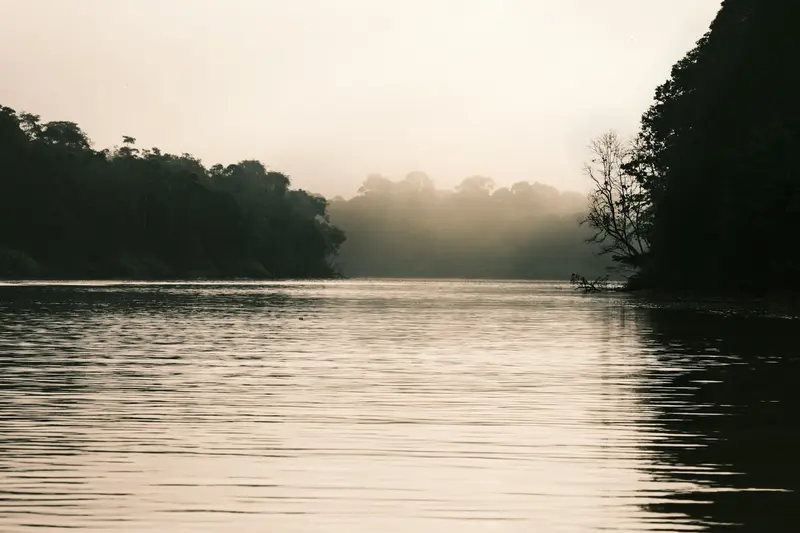
    Kinabatangan

    Photo by ELISA KERSCHBAUMER on Unsplash

    Malaysia

    Kinabatangan

    Point of Interest

    The Kinabatangan district lies in eastern Sabah, inside the Eastern Sabah Security Zone (ESSZone). Read the UK FCDO travel advice for Malaysia (gov.

    by Felix Gillen

    1. Home
    2. Destinations
    3. Malaysia
    4. Sabah
    5. Kinabatangan
    The Kinabatangan district lies in eastern Sabah, inside the Eastern Sabah Security Zone (ESSZone). Read the UK FCDO travel advice for Malaysia (gov.uk/foreign-travel-advice/malaysia) before planning a trip here.At around 560 kilometres, the Kinabatangan is Sabah's longest river and the second longest in Malaysia. On its lower reaches around the village of Sukau in eastern Sabah you can watch proboscis monkeys, orangutans, hornbills and, with luck, Bornean elephants from a boat.Wildlife watching mostly happens on boat trips in the early morning and late afternoon; you stay in riverside lodges.
    Malaysia travel guideRound trips in MalaysiaPlan a trip with Kinabatangan

    Contents

    • Places & highlights
    • Eat & drink
    • Culture
    • Getting around
    • Accommodation
    • Nearby

    Sights in Kinabatangan

    Discover the most important sights and attractions

    Gomantong Caves

    Josefito123 / Wikimedia Commons / CC BY-SA 4.0, mod.

    Attraction

    1Gomantong Caves

    Cave system in Gomantong Hill, the lower Kinabatangan's largest limestone feature. A wooden boardwalk spans the publicly accessible Simud Hitam, with a ceiling up to 60 meters. Licensed collectors twice yearly gather edible swiftlet nests, scaling rattan ladders, ropes, and bamboo poles. Guano covers the floor. At dusk, bat swarms exit the caves.
    Open in Google Maps
    Kinabatangan Wildlife Sanctuary

    Artchenphoto / Wikimedia Commons / CC BY-SA 4.0, mod.

    Park

    2Kinabatangan Wildlife Sanctuary

    Protected forest strips along the lower river. Morning and late afternoon boat trips reveal Proboscis monkeys in river trees, macaques, hornbills, crocodiles, and, if lucky, orangutans or pygmy elephants. Night flashlight boat trips are worthwhile.
    Open in Google Maps

    Restaurants in Kinabatangan

    Pressured Forest

    From the early 1950s until 1987, commercial logging occurred in the river plain, and over 60,000 hectares of lowland rainforest were converted into cocoa and oil palm plantations. What remained is often just a narrow strip of forest along the riverbank. Animals therefore crowd by the river, which makes observation easy, but also reveals how threatened their habitat is.In 1999, a roughly 28,000-hectare reserve was designated on the lower river; since 2009, it has officially been the Kinabatangan Wildlife Sanctuary.

    Getting to the Kinabatangan

    Getting thereFrom Sandakan or Sepilok you travel by road to Sukau or Bilit. Most lodges pick you up in Sandakan, at the airport or in Sepilok. Buses only go as far as the turn-off on the main road, from where you need a transfer. On site you get around almost entirely by boat with a guide. Bring binoculars, rain gear, long clothing and mosquito repellent.Travel adviceKinabatangan district is part of the Eastern Sabah Security Zone (ESSZone). Before any planning, check the UK FCDO travel advice, which covers eastern Sabah specifically and also includes health information.

    Accommodations in Kinabatangan

    Find perfect stay in Kinabatangan

    Booking.com* (Affiliate link)
    Search Hotels
    Agoda* (Affiliate link)
    Search Hotels
    Airbnb
    Vacation Rentals

    * Affiliate link: if you book through it, we earn a small commission. The price stays the same for you.

    Nearby

    Sandakan

    Sandakan

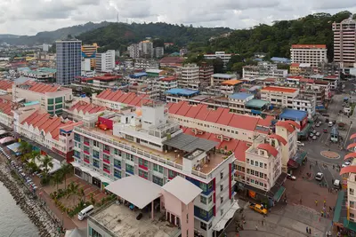
    Sandakan lies in eastern Sabah, inside the Eastern Sabah Security Zone (ESSZone). The UK FCDO advises against all but essential travel to the islands and dive sites off this coast, including Lankayan. Read the FCDO travel advice for Malaysia (gov.uk/foreign-travel-advice/malaysia) before planning a trip here.The port city on Sabah's east coast was the capital of British North Borneo until 1946. Today it is mainly the gateway to Sepilok, the Kinabatangan and the Turtle Islands.In town, Agnes Keith House and Sandakan Memorial Park recall the colonial era and the Second World War, and at the harbour you will find fresh fish and seafood.

    CEphoto, Uwe Aranas·CC BY-SA 4.0

    Sepilok Orangutan Rehabilitation Centre

    Sepilok Orangutan Rehabilitation Centre

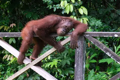
    Sepilok lies near Sandakan in eastern Sabah, inside the Eastern Sabah Security Zone (ESSZone). Read the UK FCDO travel advice for Malaysia (gov.uk/foreign-travel-advice/malaysia) before planning a trip here.At the Sepilok Orangutan Rehabilitation Centre near Sandakan on the east coast of Sabah in northern Borneo, orphaned orangutans have been prepared for life in the rainforest since 1964. At feeding times you see the apes from a few metres away, in protected forest rather than a zoo.Right next door is the Bornean Sun Bear Conservation Centre for rescued sun bears, and a few minutes away the Rainforest Discovery Centre with its canopy walkway.

    kallerna·CC BY-SA 4.0

    Danum Valley Conservation Area

    Danum Valley is reached via Lahad Datu in eastern Sabah, inside the Eastern Sabah Security Zone (ESSZone). Read the UK FCDO travel advice for Malaysia (gov.uk/foreign-travel-advice/malaysia) before planning a trip here.Danum Valley in eastern Sabah protects around 438 square kilometres of largely untouched lowland rainforest with towering dipterocarp trees. On guided walks and night excursions you may see orangutans, gibbons, hornbills and, with luck, Bornean pygmy elephants.In 2019 Menara was discovered here, a yellow meranti of almost 98 metres, regarded as the tallest known tropical tree in the world.
    Semporna Islands

    Semporna Islands

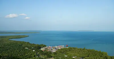
    The UK FCDO advises against all but essential travel to all islands and dive sites off the coast of eastern Sabah, from Sandakan to Tawau, which includes Sipadan, Mabul and the other islands off Semporna, because of the threat of kidnapping. Read the FCDO travel advice for Malaysia (gov.uk/foreign-travel-advice/malaysia) before planning a trip here.The Semporna Archipelago in south-eastern Sabah is one of Malaysia's best-known dive areas. Off the small town of Semporna lie dozens of islands with coral reefs, stilt villages of the Bajau Laut and the dive site of Sipadan.Sabah Parks issues only a limited number of permits for Sipadan each day. On the volcanic island of Bohey Dulang a steep path leads to a viewpoint over the lagoon.

    ma hxin·Pexels

    Kinabalu National Park

    Kinabalu National Park

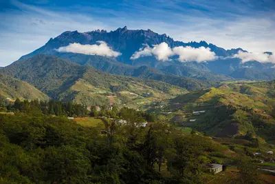
    Kinabalu National Park in Sabah in northern Borneo protects the 4,095-meter-high Mount Kinabalu, the highest mountain in Malaysia. You come for the two-day summit climb to the sunrise or for the montane forests, which have been protected by UNESCO since 2000 as Malaysia's first World Heritage Site.On the way up, the vegetation changes from rainforest through cloud forest with pitcher plants and orchids to the bare granite dome. Even without the summit, the forest trails at the headquarters, the hot springs of Poring and the cool mountain village of Kundasang are worth it.

    Anton Zelenov·CC BY-SA 4.0

    Your next steps

    Kinabatangan is in Malaysia. Ways to carry on from here.

    • More in Malaysia

      Highlights, areas, routes and the best time to travel for all of Malaysia.

      Malaysia travel guide
    • Round trips in Malaysia

      Ready-made routes through Malaysia, with stops, nights and a map.

      See the routes
    • Plan a trip with Kinabatangan

      The Guide asks about season, length and who is coming, and suggests a trip with Kinabatangan.

      Plan the trip

    Sources & method

    • Photos: Wikimedia Commons, Unsplash. Each photo carries its credit.
    • Place data such as addresses and ratings comes from Google Maps.
    • The content is based on web research from public, traceable sources. How the content is made · The role of AI