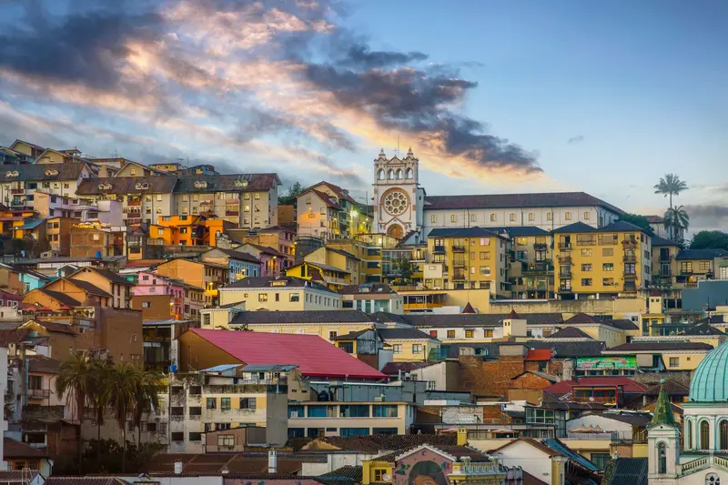
Photo by tommy picone on Pexels
Round trip · Madagascar
Along the RN7: Highlands, Rainforest and Isalo
by Felix Gillen
- 9 Days / 8 Nights
- Antananarivo → Isalo
The route follows the RN7, Madagascar's classic travel road, from the capital through the highlands southwards: Antananarivo with the Rova, the Ranomafana rainforest with its bamboo lemurs, the Kattas of Anja near Ambalavao, and the Isalo sandstone massif. Travel most comfortably with rental car and driver. As an extension, a prior side trip to the Andasibe rainforest east of the capital is worthwhile.
At a glance
- Duration
- 9 Days / 8 Nights
- Stops
- 4 · Antananarivo → Isalo
- Arrival
- Flight · Antananarivo-Ivato (TNR)
- Departure
- Flight · Toliara (TLE)
- Best Time to Go
- April to November
4 stops
Why This Route?
The RN7 is Madagascar’s classic travel route, connecting some of the island’s most important destinations. The legs can be driven during daylight, and at the end, you fly back from Toliara instead of driving the entire route again.
Hidden Gems
- Visit Antemoro paper workshop in Ambalavao mornings, sheets drying in sun
- book Isalo guide in advance at Ranohira park office
- jacarandas bloom October at Lac Anosy, Antananarivo.
Getting there and back
Open jaw: start and end are in different places
- Arrival
- Flight · Antananarivo-Ivato (TNR)At Ivato Airport, you will receive your visa on arrival (fee based on length of stay). Do not travel overland at night; the German Foreign Office explicitly advises against this.
- Departure
- Flight · Toliara (TLE)From Toliara, you fly back to Antananarivo in about 1 hr 15 min; check the current flight schedule.
Itinerary
Antananarivo
Antananarivo, known as Tana, is Madagascar's capital, situated at around 1,280 m on hills in the central highlands. On the highest hill, the Rova, the palace complex of the Merina monarchy, stands with Manjakamiadana Palace.You'll explore the Upper Town with the Prime Minister's Palace, the Lower Town's markets around Analakely, and the heart-shaped Lac Anosy. Nearby are the UNESCO Royal Hill of Ambohimanga and a lemur park, and Tana is a starting point for the RN7 south and the Andasibe rainforest.
Rova and Prime Minister's Palace, excursion to UNESCO Ambohimanga Hill and Lemurs' Park.
4 Sights
History and the City Life
Merina HeritageThe Manjakamiadana Palace in the Rova was built between 1839 and 1841 as a wooden structure for Queen Ranavalona I and received a stone casing in 1867. On November 6, 1995, a fire destroyed almost all its wooden buildings; the palace reopened in June 2023. The palace of Prime Minister Rainilaiarivony, built in 1872, houses approximately 1,500 objects salvaged from the Rova in 1995.Lower TownThe Avenue de l'Indépendance stretches about 1 km from Soarano Station through the Lower Town. Along it stand the brick pavilions from 1925, which were built for the Zoma Friday market. In October, jacarandas bloom around Lac Anosy.New YearIn March, the city celebrates Alahamady Be, the Malagasy New Year, including at Mahamasina Stadium.
Car
To Antsirabe about 190 km (approx. 6 hours), then about 250 km further to Ranomafana (approx. 7 hours); best with an overnight stay in Antsirabe, a total of approx. 10 hours actual driving time.
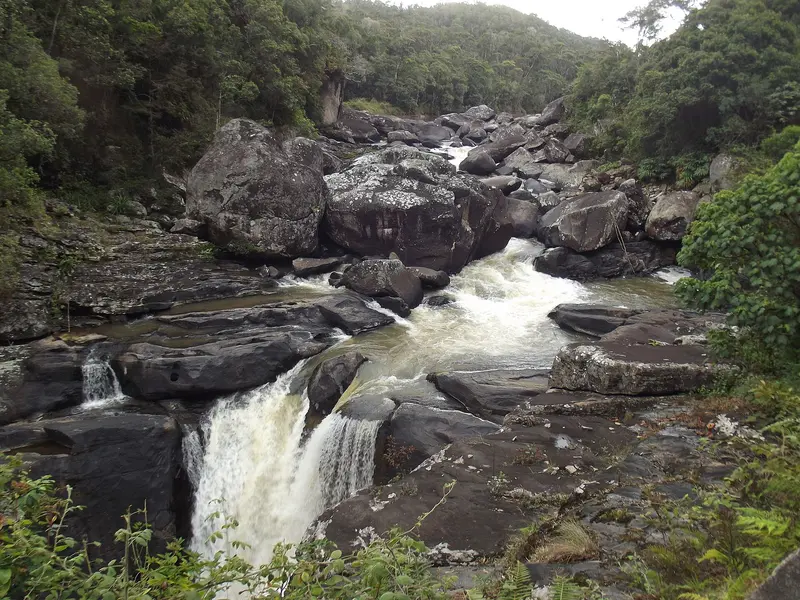
Ranomafana
Ranomafana National Park, on the eastern edge of the southern highlands, protects mountain rainforest and is part of the UNESCO World Heritage Site Rainforests of Atsinanana. It is known for the Golden Bamboo Lemur, first discovered here in 1986 and endangered.On three to four-hour hikes, you'll see bamboo lemurs, mouse lemurs, and chameleons; an evening night walk is also worthwhile. The village of Ranomafana, meaning 'hot water,' owes its name to the thermal springs.
Overnight stay en route in Antsirabe included. Rainforest hike, night walk, local thermal bath.
2 Sights
Nature and Research
World Heritage RainforestRanomafana has been a national park since 1991 and, according to Madagascar National Parks, covers 43,550 ha with 14 lemur species. It is one of six parks in the UNESCO World Heritage Site Rainforests of Atsinanana, which has been on the List of World Heritage in Danger since 2010.Thermal SpringsThe hot springs were discovered around 100 years ago. The French developed a bath around them, leading to the town's formation. The Centre ValBio research station is also located at the edge of the park.
Car
Around 120 to 130 km to Ambalavao, about 5 hours

Ambalavao and Anja
Ambalavao is located on the RN7, about 56 km south of Fianarantsoa in the southern highlands, and is a classic stop on the way to Isalo. The town is known for its handmade Antemoro paper and its Zebu market.About 13 km south, some 300 Kattas live in the Anja Community Reserve, managed by the Anja Miray village community. On circular routes of two to six hours, you can get close to the lemurs.
Kattas at Anja Community Reserve, Antemoro paper workshop.
1 Sight
Crafts and Communities
Antemoro PaperCrafted from Avoha shrub bark. At the village workshop, you'll see all steps; admission is free. Visit in the morning when sheets dry in the sun.Community ReserveAnja is managed by the community organization Anja Miray. About 300 Kattas live on around 30 hectares.Zebu MarketAmbalavao hosts a Zebu market twice weekly; ask locally for days.
Car
About 220 to 230 km via RN7 to Ranohira, approx. 4 hours.
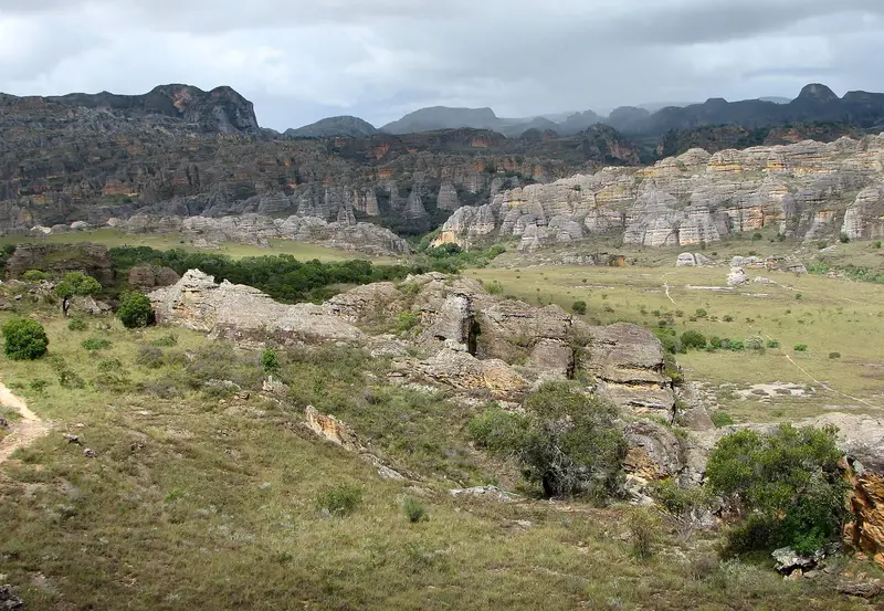
“Isalo National Park 04” by Bernard Gagnon / Wikimedia Commons / CC BY-SA 3.0, mod.
Stop 4 • 2 Nights
Isalo
Isalo National Park in southern Madagascar, along the RN7, is a rugged sandstone massif with canyons up to 200m deep and natural pools. For many travelers, it's the highlight of the journey along the RN7 from Antananarivo to Toliara.You'll hike to the Piscine Naturelle, spot lemurs in the Canyon des Makis, and experience sunset at the rock window, Fenêtre de l'Isalo. The starting point is Ranohira village, about 3 km east of the park.
Piscine Naturelle, Canyon des Makis, sunset at Fenêtre de l'Isalo. Do not enter gorges during the rainy season.
1 Sight
Landscape and Bara
A Sandstone MassifIsalo has been a national park since July 19, 1962, covering 81,540 ha. The massif consists of sandstone from the Triassic and early Jurassic Isalo Group, into which rivers have carved canyons up to 200 m deep.Bara TombsOn the way to the Piscine Naturelle, you'll pass tombs of the Bara, the ethnic group of the region. Respect your guide's instructions, as many places are subject to fady.
Car
Around 240 to 250 km to Toliara, about 5 to 6 hours, then flight
Plan this route as your trip
All stops, trains and nights go into your trip planner. You adjust dates and places to stay afterwards.
This route is a suggestion from our research. Please check timetables, times in port, opening hours and prices before you book – what your tour operator or carrier says is what counts.
Fernweh is a free travel guide and trip planner: routes researched by people, taken over in one click, used day by day on the road. More about Fernweh
4 stops
Route Summary
Duration9 Days
Stops4 Places
TypeMixed