Fernweh: Home
ExploreGuideDestinationsMy tripsMy trip
de|en
All Places & RegionsRound tripsNight trains in EuropeAll highlightsAbout FernwehFAQPrivacy PolicyImprint
Download on the App StoreGet it on Google Play
ExploreGuideDestinationsMy tripsMy trip
    • Neighborhoods & highlights
    • Recommendations
    • Tours
    • Eat & drink
    • Culture
    • Getting around
    • Accommodation
    • Plan trip
    • Round trips
    • Nearby
    Ambalavao and Anja

    Charles J. Sharp / Wikimedia Commons / CC BY-SA 4.0, mod.

    Madagascar

    Ambalavao and Anja

    City

    Ambalavao is located on the RN7, about 56 km south of Fianarantsoa in the southern highlands, and is a classic stop on the way to Isalo. The town is known for its handmade Antemoro paper and its Zebu market.

    by Felix Gillen

    1. Home
    2. Destinations
    3. Madagascar
    4. Ambalavao and Anja
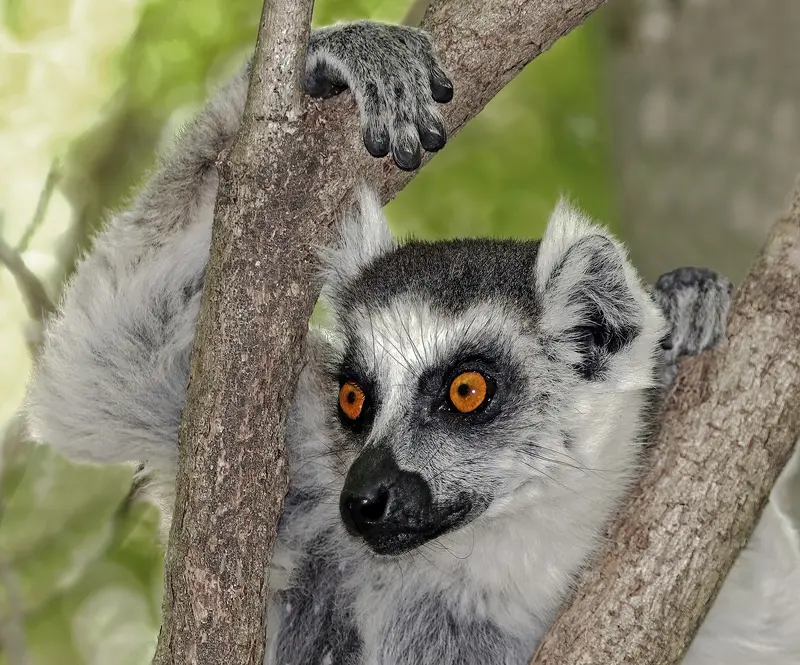
    Ambalavao is located on the RN7, about 56 km south of Fianarantsoa in the southern highlands, and is a classic stop on the way to Isalo. The town is known for its handmade Antemoro paper and its Zebu market.About 13 km south, some 300 Kattas live in the Anja Community Reserve, managed by the Anja Miray village community. On circular routes of two to six hours, you can get close to the lemurs.
    Madagascar travel guideSee the round tripPlan a trip with Ambalavao and Anja

    Contents

    • Neighborhoods & highlights
    • Recommendations
    • Tours
    • Eat & drink
    • Culture
    • Getting around
    • Accommodation
    • Round trips
    • Nearby

    Sights in Ambalavao and Anja

    Discover the most important sights and attractions

    Attraction

    1Anja Community Reserve

    About 300 ring-tailed lemurs live in the approximately 30-hectare community reserve, 13 km south of Ambalavao. Two circular trails last two to six hours, with administration handled by the Anja Miray village community.
    Open in Google Maps

    Tours & experiences in Ambalavao and Anja

    Search tours for Ambalavao and Anja on GetYourGuide* (Affiliate link)On GetYourGuide, with reviews from other travellers

    * Affiliate link: if you book through it, we earn a small commission. The price stays the same for you.

    Restaurants in Ambalavao and Anja

    Crafts and Communities

    Antemoro PaperCrafted from Avoha shrub bark. At the village workshop, you'll see all steps; admission is free. Visit in the morning when sheets dry in the sun.Community ReserveAnja is managed by the community organization Anja Miray. About 300 Kattas live on around 30 hectares.Zebu MarketAmbalavao hosts a Zebu market twice weekly; ask locally for days.

    Arrival & Practical

    Getting ThereAmbalavao is located on RN7, approximately 56 km south of Fianarantsoa. From Ranomafana, it's about 120 to 130 km or around five hours, and to Isalo, roughly 220 to 230 km or four hours.AnjaAbout 13 km south of AmbalavaoTwo circular trails of two to six hoursCheck current entrance fees at the entrance; bring cash in Ariary.

    Accommodations in Ambalavao and Anja

    Find perfect stay in Ambalavao and Anja

    Booking.com* (Affiliate link)
    Search Hotels
    Agoda* (Affiliate link)
    Search Hotels
    Airbnb
    Vacation Rentals

    * Affiliate link: if you book through it, we earn a small commission. The price stays the same for you.

    Plan your trip to Ambalavao and Anja

    Save places, build a route and plan your city trip, all in one place.

    1. 1
      Sunrise over alpine peaks and a sea of clouds
      1234

      Round trip

      12 days · 4 stops

      Saved

      Pick a route

      Pick a ready-made one or save places and plan your own.

      Open bookmarks
    2. 2

      Trip to Ambalavao and Anja

      Live
      • 1Anja Community Reserve3 days
      Budget

      Plan your trip

      The planner sorts stops, days and budget. Plan together in real time.

      Start trip planning
    3. 3
      9:41 No signal
      Ambalavao and Anja
      Available offline

      Charles J. Sharp / Wikimedia Commons / CC BY-SA 4.0, mod.

      Use it on the road

      Download the guide to your phone and use it on site, even offline.

    Round trips with Ambalavao and Anja

    Along the RN7: Highlands, Rainforest and Isalo

    Along the RN7: Highlands, Rainforest and Isalo

    The route follows the RN7, Madagascar's classic travel road, from the capital through the highlands southwards: Antananarivo with the Rova, the Ranomafana rainforest with its bamboo lemurs, the Kattas of Anja near Ambalavao, and the Isalo sandstone massif. Travel most comfortably with rental car and driver. As an extension, a prior side trip to the Andasibe rainforest east of the capital is worthwhile.

    9 Days
    4 stops
    Open jaw

    tommy picone·Pexels

    Nearby

    Ranomafana

    Ranomafana

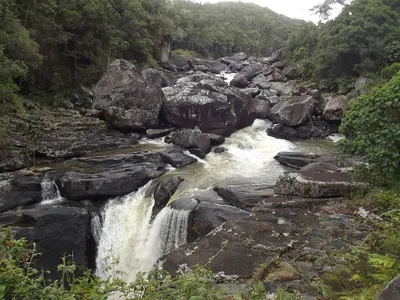
    Ranomafana National Park, on the eastern edge of the southern highlands, protects mountain rainforest and is part of the UNESCO World Heritage Site Rainforests of Atsinanana. It is known for the Golden Bamboo Lemur, first discovered here in 1986 and endangered.On three to four-hour hikes, you'll see bamboo lemurs, mouse lemurs, and chameleons; an evening night walk is also worthwhile. The village of Ranomafana, meaning 'hot water,' owes its name to the thermal springs.

    Smiley.toerist·CC BY-SA 4.0

    Isalo

    Isalo National Park in southern Madagascar, along the RN7, is a rugged sandstone massif with canyons up to 200m deep and natural pools. For many travelers, it's the highlight of the journey along the RN7 from Antananarivo to Toliara.You'll hike to the Piscine Naturelle, spot lemurs in the Canyon des Makis, and experience sunset at the rock window, Fenêtre de l'Isalo. The starting point is Ranohira village, about 3 km east of the park.
    Baobab Alley and Morondava

    Baobab Alley and Morondava

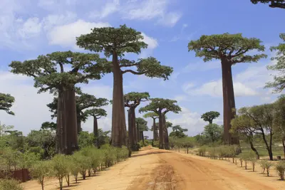
    The Avenue of the Baobabs on Piste RN8 near Morondava on the west coast is Madagascar's most famous photo opportunity: 20 to 25 baobab trees, up to 30 m high, of the highly endangered species Adansonia grandidieri, line the path here for approximately 260 m. Since 2015, the avenue has been protected as a natural monument.It is most beautiful at sunrise and sunset. Very nearby are the intertwined Baobab Amoureux, and Morondava is the starting point for the Kirindy Dry Forest and the Tsingy de Bemaraha.

    NP023·CC BY-SA 4.0

    Antananarivo

    Antananarivo

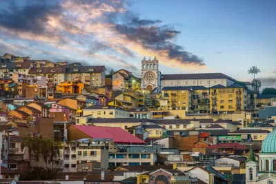
    Antananarivo, known as Tana, is Madagascar's capital, situated at around 1,280 m on hills in the central highlands. On the highest hill, the Rova, the palace complex of the Merina monarchy, stands with Manjakamiadana Palace.You'll explore the Upper Town with the Prime Minister's Palace, the Lower Town's markets around Analakely, and the heart-shaped Lac Anosy. Nearby are the UNESCO Royal Hill of Ambohimanga and a lemur park, and Tana is a starting point for the RN7 south and the Andasibe rainforest.

    tommy picone·Pexels

    Ambohimanga

    Ambohimanga

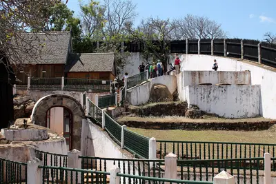
    The Royal Hill of Ambohimanga, about 24 km northeast of Antananarivo, has been a UNESCO World Heritage site since 2001 and a sacred place for the Merina for about 500 years. This was the royal city from which Andrianampoinimerina united the highlands at the end of the 18th century.Within the walls, you can see two palaces, including the rosewood palace Mahandrihono, four royal tombs and some of the 14 fortified stone gates. To this day, pilgrims come here to honor their ancestors.

    Heinonlein·CC BY-SA 4.0

    Your next steps

    Ambalavao and Anja is in Madagascar. Ways to carry on from here.

    • More in Madagascar

      Highlights, areas, routes and the best time to travel for all of Madagascar.

      Madagascar travel guide
    • Round trips with Ambalavao and Anja

      One route passes through Ambalavao and Anja, with stops, nights and a map.

      See the round trip

    Sources & method

    • Photos: Wikimedia Commons. Each photo carries its credit.
    • Place data such as addresses and ratings comes from Google Maps.
    • The content is based on web research from public, traceable sources. How the content is made · The role of AI