Fernweh: Home
ExploreGuideDestinationsMy tripsMy trip
de|en
All Places & RegionsRound tripsNight trains in EuropeAll highlightsAbout FernwehFAQPrivacy PolicyImprint
Download on the App StoreGet it on Google Play
ExploreGuideDestinationsMy tripsMy trip
    • Places & highlights
    • Eat & drink
    • Culture
    • Getting around
    • Accommodation
    • Nearby
    Ambohimanga

    Heinonlein / Wikimedia Commons / CC BY-SA 4.0, mod.

    Madagascar

    Ambohimanga

    Point of InterestUNESCOCulture

    The Royal Hill of Ambohimanga, about 24 km northeast of Antananarivo, has been a UNESCO World Heritage site since 2001 and a sacred place for the Merina for about 500 years.

    by Felix Gillen

    1. Home
    2. Destinations
    3. Madagascar
    4. Antananarivo
    5. Ambohimanga
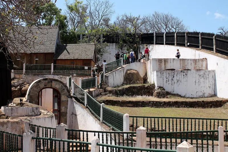
    The Royal Hill of Ambohimanga, about 24 km northeast of Antananarivo, has been a UNESCO World Heritage site since 2001 and a sacred place for the Merina for about 500 years. This was the royal city from which Andrianampoinimerina united the highlands at the end of the 18th century.Within the walls, you can see two palaces, including the rosewood palace Mahandrihono, four royal tombs and some of the 14 fortified stone gates. To this day, pilgrims come here to honor their ancestors.
    Madagascar travel guideRound trips in MadagascarPlan a trip with Ambohimanga

    Contents

    • Places & highlights
    • Eat & drink
    • Culture
    • Getting around
    • Accommodation
    • Nearby

    Sights in Ambohimanga

    Discover the most important sights and attractions

    Museum

    1Mahandrihono

    The Rosewood Palace was the residence of King Andrianampoinimerina and is the only surviving building from his era.
    Open in Google Maps
    Historic Landmark

    2Rova of Ambohimanga

    According to UNESCO, the walled district on the sacred hill comprises the royal city with two palaces, four royal tombs, and 14 fortified stone gates. The hill has been a World Heritage site since 2001 and is still a pilgrimage site today.
    Open in Google Maps

    Restaurants in Ambohimanga

    The Sacred Hill

    A Place of AncestorsUNESCO describes Ambohimanga as a royal city, burial site, and pilgrimage site that has been considered sacred for about 500 years. The fortified settlement, the palaces, and the royal tombs are part of the World Heritage site.AndrianampoinimerinaFrom here, King Andrianampoinimerina, who reigned from 1787 to 1810, united the Imerina highlands. His rosewood palace, Mahandrihono, is the only surviving building from his era.

    Getting Here & Tips

    Getting thereAmbohimanga is about 24 km northeast of Antananarivo and is a half-day trip from the capital, ideally with a driver.Practical tipsRespect fady, local taboos, and ask your guide how to behave at the tombs.Avoid driving back after dark.

    Accommodations in Ambohimanga

    Find perfect stay in Ambohimanga

    Booking.com* (Affiliate link)
    Search Hotels
    Agoda* (Affiliate link)
    Search Hotels
    Airbnb
    Vacation Rentals

    * Affiliate link: if you book through it, we earn a small commission. The price stays the same for you.

    Nearby

    Antananarivo

    Antananarivo

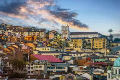
    Antananarivo, known as Tana, is Madagascar's capital, situated at around 1,280 m on hills in the central highlands. On the highest hill, the Rova, the palace complex of the Merina monarchy, stands with Manjakamiadana Palace.You'll explore the Upper Town with the Prime Minister's Palace, the Lower Town's markets around Analakely, and the heart-shaped Lac Anosy. Nearby are the UNESCO Royal Hill of Ambohimanga and a lemur park, and Tana is a starting point for the RN7 south and the Andasibe rainforest.

    tommy picone·Pexels

    Andasibe-Mantadia

    Andasibe-Mantadia

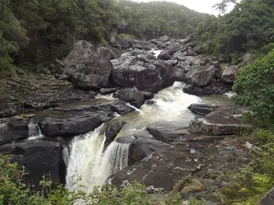
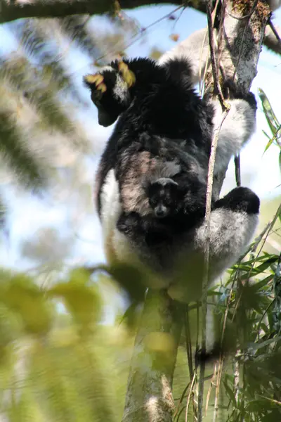
    Andasibe-Mantadia National Park on the RN2 east of Antananarivo protects humid montane rainforest and is the best-known destination to experience the Indri, Madagascar's largest primate. The drive from the capital, covering around 140 to 150 km, takes three to five hours.In the Analamazaotra section of the park, 14 lemur species live alongside the Indri; in the mornings, you'll hear the Indris' song through the forest. The wilder Mantadia section is 15 to 23 km away and is well worth it for longer hikes.

    Heinonlein·CC BY-SA 4.0

    Ranomafana

    Ranomafana

    Ranomafana National Park, on the eastern edge of the southern highlands, protects mountain rainforest and is part of the UNESCO World Heritage Site Rainforests of Atsinanana. It is known for the Golden Bamboo Lemur, first discovered here in 1986 and endangered.On three to four-hour hikes, you'll see bamboo lemurs, mouse lemurs, and chameleons; an evening night walk is also worthwhile. The village of Ranomafana, meaning 'hot water,' owes its name to the thermal springs.

    Smiley.toerist·CC BY-SA 4.0

    Tsingy de Bemaraha

    Tsingy de Bemaraha

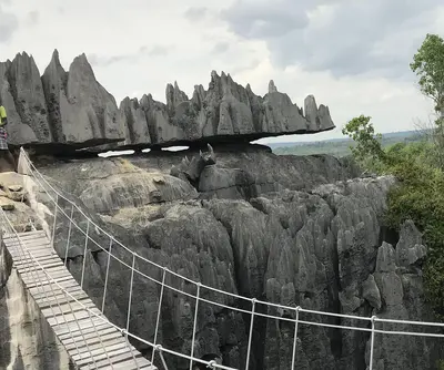
    The Tsingy de Bemaraha in western Madagascar is a karst landscape of sharp, 100m-high limestone pinnacles, cut by the deep Manambolo gorge. A UNESCO World Heritage site since 1990, it is now part of the Dry Forests of Andrefana.Explore the Grands Tsingy via secured via ferratas, suspension bridges, and narrow crevices; the Petits Tsingy near Bekopaka village are more easily accessible. The park is only reachable in the dry season; the journey from Morondava, involving dirt tracks and two ferry crossings, takes a full day.

    Cactus0625·CC BY-SA 4.0

    Île Sainte-Marie

    Île Sainte-Marie

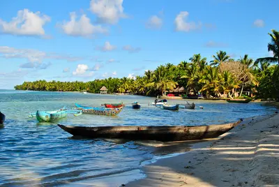
    Île Sainte-Marie, known as Nosy Boraha in Malagasy, is located off Madagascar's east coast and is approximately 60 km long. From July to September, humpback whales migrate from Antarctica to calve in the waters off the island. Boat trips from the main town of Ambodifotatra will take you to them.On land, visit the Pirate Cemetery near Ambodifotatra and the town's Catholic church, built in 1837, one of the oldest in the country. From the southern tip, you can cross by pirogue to the small Île aux Nattes.

    Anai171·CC BY-SA 4.0

    Your next steps

    Ambohimanga is in Madagascar. Ways to carry on from here.

    • More in Madagascar

      Highlights, areas, routes and the best time to travel for all of Madagascar.

      Madagascar travel guide
    • Round trips in Madagascar

      Ready-made routes through Madagascar, with stops, nights and a map.

      See the routes
    • Plan a trip with Ambohimanga

      The Guide asks about season, length and who is coming, and suggests a trip with Ambohimanga.

      Plan the trip
    Sources & method

    • Photos: Wikimedia Commons. Each photo carries its credit.
    • Place data such as addresses and ratings comes from Google Maps.
    • The content is based on web research from public, traceable sources. How the content is made · The role of AI