Fernweh: Home
ExploreGuideDestinationsMy tripsMy trip
de|en
All Places & RegionsRound tripsNight trains in EuropeAll highlightsAbout FernwehFAQPrivacy PolicyImprint
Download on the App StoreGet it on Google Play
ExploreGuideDestinationsMy tripsMy trip
    • Places & highlights
    • Recommendations
    • Tours
    • Eat & drink
    • Culture
    • Getting around
    • Accommodation
    • Nearby
    Tsingy de Bemaraha

    Cactus0625 / Wikimedia Commons / CC BY-SA 4.0, mod.

    Madagascar

    Tsingy de Bemaraha

    Point of InterestUNESCONature

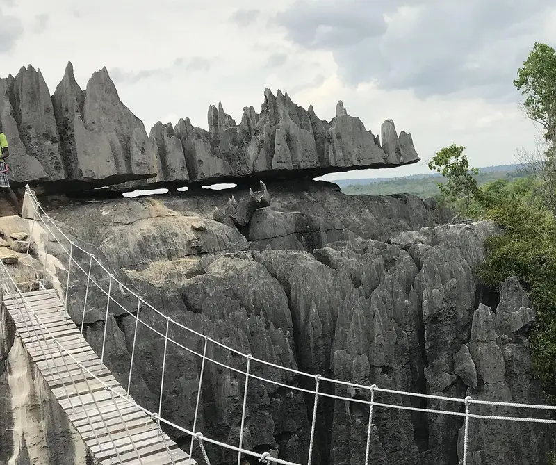
    The Tsingy de Bemaraha in western Madagascar is a karst landscape of sharp, 100m-high limestone pinnacles, cut by the deep Manambolo gorge. A UNESCO World Heritage site since 1990, it is now part of the Dry Forests of Andrefana.

    by Felix Gillen

    1. Home
    2. Destinations
    3. Madagascar
    4. Tsingy de Bemaraha
    The Tsingy de Bemaraha in western Madagascar is a karst landscape of sharp, 100m-high limestone pinnacles, cut by the deep Manambolo gorge. A UNESCO World Heritage site since 1990, it is now part of the Dry Forests of Andrefana.Explore the Grands Tsingy via secured via ferratas, suspension bridges, and narrow crevices; the Petits Tsingy near Bekopaka village are more easily accessible. The park is only reachable in the dry season; the journey from Morondava, involving dirt tracks and two ferry crossings, takes a full day.
    Madagascar travel guideRound trips in MadagascarPlan a trip with Tsingy de Bemaraha

    Contents

    • Places & highlights
    • Recommendations
    • Tours
    • Eat & drink
    • Culture
    • Getting around
    • Accommodation
    • Nearby

    Sights in Tsingy de Bemaraha

    Discover the most important sights and attractions

    National Park

    1Grands and Petits Tsingy

    The Andamozavaky circuit in the Grands Tsingy is 4 km long, takes about four hours, and crosses a suspension bridge at a height of 70 m. The Petits Tsingy (Andadoany, 2 km) are near Bekopaka and are easier. Further routes include Ankeligoa, Broadway, and Ranotsara, plus the Manambolo Gorge by pirogue. A guide is mandatory.
    Open in Google Maps

    Tours & experiences in Tsingy de Bemaraha

    Search tours for Tsingy de Bemaraha on GetYourGuide* (Affiliate link)On GetYourGuide, with reviews from other travellers

    * Affiliate link: if you book through it, we earn a small commission. The price stays the same for you.

    Restaurants in Tsingy de Bemaraha

    World Heritage, Taboos

    A UNESCO SiteThe Tsingy de Bemaraha has been a UNESCO World Heritage Site since 1990, extended in 2023 to the Dry Forests of Andrefana. Per Madagascar National Parks, the area covers 157,710 ha. It has been a nature reserve since 1927; the southern part became a National Park in 1997.Fady at ManamboloThe Vazimba tombs in the Manambolo Gorge are fady, meaning taboo. Follow your guide's instructions.

    Arrival and Details

    Getting ThereFrom Morondava to Bekopaka, about 150 to 200 km of dirt road, 8 to 10 hours by 4x4, with two ferries, including across the Tsiribihina near Belo-sur-TsiribihinaThe ferry at Bekopaka operates only until 6 PMSafetyThe Federal Foreign Office advises against visiting the banks of the Tsiribihina River due to high crime rates. River and boat tours on the Tsiribihina, which some providers promote as a travel option, should therefore be avoided. Before your trip, clarify how your route is affected and read the current advisories.Practical InformationAccessible only during the dry season, approximately mid-April to NovemberA guide is mandatory; book tickets and guides in Bekopaka, reserve early in July and AugustFor the Grands Tsingy, you need stamina and a head for heights; a climbing harness is provided

    Accommodations in Tsingy de Bemaraha

    Find perfect stay in Tsingy de Bemaraha

    Booking.com* (Affiliate link)
    Search Hotels
    Agoda* (Affiliate link)
    Search Hotels
    Airbnb
    Vacation Rentals

    * Affiliate link: if you book through it, we earn a small commission. The price stays the same for you.

    Nearby

    Baobab Alley and Morondava

    Baobab Alley and Morondava

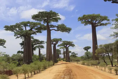
    The Avenue of the Baobabs on Piste RN8 near Morondava on the west coast is Madagascar's most famous photo opportunity: 20 to 25 baobab trees, up to 30 m high, of the highly endangered species Adansonia grandidieri, line the path here for approximately 260 m. Since 2015, the avenue has been protected as a natural monument.It is most beautiful at sunrise and sunset. Very nearby are the intertwined Baobab Amoureux, and Morondava is the starting point for the Kirindy Dry Forest and the Tsingy de Bemaraha.

    NP023·CC BY-SA 4.0

    Antananarivo

    Antananarivo

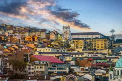
    Antananarivo, known as Tana, is Madagascar's capital, situated at around 1,280 m on hills in the central highlands. On the highest hill, the Rova, the palace complex of the Merina monarchy, stands with Manjakamiadana Palace.You'll explore the Upper Town with the Prime Minister's Palace, the Lower Town's markets around Analakely, and the heart-shaped Lac Anosy. Nearby are the UNESCO Royal Hill of Ambohimanga and a lemur park, and Tana is a starting point for the RN7 south and the Andasibe rainforest.

    tommy picone·Pexels

    Ambohimanga

    Ambohimanga

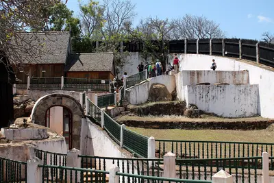
    The Royal Hill of Ambohimanga, about 24 km northeast of Antananarivo, has been a UNESCO World Heritage site since 2001 and a sacred place for the Merina for about 500 years. This was the royal city from which Andrianampoinimerina united the highlands at the end of the 18th century.Within the walls, you can see two palaces, including the rosewood palace Mahandrihono, four royal tombs and some of the 14 fortified stone gates. To this day, pilgrims come here to honor their ancestors.

    Heinonlein·CC BY-SA 4.0

    Ranomafana

    Ranomafana

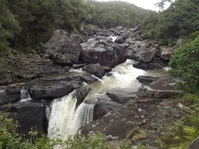
    Ranomafana National Park, on the eastern edge of the southern highlands, protects mountain rainforest and is part of the UNESCO World Heritage Site Rainforests of Atsinanana. It is known for the Golden Bamboo Lemur, first discovered here in 1986 and endangered.On three to four-hour hikes, you'll see bamboo lemurs, mouse lemurs, and chameleons; an evening night walk is also worthwhile. The village of Ranomafana, meaning 'hot water,' owes its name to the thermal springs.

    Smiley.toerist·CC BY-SA 4.0

    Andasibe-Mantadia

    Andasibe-Mantadia

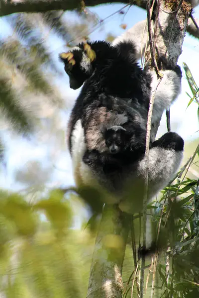
    Andasibe-Mantadia National Park on the RN2 east of Antananarivo protects humid montane rainforest and is the best-known destination to experience the Indri, Madagascar's largest primate. The drive from the capital, covering around 140 to 150 km, takes three to five hours.In the Analamazaotra section of the park, 14 lemur species live alongside the Indri; in the mornings, you'll hear the Indris' song through the forest. The wilder Mantadia section is 15 to 23 km away and is well worth it for longer hikes.

    Heinonlein·CC BY-SA 4.0

    Your next steps

    Tsingy de Bemaraha is in Madagascar. Ways to carry on from here.

    • More in Madagascar

      Highlights, areas, routes and the best time to travel for all of Madagascar.

      Madagascar travel guide
    • Round trips in Madagascar

      Ready-made routes through Madagascar, with stops, nights and a map.

      See the routes
    • Plan a trip with Tsingy de Bemaraha

      The Guide asks about season, length and who is coming, and suggests a trip with Tsingy de Bemaraha.

      Plan the trip

    Sources & method

    • Photos: Wikimedia Commons. Each photo carries its credit.
    • Place data such as addresses and ratings comes from Google Maps.
    • The content is based on web research from public, traceable sources. How the content is made · The role of AI