Fernweh: Home
    ExploreTravel GuidesPlan a tripMy tripLast visited
    de|en
    All Places & RegionsAll highlightsAbout FernwehFAQPrivacy PolicyImprint
    ExploreTravel GuidesPlan a tripMy tripLast visited
    Titicaca Lake
    Diego Delso / Wikimedia Commons / CC BY-SA 4.0

    Peru

    Titicaca Lake

    Point of Interest

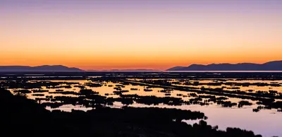
    Lake Titicaca lies at an altitude of approximately 3,810 meters in the Altiplano and is shared by Peru and Bolivia. It is considered the world's highest navigable lake.

    by Felix Gillen

    1. Home
    2. Destinations
    3. Peru
    4. Puno and Lake Titicaca
    5. Titicaca Lake
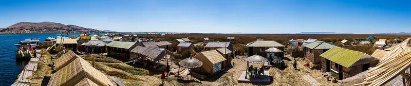
    Lake Titicaca lies at an altitude of approximately 3,810 meters in the Altiplano and is shared by Peru and Bolivia. It is considered the world's highest navigable lake. From Puno, boats depart for the Uros, islands that the inhabitants build and constantly renew from layers of totora reeds. Their boats are also made from the same reeds.Further out lies the natural island of Taquile, whose inhabitants speak Quechua and are renowned for their woven and knitted textiles. UNESCO recognizes Taquile's textile art as intangible cultural heritage. On the neighboring island of Amantaní, you can stay with families.Day trips to Uros and Taquile start in the morning from Puno's harbor.On the water, it is sunny and windy; bring warm clothing and sun protection.

    Restaurants in Titicaca Lake

    Exploring locally

    By BoatYou can reach all islands from Puno port. It's only a short trip to Uros, but getting to Taquile and Amantaní takes several hours.Tours and AccommodationMany combine Uros and Taquile in one day. Those with more time can stay with a family on Amantaní or in accommodation on Uros. Bring warm clothes, as it gets cold on the lake quickly after sunset.

    Accommodations in Titicaca Lake

    Find perfect stay in Titicaca Lake

    Booking.com* (Affiliate link)
    Search Hotels
    Agoda* (Affiliate link)
    Search Hotels
    Airbnb
    Vacation Rentals

    * Affiliate link: if you book through it, we earn a small commission. The price stays the same for you.
    Nearby

    Puno and Lake Titicaca

    Puno and Lake Titicaca

    In the Altiplano on the border with Bolivia lies Lake Titicaca at an altitude of approximately 3,810 meters, the highest navigable lake in the world. The city of Puno on the west shore is the starting point for boat tours to the floating reed islands of the Uros and to Taquile Island, whose textile art UNESCO has recognized as intangible cultural heritage. In February, Puno celebrates the Fiesta de la Candelaria, also a UNESCO cultural heritage. The region is accessible by flight to Juliaca, by bus, or by train from Cusco.
    Puno

    Puno

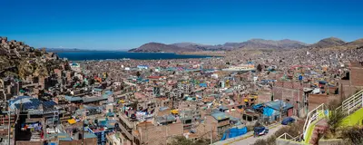
    Puno is located at about 3,800 meters on the western shore of Lake Titicaca and is the starting point for boat trips on the lake. The city calls itself the “Folklore Capital of Peru”: Every February, it celebrates the Fiesta de la Virgen de la Candelaria with thousands of dancers and musicians, an intangible UNESCO cultural heritage since 2014.On the Plaza de Armas stands the baroque cathedral, completed in 1757. From the hill with the monument to Manco Cápac, the legendary first Inca, you overlook the city and the lake. About 30 kilometers outside, on Lago Umayo, are the funerary towers of Sillustani, built by the Colla before Inca rule.The nearest airport is Inca Manco Cápac Airport in Juliaca. You can also reach Puno by bus or with the PeruRail Titicaca train from Cusco.After arrival, allow yourself time to acclimatize before going on excursions.
    Arequipa and Colca

    Arequipa and Colca

    The southern region links colonial Arequipa (approx. 2,400m) to the Andean highlands. Above the city rise volcanoes Misti, Chachani, and Pichu Pichu. Roughly 160 km northwest, Colca Canyon offers Inca terraces and the Cruz del Cóndor viewpoint for observing Andean condors. Arequipa is a common stopover for the Puno and Cusco highlands.

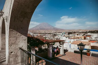
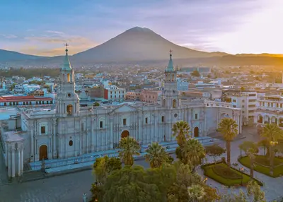
    Arequipa is located in southern Peru at around 2,400 meters, at the foot of Misti volcano. The Spanish founded the city on August 15, 1540. Its center is almost entirely built from Sillar, a white to pink volcanic rock that earned it the nickname "White City." Since 2000, its historic center has been a UNESCO World Heritage site.The most important sight is the Santa Catalina Monastery, founded in 1579 and, covering around 20,000 square meters, is like a small city itself with alleys, courtyards, and colorful walls. The Museo Santuarios Andinos displays the mummy Juanita, an Inca girl found in 1995 on the summit of Ampato volcano. Enjoy views of Misti and Chachani from the Mirador de Yanahuara, with its Sillar arches.
    Colca Canyon

    Colca Canyon

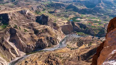
    The Colca Canyon is located approximately 160 kilometers northwest of Arequipa and is one of the deepest canyons in the world. Along the valley, villages still cultivate ancient agricultural terraces, some of which date back to pre-Incan times. At the Cruz del Cóndor viewpoint, where the canyon floor lies approximately 1,200 meters deeper, Andean condors circle, best observed in the morning.The starting point is the town of Chivay, about a four-hour drive from Arequipa, with thermal baths in the surrounding area.To visit the viewpoints, you need the Colca Tourist Ticket, which you can purchase in Chivay or at the checkpoints.The road leads over high altitudes; plan for acclimatization.

    Sources & method

    • Photos: Wikimedia Commons. Each photo carries its credit.
    • The content is based on web research from public, traceable sources. How the content is made · The role of AI