Fernweh: Home
ExploreGuideDestinationsMy tripsMy trip
de|en
All Places & RegionsRound tripsNight trains in EuropeAll highlightsAbout FernwehFAQPrivacy PolicyImprint
Download on the App StoreGet it on Google Play
ExploreGuideDestinationsMy tripsMy trip
    • Neighborhoods & highlights
    • Eat & drink
    • Culture
    • Getting around
    • Accommodation
    • Plan trip
    • Nearby
    Riobamba and Chimborazo

    Dabit100 / David Torres Costales Riobamba / Wikimedia Commons / CC BY-SA 4.0, mod.

    Ecuador

    Riobamba and Chimborazo

    City

    For current travel, safety and health advice, including any state of emergency, check the UK FCDO travel advice, linked on the country page.

    by Felix Gillen

    1. Home
    2. Destinations
    3. Ecuador
    4. Central Andes
    5. Riobamba and Chimborazo
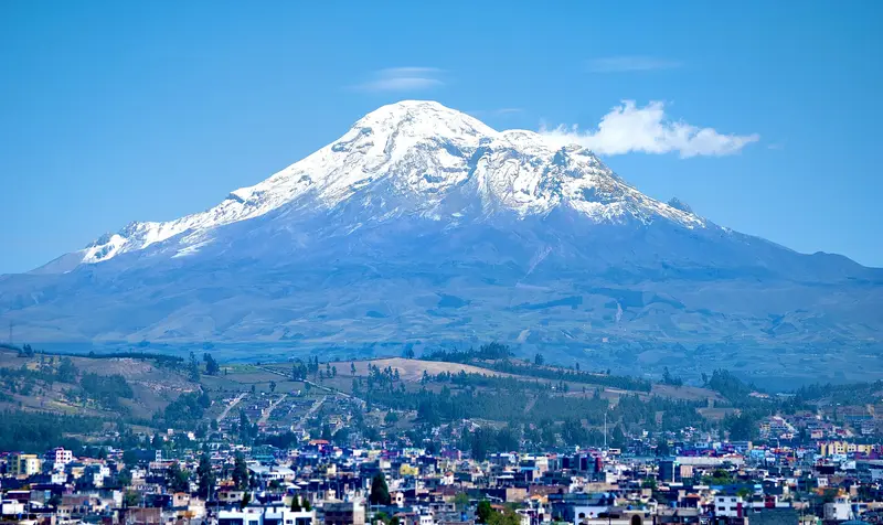
    For current travel, safety and health advice, including any state of emergency, check the UK FCDO travel advice, linked on the country page.Riobamba lies at just over 2,750 metres in the central Sierra and is the base for trips to 6,268-metre Chimborazo, Ecuador's highest mountain. After the earthquake of 1797 the town was rebuilt on a new site; its centre around Parque Maldonado is shaped by 19th-century buildings. On the volcano you can drive up to the Refugio Carrel at around 4,800 metres and spot vicuñas on the páramo.
    Ecuador travel guideRound trips in EcuadorPlan a trip with Riobamba and Chimborazo

    Contents

    • Neighborhoods & highlights
    • Eat & drink
    • Culture
    • Getting around
    • Accommodation
    • Nearby

    Sights in Riobamba and Chimborazo

    Discover the most important sights and attractions

    Cathedral of Riobamba

    Carlos Costales Terán / Wikimedia Commons / CC BY-SA 4.0, mod.

    Church

    1Cathedral of Riobamba

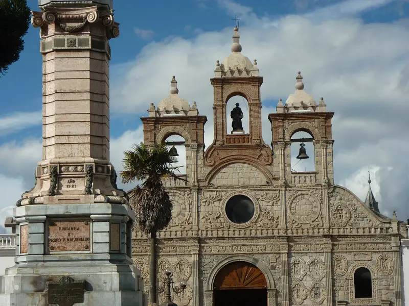
    The cathedral on the northeast side of Parque Maldonado bears the carved stone facade of the old city, the only structure that survived the 1797 earthquake. The facade was dismantled and reassembled in the new city.

    Open in Google Maps
    Park

    2Parque 21 de Abril

    The small hill park north of the center offers a view over the city and, in clear weather, of Chimborazo.
    Open in Google Maps

    Restaurants in Riobamba and Chimborazo

    Culture and History

    A City After the EarthquakeThe 1797 earthquake destroyed old Riobamba; the city was subsequently rebuilt further north. Only the cathedral's carved stone facade survived the quake; it was dismantled and reassembled in the new city. 19th-century buildings line Parque Maldonado.The ChimborazoAt 6,268 meters, according to the Ministry of Tourism, Chimborazo is Ecuador's highest mountain. Because the Earth bulges at the equator, its summit is approximately 6,384 kilometers from the Earth's center, making it further than Mount Everest's peak; this was confirmed in 2016 by a GPS measurement from French and Ecuadorian institutes.Vicuñas in the PáramoThe volcano is located within the Reserva de Producción de Fauna Chimborazo. Vicuñas were reintroduced here in 1988; llamas and alpacas also live in the protected area.
    Getting There & Around

    Getting to RiobambaBuses from Quito run frequently, reaching Riobamba in just under four hours.Riobamba has two bus terminals: Terminal Terrestre for Guayaquil, Cuenca, and Guaranda, and Terminal Oriente for Baños, Puyo, and Tena.To ChimborazoThe entrance to the protected area is on the road to Guaranda, about 45 kilometers from Riobamba. From the El Arenal Visitor Center, an 8-kilometer track leads to Refugio Carrel; you may drive your own car up to this point.Entry is free; you register at the entrance. A maximum speed of 40 km/h applies on the marked track; motorcycles, pets, campfires, and alcohol are prohibited, and you must take your trash with you.From Refugio Carrel, it's about a 30-minute walk to Refugio Whymper at approximately 5,000 meters. For tours above the first refuge, you need a guide and a permit.Fog often rolls in during the afternoon, so it's best to visit in the morning.

    Accommodations in Riobamba and Chimborazo

    Find perfect stay in Riobamba and Chimborazo

    Booking.com* (Affiliate link)
    Search Hotels
    Agoda* (Affiliate link)
    Search Hotels
    Airbnb
    Vacation Rentals

    * Affiliate link: if you book through it, we earn a small commission. The price stays the same for you.

    Plan your trip to Riobamba and Chimborazo

    Save places, build a route and plan your city trip, all in one place.

    1. 1
      Sunrise over alpine peaks and a sea of clouds
      1234

      Round trip

      12 days · 4 stops

      Saved

      Pick a route

      Pick a ready-made one or save places and plan your own.

      Open bookmarks
    2. 2

      Trip to Riobamba and Chimborazo

      Live
      • 1Cathedral of Riobamba3 days
      • 2Parque 21 de Abril4 days
      Budget

      Plan your trip

      The planner sorts stops, days and budget. Plan together in real time.

      Start trip planning
    3. 3
      9:41 No signal
      Riobamba and Chimborazo
      Available offline

      Dabit100 / David Torres Costales Riobamba / Wikimedia Commons / CC BY-SA 4.0, mod.

      Use it on the road

      Download the guide to your phone and use it on site, even offline.

    Nearby

    Baños de Agua Santa

    Baños de Agua Santa

    For current travel and safety advice, including volcanic activity and any state of emergency, check the UK FCDO travel advice, linked on the country page.Baños de Agua Santa lies at around 1,800 metres at the foot of Tungurahua volcano, about 180 kilometres south of Quito, and is known for its thermal baths, the basilica of the Virgen del Rosario de Agua Santa and outdoor activities. From here the waterfall road with the Pailón del Diablo descends towards Puyo and the Amazon.

    Shad Meeg·Pexels

    Central Andes

    Central Andes

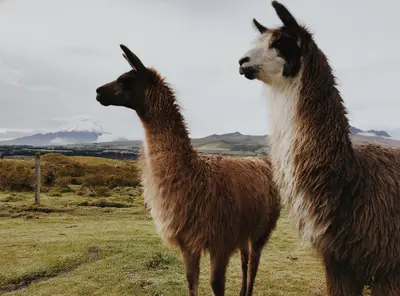
    For current travel and safety advice, including volcanic activity and any state of emergency, check the UK FCDO travel advice, linked on the country page.South of Quito, volcanoes line the Pan-American Highway: 5,897-metre Cotopaxi is around an hour's drive from the capital, and west of Latacunga lies the turquoise crater lake of Quilotoa. At the foot of Tungurahua, Baños with its thermal baths and the waterfall road towards Puyo is the gateway to the Amazon.

    DΛVΞ GΛRCIΛ·Pexels

    Quilotoa Loop

    Quilotoa Loop

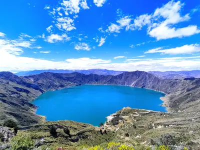
    For current travel and safety advice, including any state of emergency, check the UK FCDO travel advice, linked on the country page.Quilotoa is a volcano around 90 kilometres west of Latacunga whose caldera, about three kilometres wide, is filled by a green-blue lake around 250 metres deep; the highest point of the crater rim is at 3,914 metres. The roughly 200-kilometre loop through the Andean villages of Zumbahua, Tigua, Chugchilán, Isinliví and Sigchos links the crater lake, highland markets and hiking trails.

    Ben Traveling·Pexels

    Ingapirca

    Ingapirca

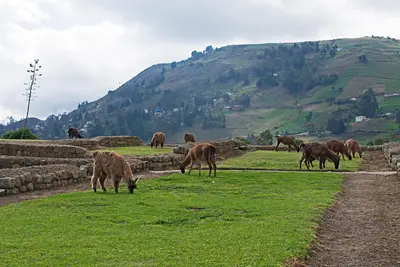
    For current travel and safety advice, including any state of emergency, check the UK FCDO travel advice, linked on the country page.Ingapirca in Cañar province, around two and a half hours by bus north of Cuenca, is regarded as Ecuador's most important archaeological site. At around 3,200 metres, Cañari buildings combine with Inca structures, whose elliptical Temple of the Sun was built around a large rock and aligned with the solstices.

    Ymblanter·CC BY-SA 4.0

    Cotopaxi National Park

    Cotopaxi National Park

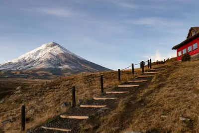
    For current travel and safety advice, including volcanic activity and any state of emergency, check the UK FCDO travel advice, linked on the country page.Cotopaxi National Park, around 50 kilometres south of Quito, surrounds the 5,897-metre, glacier-capped Cotopaxi volcano. On the plateau at around 4,000 metres you'll find Laguna Limpiopungo, hiking trails and an almost flat cycling route; entry is free.

    Alain Bonnardeaux·Unsplash

    Your next steps

    Riobamba and Chimborazo is in Ecuador. Ways to carry on from here.

    • More in Ecuador

      Highlights, areas, routes and the best time to travel for all of Ecuador.

      Ecuador travel guide
    • Round trips in Ecuador

      Ready-made routes through Ecuador, with stops, nights and a map.

      See the routes

    Sources & method

    • Photos: Wikimedia Commons. Each photo carries its credit.
    • Place data such as addresses and ratings comes from Google Maps.
    • The content is based on web research from public, traceable sources. How the content is made · The role of AI