Fernweh: Home
ExploreGuideDestinationsMy tripsMy trip
de|en
  • Why go
  • Highlights
  • Regions
  • Round trips
  • Local food
  • Good to know
  • Best time to visit
  • Travel advice
Ecuador

Photo by Sasha Valle on Unsplash

Travel Guide Ecuador

UK FCDO travel advice (updated 1 November 2026): the FCDO advises against all but essential travel to the coastal provinces of Esmeraldas, Manabí, Santa Elena, Guayas, El Oro, Los Ríos and Santo Domingo de los Tsáchilas (except transit…

by Felix Gillen

Why Go To Ecuador?

In Ecuador, snow-capped volcanoes, UNESCO World Heritage colonial towns, Amazon rainforest, and Pacific beaches lie so close you'll experience multiple climate zones in a few days. Quito and Cuenca rank among South America's best-preserved colonial cities; the Avenue of Volcanoes (Cotopaxi, Chimborazo) marks the highlands. About 1,000 kilometers offshore, the Galápagos Islands host animals showing little fear of humans.

Contents

  • Highlights
  • Regions
  • Round trips
  • Local food
  • Good to know
  • Best time to visit
  • Travel advice

Where in Ecuador?

Pick an area. The highlights, road trips and places below follow your choice.

Highlights in Ecuador

What you should have seen
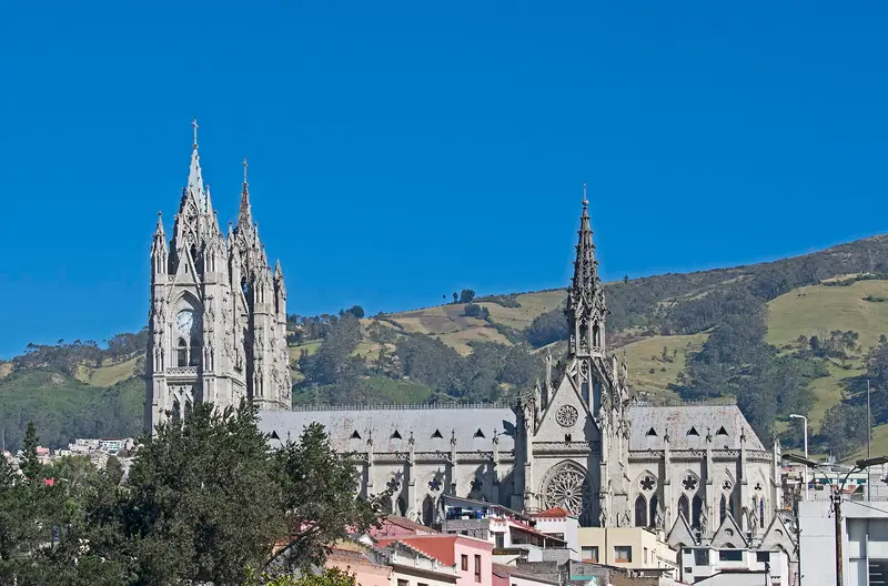
Quito

Ymblanter / Wikimedia Commons / CC BY-SA 4.0, mod.
Highlight 1 of 4

Quito

UK FCDO travel advice (updated 1 November 2026): Pichincha province, which includes Quito, is among the provinces where a state of emergency for security reasons has been declared. Check the current FCDO travel advice, linked on the country page.

Discover
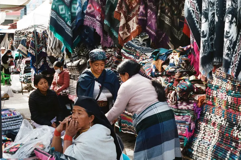
Otavalo

Photo by Mar Ahumada on Pexels

Highlight 2 of 4

Otavalo

Otavalo is located at around 2,500 meters in the province of Imbabura, about two bus hours north of Quito, and is known for its market at the Plaza de Ponchos.

Discover
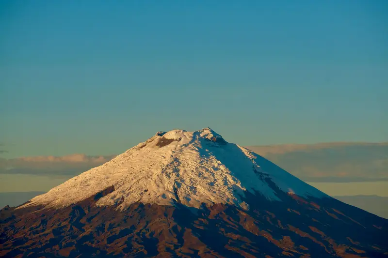
Cotopaxi National Park

Photo by Alain Bonnardeaux on Unsplash
Highlight 3 of 4

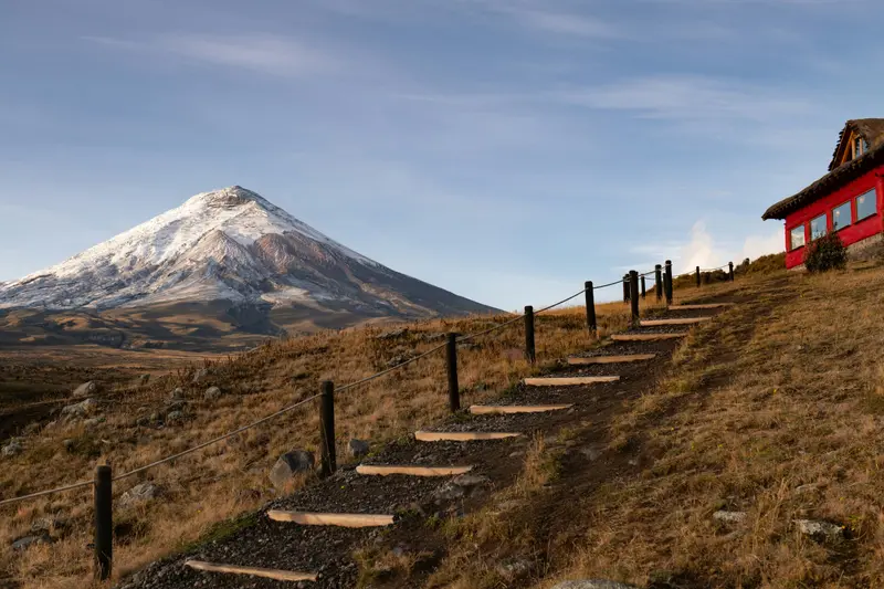
Cotopaxi National Park

For current travel and safety advice, including volcanic activity and any state of emergency, check the UK FCDO travel advice, linked on the country page.

Discover
Quilotoa Loop

Photo by Ben Traveling on Pexels

Highlight 4 of 4

Quilotoa Loop

For current travel and safety advice, including any state of emergency, check the UK FCDO travel advice, linked on the country page.

Discover

More highlights in Ecuador

Baños de Agua Santa

Baños de Agua Santa

For current travel and safety advice, including volcanic activity and any state of emergency, check the UK FCDO travel advice, linked on the country page.Baños de Agua Santa lies at around 1,800 metres at the foot of Tungurahua volcano, about 180 kilometres south of Quito, and is known for its thermal baths, the basilica of the Virgen del Rosario de Agua Santa and outdoor activities. From here the waterfall road with the Pailón del Diablo descends towards Puyo and the Amazon.

Shad Meeg·Pexels

Yasuní National Park

Yasuní National Park

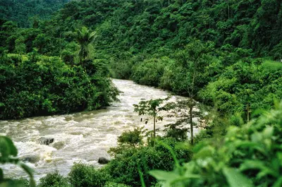
For current travel, safety and health advice, including any state of emergency, check the UK FCDO travel advice, linked on the country page.Yasuní National Park in Orellana and Pastaza provinces has protected around one million hectares of Amazon rainforest since 1979 and, together with Waorani territory, has been a UNESCO biosphere reserve since 1989. It is reached via Coca and the Río Napo; allow at least four to five days for the remoter parts.

Tom Fisk·Pexels

Cuenca

Cuenca

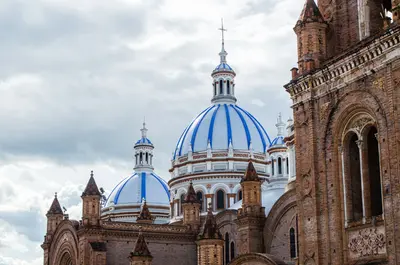
For current travel and safety advice, including any state of emergency, check the UK FCDO travel advice, linked on the country page. Cuenca lies at around 2,500 metres in the southern highlands and had just under 600,000 inhabitants in the 2022 census. Founded in 1557, the city with its grid layout, colonial churches and the sky-blue domes of the New Cathedral has been a UNESCO World Heritage Site since 1999. The houses of the Barranco line the banks of the Río Tomebamba, and the Museo Pumapungo has the ruins of an Inca site. The region is also known for its toquilla straw hats, sold internationally as Panama hats; their…

David Mosquera·Pexels

Galápagos Islands

Galápagos Islands

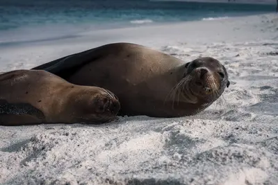
UK FCDO travel advice (updated 1 November 2026): heavy rain caused flooding on Santa Cruz Island, and an emergency was declared on 31 October 2026, with road closures, power cuts and disruption to journeys to Baltra airport. Avoid flooded areas, confirm travel arrangements with your airline or tour operator and check the current FCDO travel advice, linked on the country page. The Galápagos Islands lie around 1,000 kilometres off the coast of Ecuador in the Pacific; giant tortoises, marine iguanas, sea lions and boobies can be watched here at close range. The archipelago comprises 127 islands, islets and rocks, only four of which…

Lloyd Douglas·Pexels

Puerto López and Machalilla

Puerto López and Machalilla

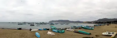
UK FCDO travel advice (updated 1 November 2026): the FCDO advises against all but essential travel to the province of Manabí, which includes Puerto López and Machalilla National Park. Check the current FCDO travel advice, linked on the country page.The fishing town of Puerto López in Manabí province is the base for Machalilla National Park, founded in 1979, with Los Frailes beach, the community of Agua Blanca and Isla de la Plata, home to blue-footed, red-footed and Nazca boobies. Humpback whales pass along the coast from June to September.

Annom·public domain

Guayaquil

Guayaquil

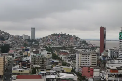
UK FCDO travel advice (updated 1 November 2026): the FCDO advises against all but essential travel to the province of Guayas, which includes Guayaquil, except transit through Guayaquil airport. Check the current FCDO travel advice, linked on the country page. Guayaquil on the Río Guayas is Ecuador's largest city, with around 2.7 million inhabitants in the canton. For travellers the main sights are the 2.5-kilometre riverside promenade Malecón 2000, the old quarter of Las Peñas on Cerro Santa Ana, Parque Seminario with its iguanas and the museums along the Malecón; many use the city as a springboard to Galápagos.

Alejandro Robles Duque·Pexels

How to plan your trip to Ecuador

From the guide to the road: here is what comes next.

  1. 1
    Sunrise over alpine peaks and a sea of clouds
    1234

    Round trip

    12 days · 4 stops

    Saved

    Pick a route

    Pick a ready-made one or save places and plan your own.

    Browse routes
  2. 2

    Trip to Ecuador

    Live
    • 1Quito3 days
    • 2Otavalo4 days
    • 3Cotopaxi National Park5 days
    Budget

    Plan your trip

    The planner sorts stops, days and budget. Plan together in real time.

    Go to My Trips
  3. 3
    9:41 No signal
    Ecuador
    Available offline

    Photo by Sasha Valle on Unsplash

    Use it on the road

    Download the guide to your phone and use it on site, even offline.

Regions to Discover

Explore the diverse regions of Ecuador.
Southern Andes

Southern Andes

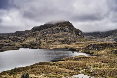
For current travel and safety advice, including any state of emergency, check the UK FCDO travel advice, linked on the country page.In the south of the highlands lies Cuenca, whose planned colonial old town has been a UNESCO World Heritage Site since 1999. From here you can reach El Cajas National Park, with hundreds of mountain lakes between 3,100 and 4,500 metres, and the site of Ingapirca in Cañar province, the country's most important archaeological site.

Viajante Dibujero·Pexels

Pacific Shore

Pacific Shore

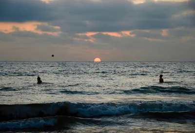
UK FCDO travel advice (updated 1 November 2026): the FCDO advises against all but essential travel to the coastal provinces of Esmeraldas, Manabí, Santa Elena, Guayas, El Oro, Los Ríos and Santo Domingo de los Tsáchilas, except transit through Guayaquil airport. Check the current FCDO travel advice, linked on the country page.Ecuador's coast stretches from the port city of Guayaquil to the beaches of Santa Elena and Manabí provinces. Montañita is known for its waves, while Puerto López is the base for Machalilla National Park, Isla de la Plata and, from June to September, whale watching.

Michiel·Pexels

Central Andes

Central Andes

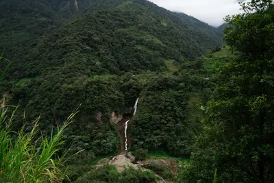
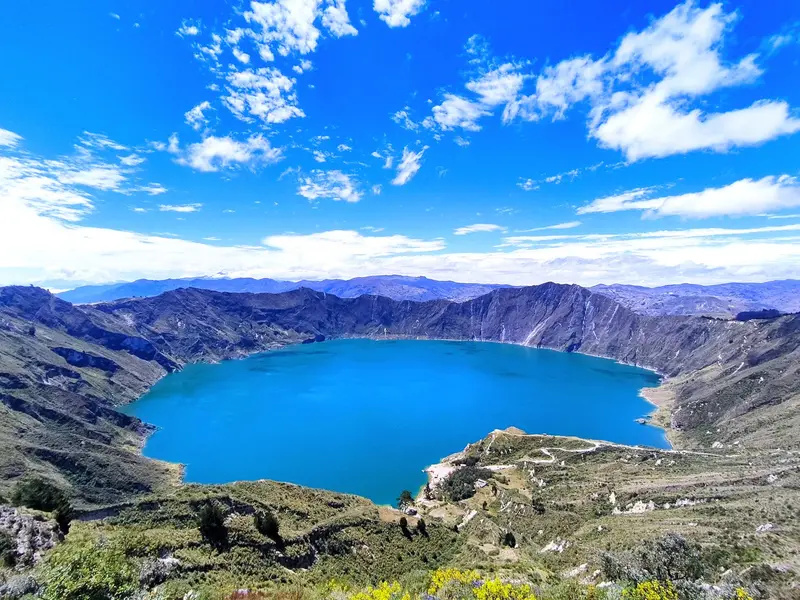
For current travel and safety advice, including volcanic activity and any state of emergency, check the UK FCDO travel advice, linked on the country page.South of Quito, volcanoes line the Pan-American Highway: 5,897-metre Cotopaxi is around an hour's drive from the capital, and west of Latacunga lies the turquoise crater lake of Quilotoa. At the foot of Tungurahua, Baños with its thermal baths and the waterfall road towards Puyo is the gateway to the Amazon.

DΛVΞ GΛRCIΛ·Pexels

Northern Andes

Northern Andes

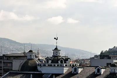
UK FCDO travel advice (updated 1 November 2026): Pichincha province, which includes Quito, is among the provinces under a state of emergency, and the FCDO advises against all but essential travel to areas within 20 km of the border with Colombia (with exceptions in Carchi, including Tulcán). Check the current FCDO travel advice, linked on the country page. For most travellers the northern Andes are the gateway to Ecuador: Quito lies at around 2,800 metres in a high valley, and its old town has been a UNESCO World Heritage Site since 1978. North of the city, Ciudad Mitad del Mundo marks the equator, and around two hours away by bus…

DΛVΞ GΛRCIΛ·Pexels

Amazonian Lowlands

Amazonian Lowlands

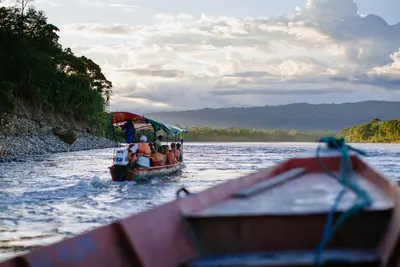
UK FCDO travel advice (updated 1 November 2026): the FCDO advises against all but essential travel to areas within 20 km of the border with Colombia, which includes parts of Sucumbíos province. Check the current FCDO travel and health advice, linked on the country page.East of the Andes lie the Amazon lowlands, the Oriente. The major protected areas are Yasuní National Park, a UNESCO biosphere reserve since 1989, and Cuyabeno Reserve with its blackwater lagoons. Gateway towns are Coca, around 30 minutes by air from Quito, Lago Agrio and Tena, Ecuador's centre for rafting and kayaking.

Jeff Stapleton·Pexels

Recommended Itineraries

Discover the best routes through Ecuador.

Andes, Cuenca and Galápagos in 15 days

The route connects the highlights of the Andean highlands with the colonial city of Cuenca and concludes with four days on the Galapagos Islands. You travel to Cuenca by long-distance buses, from Cuenca to Guayaquil by bus or domestic flight, to Galapagos by flight, and between the islands by public speedboats.

16 Days
Open jaw
Stops at a glance
  1. 1.Quito
  2. 2.Otavalo
  3. 3.Cotopaxi National Park
  4. 4.Quilotoa Loop
  5. 5.Baños de Agua Santa
  6. 6.Cuenca
  7. 7.Guayaquil
  8. 8.Santa Cruz and Puerto Ayora
  9. 9.San Cristóbal and Puerto Baquerizo Moreno
View Route Details →

What you eat in Ecuador

Encebollado

Vapelaez2212·CC BY-SA 4.0

Encebollado

Fish soup with tuna and onions

A hearty broth with Albacore tuna, cassava, tomato, plenty of onions, and cilantro. Especially in Guayaquil and on the coast, Encebollado is considered a typical breakfast and a classic hangover cure.
Bolón de verde

Z thomas·CC BY-SA 4.0

Bolón de verde

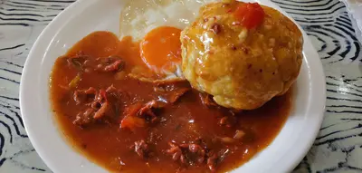
Ball made of green plantain

Green plantains are fried, mashed, and formed into balls with cheese, chicharrón (pork crackling) or both. On the coast, Bolón is eaten for breakfast, often with a café pasado, freshly brewed coffee.
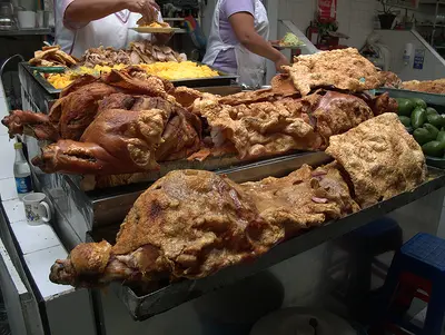
Hornado

Pedro M. Martínez Corada·CC BY-SA 4.0

Hornado

Slowly roasted joint of pork

A whole pig is marinated with beer, garlic, cumin, and achiote, and slowly roasted in the oven. In the highlands, you'll find Hornado at market stalls, served with potatoes.

Llapingachos

Pan-fried potato fritters

Llapingachos are pan-fried mashed potato patties, a typical side dish in the Andean highlands. On markets, they are often served together with Hornado.
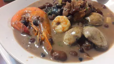
Fanesca

Montielec98·CC BY-SA 4.0

Fanesca

Soup of Holy Week

Fanesca is a hearty soup made from fish, various beans, lentils, and corn. It is traditionally cooked only during Lent and around Easter, and is as essential to Semana Santa as almost no other dish.
Colada morada with Guaguas de pan

Taty2007·CC BY 4.0

Colada morada with Guaguas de pan

Spiced drink and bread figures for All Souls' Day

Colada morada is a thick drink made from black corn flour, Panela (cane sugar), fruits, and spices. With it, people eat Guaguas de pan, sweet breads in the shape of a child; both are available in the week before the Día de los Difuntos on November 2nd.

Good to Know

Essential info for your trip planning.

Key facts

Quito · 283,561 km² · Spanish

Land & People

Four Major RegionsEcuador is divided into the Coastal Plain (Costa), the Andean Highlands (Sierra), the Amazon Lowlands…

History & Society

From the Inca to the ColonyAt the end of the 15th century, the Inca conquered the territory of present-day Ecuador.

Food & Drink

Coast, Highlands, AmazonCuisine varies by region: On the coast, fish, shrimp, and plantains dominate, such as…

Practical Info

UK FCDO travel advice (updated 1 November 2026): the FCDO advises against all but essential travel to the coastal…

Getting Around

Flights and busesThe bus network connects all major cities; in Quito, long-distance buses leave from Terminal Quitumbe…

Traveling with Kids

Galápagos with childrenChildren under 12 pay a 100 US dollar park entrance fee on Galápagos; children under 2 are…

Best Time to Visit

When is the best time for your trip?

June
July
August
September
14–15°C·22–69 mm(little rain)
In the Andean highlands with Quito, Cotopaxi, and Quilotoa, June to September are the driest and sunniest months. The Pacific coast is warm and humid from December to April; from June to September, humpback whales can be observed off Puerto López. Galápagos is a year-round destination: December to May is warmer with calmer seas, June to November is cooler with drizzle (Garúa) and nutrient-rich water.
Climate data for Quito (Mariscal Sucre Airport station, normal values 1991-2020): Temperatures remain around 14 degrees year-round; rainfall is the main source of variation. Guayaquil on the coast is significantly warmer with an average of about 26 degrees and has its rainy season from January to April, while June to November are almost dry. In the Amazon lowlands, it rains all year. On Galápagos, water temperatures are about 25 degrees in the warm season (December to May) and about 22 degrees in the cool season (June to November).

Seasons

Jan
Feb
Mar
Apr
May
Jun
Jul
Aug
Sep
Oct
Nov
Dec
Highland Dry Season
High season (also Galápagos)
Rainiest months in the Highlands
Best Time to Visit
▶Show detailed monthly data
MonthTemp (°C)Rain (mm)
January13.981
February13.9109
March14.1142
April14.1168
May14.2121
June14.241
July14.322
August14.532
September14.569
October14.2112
November13.8109
December13.994

Travel advice

Safety, entry requirements and health: the official, up-to-date advice for Ecuador is published by the UK government on GOV.UK.

Go to GOV.UK
Sources & method

  • Photos: Wikimedia Commons, Unsplash, Pexels. Each photo carries its credit.
  • The content is based on web research from public, traceable sources. How the content is made · The role of AI
Felix at Kuirau Park in Rotorua, New Zealand

Who's behind Fernweh?

Hi, I'm Felix.

I love to travel, and I love planning even more. Fernweh.guide is my attempt at building a really good online travel guide.

About Fernweh

All places in Ecuador

  • Amazonian Lowlands
  • Baños de Agua Santa
  • Central Andes
  • Coca (Puerto Francisco de Orellana)
  • Cotopaxi National Park
  • Cuenca
  • Cuyabeno Reserve
  • El Cajas National Park
  • Floreana
  • Galápagos Islands
  • Guayaquil
  • Ingapirca
  • Isabela and Puerto Villamil
  • Mitad del Mundo and Pululahua
  • Montañita
  • Northern Andes
  • Otavalo
  • Pacific Shore
  • Puerto López and Machalilla
  • Quilotoa Loop
  • Quito
  • Riobamba and Chimborazo
  • San Cristóbal and Puerto Baquerizo Moreno
  • Santa Cruz and Puerto Ayora
  • Southern Andes
  • Tena
  • Yasuní National Park

More about Ecuador

  • Best Time to Visit Ecuador
  • Ecuador with Kids
All Places & RegionsRound tripsNight trains in EuropeAll highlightsAbout FernwehFAQPrivacy PolicyImprint
Download on the App StoreGet it on Google Play
ExploreGuideDestinationsMy tripsMy trip