Fernweh: Home
ExploreGuideDestinationsMy tripsMy trip
de|en
All Places & RegionsRound tripsNight trains in EuropeAll highlightsAbout FernwehFAQPrivacy PolicyImprint
Download on the App StoreGet it on Google Play
ExploreGuideDestinationsMy tripsMy trip
    • Neighborhoods & highlights
    • Recommendations
    • Tours
    • Eat & drink
    • Culture
    • Getting around
    • Accommodation
    • Plan trip
    • Round trips
    • Nearby
    Otavalo

    Photo by Mar Ahumada on Pexels

    Ecuador

    Otavalo

    City

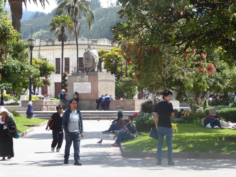
    Otavalo is located at around 2,500 meters in the province of Imbabura, about two bus hours north of Quito, and is known for its market at the Plaza de Ponchos.

    by Felix Gillen

    1. Home
    2. Destinations
    3. Ecuador
    4. Northern Andes
    5. Otavalo
    Otavalo is located at around 2,500 meters in the province of Imbabura, about two bus hours north of Quito, and is known for its market at the Plaza de Ponchos. Around the city, weaving villages, the Peguche Waterfall, Lago San Pablo, and the Cuicocha crater lake invite visitors for excursions.
    Ecuador travel guideSee the round tripPlan a trip with Otavalo

    Contents

    • Neighborhoods & highlights
    • Recommendations
    • Tours
    • Eat & drink
    • Culture
    • Getting around
    • Accommodation
    • Round trips
    • Nearby

    Sights in Otavalo

    Discover the most important sights and attractions

    Waterfall of Peguche

    Arabsalam / Wikimedia Commons / CC BY-SA 4.0, mod.

    Attraction

    1Waterfall of Peguche

    The waterfall is near the weaving village of Peguche and is reachable on foot from Otavalo. In February or March, Peguche and the neighboring village of Agato celebrate the Pawkar Raimi festival.
    Open in Google Maps
    Market at the Plaza de Ponchos

    Arabsalam / Wikimedia Commons / CC BY-SA 4.0, mod.

    Shopping Mall

    2Market at the Plaza de Ponchos

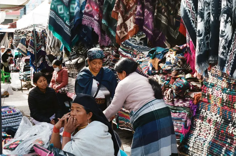
    The stalls with textiles and handicrafts are open daily. The main day is Saturday, and on Wednesdays, it's almost equally crowded. Come early: Around 9 to 10 AM, tour groups from Quito arrive. Bargaining is customary.
    Open in Google Maps
    Cuicocha Lagoon

    Ymblanter / Wikimedia Commons / CC BY-SA 4.0, mod.

    Attraction

    3Cuicocha Lagoon

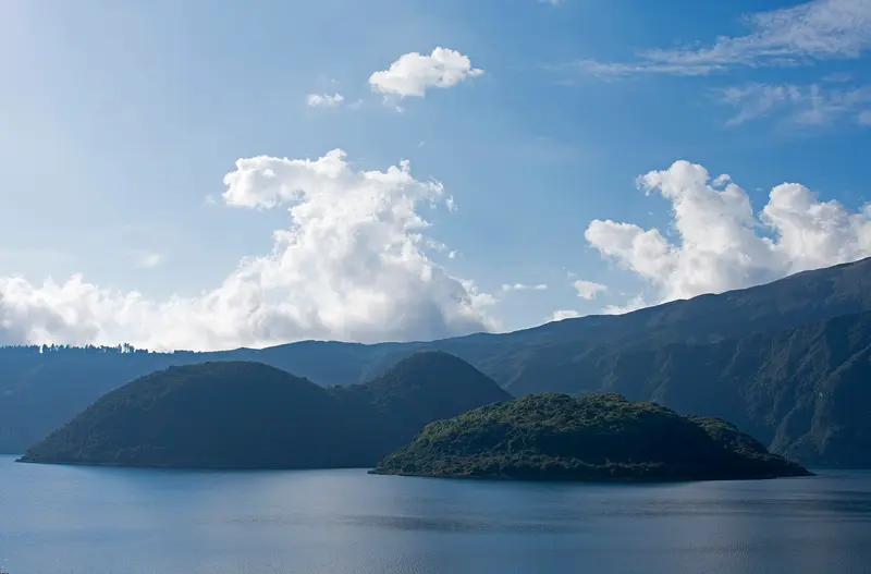
    The crater lake 18 kilometers west of Cotacachi lies at around 3,100 meters, the crater is about 3 kilometers wide and 200 meters deep; its Kichwa name means Guinea Pig Lake. You may not enter the two islands; boat trips on the lake are offered. Guidebooks indicate the circular path along the crater rim as 10 to 14 kilometers.
    Open in Google Maps
    Attraction

    4Lagunas de Mojanda

    The three highland lakes south of Otavalo are surrounded by cloud-shrouded peaks. You can hike and ride there.
    Open in Google Maps
    Attraction

    5Lago San Pablo

    The lake with reedy shores lies about three kilometers southeast of the weaving village Peguche. Many weavers live in the lakeside villages.
    Open in Google Maps

    Tours & experiences in Otavalo

    Search tours for Otavalo on GetYourGuide* (Affiliate link)On GetYourGuide, with reviews from other travellers

    * Affiliate link: if you book through it, we earn a small commission. The price stays the same for you.

    Restaurants in Otavalo

    1

    My Otavalito

    Rustic eatery at the corner of Sucre and Morales with a simple menu of fresh trout and pepper steak, and daily lunch specials; Fodor's and Lonely Planet mention it.
    Show on Google Maps
    2

    Sumac

    Restaurant with artfully plated meat, fish dishes and desserts; its chef, according to Lonely Planet, trained in Quito in French cuisine.
    Show on Google Maps

    Market, Weavers & Feasts

    The MarketThe stalls at Plaza de Ponchos are open daily, with Saturday being the main day, when the entire city center fills up. On Saturdays, an animal market also takes place from 5 to 10 AM. Haggling is common; ask before you photograph people.Weaver VillagesIn Peguche, reachable on foot from Otavalo, weaver cooperatives operate; other weaver villages are located by the reed-lined Lago San Pablo. Cotacachi, 11 kilometers away, is known for leather goods, and on Sundays, there's a leather market there in Parque San Francisco.FestivalsAt the June solstice, Inti Raymi is celebrated in Otavalo, Peguche, and other places in Imbabura; in February or March, Pawkar Raimi is celebrated in Peguche and Agato.

    Arrival & Logistics

    Getting ThereBuses take about two hours from Quito to Otavalo.Tips for Market DayCome early: It's already busy by 7 AM; tour groups from Quito arrive between 9 and 10 AM.On Wednesdays, the market is almost as big as on Saturdays.Watch out for pickpockets in the crowds.Laguna CuicochaThis crater lake lies 18 kilometers west of Cotacachi at roughly 3,100 meters. Guidebooks suggest 10-14 kilometers and 4-5 hours for the rim circuit; ask locally about the current safety situation before hiking, as isolated robberies have occurred.

    Accommodations in Otavalo

    Find perfect stay in Otavalo

    Booking.com* (Affiliate link)
    Search Hotels
    Agoda* (Affiliate link)
    Search Hotels
    Airbnb
    Vacation Rentals

    * Affiliate link: if you book through it, we earn a small commission. The price stays the same for you.

    Plan your trip to Otavalo

    Save places, build a route and plan your city trip, all in one place.

    1. 1
      Sunrise over alpine peaks and a sea of clouds
      1234

      Round trip

      12 days · 4 stops

      Saved

      Pick a route

      Pick a ready-made one or save places and plan your own.

      Open bookmarks
    2. 2

      Trip to Otavalo

      Live
      • 1Waterfall of Peguche3 days
      • 2Market at the Plaza de Ponchos4 days
      • 3Cuicocha Lagoon5 days
      Budget

      Plan your trip

      The planner sorts stops, days and budget. Plan together in real time.

      Start trip planning
    3. 3
      9:41 No signal
      Otavalo
      Available offline

      Photo by Mar Ahumada on Pexels

      Use it on the road

      Download the guide to your phone and use it on site, even offline.

    Round trips with Otavalo

    Andes, Cuenca and Galápagos in 15 days

    Andes, Cuenca and Galápagos in 15 days

    The route connects the highlights of the Andean highlands with the colonial city of Cuenca and concludes with four days on the Galapagos Islands. You travel to Cuenca by long-distance buses, from Cuenca to Guayaquil by bus or domestic flight, to Galapagos by flight, and between the islands by public speedboats.

    16 Days
    9 stops
    Open jaw

    Ymblanter·CC BY-SA 4.0

    Nearby

    Northern Andes

    Northern Andes

    UK FCDO travel advice (updated 1 November 2026): Pichincha province, which includes Quito, is among the provinces under a state of emergency, and the FCDO advises against all but essential travel to areas within 20 km of the border with Colombia (with exceptions in Carchi, including Tulcán). Check the current FCDO travel advice, linked on the country page.For most travellers the northern Andes are the gateway to Ecuador: Quito lies at around 2,800 metres in a high valley, and its old town has been a UNESCO World Heritage Site since 1978. North of the city, Ciudad Mitad del Mundo marks the equator, and around two hours away by bus lies Otavalo with its market, weaving villages and the crater lake of Cuicocha.

    DΛVΞ GΛRCIΛ·Pexels

    Mitad del Mundo and Pululahua

    Mitad del Mundo and Pululahua

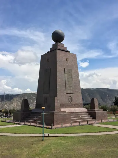
    UK FCDO travel advice (updated 1 November 2026): Pichincha province is among the provinces under a state of emergency. Check the current FCDO travel advice, linked on the country page.North of Quito, Ciudad Mitad del Mundo and its monument mark the equator line, and around 200 metres away the Museo Intiñán demonstrates experiments related to the equator. About 17 kilometres north of the capital lies the volcanic crater of Pululahua, with fields and farms on its floor.

    Kaldari·CC0

    Quito

    Quito

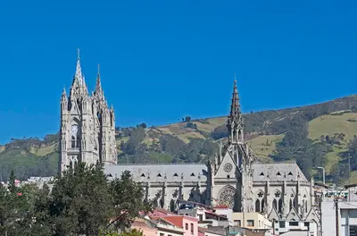
    UK FCDO travel advice (updated 1 November 2026): Pichincha province, which includes Quito, is among the provinces where a state of emergency for security reasons has been declared. Check the current FCDO travel advice, linked on the country page.Quito, the capital of Ecuador, lies at around 2,800 metres in a long Andean valley at the foot of Pichincha volcano. Its old town, with churches such as La Compañía and San Francisco, has been a UNESCO World Heritage Site since 1978 and, according to UNESCO, is the least altered historic centre in Latin America.Beyond the colonial old town, the viewpoints of El Panecillo and the TelefériQo, the museums in the north of the city and the restaurant scene are worth your time; in 2026 Nuema became the first Ecuadorian restaurant in the top 50 of The World's 50 Best Restaurants.
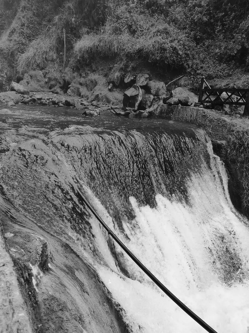
    Ymblanter·CC BY-SA 4.0

    Cotopaxi National Park

    Cotopaxi National Park

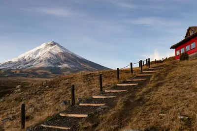
    For current travel and safety advice, including volcanic activity and any state of emergency, check the UK FCDO travel advice, linked on the country page.Cotopaxi National Park, around 50 kilometres south of Quito, surrounds the 5,897-metre, glacier-capped Cotopaxi volcano. On the plateau at around 4,000 metres you'll find Laguna Limpiopungo, hiking trails and an almost flat cycling route; entry is free.

    Alain Bonnardeaux·Unsplash

    Central Andes

    Central Andes

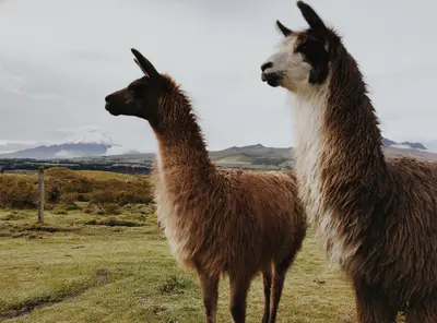
    For current travel and safety advice, including volcanic activity and any state of emergency, check the UK FCDO travel advice, linked on the country page.South of Quito, volcanoes line the Pan-American Highway: 5,897-metre Cotopaxi is around an hour's drive from the capital, and west of Latacunga lies the turquoise crater lake of Quilotoa. At the foot of Tungurahua, Baños with its thermal baths and the waterfall road towards Puyo is the gateway to the Amazon.

    DΛVΞ GΛRCIΛ·Pexels

    Your next steps

    Otavalo is in Ecuador. Ways to carry on from here.

    • More in Ecuador

      Highlights, areas, routes and the best time to travel for all of Ecuador.

      Ecuador travel guide
    • Round trips with Otavalo

      One route passes through Otavalo, with stops, nights and a map.

      See the round trip

    Sources & method

    • Photos: Wikimedia Commons, Pexels. Each photo carries its credit.
    • Place data such as addresses and ratings comes from Google Maps.
    • The content is based on web research from public, traceable sources. How the content is made · The role of AI