Fernweh: Home
ExploreGuideDestinationsMy tripsMy trip
de|en
All Places & RegionsRound tripsNight trains in EuropeAll highlightsAbout FernwehFAQPrivacy PolicyImprint
Download on the App StoreGet it on Google Play
ExploreGuideDestinationsMy tripsMy trip
    • Places in the region
    • Culture
    • Getting around
    • Round trips
    • Nearby
    Northern Andes

    Photo by DΛVΞ GΛRCIΛ on Pexels

    Ecuador

    Northern Andes

    Region

    UK FCDO travel advice (updated 1 November 2026): Pichincha province, which includes Quito, is among the provinces under a state of emergency, and the FCDO advises against all but essential travel to areas within 20 km of the border with…

    by Felix Gillen

    1. Home
    2. Destinations
    3. Ecuador
    4. Northern Andes
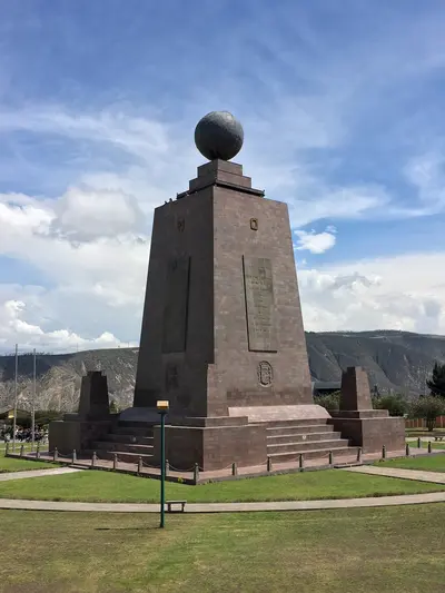
    UK FCDO travel advice (updated 1 November 2026): Pichincha province, which includes Quito, is among the provinces under a state of emergency, and the FCDO advises against all but essential travel to areas within 20 km of the border with Colombia (with exceptions in Carchi, including Tulcán). Check the current FCDO travel advice, linked on the country page.For most travellers the northern Andes are the gateway to Ecuador: Quito lies at around 2,800 metres in a high valley, and its old town has been a UNESCO World Heritage Site since 1978. North of the city, Ciudad Mitad del Mundo marks the equator, and around two hours away by bus lies Otavalo with its market, weaving villages and the crater lake of Cuicocha.
    Ecuador travel guideSee the round tripPlan a trip with Northern Andes

    Contents

    • Places in the region
    • Culture
    • Getting around
    • Round trips
    • Nearby
    Otavalo

    Photo by Mar Ahumada on Pexels

    Place 1 of 2

    Otavalo

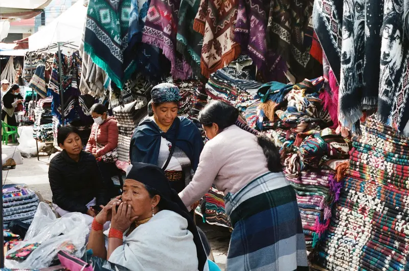
    Otavalo is located at around 2,500 meters in the province of Imbabura, about two bus hours north of Quito, and is known for its market at the Plaza de Ponchos.

    Discover
    Quito

    Ymblanter / Wikimedia Commons / CC BY-SA 4.0, mod.

    Place 2 of 2

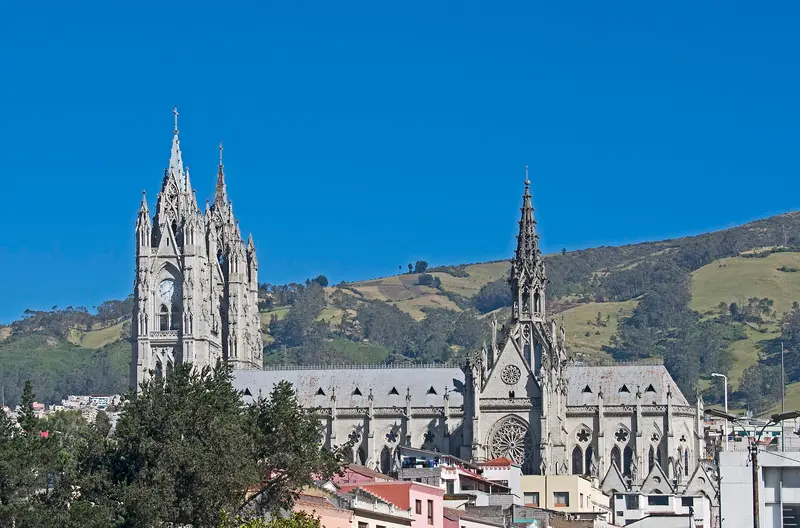
    Quito

    UK FCDO travel advice (updated 1 November 2026): Pichincha province, which includes Quito, is among the provinces where a state of emergency for security reasons has been declared. Check the current FCDO travel advice, linked on the country page.

    Discover

    Regional Culture

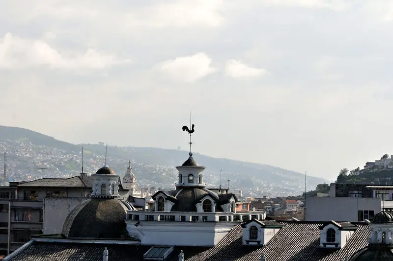
    Colonial CapitalQuito's Old Town is a UNESCO World Heritage site since 1978, preserving churches and monasteries from the Spanish colonial era.Indigenous HighlandsIn the Imbabura province around Otavalo, weaver villages, markets, and festivals like Inti Raymi in June shape life.

    Getting around the northern Andes

    From QuitoQuito is the base for the region: buses take about two hours to Otavalo, and Mitad del Mundo lies north of the city. Mariscal Sucre International Airport is outside the city in Tababela.AltitudeQuito lies at around 2,800 metres, Otavalo at around 2,500 metres and Laguna Cuicocha at around 3,100 metres. For health advice, see the FCDO travel advice.

    Round trips through this region
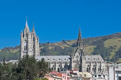
    Andes, Cuenca and Galápagos in 15 days

    Andes, Cuenca and Galápagos in 15 days

    The route connects the highlights of the Andean highlands with the colonial city of Cuenca and concludes with four days on the Galapagos Islands. You travel to Cuenca by long-distance buses, from Cuenca to Guayaquil by bus or domestic flight, to Galapagos by flight, and between the islands by public speedboats.

    16 Days
    9 stops
    Open jaw

    Ymblanter·CC BY-SA 4.0

    Nearby

    Mitad del Mundo and Pululahua

    Mitad del Mundo and Pululahua

    UK FCDO travel advice (updated 1 November 2026): Pichincha province is among the provinces under a state of emergency. Check the current FCDO travel advice, linked on the country page.North of Quito, Ciudad Mitad del Mundo and its monument mark the equator line, and around 200 metres away the Museo Intiñán demonstrates experiments related to the equator. About 17 kilometres north of the capital lies the volcanic crater of Pululahua, with fields and farms on its floor.

    Kaldari·CC0

    Cotopaxi National Park

    Cotopaxi National Park

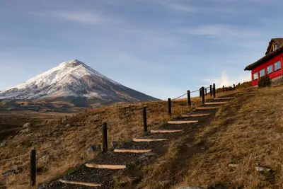
    For current travel and safety advice, including volcanic activity and any state of emergency, check the UK FCDO travel advice, linked on the country page.Cotopaxi National Park, around 50 kilometres south of Quito, surrounds the 5,897-metre, glacier-capped Cotopaxi volcano. On the plateau at around 4,000 metres you'll find Laguna Limpiopungo, hiking trails and an almost flat cycling route; entry is free.

    Alain Bonnardeaux·Unsplash

    Central Andes

    Central Andes

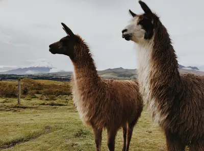
    For current travel and safety advice, including volcanic activity and any state of emergency, check the UK FCDO travel advice, linked on the country page.South of Quito, volcanoes line the Pan-American Highway: 5,897-metre Cotopaxi is around an hour's drive from the capital, and west of Latacunga lies the turquoise crater lake of Quilotoa. At the foot of Tungurahua, Baños with its thermal baths and the waterfall road towards Puyo is the gateway to the Amazon.

    DΛVΞ GΛRCIΛ·Pexels

    Quilotoa Loop

    Quilotoa Loop

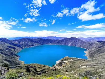
    For current travel and safety advice, including any state of emergency, check the UK FCDO travel advice, linked on the country page.Quilotoa is a volcano around 90 kilometres west of Latacunga whose caldera, about three kilometres wide, is filled by a green-blue lake around 250 metres deep; the highest point of the crater rim is at 3,914 metres. The roughly 200-kilometre loop through the Andean villages of Zumbahua, Tigua, Chugchilán, Isinliví and Sigchos links the crater lake, highland markets and hiking trails.

    Ben Traveling·Pexels

    Tena

    Tena

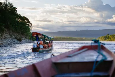
    For current and binding travel, safety and health advice, check the UK FCDO travel advice, linked on the country page.Tena is the capital of Napo province and lies at the confluence of the Río Tena and Río Pano. The town is one of Ecuador's main bases for rafting and kayaking on the rivers of the upper Napo. By the river you'll find a small Malecón, bathing spots and the Parque Amazónico La Isla.

    Jeff Stapleton·Pexels

    Your next steps

    Northern Andes is in Ecuador. Ways to carry on from here.

    • More in Ecuador

      Highlights, areas, routes and the best time to travel for all of Ecuador.

      Ecuador travel guide
    • Round trips with Northern Andes

      One route passes through Northern Andes, with stops, nights and a map.

      See the round trip
    • Plan a trip with Northern Andes

      The Guide asks about season, length and who is coming, and suggests a trip with Northern Andes.

      Plan the trip

    Sources & method

    • Photos: Pexels. Each photo carries its credit.
    • The content is based on web research from public, traceable sources. How the content is made · The role of AI