Ymblanter / Wikimedia Commons / CC BY-SA 4.0, mod.
Round trip · Ecuador
Andes, Cuenca and Galápagos in 15 days
by Felix Gillen
- 16 Days / 15 Nights
- Quito → San Cristóbal and Puerto Baquerizo Moreno
The route connects the highlights of the Andean highlands with the colonial city of Cuenca and concludes with four days on the Galapagos Islands. You travel to Cuenca by long-distance buses, from Cuenca to Guayaquil by bus or domestic flight, to Galapagos by flight, and between the islands by public speedboats.
At a glance
- Duration
- 16 Days / 15 Nights
- Stops
- 9 · Quito → San Cristóbal and Puerto Baquerizo Moreno
- Arrival
- Flight · Quito (UIO)
- Departure
- Flight · Guayaquil (GYE)
- Best Time to Go
- June to September (highlands' driest months)
9 stops
Why This Route?
It showcases in a reasonable time three of Ecuador's four main regions: colonial cities and markets in the highlands, volcanoes and crater lakes, the Pacific metropolis Guayaquil, and the wildlife of Galápagos, without long return trips.
Hidden Gems
- Thursday Market in Saquisilí near Latacunga
- Saturday Market in Zumbahua
- Laguna Cuicocha near Cotacachi
- Museo Remigio Crespo Toral with Cuenca's founding charter
Getting there and back
Open jaw: start and end are in different places
- Arrival
- Flight · Quito (UIO)From Mariscal Sucre Airport in Tababela, public buses run for 2 US dollars to the Río Coca, Quitumbe, and Carcelén terminals, as well as to El Labrador metro station; a taxi costs around 25 to 30 US dollars.
- Departure
- Flight · Guayaquil (GYE)From San Cristóbal, you'll fly back to the mainland, to Guayaquil. Round-trip flights to Galápagos must be booked together; please ensure ample buffer time for your connecting flight to Europe.
Itinerary
Quito
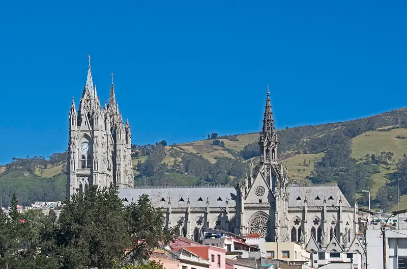
UK FCDO travel advice (updated 1 November 2026): Pichincha province, which includes Quito, is among the provinces where a state of emergency for security reasons has been declared. Check the current FCDO travel advice, linked on the country page.Quito, the capital of Ecuador, lies at around 2,800 metres in a long Andean valley at the foot of Pichincha volcano. Its old town, with churches such as La Compañía and San Francisco, has been a UNESCO World Heritage Site since 1978 and, according to UNESCO, is the least altered historic centre in Latin America.Beyond the colonial old town, the viewpoints of El Panecillo and the TelefériQo, the museums in the north of the city and the restaurant scene are worth your time; in 2026 Nuema became the first Ecuadorian restaurant in the top 50 of The World's 50 Best Restaurants.
Old Town, TelefériQo and a trip to Mitad del Mundo. Get used to the altitude of around 2,800 metres here.
10 Sights
4 Restaurants
Culture and History
Colonial HeritageSan Francisco de Quito was founded on December 6, 1534, on the remains of an Inca city. UNESCO particularly highlights the monasteries of San Francisco and Santo Domingo, as well as the Jesuit Church La Compañía, whose interior is covered in gold leaf; it was built from 1605 to 1765. The independence hero Antonio José de Sucre is buried in the Cathedral on Plaza Grande.ArtThe Capilla del Hombre in the Bellavista neighborhood, designed by painter Oswaldo Guayasamín and completed in 2002 after his death, showcases his work. In the Old Town, the Casa del Alabado is dedicated to pre-Columbian art.FestivalsAround its founding day on December 6, the city celebrates the Fiestas de Quito in early December. During Holy Week, processions move through the Old Town, and on All Souls' Day, Colada morada and Guaguas de pan are available everywhere.
Otavalo
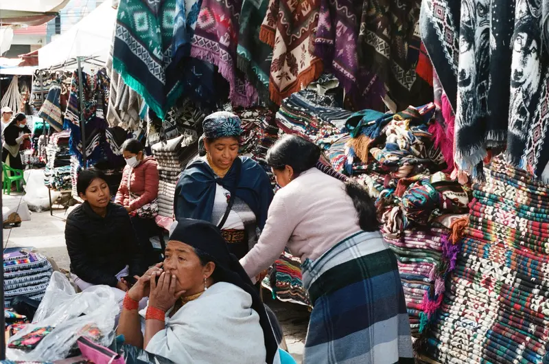
Otavalo is located at around 2,500 meters in the province of Imbabura, about two bus hours north of Quito, and is known for its market at the Plaza de Ponchos. Around the city, weaving villages, the Peguche Waterfall, Lago San Pablo, and the Cuicocha crater lake invite visitors for excursions.
About two hours by bus from Quito; best on market day, Saturday or Wednesday.
5 Sights
2 Restaurants
Market, Weavers & Feasts
The MarketThe stalls at Plaza de Ponchos are open daily, with Saturday being the main day, when the entire city center fills up. On Saturdays, an animal market also takes place from 5 to 10 AM. Haggling is common; ask before you photograph people.Weaver VillagesIn Peguche, reachable on foot from Otavalo, weaver cooperatives operate; other weaver villages are located by the reed-lined Lago San Pablo. Cotacachi, 11 kilometers away, is known for leather goods, and on Sundays, there's a leather market there in Parque San Francisco.FestivalsAt the June solstice, Inti Raymi is celebrated in Otavalo, Peguche, and other places in Imbabura; in February or March, Pawkar Raimi is celebrated in Peguche and Agato.
Cotopaxi National Park
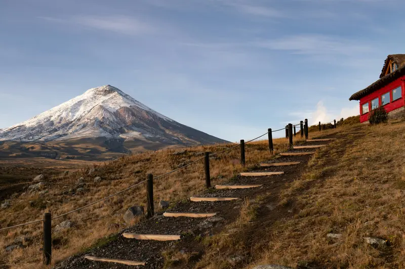
For current travel and safety advice, including volcanic activity and any state of emergency, check the UK FCDO travel advice, linked on the country page.Cotopaxi National Park, around 50 kilometres south of Quito, surrounds the 5,897-metre, glacier-capped Cotopaxi volcano. On the plateau at around 4,000 metres you'll find Laguna Limpiopungo, hiking trails and an almost flat cycling route; entry is free.
About an hour's drive south of Quito, day visit on the way to Latacunga; entry 8 am to 3 pm, free admission.
4 Sights
Volcano and Plateau
The VolcanoCotopaxi stands at 5,897 meters and is located approximately 50 kilometers south of Quito and 31 kilometers northeast of Latacunga. From October 2022, it underwent an eruption phase, which the Instituto Geofísico reported as ending in October 2023. In 2026, the institute reported avalanches and lahars following heavy rainfall, but no increase in internal activity.Hiking and BikingLaguna Limpiopungo: A lake at around 3,800 meters with an approximately one-hour loop trail and views of Rumiñahui.Refugio José Ribas: You can reach this mountain hut at 4,800 meters on foot from the parking lot in 45 to 60 minutes.Cycling Route: 13 kilometers, almost flat, at around 4,000 meters.
Quilotoa Loop
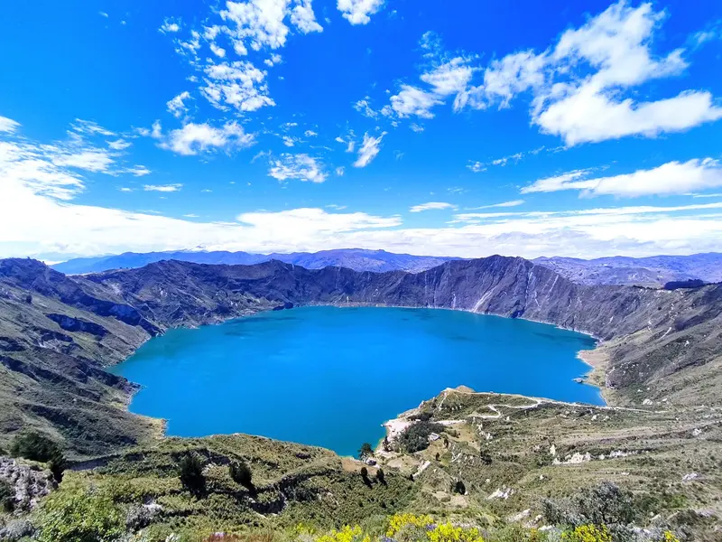
For current travel and safety advice, including any state of emergency, check the UK FCDO travel advice, linked on the country page.Quilotoa is a volcano around 90 kilometres west of Latacunga whose caldera, about three kilometres wide, is filled by a green-blue lake around 250 metres deep; the highest point of the crater rim is at 3,914 metres. The roughly 200-kilometre loop through the Andean villages of Zumbahua, Tigua, Chugchilán, Isinliví and Sigchos links the crater lake, highland markets and hiking trails.
From Latacunga by bus via Zumbahua; around four hours to Chugchilán.
3 Sights
Towns and Markets
Crater LakeThe last major eruption of Quilotoa is dated to around 1280. From the crater rim, a steep path leads down to the lakeshore; the descent and ascent together take two to three hours, with the return journey up alone often taking over an hour. Those who prefer not to walk up can rent a mule for around 4 to 5 US dollars.MarketsZumbahua: A colorful market takes place on Saturday mornings at around 3,500 meters.Saquisilí: The Thursday market, located about 20 minutes from Latacunga, is considered particularly authentic by guidebooks.
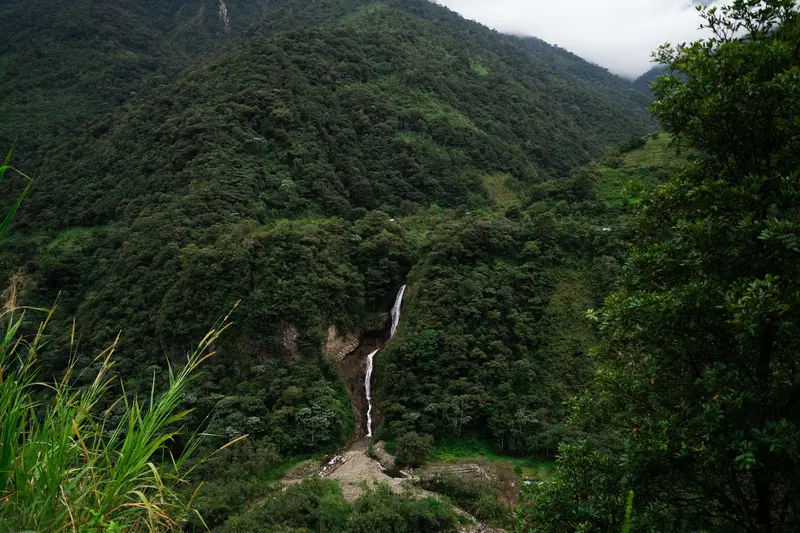
Baños de Agua Santa
For current travel and safety advice, including volcanic activity and any state of emergency, check the UK FCDO travel advice, linked on the country page.Baños de Agua Santa lies at around 1,800 metres at the foot of Tungurahua volcano, about 180 kilometres south of Quito, and is known for its thermal baths, the basilica of the Virgen del Rosario de Agua Santa and outdoor activities. From here the waterfall road with the Pailón del Diablo descends towards Puyo and the Amazon.
Waterfall Route by bike, thermal baths.
5 Sights
1 Restaurant
Water, Volcano and Pilgrims
Thermal Baths and BasilicaThe town's name refers to its thermal springs; the Piscinas de la Virgen on the outskirts are among the most important baths. In the basilica, the Virgen del Rosario de Agua Santa is revered, a destination for many pilgrims.Life at the VolcanoIn October 1999, all of Baños was evacuated for weeks due to Tungurahua. The Ministry of Environment continues to speak of an ongoing eruption process since 1999; the summit is only accessible via the Sendero Pondoa (as of June 2026).Ruta de las CascadasThe 61-kilometer road from Baños to Puyo descends almost 1,000 meters and passes several waterfalls: Agoyán is about 3 kilometers, Manto de la Novia about 7 kilometers past Baños, and Pailón del Diablo near Río Verde after 15 kilometers.
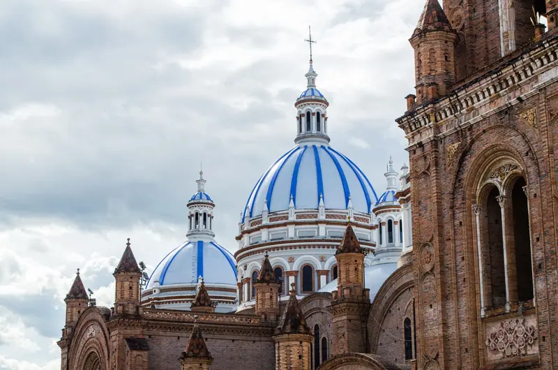
Cuenca
For current travel and safety advice, including any state of emergency, check the UK FCDO travel advice, linked on the country page.Cuenca lies at around 2,500 metres in the southern highlands and had just under 600,000 inhabitants in the 2022 census. Founded in 1557, the city with its grid layout, colonial churches and the sky-blue domes of the New Cathedral has been a UNESCO World Heritage Site since 1999.The houses of the Barranco line the banks of the Río Tomebamba, and the Museo Pumapungo has the ruins of an Inca site. The region is also known for its toquilla straw hats, sold internationally as Panama hats; their traditional weaving has been UNESCO intangible cultural heritage since 2012.
From Baños, bus operators quote around 6 hours via Riobamba; day trip to El Cajas or Ingapirca.
7 Sights
3 Restaurants
Culture and Handicraft
Colonial-era Planned CityGil Ramírez Dávalos founded Cuenca on April 12, 1557. UNESCO recognizes the city as a planned Spanish colonial city in the Andes valley, whose grid plan follows 16th-century planning guidelines.Panama HatThe weaving of Toquilla straw hats has been on UNESCO's Intangible Cultural Heritage list since 2012. Depending on its fineness, a hat takes one day to eight months to make; the palm grows on the coast. The small Museo del Sombrero de Paja Toquilla showcases its production (admission $1 USD).MuseumsMuseo Pumapungo features an archaeological park with Inca ruins and canals, as well as a garden with native plants. The Museo Remigio Crespo Toral, located on the Barranco, preserves the city's founding charter in its municipal archive.
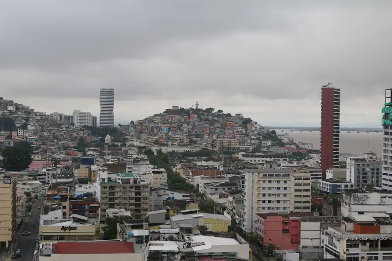
Guayaquil
UK FCDO travel advice (updated 1 November 2026): the FCDO advises against all but essential travel to the province of Guayas, which includes Guayaquil, except transit through Guayaquil airport. Check the current FCDO travel advice, linked on the country page.Guayaquil on the Río Guayas is Ecuador's largest city, with around 2.7 million inhabitants in the canton. For travellers the main sights are the 2.5-kilometre riverside promenade Malecón 2000, the old quarter of Las Peñas on Cerro Santa Ana, Parque Seminario with its iguanas and the museums along the Malecón; many use the city as a springboard to Galápagos.
On to Guayaquil by bus (around 3.5 to 4 hours) or, since November 2026, by domestic flight (around 50 minutes); buy the Transit Control Card at the airport.
6 Sights
3 Restaurants
City by River
Malecón 2000This 2.5-kilometer-long riverside promenade along the Río Guayas, officially Malecón Simón Bolívar, opened in sections starting October 1999. It features the Torre Morisca, inaugurated in 1931, and La Rotonda, which commemorates the 1822 meeting of Bolívar and San Martín.Las Peñas and Cerro Santa AnaGuayaquil was founded at Cerro Santa Ana. 444 steps lead through the colorful neighborhood up to the lighthouse on the summit.MuseumsThe MAAC on the Malecón exhibits pre-Columbian cultures and contemporary art, the Museo Presley Norton over 8,000 archaeological pieces; both are free of charge (as of May 2026).
Flight
Flight to Baltra, then bus, water taxi across the Itabaca Channel and bus or taxi to Puerto Ayora
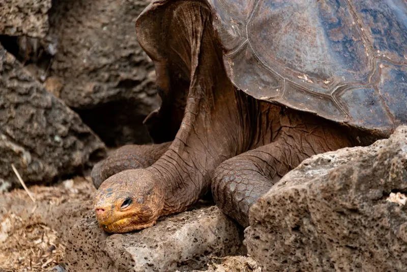
Santa Cruz and Puerto Ayora
UK FCDO travel advice (updated 1 November 2026): heavy rain caused flooding on Santa Cruz Island and an emergency was declared on 31 October 2026, with road closures, power cuts and disruption to journeys to Baltra airport. Avoid flooded areas, confirm arrangements with your airline or tour operator and check the current FCDO travel advice, linked on the country page.Santa Cruz is the most populous island in Galápagos and, with the nearby airport on Baltra, the archipelago's main hub. The harbour town of Puerto Ayora is home to the Charles Darwin Research Station and the start of the trail to Tortuga Bay; giant tortoises roam free in the highlands.
Darwin Station, Tortuga Bay, giant tortoises in the highlands. Pay the park fee in cash on arrival.
7 Sights
2 Restaurants
Research and the Turtles
Charles Darwin Research StationThe station on the outskirts of Puerto Ayora is open daily from 8 AM to 6 PM, and admission is free. Since 2017, the preserved Lonesome George, the last Pinta Island giant tortoise who died in 2012, has been exhibited in the Fausto Llerena Center. For the adjacent Giant Tortoise Breeding Center, you need a certified natural guide.HighlandsIn the Santa Cruz Highlands, giant tortoises live in the wild, for example in the area of the El Chato Reserve.
Ferry
Public speedboat, around two hours
San Cristóbal and Puerto Baquerizo Moreno
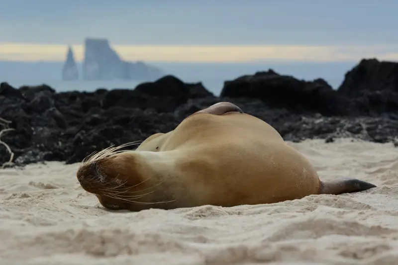
San Cristóbal is the fifth-largest Galápagos island, covering 558 square kilometers. Its main town, Puerto Baquerizo Moreno, is the provincial capital and has its own airport. From here, you can reach the Interpretation Center, Cerro Tijeretas with snorkeling cove, and the La Lobería sea lion colony on foot; by boat, you can visit León Dormido rock.
Sea lions, Cerro Tijeretas, boat trip to León Dormido; return flight from San Cristóbal.
5 Sights
1 Restaurant
Nature around the Place
Interpretation CenterThe Centro de Interpretación, located about a 20-minute walk north of the center, explains geology, climate, conservation, and the settlement attempts of the 1920s, in Spanish and English.Cerro Tijeretas and La LoberíaA path through Palo Santo forest leads in about 20 minutes to the Cerro Tijeretas viewpoint, with views of the bay and León Dormido rock; below is a protected snorkeling cove with sea lions. For the La Lobería sea lion colony, walk about an hour or take a taxi.Laguna El JuncoIn the highlands, at about 700 meters, lies Laguna El Junco, according to Rough Guides the largest freshwater lake in Galápagos.
Plan this route as your trip
All stops, trains and nights go into your trip planner. You adjust dates and places to stay afterwards.
This route is a suggestion from our research. Please check timetables, times in port, opening hours and prices before you book – what your tour operator or carrier says is what counts.
Fernweh is a free travel guide and trip planner: routes researched by people, taken over in one click, used day by day on the road. More about Fernweh
9 stops
Route Summary
Duration16 Days
Stops9 Places
TypeMixed