Fernweh: Home
ExploreGuideDestinationsMy tripsMy trip
de|en
All Places & RegionsRound tripsNight trains in EuropeAll highlightsAbout FernwehFAQPrivacy PolicyImprint
Download on the App StoreGet it on Google Play
ExploreGuideDestinationsMy tripsMy trip
    • Neighborhoods & highlights
    • Eat & drink
    • Culture
    • Getting around
    • Accommodation
    • Plan trip
    • Round trips
    • Nearby
    Santa Cruz and Puerto Ayora

    Photo by Diego F. Parra on Pexels

    Ecuador

    Santa Cruz and Puerto Ayora

    City

    UK FCDO travel advice (updated 1 November 2026): heavy rain caused flooding on Santa Cruz Island and an emergency was declared on 31 October 2026, with road closures, power cuts and disruption to journeys to Baltra airport.

    by Felix Gillen

    1. Home
    2. Destinations
    3. Ecuador
    4. Galápagos Islands
    5. Santa Cruz and Puerto Ayora
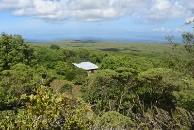
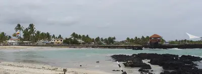
    UK FCDO travel advice (updated 1 November 2026): heavy rain caused flooding on Santa Cruz Island and an emergency was declared on 31 October 2026, with road closures, power cuts and disruption to journeys to Baltra airport. Avoid flooded areas, confirm arrangements with your airline or tour operator and check the current FCDO travel advice, linked on the country page.Santa Cruz is the most populous island in Galápagos and, with the nearby airport on Baltra, the archipelago's main hub. The harbour town of Puerto Ayora is home to the Charles Darwin Research Station and the start of the trail to Tortuga Bay; giant tortoises roam free in the highlands.
    Ecuador travel guideSee the round tripPlan a trip with Santa Cruz and Puerto Ayora

    Contents

    • Neighborhoods & highlights
    • Eat & drink
    • Culture
    • Getting around
    • Accommodation
    • Round trips
    • Nearby

    Sights in Santa Cruz and Puerto Ayora

    Discover the most important sights and attractions

    Tortuga Bay

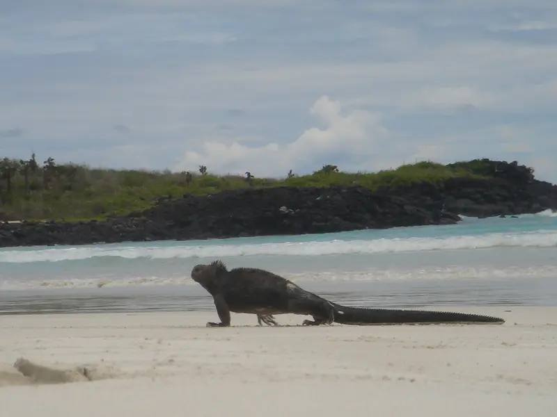
    “Tortuga Bay Iguana - panoramio” by waltermera182 / Wikimedia Commons / CC BY 3.0, mod.

    Attraction

    1Tortuga Bay

    A path approximately 2.5 kilometers long leads from Puerto Ayora to the bay; you sign in at the trailhead, no guide is necessary. Swimming is forbidden at the main beach due to strong currents. In case of high swells, the park administration closes the beach at short notice.
    Open in Google Maps
    Attraction

    2Playa Mansa

    The protected lagoon at the end of Tortuga Bay is the bay's swimming area; unlike the main beach, the water here is calm.
    Open in Google Maps
    Attraction

    3Charles Darwin Research Station

    The station on the edge of Puerto Ayora is open daily from 8am to 6pm and entry is free. The Fausto Llerena Centre displays the preserved Lonesome George, the giant tortoise that died in 2012; for the neighbouring breeding centre you need a certified naturalist guide.
    Open in Google Maps
    Las Grietas

    Diego Delso / Wikimedia Commons / CC BY-SA 4.0, mod.

    Point of Interest

    4Las Grietas

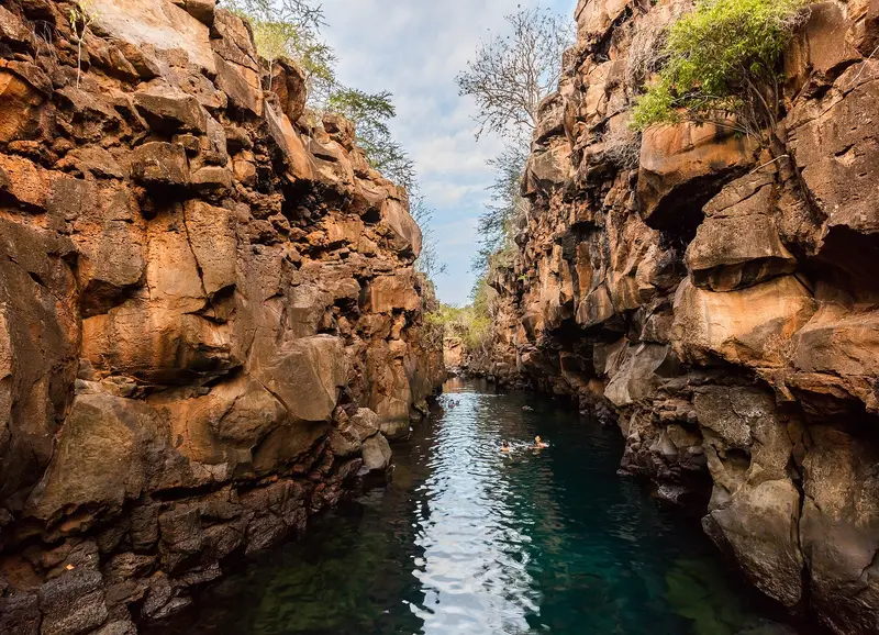
    Take a water taxi from the main jetty to the start of the path and walk across Playa de los Alemanes for about 15 to 20 minutes to the rock crevice where fresh water sits above saltwater; a guide is not necessary, but caution is advised when entering the water. Following the storm at the end of October 2026, the spot was only partially accessible on 11/11/2026.
    Open in Google Maps
    Playa El Garrapatero

    Pi3.124 / Wikimedia Commons / CC BY-SA 4.0, mod.

    Beach

    5Playa El Garrapatero

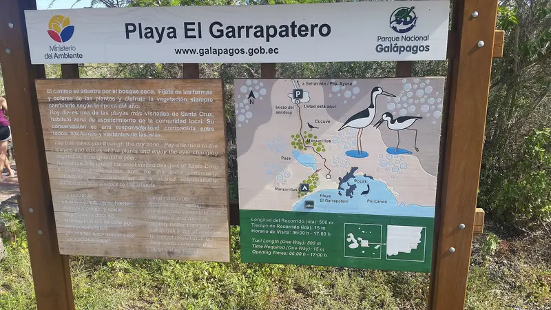
    The beach lies about 19 kilometers northeast of Puerto Ayora; you'll drive by taxi through the highlands, then walk a short distance from the parking lot. In the lagoon behind it, you sometimes spot flamingos, and on calm days you can snorkel in the tidal pools.
    Open in Google Maps
    Lava tunnel near Santa Rosa

    “A Lava tunnel on the Island of Santa Cruz Galapagos photo by Alvaro Sevilla Design” by David Adam Kess / Wikimedia Commons / CC BY-SA 3.0, mod.

    Attraction

    6Lava tunnel near Santa Rosa

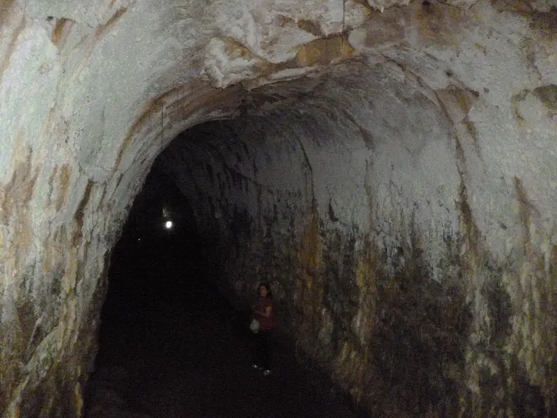
    The lava tunnels, stretching over a kilometer, are located on private land southwest of Santa Rosa in the highlands, so you won't need an official guide. A small entrance fee applies, and flashlights can be rented on-site.
    Open in Google Maps

    Restaurants in Santa Cruz and Puerto Ayora

    1

    Isla Grill

    Grill restaurant at Avenida Charles Darwin & Charles Binford corner with meat and seafood, which Lonely Planet and Frommer's recommend for Puerto Ayora.
    Show on Google Maps
    2

    Galápagos Deli

    Lonely Planet and Frommer's list the cafe on Calle Tomás de Berlanga in Puerto Ayora as a simple spot for a snack.
    Show on Google Maps

    Research and the Turtles

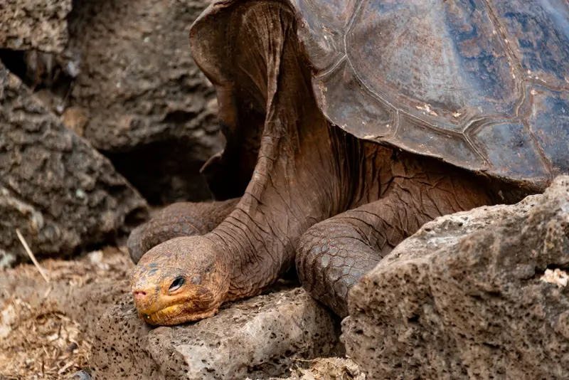
    Charles Darwin Research StationThe station on the outskirts of Puerto Ayora is open daily from 8 AM to 6 PM, and admission is free. Since 2017, the preserved Lonesome George, the last Pinta Island giant tortoise who died in 2012, has been exhibited in the Fausto Llerena Center. For the adjacent Giant Tortoise Breeding Center, you need a certified natural guide.HighlandsIn the Santa Cruz Highlands, giant tortoises live in the wild, for example in the area of the El Chato Reserve.

    Getting Here and About

    From Baltra AirportFrom Baltra Airport, a bus travels to the Itabaca Channel; a water taxi crosses to Santa Cruz, and from there, you continue by bus or taxi to Puerto Ayora.Continuing to the IslandsPublic speedboats (Lanchas) depart mornings and afternoons, taking approximately two hours to San Cristóbal, Isabela, and Floreana. Day trips to North Seymour, South Plaza, Bartolomé, or Santa Fe are limited to a few boats, so book early.Tortuga BayThe approximately 2.5-kilometer path to the bay is accessible without a guide; you must sign in at the path's start. Swimming is prohibited on the main beach due to strong currents; swimming is permitted in the sheltered Playa Mansa. In case of high waves, the park administration may close the beach at short notice.

    Accommodations in Santa Cruz and Puerto Ayora

    Find perfect stay in Santa Cruz and Puerto Ayora

    Booking.com* (Affiliate link)
    Search Hotels
    Agoda* (Affiliate link)
    Search Hotels
    Airbnb
    Vacation Rentals

    * Affiliate link: if you book through it, we earn a small commission. The price stays the same for you.

    Plan your trip to Santa Cruz and Puerto Ayora

    Save places, build a route and plan your city trip, all in one place.

    1. 1
      Sunrise over alpine peaks and a sea of clouds
      1234

      Round trip

      12 days · 4 stops

      Saved

      Pick a route

      Pick a ready-made one or save places and plan your own.

      Open bookmarks
    2. 2

      Trip to Santa Cruz and Puerto Ayora

      Live
      • 1Tortuga Bay3 days
      • 2Playa Mansa4 days
      • 3Charles Darwin Research Station5 days
      Budget

      Plan your trip

      The planner sorts stops, days and budget. Plan together in real time.

      Start trip planning
    3. 3
      9:41 No signal
      Santa Cruz and Puerto Ayora
      Available offline

      Photo by Diego F. Parra on Pexels

      Use it on the road

      Download the guide to your phone and use it on site, even offline.

    Round trips with Santa Cruz and Puerto Ayora

    Andes, Cuenca and Galápagos in 15 days

    Andes, Cuenca and Galápagos in 15 days

    The route connects the highlights of the Andean highlands with the colonial city of Cuenca and concludes with four days on the Galapagos Islands. You travel to Cuenca by long-distance buses, from Cuenca to Guayaquil by bus or domestic flight, to Galapagos by flight, and between the islands by public speedboats.

    16 Days
    9 stops
    Open jaw

    Ymblanter·CC BY-SA 4.0

    Nearby

    Galápagos Islands

    Galápagos Islands

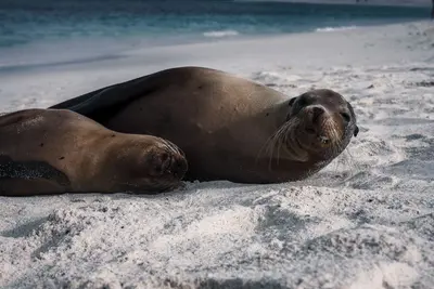
    UK FCDO travel advice (updated 1 November 2026): heavy rain caused flooding on Santa Cruz Island, and an emergency was declared on 31 October 2026, with road closures, power cuts and disruption to journeys to Baltra airport. Avoid flooded areas, confirm travel arrangements with your airline or tour operator and check the current FCDO travel advice, linked on the country page.The Galápagos Islands lie around 1,000 kilometres off the coast of Ecuador in the Pacific; giant tortoises, marine iguanas, sea lions and boobies can be watched here at close range. The archipelago comprises 127 islands, islets and rocks, only four of which are inhabited; around 97 per cent of the land area has been a national park since 1959.In 1978 Galápagos was among the first sites on the UNESCO World Heritage List; the surrounding marine reserve was created in 1986 and enlarged in 1998 to around 133,000 square kilometres. Charles Darwin visited the islands in 1835. Most travellers land on Baltra near Santa Cruz or on San Cristóbal and explore the islands by cruise ship or from the towns of Puerto Ayora, Puerto Baquerizo Moreno and Puerto Villamil.
    Lloyd Douglas·Pexels

    Floreana

    Floreana

    Before you travel, check the current UK FCDO travel advice, linked on the country page, which reports flooding on Santa Cruz and an emergency declared on 31 October 2026, and the national park's notices on closed visitor sites.Floreana lies in the south of the archipelago, around 50 kilometres south of Santa Cruz, and is one of the four inhabited islands of Galápagos. Most of its roughly 100 residents live in Puerto Velasco Ibarra on the west coast. The island is known for the post barrel at Post Office Bay and for the settler stories of the 1930s.

    Andrew Katsis·CC BY 4.0

    Isabela and Puerto Villamil

    Isabela and Puerto Villamil

    Isabela, at approximately 4,586 square kilometers, is Galápagos' largest island, bigger than all others combined. Its small main town, Puerto Villamil, is about a two-hour boat ride from Santa Cruz. From here, hike to Sierra Negra volcano's caldera, snorkel in Concha de Perla mangrove bay, or spot flamingos in the Humedales lagoons.

    David C. S.·CC BY-SA 4.0

    San Cristóbal and Puerto Baquerizo Moreno

    San Cristóbal and Puerto Baquerizo Moreno

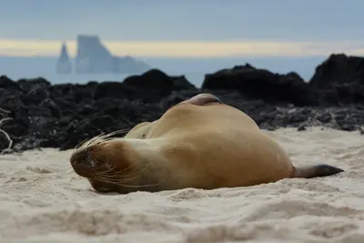
    San Cristóbal is the fifth-largest Galápagos island, covering 558 square kilometers. Its main town, Puerto Baquerizo Moreno, is the provincial capital and has its own airport. From here, you can reach the Interpretation Center, Cerro Tijeretas with snorkeling cove, and the La Lobería sea lion colony on foot; by boat, you can visit León Dormido rock.

    Caroline Ebinger·Unsplash

    Puerto López and Machalilla

    Puerto López and Machalilla

    UK FCDO travel advice (updated 1 November 2026): the FCDO advises against all but essential travel to the province of Manabí, which includes Puerto López and Machalilla National Park. Check the current FCDO travel advice, linked on the country page.The fishing town of Puerto López in Manabí province is the base for Machalilla National Park, founded in 1979, with Los Frailes beach, the community of Agua Blanca and Isla de la Plata, home to blue-footed, red-footed and Nazca boobies. Humpback whales pass along the coast from June to September.

    Annom·public domain

    Your next steps

    Santa Cruz and Puerto Ayora is in Ecuador. Ways to carry on from here.

    • More in Ecuador

      Highlights, areas, routes and the best time to travel for all of Ecuador.

      Ecuador travel guide
    • Round trips with Santa Cruz and Puerto Ayora

      One route passes through Santa Cruz and Puerto Ayora, with stops, nights and a map.

      See the round trip

    Sources & method

    • Photos: Wikimedia Commons, Pexels. Each photo carries its credit.
    • Place data such as addresses and ratings comes from Google Maps.
    • The content is based on web research from public, traceable sources. How the content is made · The role of AI