Fernweh: Home
ExploreGuideDestinationsMy tripsMy trip
de|en
All Places & RegionsRound tripsNight trains in EuropeAll highlightsAbout FernwehFAQPrivacy PolicyImprint
Download on the App StoreGet it on Google Play
ExploreGuideDestinationsMy tripsMy trip
    • Neighborhoods & highlights
    • Recommendations
    • Tours
    • Eat & drink
    • Culture
    • Getting around
    • Accommodation
    • Plan trip
    • Nearby
    Puerto López and Machalilla

    Annom / Wikimedia Commons / public domain

    Ecuador

    Puerto López and Machalilla

    City

    UK FCDO travel advice (updated 1 November 2026): the FCDO advises against all but essential travel to the province of Manabí, which includes Puerto López and Machalilla National Park.

    by Felix Gillen

    1. Home
    2. Destinations
    3. Ecuador
    4. Pacific Shore
    5. Puerto López and Machalilla
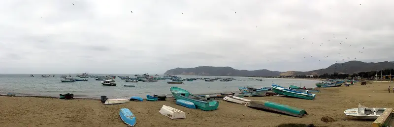
    UK FCDO travel advice (updated 1 November 2026): the FCDO advises against all but essential travel to the province of Manabí, which includes Puerto López and Machalilla National Park. Check the current FCDO travel advice, linked on the country page.The fishing town of Puerto López in Manabí province is the base for Machalilla National Park, founded in 1979, with Los Frailes beach, the community of Agua Blanca and Isla de la Plata, home to blue-footed, red-footed and Nazca boobies. Humpback whales pass along the coast from June to September.
    Ecuador travel guideRound trips in EcuadorPlan a trip with Puerto López and Machalilla

    Contents

    • Neighborhoods & highlights
    • Recommendations
    • Tours
    • Eat & drink
    • Culture
    • Getting around
    • Accommodation
    • Nearby

    Sights in Puerto López and Machalilla

    Discover the most important sights and attractions

    Attraction

    1Comuna Agua Blanca

    The community of around 300 residents in Machalilla National Park displays Spondylus shells and textiles in its museum; nearby lie remnants of about 650 houses from the Manteño culture. The community also features a sulfur lagoon roughly 60 meters in diameter.
    Open in Google Maps
    Attraction

    2Island of Salango

    The small island is about a ten-minute boat ride off the coast near Salango; frigatebirds and pelicans live there. At the reefs, you can snorkel on a boat tour.
    Open in Google Maps
    Museum

    3Archaeological Museum of Salango

    The museum in the town center of Salango, a few minutes south of Puerto López, displays 245 pieces from cultures ranging from Valdivia to Manteña. It opens daily from 9 AM.
    Open in Google Maps

    Tours & experiences in Puerto López and Machalilla

    Search tours for Puerto López and Machalilla on GetYourGuide* (Affiliate link)On GetYourGuide, with reviews from other travellers

    * Affiliate link: if you book through it, we earn a small commission. The price stays the same for you.

    Restaurants in Puerto López and Machalilla

    1

    Restaurant Carmita

    A simple fish restaurant on the beach in Puerto López, recommended by Fodor's, especially for its fish soup with lemon and vegetables.
    Show on Google Maps
    2

    Magic Dolphin

    Seafood restaurant in Salango near the archaeological museum, a few minutes south of Puerto López. Lonely Planet and El Comercio recommend fish like grouper, as well as clams in seawater with lime.
    Show on Google Maps

    Machalilla National Park

    The ParkThe Machalilla National Park was founded in July 1979 and comprises coastal forest, beaches, and Isla de la Plata. About 300 people live in the Agua Blanca community within the park; their museum displays Spondylus shells and textiles, and in the surrounding area are remnants of approximately 650 Manteño culture houses and a sulfur lagoon.Isla de la PlataThe island lies about 37 kilometers off the coast; the boat trip from Puerto López takes approximately 90 minutes. It is the only place in Ecuador, including Galápagos, where blue-footed, red-footed, and Nazca boobies occur together; Waved Albatrosses breed here from April to October.WhalesFrom June to September, humpback whales pass by Puerto López, with occasional sightings into October.

    Getting There and Details

    Getting ThereDirect buses run year-round from Guayaquil to Puerto López; from Montañita, buses depart every 15 to 20 minutes.Los FrailesThe beach is located about 10 kilometers north of Puerto López. From the entrance, a short path leads to the beach in about 30 minutes; a 4-kilometer loop trail via La Playita and La Tortuguita leads to a viewpoint. It's quietest in the early morning. The Ministry of Environment occasionally closes the beach for maintenance.Boat ToursTrips to Isla de la Plata and for whale watching depart from Puerto López pier; book only with authorized providers.

    Accommodations in Puerto López and Machalilla

    Find perfect stay in Puerto López and Machalilla

    Booking.com* (Affiliate link)
    Search Hotels
    Agoda* (Affiliate link)
    Search Hotels
    Airbnb
    Vacation Rentals

    * Affiliate link: if you book through it, we earn a small commission. The price stays the same for you.

    Plan your trip to Puerto López and Machalilla

    Save places, build a route and plan your city trip, all in one place.

    1. 1
      Sunrise over alpine peaks and a sea of clouds
      1234

      Round trip

      12 days · 4 stops

      Saved

      Pick a route

      Pick a ready-made one or save places and plan your own.

      Open bookmarks
    2. 2

      Trip to Puerto López and Machalilla

      Live
      • 1Comuna Agua Blanca3 days
      • 2Island of Salango4 days
      • 3Archaeological Museum of Salango5 days
      Budget

      Plan your trip

      The planner sorts stops, days and budget. Plan together in real time.

      Start trip planning
    3. 3
      9:41 No signal
      Puerto López and Machalilla
      Available offline

      Annom / Wikimedia Commons / public domain

      Use it on the road

      Download the guide to your phone and use it on site, even offline.

    Nearby

    Montañita

    Montañita

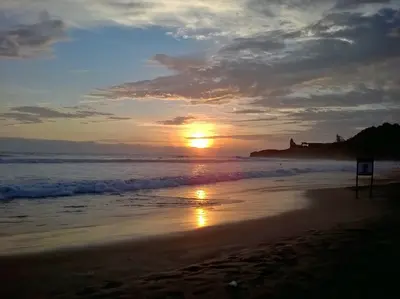
    UK FCDO travel advice (updated 1 November 2026): the FCDO advises against all but essential travel to the province of Santa Elena, which includes Montañita. Check the current FCDO travel advice, linked on the country page.Montañita in Santa Elena province, around 180 kilometres north-west of Guayaquil, is a surf town on the Ruta del Sol. The strong, consistent waves suit experienced surfers best; an international surf competition takes place here around Carnival in February.

    Mikaelashamrock·CC BY-SA 4.0

    Pacific Shore

    Pacific Shore

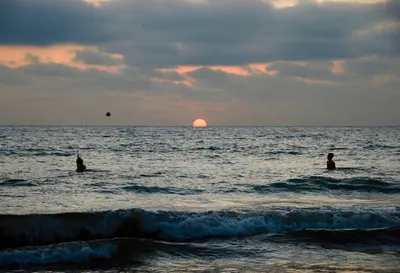
    UK FCDO travel advice (updated 1 November 2026): the FCDO advises against all but essential travel to the coastal provinces of Esmeraldas, Manabí, Santa Elena, Guayas, El Oro, Los Ríos and Santo Domingo de los Tsáchilas, except transit through Guayaquil airport. Check the current FCDO travel advice, linked on the country page.Ecuador's coast stretches from the port city of Guayaquil to the beaches of Santa Elena and Manabí provinces. Montañita is known for its waves, while Puerto López is the base for Machalilla National Park, Isla de la Plata and, from June to September, whale watching.

    Michiel·Pexels

    Guayaquil

    Guayaquil

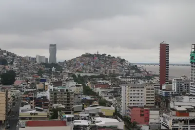
    UK FCDO travel advice (updated 1 November 2026): the FCDO advises against all but essential travel to the province of Guayas, which includes Guayaquil, except transit through Guayaquil airport. Check the current FCDO travel advice, linked on the country page.Guayaquil on the Río Guayas is Ecuador's largest city, with around 2.7 million inhabitants in the canton. For travellers the main sights are the 2.5-kilometre riverside promenade Malecón 2000, the old quarter of Las Peñas on Cerro Santa Ana, Parque Seminario with its iguanas and the museums along the Malecón; many use the city as a springboard to Galápagos.

    Alejandro Robles Duque·Pexels

    El Cajas National Park

    El Cajas National Park

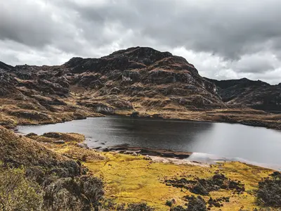
    For current travel and safety advice, including any state of emergency, check the UK FCDO travel advice, linked on the country page.El Cajas National Park lies around 30 kilometres west of Cuenca on the road towards the coast and has been a national park since 1996. Between around 3,100 and 4,500 metres there are 786 bodies of water, 165 of them larger than one hectare; most hiking trails start at Laguna Toreadora.

    Romario Rodrigo·Pexels

    Quilotoa Loop

    Quilotoa Loop

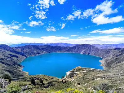
    For current travel and safety advice, including any state of emergency, check the UK FCDO travel advice, linked on the country page.Quilotoa is a volcano around 90 kilometres west of Latacunga whose caldera, about three kilometres wide, is filled by a green-blue lake around 250 metres deep; the highest point of the crater rim is at 3,914 metres. The roughly 200-kilometre loop through the Andean villages of Zumbahua, Tigua, Chugchilán, Isinliví and Sigchos links the crater lake, highland markets and hiking trails.

    Ben Traveling·Pexels

    Your next steps

    Puerto López and Machalilla is in Ecuador. Ways to carry on from here.

    • More in Ecuador

      Highlights, areas, routes and the best time to travel for all of Ecuador.

      Ecuador travel guide
    • Round trips in Ecuador

      Ready-made routes through Ecuador, with stops, nights and a map.

      See the routes

    Sources & method

    • Photos: Wikimedia Commons. Each photo carries its credit.
    • Place data such as addresses and ratings comes from Google Maps.
    • The content is based on web research from public, traceable sources. How the content is made · The role of AI