Fernweh: Home
ExploreGuideDestinationsMy tripsMy trip
de|en
All Places & RegionsRound tripsNight trains in EuropeAll highlightsAbout FernwehFAQPrivacy PolicyImprint
Download on the App StoreGet it on Google Play
ExploreGuideDestinationsMy tripsMy trip
    • Places & highlights
    • Tours
    • Eat & drink
    • Culture
    • Getting around
    • Accommodation
    • Nearby
    El Cajas National Park

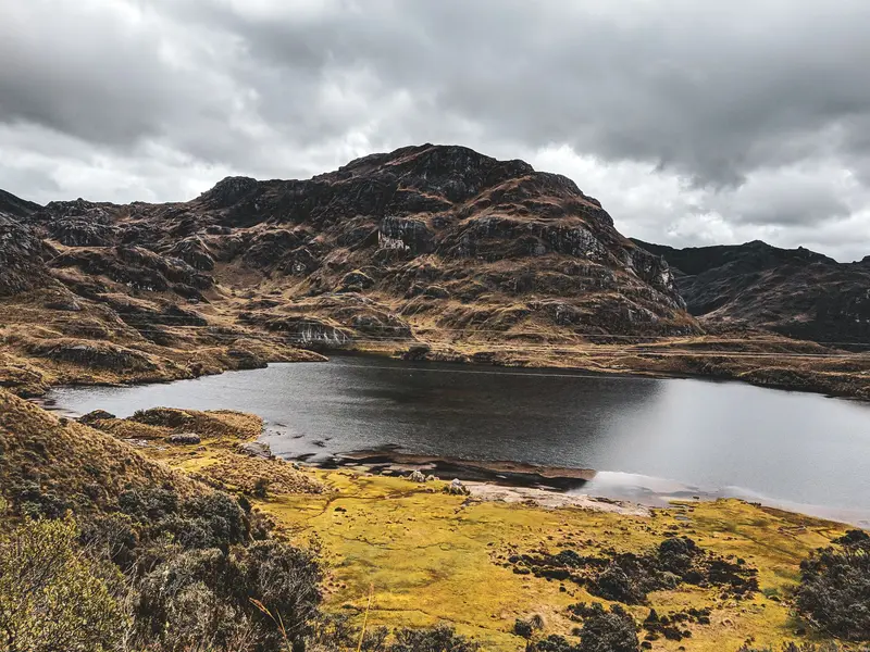
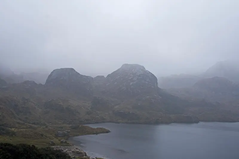
    Photo by Romario Rodrigo on Pexels

    Ecuador

    El Cajas National Park

    Point of Interest

    For current travel and safety advice, including any state of emergency, check the UK FCDO travel advice, linked on the country page.

    by Felix Gillen

    1. Home
    2. Destinations
    3. Ecuador
    4. Southern Andes
    5. El Cajas National Park
    For current travel and safety advice, including any state of emergency, check the UK FCDO travel advice, linked on the country page.El Cajas National Park lies around 30 kilometres west of Cuenca on the road towards the coast and has been a national park since 1996. Between around 3,100 and 4,500 metres there are 786 bodies of water, 165 of them larger than one hectare; most hiking trails start at Laguna Toreadora.
    Ecuador travel guideRound trips in EcuadorPlan a trip with El Cajas National Park

    Contents

    • Places & highlights
    • Tours
    • Eat & drink
    • Culture
    • Getting around
    • Accommodation
    • Nearby

    Sights in El Cajas National Park

    Discover the most important sights and attractions

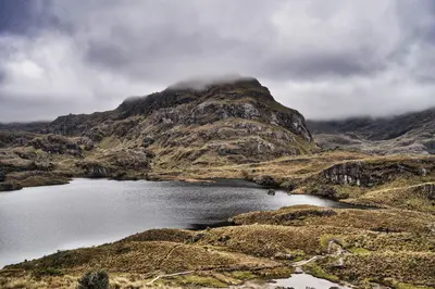
    Laguna Toreadora

    Ymblanter / Wikimedia Commons / CC BY-SA 4.0, mod.

    Park

    1Laguna Toreadora

    At the Toreadora Checkpoint at Kilometer 32 on the Cuenca–Molleturo road, you register for the park. The loop trail around the lagoon takes 1.5 to 2 hours; on busy days, parking is scarce.
    Open in Google Maps
    Park

    2Cerro San Luis

    The 4,264-meter-high peak near Laguna Toreadora requires a steep ascent of about three hours. Moon recommends it only with a private guide; away from Toreadora, the park administration advises you should only hike with a guide anyway.
    Open in Google Maps

    Tours & experiences in El Cajas National Park

    Search tours for El Cajas National Park on GetYourGuide* (Affiliate link)On GetYourGuide, with reviews from other travellers

    * Affiliate link: if you book through it, we earn a small commission. The price stays the same for you.

    Restaurants in El Cajas National Park

    Hiking the High Moor

    Laguna ToreadoraThe circular route around Laguna Toreadora takes 1.5 to 2 hours. Overall, there are at least 14 visitor points; Tres Cruces lies on the continental divide.WeatherIt can hail within minutes in the park, March and April are the wettest. Those coming from the coast should acclimatize to the altitude for one to two days beforehand in Cuenca.

    Access and Rules

    DirectionsThe Toreadora checkpoint is at kilometer 32 of the Cuenca-Molleturo road, about an hour by bus from Cuenca. Buses to Guayaquil run roughly every 30 minutes from Terminal Terrestre and stop at the park if requested. On busy days, Toreadora has few parking spots, come early.RulesAdmission 8 AM to 4:30 PM, registration at the checkpoints is compulsory.No pets, no open fires, do not leave paths.The Llaviucu area is closed following the 2024 fires (as of April 2026).

    Accommodations in El Cajas National Park

    Find perfect stay in El Cajas National Park

    Booking.com* (Affiliate link)
    Search Hotels
    Agoda* (Affiliate link)
    Search Hotels
    Airbnb
    Vacation Rentals

    * Affiliate link: if you book through it, we earn a small commission. The price stays the same for you.

    Nearby

    Southern Andes

    Southern Andes

    For current travel and safety advice, including any state of emergency, check the UK FCDO travel advice, linked on the country page.In the south of the highlands lies Cuenca, whose planned colonial old town has been a UNESCO World Heritage Site since 1999. From here you can reach El Cajas National Park, with hundreds of mountain lakes between 3,100 and 4,500 metres, and the site of Ingapirca in Cañar province, the country's most important archaeological site.

    Viajante Dibujero·Pexels

    Cuenca

    Cuenca

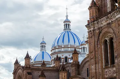
    For current travel and safety advice, including any state of emergency, check the UK FCDO travel advice, linked on the country page.Cuenca lies at around 2,500 metres in the southern highlands and had just under 600,000 inhabitants in the 2022 census. Founded in 1557, the city with its grid layout, colonial churches and the sky-blue domes of the New Cathedral has been a UNESCO World Heritage Site since 1999.The houses of the Barranco line the banks of the Río Tomebamba, and the Museo Pumapungo has the ruins of an Inca site. The region is also known for its toquilla straw hats, sold internationally as Panama hats; their traditional weaving has been UNESCO intangible cultural heritage since 2012.

    David Mosquera·Pexels

    Ingapirca

    Ingapirca

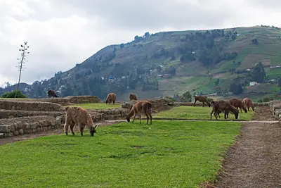
    For current travel and safety advice, including any state of emergency, check the UK FCDO travel advice, linked on the country page.Ingapirca in Cañar province, around two and a half hours by bus north of Cuenca, is regarded as Ecuador's most important archaeological site. At around 3,200 metres, Cañari buildings combine with Inca structures, whose elliptical Temple of the Sun was built around a large rock and aligned with the solstices.

    Ymblanter·CC BY-SA 4.0

    Guayaquil

    Guayaquil

    UK FCDO travel advice (updated 1 November 2026): the FCDO advises against all but essential travel to the province of Guayas, which includes Guayaquil, except transit through Guayaquil airport. Check the current FCDO travel advice, linked on the country page.Guayaquil on the Río Guayas is Ecuador's largest city, with around 2.7 million inhabitants in the canton. For travellers the main sights are the 2.5-kilometre riverside promenade Malecón 2000, the old quarter of Las Peñas on Cerro Santa Ana, Parque Seminario with its iguanas and the museums along the Malecón; many use the city as a springboard to Galápagos.

    Alejandro Robles Duque·Pexels

    Riobamba and Chimborazo

    Riobamba and Chimborazo

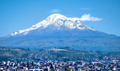
    For current travel, safety and health advice, including any state of emergency, check the UK FCDO travel advice, linked on the country page.Riobamba lies at just over 2,750 metres in the central Sierra and is the base for trips to 6,268-metre Chimborazo, Ecuador's highest mountain. After the earthquake of 1797 the town was rebuilt on a new site; its centre around Parque Maldonado is shaped by 19th-century buildings. On the volcano you can drive up to the Refugio Carrel at around 4,800 metres and spot vicuñas on the páramo.

    Dabit100 / David Torres Costales Riobamba·CC BY-SA 4.0

    Your next steps

    El Cajas National Park is in Ecuador. Ways to carry on from here.

    • More in Ecuador

      Highlights, areas, routes and the best time to travel for all of Ecuador.

      Ecuador travel guide
    • Round trips in Ecuador

      Ready-made routes through Ecuador, with stops, nights and a map.

      See the routes
    • Plan a trip with El Cajas National Park

      The Guide asks about season, length and who is coming, and suggests a trip with El Cajas National Park.

      Plan the trip

    Sources & method

    • Photos: Wikimedia Commons, Pexels. Each photo carries its credit.
    • Place data such as addresses and ratings comes from Google Maps.
    • The content is based on web research from public, traceable sources. How the content is made · The role of AI