Fernweh: Home
ExploreGuideDestinationsMy tripsMy trip
de|en
All Places & RegionsRound tripsNight trains in EuropeAll highlightsAbout FernwehFAQPrivacy PolicyImprint
Download on the App StoreGet it on Google Play
ExploreGuideDestinationsMy tripsMy trip
    • Places & highlights
    • Tours
    • Eat & drink
    • Culture
    • Getting around
    • Accommodation
    • Nearby
    Semuc Champey

    Betipá / Wikimedia Commons / CC BY-SA 4.0, mod.

    Guatemala

    Semuc Champey

    Point of Interest

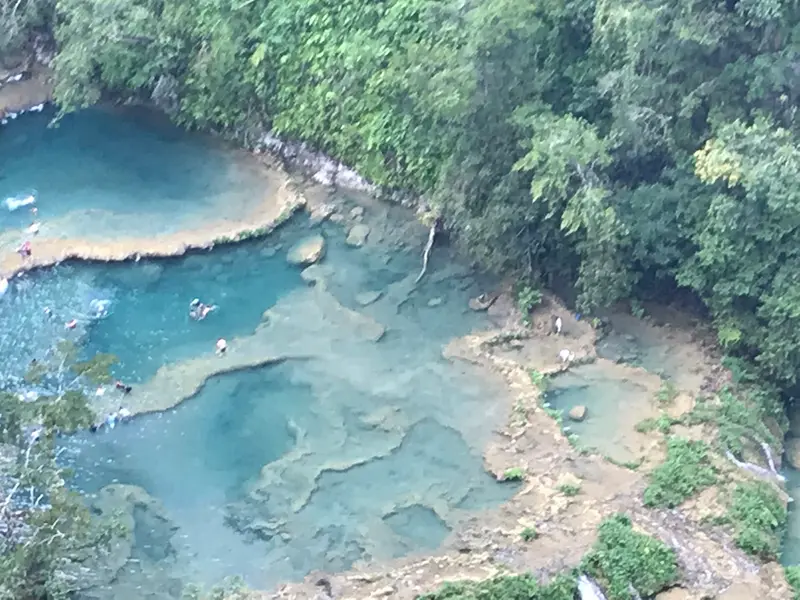
    Semuc Champey is a natural limestone bridge, approximately 300 meters long, spanning the Río Cahabón, where turquoise pools cascade in terraces.

    by Felix Gillen

    1. Home
    2. Destinations
    3. Guatemala
    4. Lanquín
    5. Semuc Champey
    Semuc Champey is a natural limestone bridge, approximately 300 meters long, spanning the Río Cahabón, where turquoise pools cascade in terraces. This natural monument is located about 11 to 12 kilometers south of Lanquín in the Departamento Alta Verapaz and is one of Guatemala's most famous swimming spots.The name comes from Q'eqchi' and roughly means "where the river disappears underground." Below the bridge, the Cahabón flows through, while above, you can swim in the calm pools. A steep path leads to the Mirador, from which you see the pools from above.Just before the entrance are the Cuevas K'anba, water caves you can explore with a group by candlelight. The area is managed by CONAP and the municipality of Lanquín.
    Guatemala travel guideRound trips in GuatemalaPlan a trip with Semuc Champey

    Contents

    • Places & highlights
    • Tours
    • Eat & drink
    • Culture
    • Getting around
    • Accommodation
    • Nearby

    Sights in Semuc Champey

    Discover the most important sights and attractions

    Pools of Semuc Champey

    Betipá / Wikimedia Commons / CC BY-SA 4.0, mod.

    Natural Feature

    1Pools of Semuc Champey

    The roughly 300-meter-long limestone bridge spans the Río Cahabón, which flows beneath it. Tiered turquoise pools line its surface, inviting you to swim. There are no lockers, so valuables are best left at your accommodation.
    Open in Google Maps
    Attraction

    2Mirador de Semuc Champey

    A steep path with steps takes about 30 minutes to the viewpoint, where you see the pools from above.
    Open in Google Maps

    Tours & experiences in Semuc Champey

    Search tours for Semuc Champey on GetYourGuide* (Affiliate link)On GetYourGuide, with reviews from other travellers

    * Affiliate link: if you book through it, we earn a small commission. The price stays the same for you.

    Restaurants in Semuc Champey

    Natural Monument in Q'eqchi' Land

    Protected AreaSemuc Champey is protected as a Monumento Natural and is managed by CONAP and the municipality of Lanquín.Q'eqchi' RegionAround Lanquín, the population is predominantly Q'eqchi' Maya, and the name Semuc Champey comes from their language.

    Arrival & Practical

    Getting HereFrom Lanquín, it's about 12 kilometers by road, and the journey by pick-up takes roughly 30 to 45 minutes. The Ministry of Transport upgraded the road from Lanquín to Semuc Champey in April 2025. From Cobán to Lanquín, you'll need around 1.5 to 2 hours. Shuttles from Antigua take approximately 8 to 10 hours.Tickets and Opening HoursAccording to CONAP, admission for foreign visitors costs Q50. You can pay in advance at a Banrural branch or with cash at the entrance. It's open daily from 8 AM to 4 PM (as of 2026, please confirm locally).On-siteThe ascent to the Mirador takes about 30 minutes and is steep. You'll need a full day for the pools, the Mirador, and the caves. There are no lockers available, so leave valuables at your accommodation.

    Accommodations in Semuc Champey

    Find perfect stay in Semuc Champey

    Booking.com* (Affiliate link)
    Search Hotels
    Agoda* (Affiliate link)
    Search Hotels
    Airbnb
    Vacation Rentals

    * Affiliate link: if you book through it, we earn a small commission. The price stays the same for you.

    Nearby

    Lanquín

    Lanquín

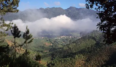
    Lanquín is a small Q'eqchi' village in the Río Cahabón valley in Alta Verapaz and the gateway to Semuc Champey, located about 10 kilometers south. In the evening, a visit to the Grutas de Lanquín on the edge of town is worthwhile, when large numbers of bats fly out of the cave.Approximately 95 percent of the population are Q'eqchi' Maya. Pick-ups will take you to Semuc Champey in about 30 to 45 minutes.

    Salix Oculus·CC BY-SA 4.0

    Río Dulce

    Río Dulce

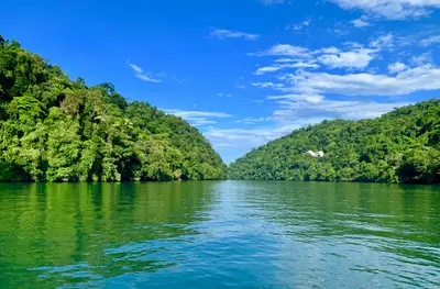
    The Río Dulce connects Lago de Izabal with the Caribbean near Lívingston and flows through a jungle-clad limestone gorge. Many come for the boat trip to Lívingston, the Castillo de San Felipe, and the hot springs of Finca El Paraíso.The town of Río Dulce, also known as Fronteras, is located at the large road bridge where the river leaves the lake. Slightly west, the Castillo de San Felipe de Lara guards the narrowest point at the lake's exit. Downstream, the Río Dulce widens into El Golfete, home to the Biotopo Chocón Machacas protected area.

    Weyden González·Unsplash

    Guatemala City

    Guatemala City

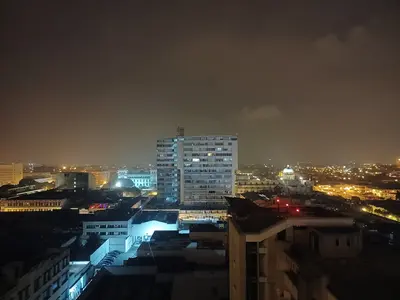
    The Foreign Office warns of increased robberies in the business and entertainment districts of Zones 10 and 14, and on the airport route via Zone 13 (As of 15.11.2026). Guatemala City is the capital and, since its 1773 earthquake relocation, the seat of government. International flights land here.The museums are particularly worth visiting. The Museo Popol Vuh and Ixchel Textile Museum are on Universidad Francisco Marroquín campus in Zone 10. In the historical center, Zone 1, the Palacio Nacional de la Cultura stands on Plaza de la Constitución.

    Simon Burchell·CC BY-SA 4.0

    Lívingston

    Lívingston

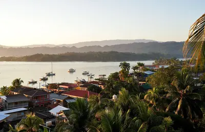
    Lívingston is a Caribbean town at the mouth of the Río Dulce and the center of Garífuna culture in Guatemala. There's no road; you can only reach the town by boat from Río Dulce or Puerto Barrios, and the journey through the river gorge alone is worth it.In the town, Garífuna, Afro-Caribbean influences, Maya, and Ladinos mix. Typical is Tapado, a seafood stew in coconut milk. From the town, a path leads to the cascades of Los Siete Altares; you reach Playa Blanca by boat.Around November 26th, Lívingston celebrates National Garífuna Day for several days.

    Exploraguate·CC BY-SA 4.0

    Antigua Guatemala

    Antigua Guatemala

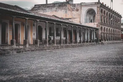
    Antigua Guatemala is the former capital of the Spanish Captaincy General and has been a UNESCO World Heritage site since 1979. The city is situated at an altitude of approximately 1500 meters in the Panchoy Valley, about 40 kilometers from Guatemala City airport and surrounded by volcanoes.It was founded in 1543 at its third location. The Santa Marta earthquakes of 1773 destroyed large parts, after which the capital was relocated. What remains is a grid of cobblestone streets with churches, convents, and ruins, some of which are restored and some accessible as ruins.Among the most famous buildings are the Palacio de los Capitanes Generales, the Cathedral, La Merced, and Las Capuchinas. During Holy Week, processions move across carpets made of flowers and colored sawdust. The German Foreign Office also warns of a risk of robberies in Antigua.
    Mario Spencer·Pexels

    Your next steps

    Semuc Champey is in Guatemala. Ways to carry on from here.

    • More in Guatemala

      Highlights, areas, routes and the best time to travel for all of Guatemala.

      Guatemala travel guide
    • Round trips in Guatemala

      Ready-made routes through Guatemala, with stops, nights and a map.

      See the routes
    • Plan a trip with Semuc Champey

      The Guide asks about season, length and who is coming, and suggests a trip with Semuc Champey.

      Plan the trip

    Sources & method

    • Photos: Wikimedia Commons. Each photo carries its credit.
    • The content is based on web research from public, traceable sources. How the content is made · The role of AI