Fernweh: Home
ExploreGuideDestinationsMy tripsMy trip
de|en
All Places & RegionsRound tripsNight trains in EuropeAll highlightsAbout FernwehFAQPrivacy PolicyImprint
Download on the App StoreGet it on Google Play
ExploreGuideDestinationsMy tripsMy trip
    • Neighborhoods & highlights
    • Eat & drink
    • Culture
    • Getting around
    • Accommodation
    • Plan trip
    • Nearby
    Bibione

    Tiesse / Wikimedia Commons / public domain

    Italy

    Bibione

    CityBeachNatureFor Families

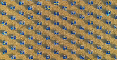
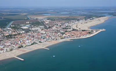
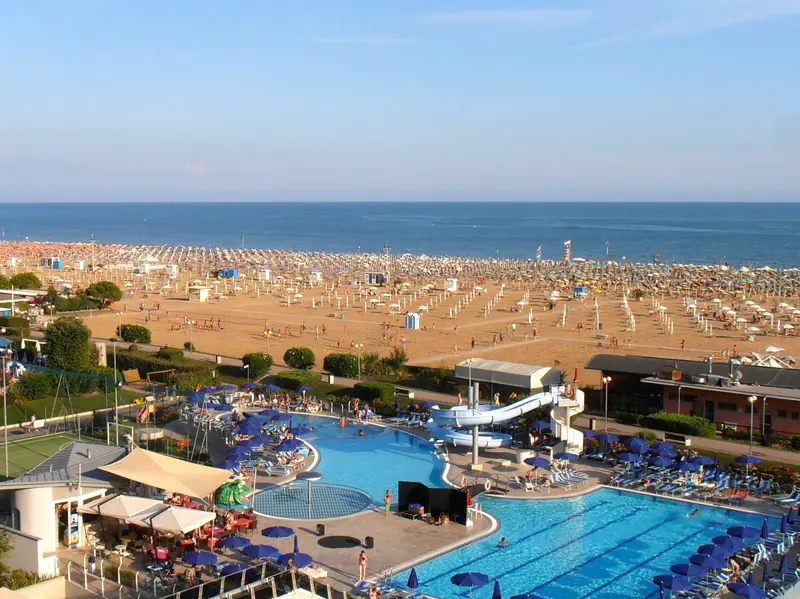
    Bibione is located in the far northeast of the Venetian coast at the mouth of the Tagliamento. Behind the sandy beach stretches a pine forest with fossil dunes, through which cycle paths lead to the lighthouse at the river mouth.

    by Felix Gillen

    1. Home
    2. Destinations
    3. Italy
    4. Venetian Adriatic Coast
    5. Bibione
    Bibione is located in the far northeast of the Venetian coast at the mouth of the Tagliamento. Behind the sandy beach stretches a pine forest with fossil dunes, through which cycle paths lead to the lighthouse at the river mouth.From the landing stage on the Tagliamento, pedestrians and cyclists cross over to Lignano Riviera.
    Italy travel guideRound trips in ItalyPlan a trip with Bibione

    Contents

    • Neighborhoods & highlights
    • Eat & drink
    • Culture
    • Getting around
    • Accommodation
    • Nearby

    Sights in Bibione

    Discover the most important sights and attractions

    Faro di Bibione

    Picsforjoo / Wikimedia Commons / CC BY-SA 4.0, mod.

    Point of Interest

    1Faro di Bibione

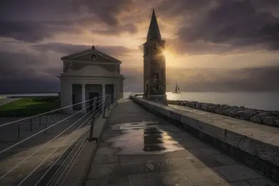
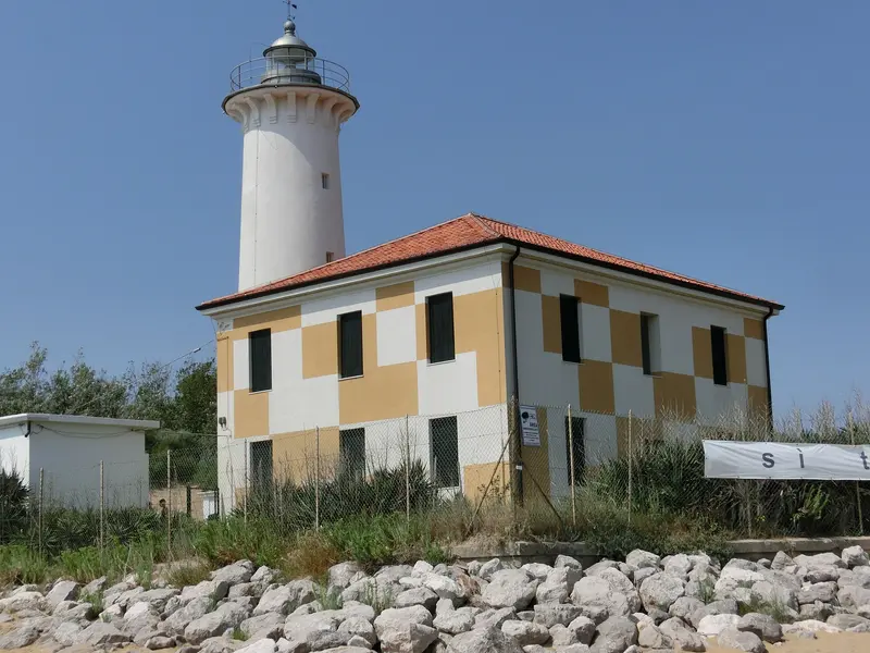
    The 22-meter-high white concrete tower on the right bank of the Tagliamento estuary was built in 1913, bombed in 1917 during WWI and immediately rebuilt. It stands in the Punta Tagliamento nature reserve with pine forest, dunes, and beach and is only accessible on foot or by bike, for example, via the 12-kilometer-long family loop through the Pineta.

    Open in Google Maps

    Restaurants in Bibione

    Nature & Culture

    Pineta and Punta TagliamentoThe natural area at the river mouth features alternating pine forest, dunes, beach, and riverbanks. The forest blooms from March to May; you can spot emerald lizards, birds, and, with luck, rare turtles. The black pine is part of the flora.The LighthouseThe Faro di Bibione from 1913 was destroyed in the First World War and immediately rebuilt. It marks the right bank of the Tagliamento estuary.

    Local experiences

    By BikeThe Il faro e la pineta loop is about 12 kilometers long and family-friendly, leading over asphalt, gravel, dirt paths, and sand. A mountain bike is recommended.To LignanoFrom the pier on the Tagliamento, a crossing for pedestrians and cyclists takes you to Lignano Riviera on the other side of the river.

    Accommodations in Bibione

    Find perfect stay in Bibione

    Booking.com* (Affiliate link)
    Search Hotels
    Agoda* (Affiliate link)
    Search Hotels
    Airbnb
    Vacation Rentals

    * Affiliate link: if you book through it, we earn a small commission. The price stays the same for you.

    Campgrounds in Bibione

    Find perfect campground in Bibione

    Search via Google Maps
    Campgrounds nearby (15km)
    Camping.info
    Find Campgrounds
    Park4Night
    RV Parks & Camping

    Plan your trip to Bibione

    Save places, build a route and plan your city trip, all in one place.

    1. 1
      Sunrise over alpine peaks and a sea of clouds
      1234

      Round trip

      12 days · 4 stops

      Saved

      Pick a route

      Pick a ready-made one or save places and plan your own.

      Open bookmarks
    2. 2

      Trip to Bibione

      Live
      • 1Faro di Bibione3 days
      Budget

      Plan your trip

      The planner sorts stops, days and budget. Plan together in real time.

      Start trip planning
    3. 3
      9:41 No signal
      Bibione
      Available offline

      Tiesse / Wikimedia Commons / public domain

      Use it on the road

      Download the guide to your phone and use it on site, even offline.

    Nearby

    Caorle

    Caorle

    Caorle, about 65 kilometers from Venice, is a fishing village with a Venetian-influenced old town: colorful facades, narrow alleys, and a still-active fishing port. Its landmarks are the 11th-century Romanesque cathedral with its round, slightly leaning bell tower and the pilgrimage church Madonna dell'Angelo, perched on a promontory in the sea.On both sides of the old town are flat sandy beaches, ideal for families. Inland stretches the Caorle lagoon with its traditional fishing huts, the Casoni.

    Maurizio Fecchio·Pexels

    Jesolo

    Jesolo

    Jesolo, with around 15 kilometers of beach, is one of the main resorts on the Adriatic northeast of Venice. Hotels, beach resorts, shops, and eateries line the Lido, and Piazza Mazzini, with its fountain and cafés, is the central meeting point.Families and rainy days can enjoy attractions like the Sea Life Aquarium. Two 92-meter-high towers at Piazza Drago shape the skyline.

    Fich View Studio·Pexels

    Venetian Adriatic Coast

    Venetian Adriatic Coast

    Between the mouth of the Tagliamento in the northeast and Chioggia in the south, the Venetian Adriatic coast is lined with long sandy beaches, seaside resorts, and lagoons. Bibione, Caorle, Jesolo, and the Cavallino-Treporti peninsula are located north of Venice; Chioggia, with its seaside resort Sottomarina, sits at the southern end of the lagoon.The coast is a classic destination for family and camping holidays. From Punta Sabbioni at the tip of Cavallino-Treporti, ACTV ferries reach Venice in about half an hour; Chioggia is connected to Venice via the Lido and Pellestrina.

    Carsten Steger·CC BY-SA 4.0

    Piran

    Piran

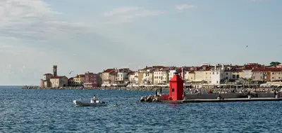
    Piran, on the Slovenian Adriatic, is considered by Marco Polo and Lonely Planet one of the country's highlights. Above the largely car-free old town is the 14th-century Church of St. George, with its 46 m high bell tower modeled on St. Mark's in Venice; you can walk along sections of the city walls.

    Jakub Hałun·CC BY 4.0

    Cavallino-Treporti

    Cavallino-Treporti

    The Cavallino-Treporti peninsula is located between the Adriatic Sea and the Lagoon northeast of Venice, with approximately 15 kilometers of Blue Flag coastline. At its tip, in Punta Sabbioni, the regular ferries to Venice depart: Line 14 travels in about 35 minutes via the Lido to San Zaccaria near St. Mark's Square, Line 12 via Burano and Murano to Fondamente Nove.The gently sloping beaches also bear the Green Flag of Italian pediatricians; large camping villages like Marina di Venezia are located directly on the sea. In the northern Lagoon lies the old village of Lio Piccolo, and along the coast stand fortifications from the 19th and early 20th centuries.

    Inna Million·Pexels

    Your next steps

    Bibione is in Italy. Ways to carry on from here.

    • More in Italy

      Highlights, areas, routes and the best time to travel for all of Italy.

      Italy travel guide
    • Round trips in Italy

      Ready-made routes through Italy, with stops, nights and a map.

      See the routes

    Sources & method

    • Photos: Wikimedia Commons. Each photo carries its credit.
    • Place data such as addresses and ratings comes from Google Maps.
    • The content is based on web research from public, traceable sources. How the content is made · The role of AI