Fernweh: Home
ExploreGuideDestinationsMy tripsMy trip
de|en
All Places & RegionsRound tripsNight trains in EuropeAll highlightsAbout FernwehFAQPrivacy PolicyImprint
Download on the App StoreGet it on Google Play
ExploreGuideDestinationsMy tripsMy trip
    • Places in the region
    • Culture
    • Getting around
    • Nearby
    Vieux Fort and South Coast

    Enrevseluj / Wikimedia Commons / CC BY-SA 4.0, mod.

    St. Lucia

    Vieux Fort and South Coast

    Region

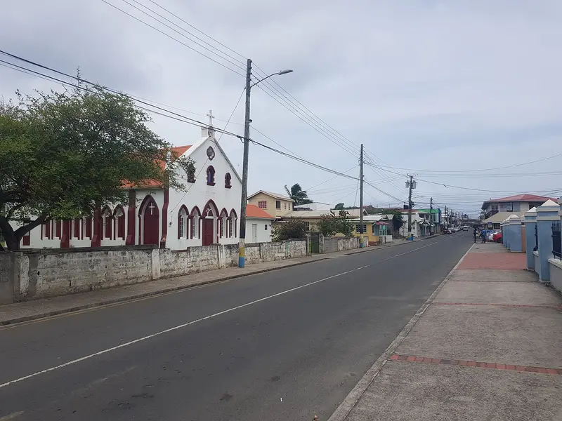
    Vieux Fort on St. Lucia's southern tip is the location of Hewanorra International Airport, which developed from a US World War II airfield.

    by Felix Gillen

    1. Home
    2. Destinations
    3. St. Lucia
    4. Vieux Fort and South Coast
    Vieux Fort on St. Lucia's southern tip is the location of Hewanorra International Airport, which developed from a US World War II airfield. In the 18th and 19th centuries, the area was a hub for sugar production; today, it's where island beer Piton is brewed.Above the town, the lighthouse on Moule à Chique offers views over the south coast. Offshore lies the Maria Islands Nature Reserve, and Kitesurfers gather at Sandy Beach.
    St. Lucia travel guideRound trips in St. LuciaPlan a trip with Vieux Fort and South Coast

    Contents

    • Places in the region
    • Culture
    • Getting around
    • Nearby

    Sights in Vieux Fort and South Coast

    Discover the most important sights and attractions

    Park

    Maria Islands Nature Reserve

    The two small islands Maria Major and Maria Minor lie half a mile off Pointe Sable and have been a nature reserve of the Saint Lucia National Trust since 1982. Over 80 plant species and five endemic reptiles live here, including the extremely rare Saint Lucia Racer (Kouwès). According to the National Trust, no tours are currently offered; you can see the islands from the coast and from Moule à Chique.
    Open in Google Maps
    Attraction

    Moule à Chique

    St. Lucia's southern tip has a headland with a lighthouse. The Port Authority reports it's about 740 feet above sea level; construction is cited as 1901 or 1912. Clear views from the lookout extend to St. Vincent, over Vieux Fort and the Maria Islands.
    Open in Google Maps
    Beach

    Sandy Beach

    The beach at Vieux Fort on the windy southeast coast is a kitesurfers' meeting point on St. Lucia, according to Lonely Planet. It is located near Hewanorra Airport.
    Open in Google Maps

    Nature and History

    Maria IslandsThe two islands, Maria Major (10.1 hectares) and Maria Minor (1.6 hectares), lie half a mile off the coast and have been a nature reserve since 1982. They are home to over 80 plant species and five endemic reptiles, including the Saint Lucia Racer (Kouwès), one of the world's rarest snakes. According to the National Trust, no tours are currently offered.Moule à ChiqueThe lighthouse on the headland stands approximately 740 feet (over 220 meters) above sea level, according to the Port Authority. On a clear day, the view extends to St. Vincent. Sources cite 1901 and 1912 as its construction year.

    Arrival and on the way

    AirportHewanorra (UVF) is the arrival airport for long-haul flights. It takes about 45 minutes to Soufrière, about 1 hour 15 minutes to Castries, and 1.5 to 2 hours to the north. According to the FCDO, the East Coast Road is considered accident-prone.ActivitiesSandy Beach is a meeting point for kitesurfers. For families, there's the Rudy John Beach Park in nearby Laborie.

    Nearby

    Island's interior rainforest

    Island's interior rainforest

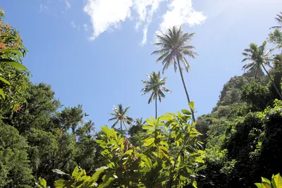
    Saint Lucia's mountainous interior is covered by rainforest; its highest peak is Mount Gimie at 950 meters. Marked trails like the Enbas Saut Trail to two waterfalls at the foot of Mount Gimie or the Des Cartiers Rainforest Trail lead through mountain forest, where with luck you'll see the endemic Saint Lucia Amazon (Jacquot) and the Saint Lucia Oriole.

    Paul Harrison·CC BY-SA 4.0

    Soufrière and the Pitons

    Soufrière and the Pitons

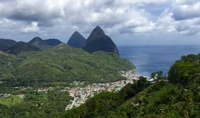
    Soufrière is why most people travel to St. Lucia: This town on the west coast lies at the foot of the two Pitons, which, along with Sulphur Springs, rainforest, and reefs, form the Pitons Management Area, a UNESCO World Heritage site since 2004. All around, you'll find hot springs, waterfalls, old plantations, and bathing coves like Anse Chastanet and Sugar Beach.You can climb Gros Piton with a certified guide; Sulphur Springs are described by the tourism office as a “drive-in volcano.”

    Simon Hurry·Pexels

    Anse La Raye

    Anse La Raye

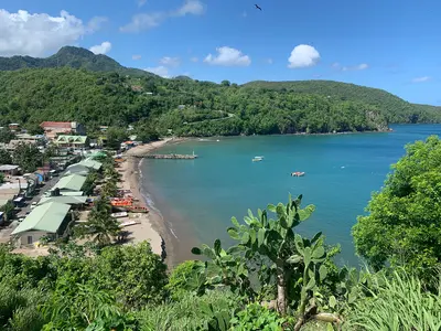
    Anse La Raye is a fishing village on the west coast between Marigot Bay and Soufrière. It's known for Seafood Friday: Every Friday evening, Front Street is closed to cars, and stalls offer fish, lobster, fishcakes, and conch.Between Anse La Raye and Canaries lies Plas Kassav, a cassava bakery known for its cassava bread.

    Mojo Hand·CC BY-SA 4.0

    Marigot Bay

    Marigot Bay

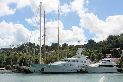
    Marigot Bay is a deep-cut bay, surrounded by palms and green hills on the west coast, about six kilometers southwest of Castries. Its inner section offers shelter for boats during hurricanes; scenes from the film "Doctor Dolittle" were shot here in 1967.The bay serves as an anchorage for sailors and a departure point for water taxis along the coast.

    ImagePerson·CC BY 4.0

    Castries

    Castries

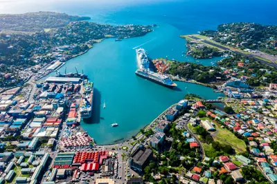
    Castries is the capital of St. Lucia and is located on a deep natural harbor in the northwest of the island. The compact downtown area around Derek Walcott Square, with its cathedral and the market established in 1891, is easily explored on foot, above which rises Morne Fortuné, featuring the remains of Fort Charlotte and the tombs of the island's two Nobel laureates.At the harbor, cruise ships dock at Pointe Seraphine, while from the ferry terminal, ships depart for Martinique, Dominica, and Guadeloupe.

    Omar Eagle·Unsplash

    Your next steps

    Vieux Fort and South Coast is in St. Lucia. Ways to carry on from here.

    • More in St. Lucia

      Highlights, areas, routes and the best time to travel for all of St. Lucia.

      St. Lucia travel guide
    • Round trips in St. Lucia

      Ready-made routes through St. Lucia, with stops, nights and a map.

      See the routes
    • Plan a trip with Vieux Fort and South Coast

      The Guide asks about season, length and who is coming, and suggests a trip with Vieux Fort and South Coast.

      Plan the trip

    Sources & method

    • Photos: Wikimedia Commons. Each photo carries its credit.
    • Place data such as addresses and ratings comes from Google Maps.
    • The content is based on web research from public, traceable sources. How the content is made · The role of AI