Fernweh: Home
ExploreGuideDestinationsMy tripsMy trip
de|en
All Places & RegionsRound tripsNight trains in EuropeAll highlightsAbout FernwehFAQPrivacy PolicyImprint
Download on the App StoreGet it on Google Play
ExploreGuideDestinationsMy tripsMy trip
    • Neighborhoods & highlights
    • Recommendations
    • Tours
    • Eat & drink
    • Culture
    • Getting around
    • Accommodation
    • Plan trip
    • Round trips
    • Nearby
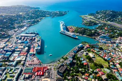
    Castries

    Photo by Omar Eagle on Unsplash

    St. Lucia

    Castries

    City

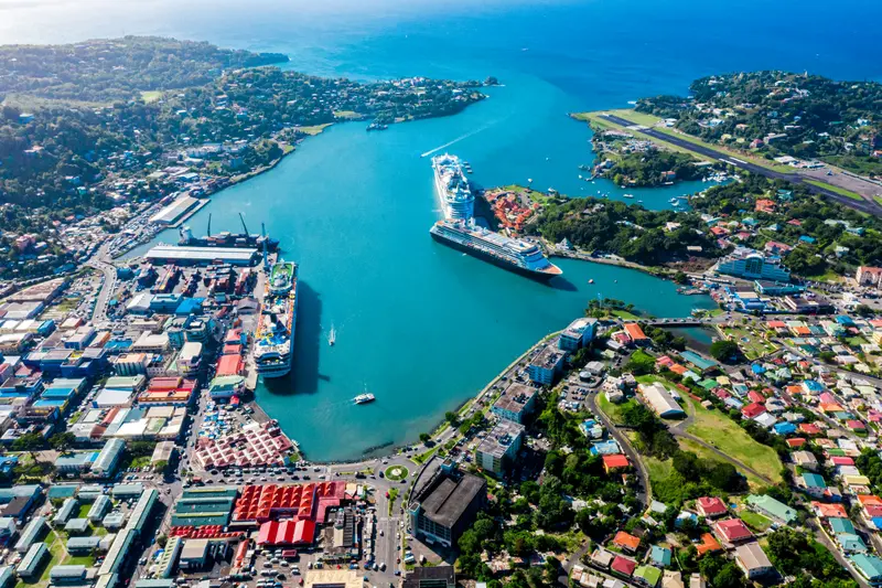
    Castries is the capital of St. Lucia and is located on a deep natural harbor in the northwest of the island.

    by Felix Gillen

    1. Home
    2. Destinations
    3. St. Lucia
    4. Castries
    Castries is the capital of St. Lucia and is located on a deep natural harbor in the northwest of the island. The compact downtown area around Derek Walcott Square, with its cathedral and the market established in 1891, is easily explored on foot, above which rises Morne Fortuné, featuring the remains of Fort Charlotte and the tombs of the island's two Nobel laureates.At the harbor, cruise ships dock at Pointe Seraphine, while from the ferry terminal, ships depart for Martinique, Dominica, and Guadeloupe.
    St. Lucia travel guideSee the round tripPlan a trip with Castries

    Contents

    • Neighborhoods & highlights
    • Recommendations
    • Tours
    • Eat & drink
    • Culture
    • Getting around
    • Accommodation
    • Round trips
    • Nearby

    Sights in Castries

    Discover the most important sights and attractions

    Market

    1Castries Market

    The market in central Castries, founded in 1891, offers fruit, vegetables, spices, handicrafts, and small food stalls. It's liveliest on Saturdays, says the Tourist Board.
    Open in Google Maps
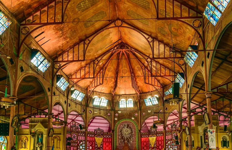
    Cathedral Basilica of the Immaculate Conception

    “Cathedral Basilica of the Immaculate Conception, Jan 2020” by Terry Ott / Wikimedia Commons / CC BY 2.0, mod.
    2Cathedral Basilica of the Immaculate Conception

    The Cathedral on Laborie Street opposite Derek Walcott Square was built between 1894 and 1897 on the site of an earlier church from 1767. Inside, the colorful murals by St. Lucian painter Dunstan St. Omer glow, which he revised before the papal visit in the 1980s. Since 1999, the church has held the title of Basilica minor.
    Open in Google Maps
    Park

    3Derek Walcott Square

    Castries' shady main square is named after poet Derek Walcott, a 1992 Nobel laureate in Literature. A mighty Saman tree provides shade, with historic buildings and the cathedral around it. The square is a good starting point for a walk through the city center.
    Open in Google Maps
    Morne Fortuné and Fort Charlotte

    Pi3.124 / Wikimedia Commons / CC BY-SA 4.0, mod.

    4Morne Fortuné and Fort Charlotte

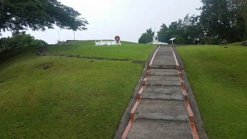
    The ridge above Castries was fortified from 1768 and renamed Fort Charlotte in 1794. Among the preserved structures are a powder magazine and guard cells from the 1760s, the Apostles Battery with four cannons from 1892, and the memorial to the 27th Inniskilling Regiment. Also located here are the graves of Nobel laureates Arthur Lewis and Derek Walcott. According to the National Trust, the site is accessible daily from 9 AM to 5 PM, without staff or admission fee; a donation is welcome.
    Open in Google Maps
    Museum

    5Vigie Lighthouse

    The lighthouse on Vigie Peninsula, north of downtown, was built in 1914 (Port Authority) and sits some 320 feet above sea. From here, you overlook Castries' harbor entrance and the city airport.
    Open in Google Maps
    Beach

    6Vigie Beach

    Sandy beach on the Vigie Peninsula north of the city center, right next to the city airport. The Tourist Board lists it among the destinations in Castries.
    Open in Google Maps

    Tours & experiences in Castries

    Search tours for Castries on GetYourGuide* (Affiliate link)On GetYourGuide, with reviews from other travellers

    * Affiliate link: if you book through it, we earn a small commission. The price stays the same for you.

    Restaurants in Castries

    1

    The Coal Pot

    Waterfront restaurant in Vigie Cove, established in 1968 according to Fodor's. For lunch, light fish dishes are available; evenings offer a tranquil meal by the water.
    Show on Google Maps
    2

    The Pink Plantation House

    French-Creole cuisine in an approximately 140-year-old plantation house on Morne Fortuné above Castries, with city views according to Fodor's. Please check closure days in advance.
    Show on Google Maps

    History and Culture

    Kathedrale und Walcott SquareDie Cathedral Basilica of the Immaculate Conception wurde 1894 bis 1897 errichtet, an der Stelle einer ersten Kirche von 1767; seit 1999 ist sie Basilica minor. Die farbigen Wandbilder stammen vom st. lucianischen Maler Dunstan St. Omer. Gegenüber liegt der schattige Derek Walcott Square, benannt nach dem Literaturnobelpreisträger von 1992.Morne FortunéDer Höhenrücken über der Stadt wurde ab 1768 befestigt und 1794 in Fort Charlotte umbenannt. 1796 eroberten die Briten mit dem 27th Inniskilling Regiment die Insel zurück, 1906 zog die Garnison ab. Heute nutzt das Sir Arthur Lewis Community College die Gebäude, und auf dem Hügel liegen die Gräber der Nobelpreisträger Arthur Lewis und Derek Walcott.

    Getting there and around

    Getting HereGeorge F. L. Charles Airport is located right on the edge of town and serves inter-island flights. From Hewanorra International Airport in the south, expect about a 1 hour 15 minute drive. The ferry to Martinique, Dominica, and Guadeloupe departs from Castries Ferry Terminal; in Dominica and St. Lucia, check-in opens two hours before departure.Around TownThe city center is compact and walkable. Minibuses to the north (Rodney Bay, 2.50 EC$) depart from Jeremy Street, to the south for Soufrière and Vieux Fort from Bridge Street. The market is liveliest on Saturdays.

    Accommodations in Castries

    Find perfect stay in Castries

    Booking.com* (Affiliate link)
    Search Hotels
    Agoda* (Affiliate link)
    Search Hotels
    Airbnb
    Vacation Rentals

    * Affiliate link: if you book through it, we earn a small commission. The price stays the same for you.

    Plan your trip to Castries

    Save places, build a route and plan your city trip, all in one place.

    1. 1
      Sunrise over alpine peaks and a sea of clouds
      1234

      Round trip

      12 days · 4 stops

      Saved

      Pick a route

      Pick a ready-made one or save places and plan your own.

      Open bookmarks
    2. 2

      Trip to Castries

      Live
      • 1Castries Market3 days
      • 2Cathedral Basilica of the Immaculate Conception4 days
      • 3Derek Walcott Square5 days
      Budget

      Plan your trip

      The planner sorts stops, days and budget. Plan together in real time.

      Start trip planning
    3. 3
      9:41 No signal
      Castries
      Available offline

      Photo by Omar Eagle on Unsplash

      Use it on the road

      Download the guide to your phone and use it on site, even offline.

    Round trips with Castries

    Island hopping by ferry: from Martinique to St. Lucia

    Island hopping by ferry: from Martinique to St. Lucia

    The final leg of island hopping through the Northern Lesser Antilles: The ferry travels from Pointe-à-Pitre (Guadeloupe) via Roseau (Dominica) and Fort-de-France (Martinique) to Castries. Those starting in Guadeloupe spend about 5 nights there, 3 in Dominica, and 5 in Martinique, before heading to St. Lucia for 4 nights. In St. Lucia, you travel from the ferry terminal in Castries on to Soufrière and fly back from Hewanorra in the south.

    5 Days
    2 stops
    Open jaw

    Omar Eagle·Unsplash

    Nearby

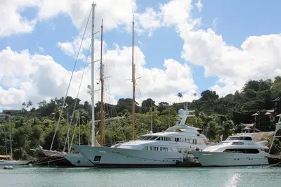
    Marigot Bay

    Marigot Bay

    Marigot Bay is a deep-cut bay, surrounded by palms and green hills on the west coast, about six kilometers southwest of Castries. Its inner section offers shelter for boats during hurricanes; scenes from the film "Doctor Dolittle" were shot here in 1967.The bay serves as an anchorage for sailors and a departure point for water taxis along the coast.

    ImagePerson·CC BY 4.0

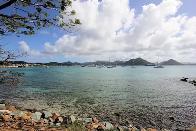
    Rodney Bay and Gros Islet

    Rodney Bay and Gros Islet

    Rodney Bay in the north is St. Lucia's tourist hub, featuring a marina, restaurants, and Reduit Beach. Right next door is the fishing village of Gros Islet, where every Friday evening the Street Party with music and barbecue stalls brings together locals, sailors, and travelers.In December, the Marina is the finish line for the Atlantic Rally for Cruisers; Pigeon Island, with its fort, is located at the end of the causeway behind Gros Islet.

    Paul Harrison·CC BY-SA 4.0

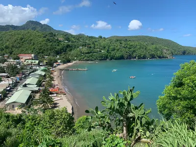
    Anse La Raye

    Anse La Raye

    Anse La Raye is a fishing village on the west coast between Marigot Bay and Soufrière. It's known for Seafood Friday: Every Friday evening, Front Street is closed to cars, and stalls offer fish, lobster, fishcakes, and conch.Between Anse La Raye and Canaries lies Plas Kassav, a cassava bakery known for its cassava bread.

    Mojo Hand·CC BY-SA 4.0

    Pigeon Island National Landmark

    Pigeon Island National Landmark

    Pigeon Island is a former island at the northwest tip of St. Lucia, now connected to Gros Islet by a causeway. The Saint Lucia National Trust manages the approximately 44-acre site with the ruins of the British naval base, Fort Rodney, Signal Peak, and two swimming beaches.From here, the British monitored the French fleet on Martinique in the 18th century, which contributed to their victory in the Battle of the Saintes in 1782.

    P. Hughes·CC BY-SA 4.0

    Island's interior rainforest

    Island's interior rainforest

    Saint Lucia's mountainous interior is covered by rainforest; its highest peak is Mount Gimie at 950 meters. Marked trails like the Enbas Saut Trail to two waterfalls at the foot of Mount Gimie or the Des Cartiers Rainforest Trail lead through mountain forest, where with luck you'll see the endemic Saint Lucia Amazon (Jacquot) and the Saint Lucia Oriole.

    Paul Harrison·CC BY-SA 4.0

    Your next steps

    Castries is in St. Lucia. Ways to carry on from here.

    • More in St. Lucia

      Highlights, areas, routes and the best time to travel for all of St. Lucia.

      St. Lucia travel guide
    • Round trips with Castries

      One route passes through Castries, with stops, nights and a map.

      See the round trip

    Sources & method

    • Photos: Wikimedia Commons, Unsplash. Each photo carries its credit.
    • Place data such as addresses and ratings comes from Google Maps.
    • The content is based on web research from public, traceable sources. How the content is made · The role of AI