Fernweh: Home
ExploreGuideDestinationsMy tripsMy trip
de|en
All Places & RegionsRound tripsNight trains in EuropeAll highlightsAbout FernwehFAQPrivacy PolicyImprint
Download on the App StoreGet it on Google Play
ExploreGuideDestinationsMy tripsMy trip
    • Places & highlights
    • Tours
    • Eat & drink
    • Culture
    • Getting around
    • Accommodation
    • Nearby
    Pigeon Island National Landmark

    P. Hughes / Wikimedia Commons / CC BY-SA 4.0, mod.

    St. Lucia

    Pigeon Island National Landmark

    Point of Interest

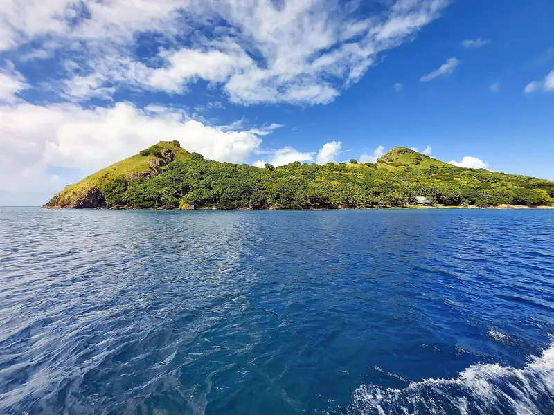
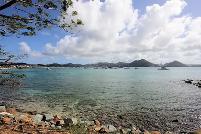
    Pigeon Island is a former island at the northwest tip of St. Lucia, now connected to Gros Islet by a causeway.

    by Felix Gillen

    1. Home
    2. Destinations
    3. St. Lucia
    4. Pigeon Island National Landmark
    Pigeon Island is a former island at the northwest tip of St. Lucia, now connected to Gros Islet by a causeway. The Saint Lucia National Trust manages the approximately 44-acre site with the ruins of the British naval base, Fort Rodney, Signal Peak, and two swimming beaches.From here, the British monitored the French fleet on Martinique in the 18th century, which contributed to their victory in the Battle of the Saintes in 1782.
    St. Lucia travel guideRound trips in St. LuciaPlan a trip with Pigeon Island National Landmark

    Contents

    • Places & highlights
    • Tours
    • Eat & drink
    • Culture
    • Getting around
    • Accommodation
    • Nearby

    Sights in Pigeon Island National Landmark

    Discover the most important sights and attractions

    Attraction

    1Signal Peak

    The highest point of Pigeon Island is about 100 meters above sea level. A short, steep path leads up to a viewpoint over St. Lucia's northwest coast.
    Open in Google Maps
    Attraction

    2Fort Rodney

    The remains of the British fortifications on Pigeon Island date from after 1778, when the British established a naval base here. The ascent takes 20 to 30 minutes, with cannons at the top and views over Rodney Bay and the channel towards Martinique.
    Open in Google Maps
    Attraction

    3Beaches of Pigeon Island

    The site has two swimming beaches with calm water, where sea turtles nest. Loungers and umbrellas are US$3 each, per National Trust.
    Open in Google Maps

    Tours & experiences in Pigeon Island National Landmark

    Search tours for Pigeon Island National Landmark on GetYourGuide* (Affiliate link)On GetYourGuide, with reviews from other travellers

    * Affiliate link: if you book through it, we earn a small commission. The price stays the same for you.

    Restaurants in Pigeon Island National Landmark

    The History

    Pirates, Navy, and WhalingAfter the Caribs, pirates led by François Le Clerc, known as Jambe de Bois, used the island. After 1778, the British built a naval base. From 1909 to 1952, a whaling station operated here. In 1979, Pigeon Island became a National Park, and in 1992, a National Landmark.NatureSea turtles nest on the two beaches. Signal Peak is the highest point at around 100 meters, and the ascent to Fort Rodney takes 20 to 30 minutes.

    Practical Details

    Opening Hours and AdmissionDaily 9:30 AM to 5:00 PM, last entry 4:15 PM; on December 24th only until noon, closed on December 25th.The park may be closed in September and during the Jazz Festival (approximately late April to May); in 2026, it was closed from September 1st to 30th.Admission for visitors: Adults aged 13+ US$10, children 5-12 US$3, under 5 free; guided tour US$20 for 1-4 people.The Interpretation Centre is closed on weekends and public holidays.Getting TherePigeon Island is located approximately 11 miles from Castries, at the end of the causeway beyond Gros Islet. Bring water and sun protection for the climb to the Fort.

    Accommodations in Pigeon Island National Landmark

    Find perfect stay in Pigeon Island National Landmark

    Booking.com* (Affiliate link)
    Search Hotels
    Agoda* (Affiliate link)
    Search Hotels
    Airbnb
    Vacation Rentals

    * Affiliate link: if you book through it, we earn a small commission. The price stays the same for you.

    Nearby

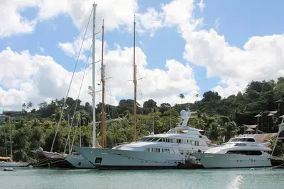
    Rodney Bay and Gros Islet

    Rodney Bay and Gros Islet

    Rodney Bay in the north is St. Lucia's tourist hub, featuring a marina, restaurants, and Reduit Beach. Right next door is the fishing village of Gros Islet, where every Friday evening the Street Party with music and barbecue stalls brings together locals, sailors, and travelers.In December, the Marina is the finish line for the Atlantic Rally for Cruisers; Pigeon Island, with its fort, is located at the end of the causeway behind Gros Islet.

    Paul Harrison·CC BY-SA 4.0

    Castries

    Castries

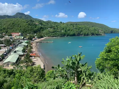
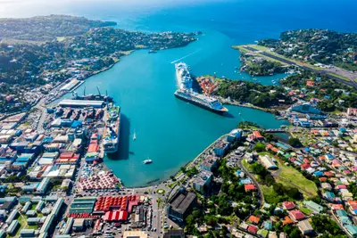
    Castries is the capital of St. Lucia and is located on a deep natural harbor in the northwest of the island. The compact downtown area around Derek Walcott Square, with its cathedral and the market established in 1891, is easily explored on foot, above which rises Morne Fortuné, featuring the remains of Fort Charlotte and the tombs of the island's two Nobel laureates.At the harbor, cruise ships dock at Pointe Seraphine, while from the ferry terminal, ships depart for Martinique, Dominica, and Guadeloupe.

    Omar Eagle·Unsplash

    Marigot Bay

    Marigot Bay

    Marigot Bay is a deep-cut bay, surrounded by palms and green hills on the west coast, about six kilometers southwest of Castries. Its inner section offers shelter for boats during hurricanes; scenes from the film "Doctor Dolittle" were shot here in 1967.The bay serves as an anchorage for sailors and a departure point for water taxis along the coast.

    ImagePerson·CC BY 4.0

    Anse La Raye

    Anse La Raye

    Anse La Raye is a fishing village on the west coast between Marigot Bay and Soufrière. It's known for Seafood Friday: Every Friday evening, Front Street is closed to cars, and stalls offer fish, lobster, fishcakes, and conch.Between Anse La Raye and Canaries lies Plas Kassav, a cassava bakery known for its cassava bread.

    Mojo Hand·CC BY-SA 4.0

    Island's interior rainforest

    Island's interior rainforest

    Saint Lucia's mountainous interior is covered by rainforest; its highest peak is Mount Gimie at 950 meters. Marked trails like the Enbas Saut Trail to two waterfalls at the foot of Mount Gimie or the Des Cartiers Rainforest Trail lead through mountain forest, where with luck you'll see the endemic Saint Lucia Amazon (Jacquot) and the Saint Lucia Oriole.

    Paul Harrison·CC BY-SA 4.0

    Your next steps

    Pigeon Island National Landmark is in St. Lucia. Ways to carry on from here.

    • More in St. Lucia

      Highlights, areas, routes and the best time to travel for all of St. Lucia.

      St. Lucia travel guide
    • Round trips in St. Lucia

      Ready-made routes through St. Lucia, with stops, nights and a map.

      See the routes
    • Plan a trip with Pigeon Island National Landmark

      The Guide asks about season, length and who is coming, and suggests a trip with Pigeon Island National Landmark.

      Plan the trip
    Sources & method

    • Photos: Wikimedia Commons. Each photo carries its credit.
    • Place data such as addresses and ratings comes from Google Maps.
    • The content is based on web research from public, traceable sources. How the content is made · The role of AI