Fernweh: Home
ExploreGuideDestinationsMy tripsMy trip
de|en
All Places & RegionsRound tripsNight trains in EuropeAll highlightsAbout FernwehFAQPrivacy PolicyImprint
Download on the App StoreGet it on Google Play
ExploreGuideDestinationsMy tripsMy trip
    • Neighborhoods & highlights
    • Tours
    • Eat & drink
    • Getting around
    • Accommodation
    • Plan trip
    • Nearby
    Oranjestad

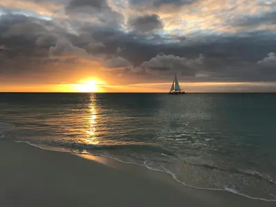
    Photo by Gregory Wangsadikrama on Unsplash

    Aruba

    Oranjestad

    CityCulture

    Oranjestad is the capital of Aruba and is located on the sheltered southwest coast near the airport.

    by Felix Gillen

    1. Home
    2. Destinations
    3. Aruba
    4. Oranjestad
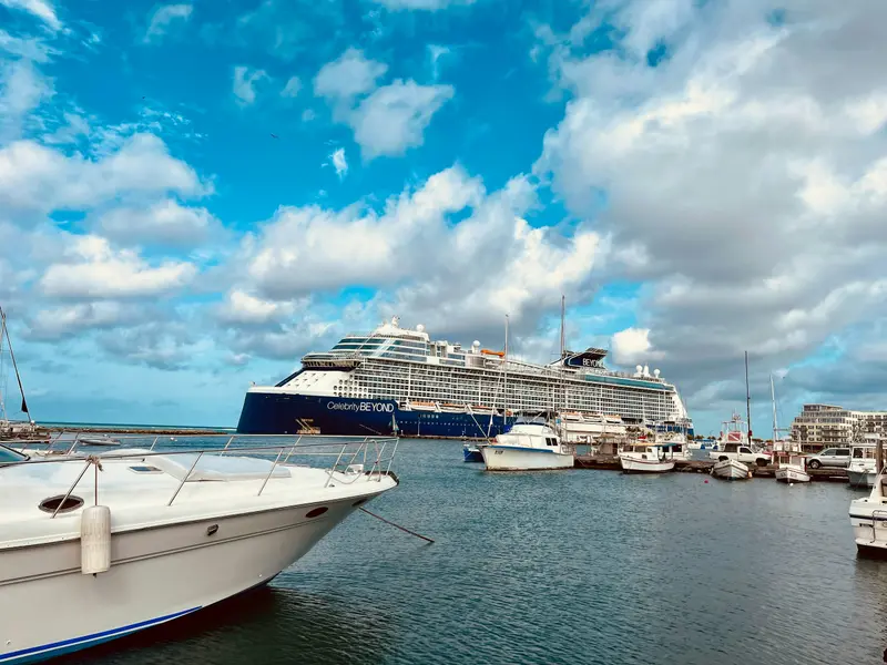
    Oranjestad is the capital of Aruba and is located on the sheltered southwest coast near the airport. Its landmark is Fort Zoutman, built from 1796 to 1798, and according to the Aruba Tourism Authority, the city's oldest surviving building, with the later added Willem III Tower; which houses the Historical Museum.A free tram connects the cruise terminal with the shopping street Main Street (Caya G. F. Betico Croes). The National Archaeological Museum, housed in the former residence of the Ecury family, displays artifacts from the time of the indigenous people. According to visitaruba.com, the Bon Bini Festival, previously held on Tuesdays at the Fort, has been paused since 2026.
    Aruba travel guidePlan a trip with Oranjestad

    Contents

    • Neighborhoods & highlights
    • Tours
    • Eat & drink
    • Getting around
    • Accommodation
    • Nearby

    Sights in Oranjestad

    Discover the most important sights and attractions

    Museum

    1National Archaeological Museum Aruba

    The museum, established 1981, displays indigenous finds from c. 2500 BC to the 19th century. It occupies the former Ecury residence. The oldest section is an 1870 Cunucu house; the newest, a 1929 villa. Open Monday-Friday, 9:30 AM - 4:30 PM.
    Open in Google Maps
    Fort Zoutman and Willem-III Tower

    MikeWard88 / Wikimedia Commons / CC BY-SA 4.0, mod.

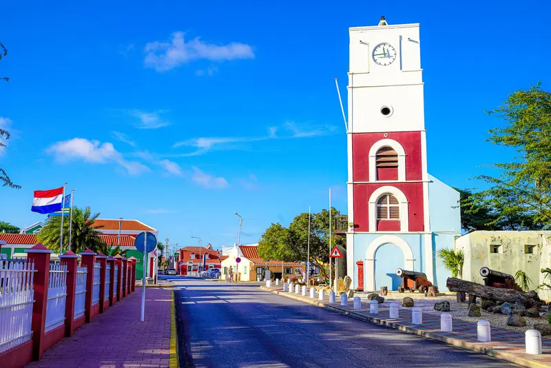
    2Fort Zoutman and Willem-III Tower

    The fort was built between 1796 and 1798 and is named after Dutch Rear Admiral Johan Arnold Zoutman. The Willem-III Tower, added later, marked the old entrance and long served as a lighthouse and public clock.
    Open in Google Maps

    Tours & experiences in Oranjestad

    Search tours for Oranjestad on GetYourGuide* (Affiliate link)On GetYourGuide, with reviews from other travellers

    * Affiliate link: if you book through it, we earn a small commission. The price stays the same for you.

    Restaurants in Oranjestad

    On the go in Oranjestad

    The center is easily explored on foot. The free streetcar commutes between the Cruise Terminal and Main Street.From the central bus station, Arubus buses travel across the island; current fares can be found at arubus.com. Taxis operate on fixed rates per route; ask for the price before your trip. Arikok National Park and the northeast coast require your own vehicle or a tour.

    Accommodations in Oranjestad

    Find perfect stay in Oranjestad

    Booking.com* (Affiliate link)
    Search Hotels
    Agoda* (Affiliate link)
    Search Hotels
    Airbnb
    Vacation Rentals

    * Affiliate link: if you book through it, we earn a small commission. The price stays the same for you.

    Plan your trip to Oranjestad

    Save places, build a route and plan your city trip, all in one place.

    1. 1
      Sunrise over alpine peaks and a sea of clouds
      1234

      Round trip

      12 days · 4 stops

      Saved

      Pick a route

      Pick a ready-made one or save places and plan your own.

      Open bookmarks
    2. 2

      Trip to Oranjestad

      Live
      • 1National Archaeological Museum Aruba3 days
      • 2Fort Zoutman and Willem-III Tower4 days
      Budget

      Plan your trip

      The planner sorts stops, days and budget. Plan together in real time.

      Start trip planning
    3. 3
      9:41 No signal
      Oranjestad
      Available offline

      Photo by Gregory Wangsadikrama on Unsplash

      Use it on the road

      Download the guide to your phone and use it on site, even offline.

    Nearby

    Eagle Beach and Palm Beach

    Eagle Beach and Palm Beach

    North of Oranjestad, the island's most famous beaches line the tranquil west coast. According to Lonely Planet, Eagle Beach is wide and white, featuring the wind-bent Fofoti trees; here, four species of sea turtles nest, and sections are closed during nesting season. Palm Beach is livelier, with numerous restaurants and watersports.Further north are Boca Catalina and Arashi Beach, with reefs close to shore, and the California Lighthouse stands at the northwest tip. Inland lie the Butterfly Farm and the small Alto Vista Chapel.

    Jared Lisack·Unsplash

    Arikok National Park

    Arikok National Park

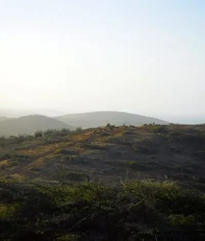
    According to the Aruba Conservation Foundation, Arikok National Park covers 34 km², about one-fifth of the island, primarily along its rugged north and east coasts. The Fontein Cave preserves Arawak rock paintings, while the Quadirikiri Cave features two chambers with light filtering through ceiling openings. Other attractions include the Boca Prins Dunes, the twin coves of Dos Playa, and Jamanota, Aruba's highest point at 188 m.The most famous destination is the Natural Pool (Conchi), a rock-sheltered natural basin on the north coast, accessible only by 4x4 vehicle, horseback, or on foot. The park is open daily from 8 AM to 4 PM.
    Ginelly.Q·CC BY-SA 4.0

    San Nicolas and the South

    San Nicolas and the South

    San Nicolas in the southeast was the site of the Lago Refinery and is now known for its large-format murals: Since the first Aruba Art Fair in September 2016, artists like Bordalo II have adorned the facades. The Carnival Museum Carnival Euphoria and the San Nicolas Community Museum tell the story of the city.Nearby lies Baby Beach, a shallow lagoon for families, and on the south coast near Savaneta, the mangroves of Mangel Halto as well as the Zeerovers fishing pier.

    Ginelly.Q·CC0

    Halbinsel Paraguaná

    Halbinsel Paraguaná

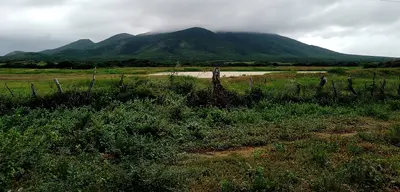
    For this area, the FCDO advises against travel unless it is essential. Check the FCDO travel advice, linked on the country page, before planning.The roughly 3,400 km² peninsula in Falcón state is joined to the mainland only by the dune landscape of the Médanos de Coro. Cabo San Román marks the northernmost point of mainland Venezuela, Cerro Santa Ana rises in the interior, and on the east coast Adícora, with its steady trade winds, is a spot for windsurfers and kitesurfers.The largest town is Punto Fijo, which grew with the Amuay and Cardón refineries on the west coast. A highway crosses the isthmus from Coro.

    Aramburu Carlos·CC BY 4.0

    Shete Boka National Park

    Shete Boka National Park

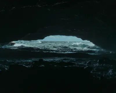
    According to CARMABI, Shete Boka National Park protects over 200 hectares of the rugged north coast with ten coves, known locally as Boka, where the surf from the open sea crashes ashore. At the entrance, Boka Tabla is a cave where waves thunder in; Boka Pistol is a dramatic blowhole.On the park's beaches, four species of sea turtles nest, as reported by CARMABI. The park is located on the north coast just a few kilometers from Christoffel Park.

    Damian Kamp·Unsplash

    Your next steps

    Oranjestad is in Aruba. Ways to carry on from here.

    • More in Aruba

      Highlights, areas, routes and the best time to travel for all of Aruba.

      Aruba travel guide

    Sources & method

    • Photos: Wikimedia Commons, Unsplash. Each photo carries its credit.
    • Place data such as addresses and ratings comes from Google Maps.
    • The content is based on web research from public, traceable sources. How the content is made · The role of AI