Fernweh: Home
ExploreGuideDestinationsMy tripsMy trip
de|en
All Places & RegionsRound tripsNight trains in EuropeAll highlightsAbout FernwehFAQPrivacy PolicyImprint
Download on the App StoreGet it on Google Play
ExploreGuideDestinationsMy tripsMy trip
    • Places in the region
    • Culture
    • Getting around
    • Nearby
    Osttirol

    Jörg Blobelt / Wikimedia Commons / CC BY-SA 4.0, mod.

    Austria

    Osttirol

    RegionMountainsNature

    Osttirol lies south of the Main Alpine Ridge, centered around the district capital Lienz.

    by Felix Gillen

    1. Home
    2. Destinations
    3. Austria
    4. Osttirol
    Osttirol lies south of the Main Alpine Ridge, centered around the district capital Lienz. The valleys reach Großvenediger and Großglockner, and much of the region belongs to the Hohe Tauern National Park, covering 1,856 square kilometers in Tirol.
    Austria travel guideRound trips in AustriaPlan a trip with Osttirol

    Contents

    • Places in the region
    • Culture
    • Getting around
    • Nearby

    Sights in Osttirol

    Discover the most important sights and attractions

    Museum

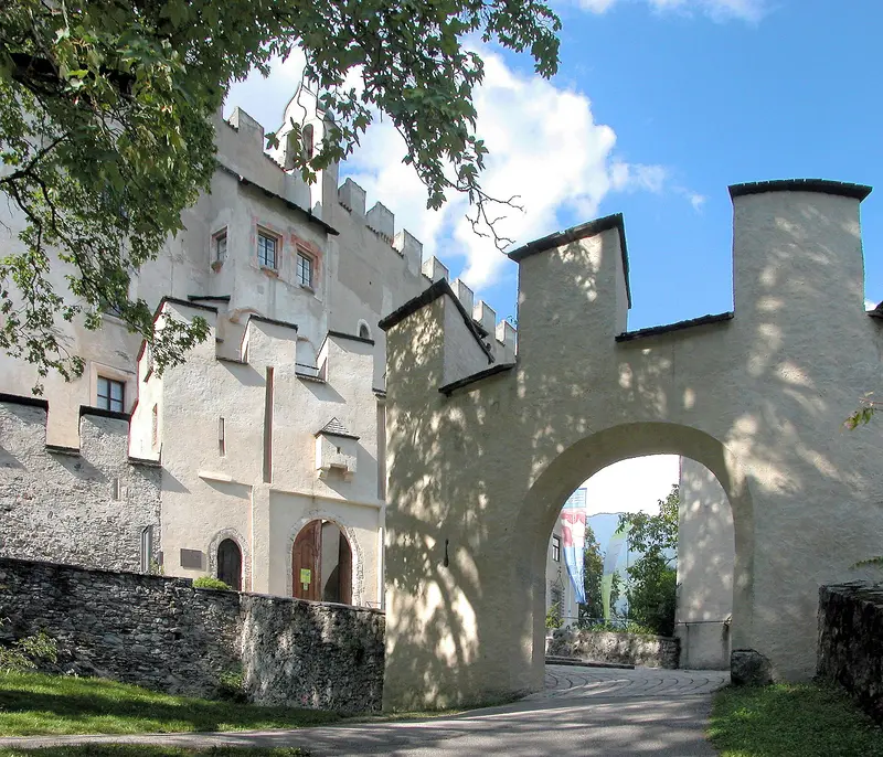
    Bruck Castle, Lienz

    The Counts of Görz built their residence on Lienz's outskirts (1252-1277); town-owned since 1942. Its museum holds the most extensive Albin Egger-Lienz collection. The 2026 season was May 29 - Oct 11; daily 10 am - 6 pm in July and August.
    Open in Google Maps
    Museum

    National Park House Matrei

    The Matrei visitor center on Kirchplatz informs about the Hohe Tauern National Park, covering 1,856 square kilometers in Tyrol, with Großvenediger (3,666 meters) and Großglockner (3,798 meters). The 2026 special exhibition features the Großvenediger; an audio guide is 4 Euros.
    Open in Google Maps

    Culture in East Tyrol

    Counts of Görz and HabsburgsLienz was the residence of the Counts of Görz, who had Schloss Bruck built between 1252 and 1277. After their extinction, the territory passed to Maximilian I in 1500.Albin Egger-LienzThe painter Albin Egger-Lienz is closely connected to the town; Schloss Bruck houses the most extensive collection of his works.National ParkThe Waterfall Trail at the Umbal Waterfalls in Umbaltal near Prägraten celebrates its 50th anniversary in 2026. According to the National Park, it's Europe's oldest such trail.

    Getting to and around East Tyrol

    By CarFrom the north, the Felbertauern Road, with its 5.3-kilometer tunnel, leads to East Tyrol. A single trip costs €13.50 for cars (as of summer 2026).The Großglockner Round Trip combi-ticket, including the Felbertauern Road and Großglockner High Alpine Road, costs €56 for cars, valid from May to October for 30 days.LocallyWith the guest card, you ride public buses for free, for example, on line 951 in the Iseltal valley. Timetables can be found at Verkehrsverbund Tirol.With the Osttirol Card, you can participate in National Park ranger-led hikes for free.The starting point for wildlife viewing and tours on the Großglockner is the Lucknerhaus in Ködnitztal near Kals.

    Nearby

    Großglockner High Alpine Road

    Großglockner High Alpine Road

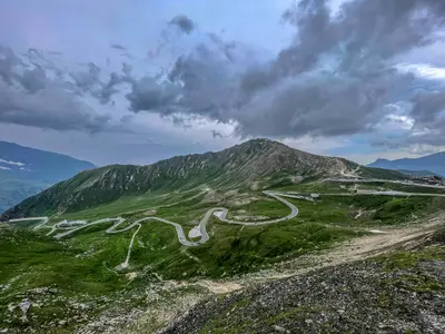
    The 47.8-kilometer toll panoramic road runs from Bruck in Salzburger Land, over the Hochtor at 2,504 meters, to Heiligenblut in Carinthia. A turn-off brings you to the Kaiser-Franz-Josefs-Höhe with views of the Grossglockner and the Pasterze; in winter, the road is typically closed from late October to early May.

    Tim D·Unsplash

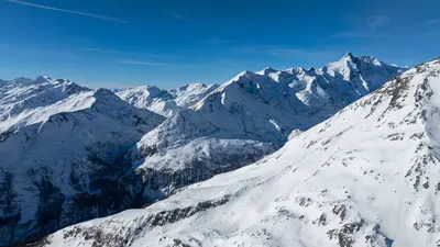
    Hohe Tauern & Großglockner

    Hohe Tauern & Großglockner

    In the Hohe Tauern National Park stands the Großglockner, at 3,798m Austria's highest mountain; at its foot lies the Pasterze, the country's largest glacier. The Großglockner High Alpine Road leads up to the Kaiser-Franz-Josefs-Höhe with views of peaks and glaciers.

    Alan Kabeš·Pexels

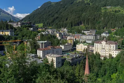
    Gasteinertal

    Gasteinertal

    The Gastein Valley is located approximately 90 kilometers south of Salzburg in the Hohe Tauern mountains and has long been known for its thermal springs. Right through Bad Gastein, the Gastein Waterfall plunges over 341 meters in three stages; thermal baths in Bad Gastein and Bad Hofgastein, and the Heilstollen utilize the warm water. Mountain railways like the Stubnerkogelbahn lead directly from the town into the hiking and skiing areas.

    Thomas Ledl·CC BY-SA 4.0

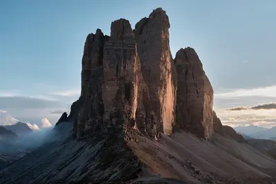
    Three Peaks

    Three Peaks

    The Drei Zinnen are three freestanding rock towers in the Sesto Dolomites, on the border between South Tyrol and the Province of Belluno. The Große Zinne reaches 2,999 meters. Their north faces are among the most famous climbing destinations in the Alps; for hikers, the circular trail around the towers is the main objective.HistoryDuring the First World War, the front line between Austria-Hungary and Italy ran through here. Remains of fortifications, tunnels, and paths can be found on Paternkofel and Monte Piana.VisitingMost visitors start at the Auronzo Hut, which is accessible via a toll road from Misurina; an online reservation is required for car access. The huts along the circular trail are generally open from June to September; outside this period, snow may be present on the paths. Check the weather and trail conditions before your tour; current safety and health advisories for Italy can be found via the link to the Federal Foreign Office on the country page.
    Unsplash

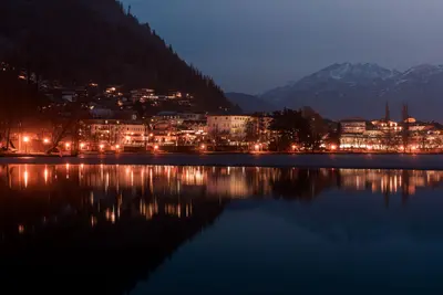
    Zell am See, Kaprun

    Zell am See, Kaprun

    Zell am See on Lake Zell and its neighbour Kaprun in Salzburger Land bring together a bathing lake and high mountains in close proximity. From Kaprun, cable cars ascend the Kitzsteinhorn, featuring Gipfelwelt 3000 at 3,029 metres and views of the Großglockner. In summer, you can also access the high-alpine reservoirs in Kapruner Tal and the Sigmund-Thun-Klamm.

    Martin Leitgeb·Pexels

    Your next steps

    Osttirol is in Austria. Ways to carry on from here.

    • More in Austria

      Highlights, areas, routes and the best time to travel for all of Austria.

      Austria travel guide
    • Round trips in Austria

      Ready-made routes through Austria, with stops, nights and a map.

      See the routes
    • Plan a trip with Osttirol

      The Guide asks about season, length and who is coming, and suggests a trip with Osttirol.

      Plan the trip

    Sources & method

    • Photos: Wikimedia Commons. Each photo carries its credit.
    • Place data such as addresses and ratings comes from Google Maps.
    • The content is based on web research from public, traceable sources. How the content is made · The role of AI