Fernweh: Home
ExploreGuideDestinationsMy tripsMy trip
de|en
All Places & RegionsRound tripsNight trains in EuropeAll highlightsAbout FernwehFAQPrivacy PolicyImprint
Download on the App StoreGet it on Google Play
ExploreGuideDestinationsMy tripsMy trip
    • Neighborhoods & highlights
    • Eat & drink
    • Culture
    • Getting around
    • Accommodation
    • Plan trip
    • Nearby
    Mondulkiri

    Wikirictor / Wikimedia Commons / CC BY-SA 4.0, mod.

    Cambodia

    Mondulkiri

    City

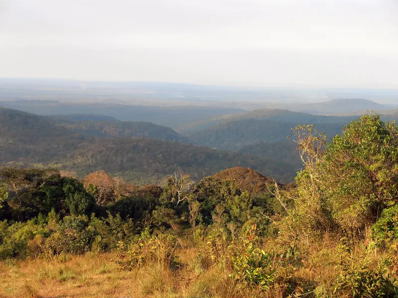
    Mondulkiri is the highland province in eastern Cambodia, a land of green hills, forests, and waterfalls. Its main town is Sen Monorom, located at about 800 m altitude, where it is noticeably cooler than in the lowlands.

    by Felix Gillen

    1. Home
    2. Destinations
    3. Cambodia
    4. East and Mekong
    5. Mondulkiri
    Mondulkiri is the highland province in eastern Cambodia, a land of green hills, forests, and waterfalls. Its main town is Sen Monorom, located at about 800 m altitude, where it is noticeably cooler than in the lowlands. This is home to the indigenous Bunong people, whose villages you can visit with local guides.The region is known for nature projects such as the Elephant Valley Project, where former working elephants live in the forest, and the Gibbon-Camp Jahoo in the Keo Seima Wildlife Sanctuary.
    Cambodia travel guideRound trips in CambodiaPlan a trip with Mondulkiri

    Contents

    • Neighborhoods & highlights
    • Eat & drink
    • Culture
    • Getting around
    • Accommodation
    • Nearby

    Sights in Mondulkiri

    Discover the most important sights and attractions

    Park

    1Elephant Valley Project

    Sanctuary for former working elephants in the forest near Sen Monorom; visitors accompany the animals on treks of 5 to 8 km. According to the operator: Full-day visit 100 US dollars, half-day 60 US dollars, children up to 12 pay half; Pick-up at 7:30 AM in Sen Monorom, booking via email and payment at least one week in advance.
    Open in Google Maps
    Park

    2Gibbon Camp Jahoo

    Community-based ecotourism project by the Bunong village of Andoung Kraloeng in the Keo Seima Wildlife Sanctuary, run jointly with the Wildlife Conservation Society. With guides, observe groups of yellow-cheeked gibbons and black-shanked doucs habituated to humans, both critically endangered. A portion of the price supports the village's development fund.
    Open in Google Maps
    Natural Feature

    3Sen-Monorom Waterfall

    Smaller waterfall around 5 km from Sen Monorom, ideal for a short excursion. Other falls in the area, according to the Ministry of Tourism, are Chrey Yos and Rum Near, and about 43 km northeast, the multi-tiered Bou-Sra Waterfall, the province's most famous.
    Open in Google Maps

    Restaurants in Mondulkiri

    Bunong and Nature Projects

    Mondulkiri is home to the indigenous Bunong people (also known as Phnong), whose traditions are vibrant; the Bunong New Year is celebrated in April. The Elephant Valley Project provides former working elephants with a forest sanctuary; Bunong staff prepare lunch for visitors. Within the Keo Seima Wildlife Sanctuary, the Bunong village of Andoung Kraloeng, in collaboration with the Wildlife Conservation Society, operates Gibbon-Camp Jahoo; a portion of the price contributes to the village fund. Locally grown coffee is a popular specialty.

    Arrival and on the go

    From Phnom Penh, it's about six to seven hours by minivan or bus to Sen Monorom.The Elephant Valley Project picks up guests at 7:30 AM in Sen Monorom; a full-day visit is $100 according to the operator, a half-day $60. Booking via email at least one week in advance.The Bou Sra Waterfall is about 43 km northeast of Sen Monorom; closer are smaller waterfalls like the Sen Monorom Waterfall.

    Accommodations in Mondulkiri

    Find perfect stay in Mondulkiri

    Booking.com* (Affiliate link)
    Search Hotels
    Agoda* (Affiliate link)
    Search Hotels
    Airbnb
    Vacation Rentals

    * Affiliate link: if you book through it, we earn a small commission. The price stays the same for you.

    Plan your trip to Mondulkiri

    Save places, build a route and plan your city trip, all in one place.

    1. 1
      Sunrise over alpine peaks and a sea of clouds
      1234

      Round trip

      12 days · 4 stops

      Saved

      Pick a route

      Pick a ready-made one or save places and plan your own.

      Open bookmarks
    2. 2

      Trip to Mondulkiri

      Live
      • 1Elephant Valley Project3 days
      • 2Gibbon Camp Jahoo4 days
      • 3Sen-Monorom Waterfall5 days
      Budget

      Plan your trip

      The planner sorts stops, days and budget. Plan together in real time.

      Start trip planning
    3. 3
      9:41 No signal
      Mondulkiri
      Available offline

      Wikirictor / Wikimedia Commons / CC BY-SA 4.0, mod.

      Use it on the road

      Download the guide to your phone and use it on site, even offline.

    Nearby

    East and Mekong

    East and Mekong

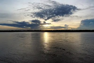
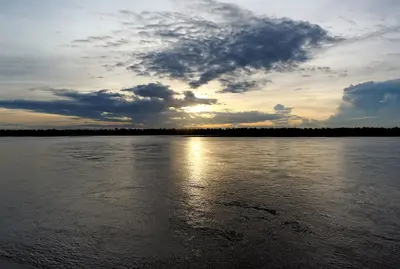
    Eastern Cambodia is sparsely populated and green. In Kratie on the Mekong, the country's last Irrawaddy dolphins live in the river stretch up to Stung Treng; you can observe them by boat about 15 km north of the town. Further east, the land rises to the Mondulkiri highlands, with waterfalls, Bunong villages, and projects for elephants and gibbons.

    Jakub Hałun·CC BY-SA 4.0

    Kratie

    Kratie

    Kratie is a quiet provincial town on the east bank of the Mekong and a starting point for observing the critically endangered Irawaddy dolphins. In the Kampi pool, about 15 km north of the town, they usually appear after only a short boat trip; according to the Ministry of Agriculture, 118 animals lived in the Mekong between Kratie and Stung Treng in April 2026.Opposite the town lies the river island of Koh Trong, which you reach by ferry and cycle around. In the evening, the sunset over the Mekong is worthwhile.

    Jakub Hałun·CC BY-SA 4.0

    Đà Lạt

    Đà Lạt

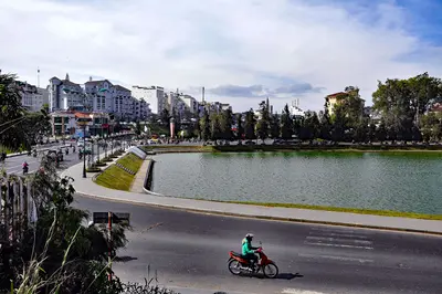
    Đà Lạt sits at about 1,500 meters (4,900 ft) on the Lâm Viên Plateau in the Central Highlands and, with average temperatures between 14 and 23 °C (57 to 73 °F), is Vietnam's cool mountain retreat. The physician and scientist Alexandre Yersin explored the plateau in 1893, and soon afterwards the French built a hill station here: the first hotel opened in 1907, the urban planner Ernest Hébrard laid out the town, and Đà Lạt was officially founded in 1916.At its heart lies Xuân Hương Lake, created by the French in 1919 by damming the Cam Ly River. Around it, colonial-era villas, pine-covered hills and vegetable and flower fields spread across the slopes. The Art Deco railway station, the summer residence of the last emperor, Bảo Đại, and the warren-like Crazy House show how varied the city's architecture is. Since the 2025 administrative reform, Đà Lạt has been the seat of the enlarged Lâm Đồng province.The dry season runs from November to April; from May to October it rains often.

    P. Hughes·CC BY 4.0

    Thảo Điền

    Thảo Điền

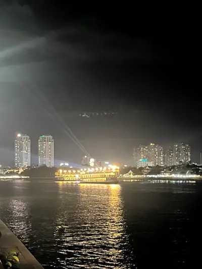
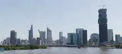
    Thảo Điền lies east of the city center on a peninsula surrounded on three sides by the Saigon River. The former village in erstwhile District 2 now belongs to Thủ Đức City and has developed into a residential area with villas and apartment complexes since its founding in 1997.In the 1970s, many journalists lived here, which is why the district was called "Làng Báo chí," or Press Village. Metro Line 1 has a Thảo Điền station, making it easy to reach the district from Bến Thành Market.

    Xuanphuocle·CC BY-SA 4.0

    Ho Chi Minh City

    Ho Chi Minh City

    Ho Chi Minh City, still called Saigon by many, is Vietnam's largest city and the economic hub of the south. You'll come for its blend of French colonial architecture, war history, street food stalls on every corner, and a pace that will captivate you from the very first evening.As of July 1, 2025, there are no longer any districts in Vietnam; the city is divided into Wards (phường) and has simultaneously incorporated the former provinces of Bình Dương and Bà Rịa-Vũng Tàu. However, in daily life and on many signs, the old district names persist, which is why they are helpful for orientation.Former District 1: The city center, home to the grand avenue Đồng Khởi, the Opera House, Central Post Office, Cathedral, and Bến Thành Market. Today, it belongs to the Wards Sài Gòn, Bến Thành, Tân Định, and Cầu Ông Lãnh.Former District 3: Quieter streets with villas, cafés, and street food stalls, plus the War Remnants Museum. Today, these are the Wards Bàn Cờ, Xuân Hòa, and Nhiêu Lộc.Chợ Lớn: The historic Chinese quarter in former Districts 5 and 6, featuring assembly halls, temples, and the Bình Tây Market.Thảo Điền: On the other side of the Saigon River in former District 2, popular with expats, with cafés, restaurants, and a Metro Line 1 station. Today, it is part of Ward An Khánh.Two to three days are sufficient for the main sights. The city also serves as the usual starting point for tours into the Mekong Delta.

    Pimnl·CC0

    Your next steps

    Mondulkiri is in Cambodia. Ways to carry on from here.

    • More in Cambodia

      Highlights, areas, routes and the best time to travel for all of Cambodia.

      Cambodia travel guide
    • Round trips in Cambodia

      Ready-made routes through Cambodia, with stops, nights and a map.

      See the routes

    Sources & method

    • Photos: Wikimedia Commons. Each photo carries its credit.
    • Place data such as addresses and ratings comes from Google Maps.
    • The content is based on web research from public, traceable sources. How the content is made · The role of AI