Fernweh: Home
ExploreGuideDestinationsMy tripsMy trip
de|en
All Places & RegionsRound tripsNight trains in EuropeAll highlightsAbout FernwehFAQPrivacy PolicyImprint
Download on the App StoreGet it on Google Play
ExploreGuideDestinationsMy tripsMy trip
    • Places in the region
    • Recommendations
    • Culture
    • Getting around
    • Round trips
    • Nearby
    Taveuni

    “Taveuni, Fiji looking toward Matagi” by Barry Peters / Wikimedia Commons / CC BY 2.0, mod.

    Fiji

    Taveuni

    Region

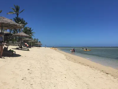
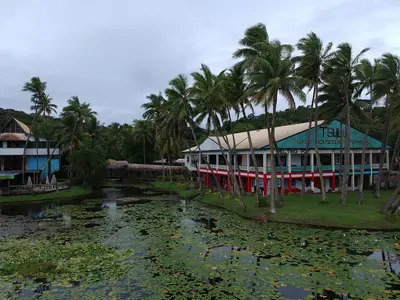
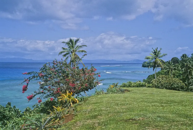
    Taveuni, Fiji's third-largest island at 434 square kilometers, is known as the Garden Isle.

    by Felix Gillen

    1. Home
    2. Destinations
    3. Fiji
    4. Taveuni
    Taveuni, Fiji's third-largest island at 434 square kilometers, is known as the Garden Isle. A volcanic ridge, featuring Uluigalau (1,241 meters) and Des Voeux Peak (1,195 meters), traverses the island, and within a crater at around 800 meters lies Lake Tagimaucia, home to the rare Tagimaucia flower. The 180th meridian runs through Taveuni.Approximately one third of the island is part of the Bouma National Heritage Park, featuring waterfalls and the Lavena Coastal Walk. More than 100 bird species live on the island. In the Somosomo Strait, between Taveuni and Vanua Levu, lies the Rainbow Reef, one of the world's most renowned soft coral diving areas.
    Fiji travel guideSee the round tripPlan a trip with Taveuni

    Contents

    • Places in the region
    • Recommendations
    • Culture
    • Getting around
    • Round trips
    • Nearby

    Sights in Taveuni

    Discover the most important sights and attractions

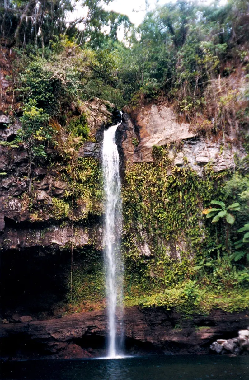
    Bouma National Heritage Park and Tavoro Waterfalls

    “BoumaFalls” by User:Doron / Wikimedia Commons / CC BY-SA 3.0, mod.

    National Park

    Bouma National Heritage Park and Tavoro Waterfalls

    Founded in 1990 as Bouma Forest Park, the protected park covers about a third of Taveuni with rainforest, villages, and waterfalls; from Matei, it's about a 35-minute drive. The most famous spot is the three Tavoro Waterfalls: The first and largest, with a large swimming pool, is reached from the Tavoro River visitor center in roughly ten to fifteen minutes, a hillside path with views leads to the second and third falls. Admission is paid at the visitor center; the Vidawa Rainforest Trail and the Lavena Coastal Walk are also located in the park.
    Open in Google Maps
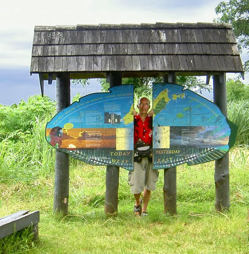
    180th Meridian (International Date Line Mark)

    “TodayYesterday” by Paul Lenz / Wikimedia Commons / CC BY-SA 2.5, mod.

    Historic Landmark

    180th Meridian (International Date Line Mark)

    At Waiyevo on the west coast, a sign marks the spot where the 180th meridian crosses the island; here you can stand with one leg in the Western and the other in the Eastern Hemisphere. The actual International Date Line, however, runs east around Fiji, so all of Taveuni has the same time as the rest of the country. The Wairiki Mission is right nearby.
    Open in Google Maps
    Lavena Coastal Walk

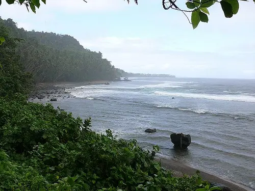
    “Taveuni, Fiji, ocean view Lavena Coastal Walk” by Tim O'Shea / Wikimedia Commons / CC BY 2.0, mod.

    Point of Interest

    Lavena Coastal Walk

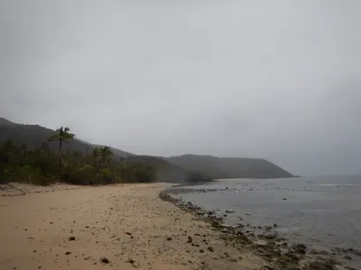
    The largely flat coastal path leads from Lavena village in Bouma National Heritage Park for about five kilometres along beaches, lagoons, and a rope-assisted river crossing to Wainibau Waterfall; the round trip is about ten kilometres. You swim or wade through a gorge for the final section to the waterfall. The fee, according to Tourism Fiji, was 35 Fiji Dollars, cash only; beyond Lavena there are no toilets or changing rooms, so wear your swimwear underneath.
    Open in Google Maps
    Wairiki-Mission

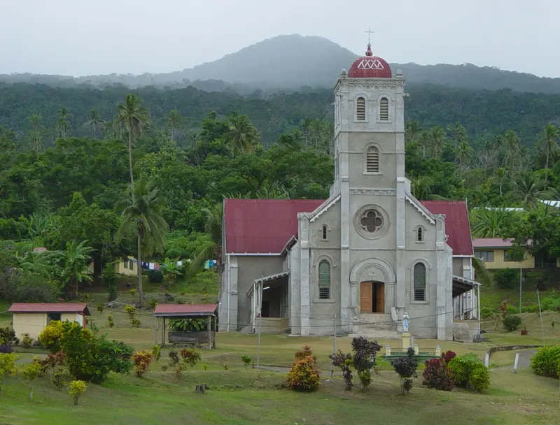
    “Wairiki Mission” by Markmark28 / Wikimedia Commons / CC BY-SA 3.0, mod.

    Church

    Wairiki-Mission

    The stone Catholic church of Wairiki Mission on the West Coast was built in 1907 and has stained-glass windows; seating is on mats on the floor. Visitors are welcome at Sunday service with multi-part a cappella singing; Lonely Planet particularly highlights it. Cover shoulders and knees.
    Open in Google Maps
    Attraction

    Des Voeux Peak

    Taveuni's second-highest peak, at 1,195 meters, is the island's best viewpoint, offering views over the Somosomo Strait to Vanua Levu. The ascent takes 30 to 40 minutes by 4x4, followed by a 20-minute walk; start early before clouds roll in. Lonely Planet also names the peak as a birdwatching spot, for instance, for the Orange Dove.
    Open in Google Maps
    National Park

    Waitabu Marine Park

    The fringing reef off Waitabu village on the east coast has been a marine protected area since 1998. Guided snorkeling tours sometimes start on bamboo rafts and end with tea and music; according to Fodor's, the raft tour costs 50 Fiji Dollars. There is a small campsite by the water.
    Open in Google Maps

    Village Life & Nature

    Somosomo and the VillagesSomosomo is the island's largest village and the traditional seat of the Tui Cakau, the paramount chief; your accommodation can arrange guided tours. The Bouma National Heritage Park also has villages whose residents lead hikes and tours. When visiting villages, observe the usual rules: cover shoulders and knees, remove hats, and bring kava as a sevusevu if your visit is not through an organised tour. Sunday service at the Wairiki Mission is renowned for its singing.Birds and ReefsTaveuni is home to over 100 bird species, including the Orange Dove and the Silktail. Good places for observation are Des Voeux Peak, the guided Vidawa Rainforest Trail, and the coast near Lavena. The rare Tagimaucia flower grows in Lake Tagimaucia within the volcanic crater.

    Arrival and On the Go

    Getting ThereAccording to Lonely Planet, Fiji Airways flies daily from Nadi to Matei in northern Taveuni, either directly or via Suva; the flight time is approximately 90 minutes. Most accommodations will pick you up from the airport; it’s best to arrange the transfer in advance.On the IslandFrom Matei, it's about a 35-minute drive to Bouma National Heritage Park, and around one hour to Lavena.Dive centres pick up their guests from accommodations in the morning; the Rainbow Reef in Somosomo Strait is about a 30-minute boat ride away.Des Voeux Peak is only accessible by 4x4, and tours are organised by the accommodation.

    Round trips through this region

    Fiji in 14 Days: Islands, Coral Coast and Taveuni

    Fiji in 14 Days: Islands, Coral Coast and Taveuni

    The tour connects the islands west of Nadi with Viti Levu's south coast and Taveuni, the Garden Isle. After an arrival day in Nadi, you'll travel by boat to the Yasawas and back via the Mamanucas, then by bus along the Queens Road to the Coral Coast, Pacific Harbour and the capital Suva. Lastly, fly to Taveuni, hike Bouma National Heritage Park, and dive or snorkel in the Somosomo Strait.

    14 Days
    7 stops

    Dead.rabbit·CC BY-SA 4.0

    Nearby

    Suva

    Suva

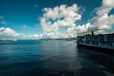
    Suva is the capital and largest city of Fiji. It lies on a hilly peninsula on the southeast coast of Viti Levu, between Laucala Bay and Suva Harbour. Since 1882, it has been the seat of administration, which was previously located in Levuka on Ovalau.Unlike Nadi, Suva is a city of government offices, banks, and universities, housing the main campus of the University of the South Pacific. Colonial buildings, the Fiji Museum in Thurston Gardens, the large Municipal Market, and the waterfront promenade make it the best place to discover Fiji's history and daily life. The climate is significantly rainier than in the west of the island.

    Donovan Kelly·Pexels

    Viti Levu

    Viti Levu

    Viti Levu, at just over 10,000 square kilometers, is Fiji's largest island and the country's hub. In the drier west are the international airport Nadi, Denarau, and Lautoka, while the wetter southeast is home to the capital, Suva. Between them, along the south coast, runs the Coral Coast, featuring Natadola, Sigatoka, and Pacific Harbour.Inland, the highlands rise to Tomanivi, at 1,324 meters Fiji's highest peak. In the highlands lies the traditional village of Navala, and off the coast near Pacific Harbour is the Beqa Lagoon, known for shark dives and the firewalkers of Beqa.

    HutheMeow·CC BY-SA 4.0

    Pacific Harbour and Beqa Lagoon

    Pacific Harbour and Beqa Lagoon

    Pacific Harbour on Viti Levu's south coast, twelve kilometers west of Navua, is considered Fiji's adventure center. From here, shark dives in the Shark Reef Marine Reserve, rafting and kayaking tours on the Navua River, and boat trips to Beqa Island depart.The Beqa Lagoon offshore is a popular dive and snorkel site. Beqa itself is home to the Sawau, whose men perform the traditional firewalk over hot stones. Located on the Queens Road between Nadi and Suva, Pacific Harbour can be visited as a day trip, though many stay one or two nights.

    Maksym Kozlenko·CC BY-SA 4.0

    Yasawa Islands

    Yasawa Islands

    The Yasawa Islands stretch as a chain of about 20 volcanic islands for approximately 80 kilometers to the north, northwest of Viti Levu. The larger islands include Waya, Naviti, Yaqeta, Matacawalevu, Nacula, and Yasawa. Until 1987, land-based tourism here was restricted; the first resorts only emerged afterwards.The Yasawa Flyer connects the islands daily with Port Denarau. Among the most famous attractions are the Sawa-i-Lau limestone caves, the Blue Lagoon near Nanuya Lailai, the manta rays in the channel near Drawaqa, and homestays on Waya and Wayasewa.

    Rickard Törnblad·CC BY-SA 4.0

    Nadi

    Nadi

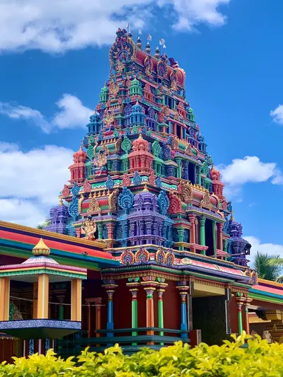
    Nadi, in western Viti Levu, is the first stop for most travelers in Fiji: About nine kilometers from the center lies Nadi International Airport, the country's main airport. The city itself is a lively commercial hub, shaped by its Indo-Fijian population, with shops, curry houses, and the colorful Sri Siva Subramaniya Temple.Nowhere in Fiji is the hotel density greater. From Port Denarau on the offshore island of Denarau, boats depart for the Mamanuca and Yasawa Islands; in the evenings, locals gather at Wailoaloa Beach. Inland, in the foothills of the Sabeto Mountains, are an orchid garden and hot mud pools.

    Dead.rabbit·CC BY-SA 4.0

    Your next steps

    Taveuni is in Fiji. Ways to carry on from here.

    • More in Fiji

      Highlights, areas, routes and the best time to travel for all of Fiji.

      Fiji travel guide
    • Round trips with Taveuni

      One route passes through Taveuni, with stops, nights and a map.

      See the round trip
    • Plan a trip with Taveuni

      The Guide asks about season, length and who is coming, and suggests a trip with Taveuni.

      Plan the trip

    Sources & method

    • Photos: Wikimedia Commons. Each photo carries its credit.
    • Place data such as addresses and ratings comes from Google Maps.
    • The content is based on web research from public, traceable sources. How the content is made · The role of AI