Fernweh: Home
ExploreGuideDestinationsMy tripsMy trip
de|en
All Places & RegionsRound tripsNight trains in EuropeAll highlightsAbout FernwehFAQPrivacy PolicyImprint
Download on the App StoreGet it on Google Play
ExploreGuideDestinationsMy tripsMy trip
    • Neighborhoods & highlights
    • Eat & drink
    • Culture
    • Getting around
    • Accommodation
    • Plan trip
    • Nearby
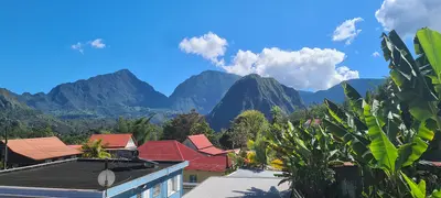
    La Plaine-des-Palmistes

    Pradigue / Wikimedia Commons / CC BY-SA 4.0, mod.

    La Réunion

    La Plaine-des-Palmistes

    City

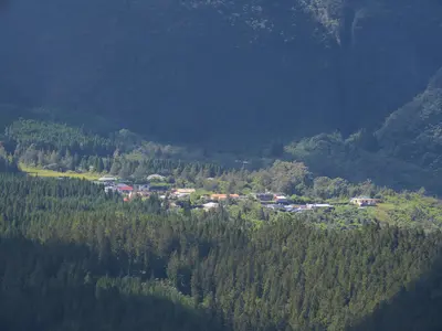
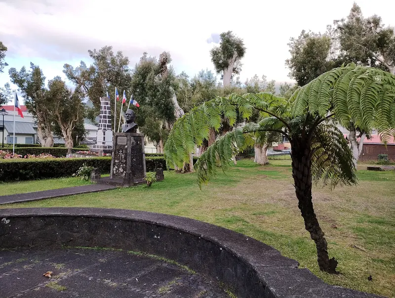
    La Plaine-des-Palmistes is a highland municipality situated at about 1,000 m on the Route des Plaines, between Saint-Benoît and Saint-Pierre, within the corridor separating Piton des Neiges and Piton de la Fournaise.

    by Felix Gillen

    1. Home
    2. Destinations
    3. La Réunion
    4. Osten
    5. La Plaine-des-Palmistes
    La Plaine-des-Palmistes is a highland municipality situated at about 1,000 m on the Route des Plaines, between Saint-Benoît and Saint-Pierre, within the corridor separating Piton des Neiges and Piton de la Fournaise. From here, you can drive via the forest road into the Bébour and Bélouve forests. In 2023, the municipality had a population of 6,936.The town is named after the palm trees that once grew here; it has been an independent municipality since 1899. The climate is cool and very wet, with an average annual rainfall exceeding 4,000 mm.
    La Réunion travel guideRound trips in La RéunionPlan a trip with La Plaine-des-Palmistes

    Contents

    • Neighborhoods & highlights
    • Eat & drink
    • Culture
    • Getting around
    • Accommodation
    • Nearby

    Sights in La Plaine-des-Palmistes

    Discover the most important sights and attractions

    Museum

    1Domaine des Tourelles

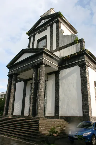
    Creole mansion from the 1920s, named after its small turrets. Today, it showcases exhibitions and regional crafts, and its garden invites a short break. A good first stop to get to know Plaine-des-Palmistes.
    Open in Google Maps
    Park

    2Forest of Bébour

    Extensive forest area above Plaine-des-Palmistes with high-altitude tamarinds, tree ferns, and cedar plantations. A forest road leads in; from there, hiking trails lead to viewpoints on the edge of the Cirque de Salazie. Expect fog and dampness, and take a rain jacket.
    Open in Google Maps

    Restaurants in La Plaine-des-Palmistes

    Highlands and Crafts

    Domaine des TourellesThe country house with its two towers was newly built in 1926/27. Today, workshops for handicrafts and an art foundry are housed here, alongside a free educational trail.Parc nationalThe Office de Tourisme de l'Est is located next to the Maison du Parc national. During the season, you can pick guavas.

    Getting There & Around

    Route des PlainesThe RN 3 connects Saint-Benoît and Saint-Pierre across 58 km through the highlands. From Saint-Benoît, you're here in about 20 minutes.Bébour-Bélouve Forest RoadThe forest road starts in the Petite Plaine district, crosses the Col de Bébour, and ends at the Gîte de Bélouve. Check with the ONF before your drive to see if it's open; the barrier is closed on Sundays and public holidays.

    Accommodations in La Plaine-des-Palmistes

    Find perfect stay in La Plaine-des-Palmistes

    Booking.com* (Affiliate link)
    Search Hotels
    Agoda* (Affiliate link)
    Search Hotels
    Airbnb
    Vacation Rentals

    * Affiliate link: if you book through it, we earn a small commission. The price stays the same for you.

    Plan your trip to La Plaine-des-Palmistes

    Save places, build a route and plan your city trip, all in one place.

    1. 1
      Sunrise over alpine peaks and a sea of clouds
      1234

      Round trip

      12 days · 4 stops

      Saved

      Pick a route

      Pick a ready-made one or save places and plan your own.

      Open bookmarks
    2. 2

      Trip to La Plaine-des-Palmistes

      Live
      • 1Domaine des Tourelles3 days
      • 2Forest of Bébour4 days
      Budget

      Plan your trip

      The planner sorts stops, days and budget. Plan together in real time.

      Start trip planning
    3. 3
      9:41 No signal
      La Plaine-des-Palmistes
      Available offline

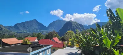
      Pradigue / Wikimedia Commons / CC BY-SA 4.0, mod.

      Use it on the road

      Download the guide to your phone and use it on site, even offline.

    Nearby

    Osten

    Osten

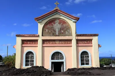
    The East is the rainier side of the island between Saint-Denis and the lava fields of Grand Brûlé. You visit for the coastal traces of Piton de la Fournaise, the vanilla growing regions, the waterfalls and bathing pools inland, and the Tamil temples.At Sainte-Rose, the Route des Laves follows cooled lava flows; the church of Notre-Dame-des-Laves was narrowly spared during the 1977 eruption. Further north, near Bras-Panon, are the pools of the Rivière des Roches, and in Saint-André, the Temple du Colosse. Inland, you reach the Bélouve cloud forest via the Plaine-des-Palmistes.

    Clémenceau Lauret·CC BY-SA 4.0

    Hell-Bourg

    Hell-Bourg

    Hell-Bourg is a former spa town in the Cirque de Salazie at the foot of Piton d'Anchaing and Piton des Neiges. You come for its 19th-century Creole houses; since 1999, it has been one of the "Plus beaux villages de France", the only member outside mainland France.The village was named after Governor Anne Chrétien Louis de Hell in 1841; its thermal baths opened in 1852. Villas followed, as affluent coastal families came to the heights for recreation. In 1948, a cyclone buried the springs, ending the spa's operation.

    Guallendra·CC0

    Cirque de Salazie and Hell-Bourg

    Cirque de Salazie and Hell-Bourg

    The Cirque de Salazie is the easternmost of the island's three central calderas and the most easily accessible. You go there for the waterfalls on the green cliffs and for Hell-Bourg, the only village outside mainland France to bear the "Plus beaux villages de France" label.Salazie is the rainiest of the three calderas. The water feeds dense vegetation, Chouchou fields, and numerous cascades such as the Voile de la Mariée. Besides Hell-Bourg, the municipality includes the localities of Grand Îlet and Mare à Vieille Place. Hiking paths go to Piton d'Anchaing, Bélouve Forest, and via Col des Bœufs to Mafate.

    Guallendra·CC0

    Bras-Sec

    Bras-Sec

    Bras-Sec is a predominantly agricultural Îlet in the northeast of the Cirque de Cilaos, 4.5 km from the main town. You come here if you want to experience tranquil mountain village life or set off for the Piton des Neiges; the Le Bloc hiking trailhead is located on the access road.A few hundred people live in the village; rock faces such as the Bonnet de Prêtre tower above Bras-Sec. The Sainte-Anne Church and a primary school stand in the village.

    Rémih·CC BY-SA 4.0

    Saint-Benoît

    Saint-Benoît

    Saint-Benoît ist eine der größten Gemeinden der Insel und liegt an der Mündung der Rivière des Marsouins an der Ostküste. Du nutzt den Ort als Ausgangspunkt für das Tal von Takamaka, den Grand Étang und die Route des Plaines ins Hochland. 2023 hatte die Gemeinde 38.604 Einwohner.Gegründet wurde Saint-Benoît 1733. Hier gewöhnte Joseph Hubert die Gewürze an, die Pierre Poivre mitgebracht hatte; später wurden Mango, Litschi und Vanille angebaut. Zur Gemeinde gehört auch der Ortsteil Sainte-Anne mit seiner reich verzierten Kirche.

    Thierry Caro·CC BY-SA 4.0

    Your next steps

    La Plaine-des-Palmistes is in La Réunion. Ways to carry on from here.

    • More in La Réunion

      Highlights, areas, routes and the best time to travel for all of La Réunion.

      La Réunion travel guide
    • Round trips in La Réunion

      Ready-made routes through La Réunion, with stops, nights and a map.

      See the routes

    Sources & method

    • Photos: Wikimedia Commons. Each photo carries its credit.
    • Place data such as addresses and ratings comes from Google Maps.
    • The content is based on web research from public, traceable sources. How the content is made · The role of AI