Fernweh: Home
ExploreGuideDestinationsMy tripsMy trip
de|en
All Places & RegionsRound tripsNight trains in EuropeAll highlightsAbout FernwehFAQPrivacy PolicyImprint
Download on the App StoreGet it on Google Play
ExploreGuideDestinationsMy tripsMy trip
    • Overview
    • Places in the region
    • Best travel time
    • Getting around
    • Round trips
    • Nearby
    Red Sea

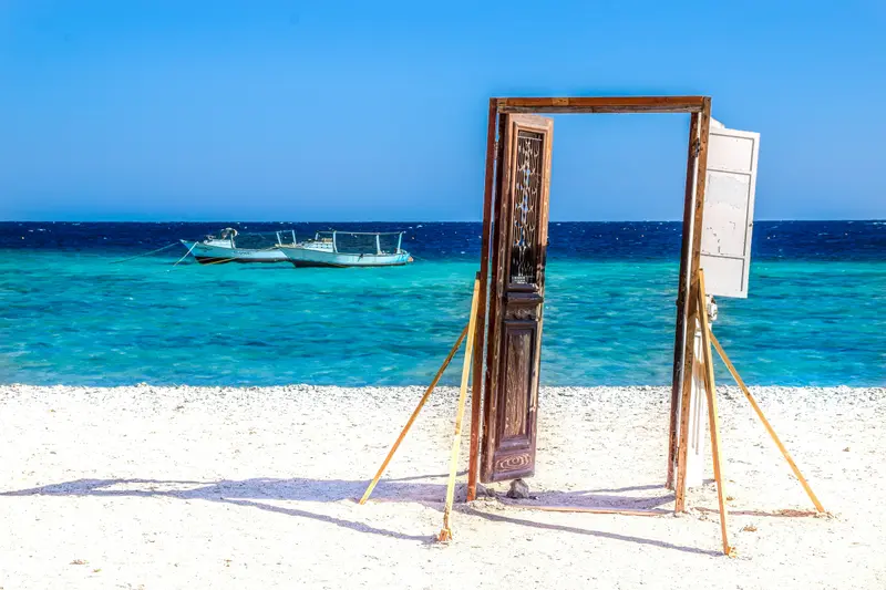
    Photo by Mohamed Gehad on Unsplash

    Egypt

    Red Sea

    Region

    The Red Sea mainland coast is Egypt's foremost beach destination. Its center is Hurghada, stretching about 40 kilometers along the coast; to the north lies the lagoon city El Gouna, to the south follow Makadi Bay and Safaga.

    by Felix Gillen

    1. Home
    2. Destinations
    3. Egypt
    4. Red Sea
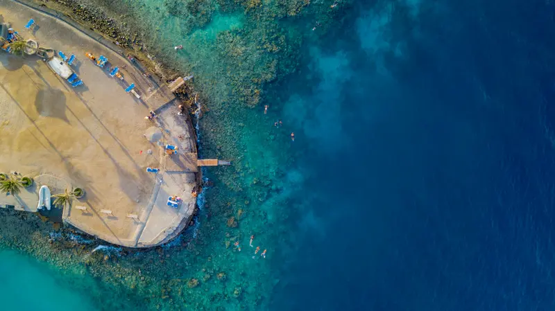
    The Red Sea mainland coast is Egypt's foremost beach destination. Its center is Hurghada, stretching about 40 kilometers along the coast; to the north lies the lagoon city El Gouna, to the south follow Makadi Bay and Safaga. Clear waters and coral reefs make the region a popular spot for diving and snorkeling, with most reefs accessible by boat.
    Egypt travel guideSee the round tripPlan a trip with Red Sea

    Contents

    • Overview
    • Places in the region
    • Best travel time
    • Getting around
    • Round trips
    • Nearby
    The resorts line the coast north and south of Hurghada: around 20 to 25 kilometers north lies the lagoon city of El Gouna; to the south are Sahl Hasheesh (about 18 kilometers), Makadi Bay (about 30 kilometers), and Soma Bay (about 45 kilometers). Further south, around 270 kilometers from Hurghada, lies Marsa Alam with its own airport; north of it is Abu Dabbab Bay. The Red Sea is warm all year round: In winter, daytime temperatures reach a good 20 degrees, in midsummer around 37 degrees.
    Hurghada

    Photo by Bahaa Mourad on Unsplash

    Place 1 of 3

    Hurghada

    From a fishing village, officially founded in 1905, it has become since the 1980s one of Egypt's most visited resorts, attracting over nine million annual visitors.

    Discover
    Marsa Alam

    Photo by Tom Podmore on Unsplash

    Place 2 of 3

    Marsa Alam

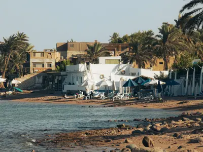
    Marsa Alam, on the west coast of the Red Sea, approximately 274 kilometers south of Hurghada, is a tranquil resort town with access to some of Egypt's most pristine coastal sections.

    Discover
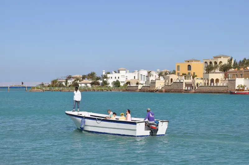
    El Gouna

    Marc Ryckaert / Wikimedia Commons / CC BY 4.0, mod.

    Place 3 of 3

    El Gouna

    The resort town, around 20-25 kilometers north of Hurghada, was founded in 1990 by entrepreneur Samih Sawiris. It is built on about 20 islands amidst lagoons, connected by bridges; its main hubs are Downtown and Abu Tig Marina.

    Discover

    Sights in Red Sea

    Discover the most important sights and attractions

    Beach

    Bay of Abu Dabbab

    The bay, about 35 kilometres north of Marsa Alam, is known for its seagrass meadows where Green Sea Turtles graze; with a bit of luck, a dugong might also appear. You can snorkel directly from the beach. Those not staying in one of the bay's hotels pay a beach entry fee.
    Open in Google Maps
    Wadi El Gemal National Park

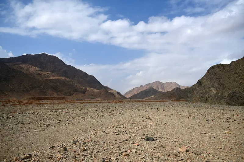
    “27057- Wadi el Gemal landscape” by Panegyrics of Granovetter / Wikimedia Commons / CC BY-SA 2.0, mod.

    National Park

    Wadi El Gemal National Park

    The national park, established in 2003, south of Marsa Alam, covers approximately 7,450 square kilometers, of which about 2,100 are marine. In the south grows the Red Sea's largest mangrove forest; seagrass meadows nourish dugongs and green sea turtles; Dorkas gazelles inhabit the desert part. The park also includes Sharm El Luli bay with its white sand, where construction is prohibited.
    Open in Google Maps

    Best Time to Visit

    When is the best time for your trip?

    March
    April
    May
    October
    November
    21–29°C·0–2 mm(little rain)
    In spring and autumn, the Red Sea is warm, but not too hot. Swimming is possible year-round. From June to September, daily temperatures reach around 37 degrees; winter is mild with cool evenings.
    Monthly values are for Hurghada (normal climate values 1991-2020 from the World Meteorological Organization (WMO)).

    Seasons

    Jan
    Feb
    Mar
    Apr
    May
    Jun
    Jul
    Aug
    Sep
    Oct
    Nov
    Dec
    Warm, ideal for swimming and diving
    Very hot
    Mild, evenings cool
    Best Time to Visit
    ▶Show detailed monthly data
    MonthTemp (°C)Rain (mm)
    January16.61
    February17.81
    March20.61
    April24.40
    May28.50
    June31.40
    July32.70
    August32.80
    September30.60
    October27.02
    November22.42
    December18.21

    Getting here and around

    Getting ThereThe main airport is Hurghada (HRG), Egypt's second most important. Marsa Alam Airport (RMF) is located about 210 kilometers south of Hurghada.Getting AroundBetween towns, travel by taxi, ride-hailing app, or hotel transfer. Long-distance buses from GoBus and other companies connect Hurghada with Cairo and Luxor.Most reefs are reached by boat; excursions depart from the marinas.

    Round trips through this region

    Classic Egypt: Pyramids, Nile Valley and Red Sea

    Classic Egypt: Pyramids, Nile Valley and Red Sea

    The route connects the three major chapters of an Egypt trip: Pyramids and museums in Cairo and Giza, the temples of the Nile Valley from Aswan to Luxor, and finally, swimming and snorkeling in the Red Sea. Cairo and Aswan are linked by a sleeper train, Aswan and Luxor by a roughly three-hour day train, and from Luxor, a bus takes you to Hurghada in four to five hours.

    13 Days
    4 stops
    Open jaw

    Nora Amer·Unsplash

    Nearby

    Sharm el-Sheikh

    Sharm el-Sheikh

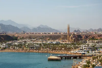
    Sharm el-Sheikh lies in South Sinai, parts of which are covered by the UK FCDO travel advice for Egypt. Check the current FCDO advice before you travel.Sharm el-Sheikh at the southern tip of the Sinai Peninsula is the largest resort in the Sinai and the base for some of the best-known diving areas of the Red Sea. The town overlooks the Strait of Tiran at the mouth of the Gulf of Aqaba and is the administrative seat of South Sinai Governorate.The tourist centre is Naama Bay with many hotels and restaurants. Offshore lie the reefs of Tiran and the wreck of the Thistlegorm, to the south Ras Mohammed National Park.

    Vika Glitter·Pexels

    Sinai

    Sinai

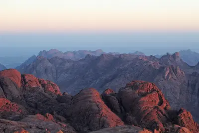
    Parts of the Sinai are covered by the UK FCDO travel advice for Egypt, including the whole of North Sinai and the northern part of South Sinai beyond the St Catherine to Nuweiba road (coastal areas excepted). Check the current FCDO advice before you travel.The south of the Sinai Peninsula between the Gulf of Suez and the Gulf of Aqaba combines coral reefs on the Red Sea with the high mountains around Mount Sinai. Here lie Sharm el-Sheikh, the smaller Dahab and Saint Catherine's Monastery, one of the oldest continuously inhabited Christian monasteries.The underwater world of Ras Mohammed National Park and the Strait of Tiran is among the best-known diving areas of the region. Inland rises the 2,285-metre Mount Sinai, sacred to Christians, Muslims and Jews.

    Ibrahim El-Mezayen·CC BY-SA 4.0

    Catherine's Monastery and Mt Sinai

    Catherine's Monastery and Mt Sinai

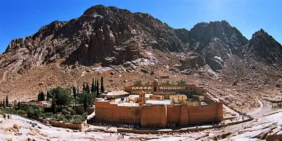
    The monastery lies in the mountains of South Sinai on the St Catherine to Nuweiba road, which marks the boundary of an area covered by the UK FCDO travel advice for Egypt. Check the current FCDO advice before you travel.Saint Catherine's Monastery at the foot of Mount Sinai in the south of the Sinai Peninsula is considered one of the oldest continuously inhabited Christian monasteries in the world and is part of the UNESCO World Heritage Saint Catherine Area. Emperor Justinian I had it built between 548 and 565. Within its walls stand the Chapel of the Burning Bush, the Well of Moses and a mosque from the Fatimid period; its library holds the second-largest collection of early codices and manuscripts after the Vatican Library.Above the monastery rises the 2,285-metre Mount Sinai (Jebel Musa), where according to tradition Moses received the Ten Commandments. A 2025 court ruling on the ownership of the monastery led to a dispute and temporary closures; in October 2026 the archbishop announced he would sign an agreement with the Egyptian government. Check before you travel whether the monastery is open.

    Dr. Ondřej Havelka·CC BY 4.0

    Dahab

    Dahab

    Dahab lies in South Sinai, parts of which are covered by the UK FCDO travel advice for Egypt. Check the current FCDO advice before you travel.Dahab is a small town on the southeastern coast of the Sinai Peninsula on the Gulf of Aqaba, about 80 kilometres northeast of Sharm el-Sheikh. Lonely Planet describes it as a relaxed, low-rise resort; it is best known as a diving destination and for windsurfing.A few kilometres north lies the Blue Hole, one of the best-known dive sites on the Red Sea. The town is divided into Masbat with the Bedouin village of Asalah in the north, Mashraba further south and Medina in the southwest.

    Mohamed Elshiekh·Pexels

    West Bank of Luxor (Thebes West)

    West Bank of Luxor (Thebes West)

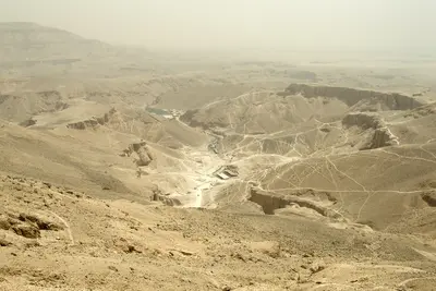
    On the West Bank of the Nile opposite Luxor, the rulers of the New Kingdom built their tombs and mortuary temples. Over 60 tombs are known in the Valley of the Kings, including the tomb of Tutankhamun, discovered by Howard Carter in 1922. Also here are the Mortuary Temple of Hatshepsut, Medinet Habu, the Valley of the Queens, and the Colossi of Memnon. At sunrise, hot air balloons float over the landscape.

    Vyacheslav Argenberg·CC BY 4.0

    Your next steps

    Red Sea is in Egypt. Ways to carry on from here.

    • More in Egypt

      Highlights, areas, routes and the best time to travel for all of Egypt.

      Egypt travel guide
    • Round trips with Red Sea

      One route passes through Red Sea, with stops, nights and a map.

      See the round trip
    • Plan a trip with Red Sea

      The Guide asks about season, length and who is coming, and suggests a trip with Red Sea.

      Plan the trip

    Sources & method

    • Photos: Wikimedia Commons, Unsplash. Each photo carries its credit.
    • Place data such as addresses and ratings comes from Google Maps.
    • The content is based on web research from public, traceable sources. How the content is made · The role of AI