Fernweh: Home
ExploreGuideDestinationsMy tripsMy trip
de|en
All Places & RegionsRound tripsNight trains in EuropeAll highlightsAbout FernwehFAQPrivacy PolicyImprint
Download on the App StoreGet it on Google Play
ExploreGuideDestinationsMy tripsMy trip
    • Neighborhoods & highlights
    • Tours
    • Eat & drink
    • Culture
    • Getting around
    • Accommodation
    • Plan trip
    • Nearby
    Baracoa

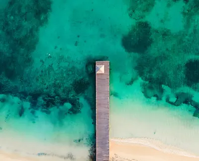
    Photo by Will Jephcott on Unsplash

    Cuba

    Baracoa

    CityNatureCulture

    Baracoa, on the northeast coast, was founded in August 1511 by Diego Velázquez and is thus considered Cuba's first city; Columbus named the place Porto Santo in 1492.

    by Felix Gillen

    1. Home
    2. Destinations
    3. Cuba
    4. Baracoa
    Baracoa, on the northeast coast, was founded in August 1511 by Diego Velázquez and is thus considered Cuba's first city; Columbus named the place Porto Santo in 1492. For a long time, Baracoa was only accessible by sea; it was not until 1965 that the La Farola pass road opened, connecting the town with Guantánamo, 120 km away.Above the city rises the flat-topped mountain El Yunque (575 m); to its west lies the Alejandro de Humboldt National Park, a UNESCO World Heritage site since 2001. The region is known for cocoa. Hurricane Melissa damaged roads and bridges around Baracoa in October 2025; according to Directorio Cubano, by the end of November 2025, connections to Maisí and Moa were only provisionally passable.
    Cuba travel guideRound trips in CubaPlan a trip with Baracoa

    Contents

    • Neighborhoods & highlights
    • Tours
    • Eat & drink
    • Culture
    • Getting around
    • Accommodation
    • Nearby

    Sights in Baracoa

    Discover the most important sights and attractions

    Natural Feature

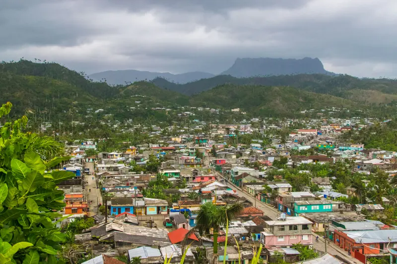
    1El Yunque

    The 575 m high Table Mountain, about 10 km west of the city, shapes its silhouette. According to Rough Guides, the ascent takes about two hours.
    Open in Google Maps
    Attraction

    2Playa Maguana

    The beach, according to Suitcase Magazine, lies about 25 km northwest of Baracoa on the coastal road towards Moa. This road was damaged by Hurricane Melissa 2025; check its condition before your trip.
    Open in Google Maps

    Tours & experiences in Baracoa

    Search tours for Baracoa on GetYourGuide* (Affiliate link)On GetYourGuide, with reviews from other travellers

    * Affiliate link: if you book through it, we earn a small commission. The price stays the same for you.

    Restaurants in Baracoa

    Nature and Cocoa

    Alejandro de Humboldt National ParkWest of Baracoa lies the Alejandro de Humboldt National Park, a UNESCO World Heritage site since 2001. According to UNESCO's description, nearly three-quarters of its plant species occur only here.CocoaThe region is known for cocoa; in the city, there is a chocolate café, the Casa del Chocolate, located on Calle Maceo.

    Arrival and On the Way

    La FarolaThe La Farola pass road was opened in 1965, connecting Baracoa with Guantánamo, 120 km away. Rough Guides advises driving it only during daylight hours.After Hurricane MelissaAccording to Directorio Cubano, as of late November 2025, the road to Maisí and the bridge over the Río Yumurí were only temporarily passable. On the road to Moa, there was a washout with a restricted detour. In 2026, long-distance buses to Baracoa were running only once a week, according to the Cuban Ministry of Transport.

    Accommodations in Baracoa

    Find perfect stay in Baracoa

    Booking.com* (Affiliate link)
    Search Hotels
    Agoda* (Affiliate link)
    Search Hotels
    Airbnb
    Vacation Rentals

    * Affiliate link: if you book through it, we earn a small commission. The price stays the same for you.

    Plan your trip to Baracoa

    Save places, build a route and plan your city trip, all in one place.

    1. 1
      Sunrise over alpine peaks and a sea of clouds
      1234

      Round trip

      12 days · 4 stops

      Saved

      Pick a route

      Pick a ready-made one or save places and plan your own.

      Open bookmarks
    2. 2

      Trip to Baracoa

      Live
      • 1El Yunque3 days
      • 2Playa Maguana4 days
      Budget

      Plan your trip

      The planner sorts stops, days and budget. Plan together in real time.

      Start trip planning
    3. 3
      9:41 No signal
      Baracoa
      Available offline

      Photo by Will Jephcott on Unsplash

      Use it on the road

      Download the guide to your phone and use it on site, even offline.

    Nearby

    Santiago de Cuba

    Santiago de Cuba

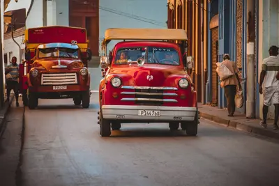
    Santiago de Cuba, in the southeast, is Cuba's second-largest city and a hub of Afro-Caribbean influenced music and festival culture. The city was founded in 1515 as the seventh Spanish villa; at Parque Céspedes stands the Casa de Diego Velázquez, built between 1516 and 1530. In July, Santiago celebrates its Carnival and the Festival del Caribe.Guarding the harbor entrance is the Castillo San Pedro de la Roca, a UNESCO World Heritage site since 1997. At Santa Ifigenia cemetery lie José Martí and Fidel Castro. Hurricane Melissa made landfall near Santiago on October 29, 2025, as a Category 3 storm, damaging the El Cobre pilgrimage church among other sites; inquire locally about the current condition.

    Denys·Unsplash

    Port Antonio

    Port Antonio

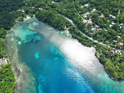
    Port Antonio, the capital of Portland Parish on the northeast coast, is quieter than the major resorts and a starting point for many natural attractions. East of the town are the Blue Lagoon, a spring-fed lagoon over 50 m deep, the bathing cove Frenchman's Cove, Boston Bay with its Jerk stands, and further south the Reach Falls. West of the town, the traditional raft trip on the Rio Grande leads through the rainforest. Portland fared relatively well during Hurricane Melissa; according to the Jamaica Tourist Board, the main attractions are open.

    Layneartz19·CC BY-SA 4.0

    Blue Mountains

    Blue Mountains

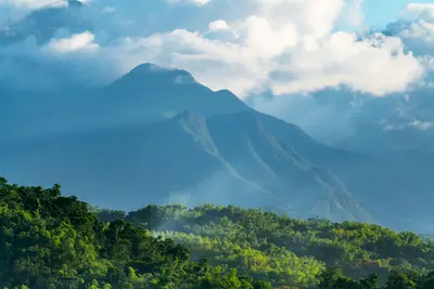
    The Blue Mountains rise directly behind Kingston, culminating in Blue Mountain Peak, at 2,256 m the highest point in Jamaica. The Blue and John Crow Mountains National Park has been a UNESCO Natural and Cultural World Heritage site since 2015: It served as a refuge for Taíno and Maroons and is home to over 1,300 flowering plants, nearly 300 of which are endemic to Jamaica. Blue Mountain coffee grows on its slopes. A classic is the nocturnal ascent to the summit to see the sunrise.Following Hurricane Melissa, the park administration received UNESCO emergency aid; repairs to Holywell and Portland Gap are planned (as of October 2026). Before visiting, inquire with the Jamaica Conservation and Development Trust about the current trail conditions.

    Sean Witter·Pexels

    North and East Coast

    North and East Coast

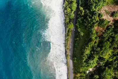
    Between Ocho Rios in St. Ann and Port Antonio in Portland lies a lush coast with rivers and waterfalls. Around Ocho Rios, rivers cascade into the sea, most famously Dunn's River Falls; east of which are Firefly, Noël Coward's estate, and in Portland the Blue Lagoon, Reach Falls, rafting on the Rio Grande, and Boston Bay, where Jerk is said to have originated. According to early 2026 reports, Portland was relatively spared during Hurricane Melissa.

    Aviz Media·Pexels

    Ocho Rios

    Ocho Rios

    Read the current UK FCDO travel advice on crime in Jamaica before you go.Ocho Rios on the north coast in St Ann is a cruise port and excursion hub. Its main attraction is Dunn's River Falls, whose cascades you climb up from the beach; after Hurricane Melissa they reopened in November 2025. In the hills lie further waterfalls such as Island Gully Falls, also called Blue Hole, and Konoko Falls; west towards Discovery Bay are the Green Grotto Caves, and to the east Firefly, Noël Coward's estate. Ian Fleming International Airport is at Boscobel, east of town.

    Amit Shubinsky·Pexels

    Your next steps

    Baracoa is in Cuba. Ways to carry on from here.

    • More in Cuba

      Highlights, areas, routes and the best time to travel for all of Cuba.

      Cuba travel guide
    • Round trips in Cuba

      Ready-made routes through Cuba, with stops, nights and a map.

      See the routes

    Sources & method

    • Photos: Unsplash. Each photo carries its credit.
    • Place data such as addresses and ratings comes from Google Maps.
    • The content is based on web research from public, traceable sources. How the content is made · The role of AI