Fernweh: Home
ExploreGuideDestinationsMy tripsMy trip
de|en
All Places & RegionsRound tripsNight trains in EuropeAll highlightsAbout FernwehFAQPrivacy PolicyImprint
Download on the App StoreGet it on Google Play
ExploreGuideDestinationsMy tripsMy trip
    • Eat & drink
    • Accommodation
    • Plan trip
    • Nearby
    Puerto del Rosario

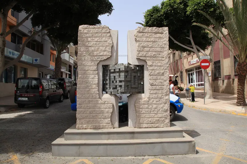
    “Puerto del Rosario - Calle Fernandez Castañeyra-Calle Virgen Del Rosario 02 ies” by Frank Vincentz / Wikimedia Commons / CC BY-SA 3.0, mod.

    Spain

    Puerto del Rosario

    City

    Puerto del Rosario is the capital of Fuerteventura and lies on the island's east coast. The small city center starts directly at the harbor, with the pedestrian street Calle Primero de Mayo leading into it.

    by Felix Gillen

    1. Home
    2. Destinations
    3. Spain
    4. Fuerteventura
    5. Puerto del Rosario
    Puerto del Rosario is the capital of Fuerteventura and lies on the island's east coast. The small city center starts directly at the harbor, with the pedestrian street Calle Primero de Mayo leading into it.Numerous open-air sculptures adorn the streets, and with Playa Chica, the city has its own small beach.
    Spain travel guideRound trips in SpainPlan a trip with Puerto del Rosario

    Contents

    • Eat & drink
    • Accommodation
    • Nearby

    Restaurants in Puerto del Rosario

    Accommodations in Puerto del Rosario

    Find perfect stay in Puerto del Rosario

    Booking.com* (Affiliate link)
    Search Hotels
    Agoda* (Affiliate link)
    Search Hotels
    Airbnb
    Vacation Rentals

    * Affiliate link: if you book through it, we earn a small commission. The price stays the same for you.

    Campgrounds in Puerto del Rosario

    Find perfect campground in Puerto del Rosario

    Search via Google Maps
    Campgrounds nearby (15km)
    Camping.info
    Find Campgrounds
    Park4Night
    RV Parks & Camping

    Plan your trip to Puerto del Rosario

    Save places, build a route and plan your city trip, all in one place.

    1. 1
      Sunrise over alpine peaks and a sea of clouds
      1234

      Round trip

      12 days · 4 stops

      Saved

      Pick a route

      Pick a ready-made one or save places and plan your own.

      Open bookmarks
    2. 2

      Chile trip

      Live
      • 1Santiago3 days
      • 2Atacama4 days
      • 3Torres del Paine5 days
      Budget

      Plan your trip

      The planner sorts stops, days and budget. Plan together in real time.

      Start trip planning
    3. 3
      9:41 No signal
      Puerto del Rosario
      Available offline

      “Puerto del Rosario - Calle Fernandez Castañeyra-Calle Virgen Del Rosario 02 ies” by Frank Vincentz / Wikimedia Commons / CC BY-SA 3.0, mod.

      Use it on the road

      Download the guide to your phone and use it on site, even offline.

    Nearby
    Fuerteventura

    Fuerteventura

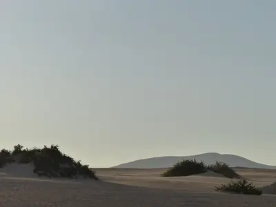
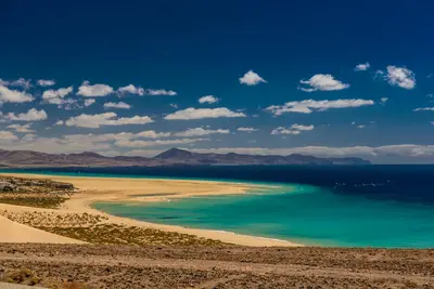
    Fuerteventura, at around 1,660 square kilometers, is the second-largest Canary Island and has been a UNESCO Biosphere Reserve since 2009. It is known for its long, bright sandy beaches, the Corralejo dunes, and the constant wind that makes it a destination for wind and kitesurfers.

    Unsplash

    Corralejo

    Corralejo

    Corralejo, located on the northern tip of Fuerteventura, was a small fishing village until the mid-20th century, but since the 1970s, it has become one of the island's most important resorts. Immediately to the south, the dunes of Corralejo Natural Park begin, stretching for around 11 kilometers of fine sand, while opposite lies the small Isla de Lobos.From the harbor, ferries depart for Playa Blanca on Lanzarote and boats for Lobos. The beaches directly in the town are more sheltered, but the water along the coast can have strong currents.

    Benjamín Núñez González·CC BY-SA 4.0

    Timanfaya National Park

    Timanfaya National Park

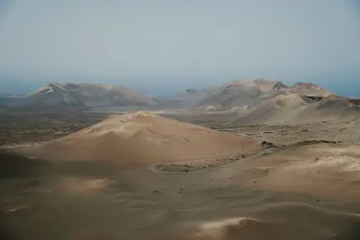
    The Timanfaya National Park in southwestern Lanzarote protects approximately 51 square kilometers of lava fields and volcanic cones, including the Montañas del Fuego. These formed during the major eruptions from September 1, 1730, to April 16, 1736; the last eruptions occurred in 1824. The area has been a National Park since 1974.You cannot explore the park freely: By car, you drive to Islote de Hilario, where the Ruta de los Volcanes bus tour, included in the admission, begins. Those who wish to explore on foot must register for a guided hike at the Mancha Blanca Visitor Center.

    Mihai Vlasceanu·Pexels

    Arrecife

    Arrecife

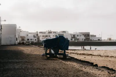
    Arrecife is the capital of Lanzarote and is located on the east coast. At Charco de San Ginés, a lagoon in the middle of the city, fishing boats lie in front of white houses, and on an island off the coast stands the fortress Castillo de San Gabriel.From here, the works of César Manrique and Timanfaya National Park can be reached by bus, rental car, or taxi.

    Mathias Reding·Pexels

    Lanzarote

    Lanzarote

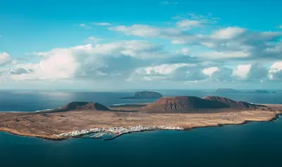
    Lanzarote is the northernmost of the main Canary Islands and has been a UNESCO Biosphere Reserve since 1993. The lava fields from the eruptions of 1730 to 1736 define the southwest, while artist César Manrique created a harmonious interplay of architecture and volcanic landscape with structures like Jameos del Agua and Mirador del Río.

    Unsplash

    Your next steps

    Puerto del Rosario is in Spain. Ways to carry on from here.

    • More in Spain

      Highlights, areas, routes and the best time to travel for all of Spain.

      Spain travel guide
    • Round trips in Spain

      Ready-made routes through Spain, with stops, nights and a map.

      See the routes

    Sources & method

    • Photos: Wikimedia Commons. Each photo carries its credit.
    • The content is based on web research from public, traceable sources. How the content is made · The role of AI