Fernweh: Home
ExploreGuideDestinationsMy tripsMy trip
de|en
All Places & RegionsRound tripsNight trains in EuropeAll highlightsAbout FernwehFAQPrivacy PolicyImprint
Download on the App StoreGet it on Google Play
ExploreGuideDestinationsMy tripsMy trip
    • Neighborhoods & highlights
    • Recommendations
    • Tours
    • Eat & drink
    • Culture
    • Getting around
    • Accommodation
    • Plan trip
    • Nearby
    Sai Kung

    Photo by Kamus Cheung on Pexels

    Hong Kong

    Sai Kung

    City

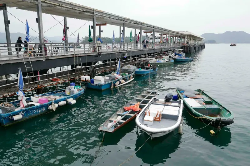
    Sai Kung Town is located on Inner Port Shelter bay, on the peninsula of the same name in the eastern New Territories.

    by Felix Gillen

    1. Home
    2. Destinations
    3. Hong Kong
    4. New Territories
    5. Sai Kung
    Sai Kung Town is located on Inner Port Shelter bay, on the peninsula of the same name in the eastern New Territories. The town has no MTR connection, but is easily accessible by bus and minibus, and serves as a gateway to the surrounding islands, beaches, and hiking trails.Along the waterfront promenade are seafood restaurants with aquariums out front, including the Michelin-starred Loaf On. From the pier, small boats, called Kaitos, travel to islands such as Sharp Island. By taxi or bus, you can reach the East Dam of the High Island Reservoir, where the Hong Kong UNESCO Global Geopark displays its most famous hexagonal rock columns.
    Hong Kong travel guideRound trips in Hong KongPlan a trip with Sai Kung

    Contents

    • Neighborhoods & highlights
    • Recommendations
    • Tours
    • Eat & drink
    • Culture
    • Getting around
    • Accommodation
    • Nearby

    Sights in Sai Kung

    Discover the most important sights and attractions

    High Island Reservoir East Dam (Hong Kong UNESCO Global Geopark)

    Yumeto / Wikimedia Commons / CC BY-SA 4.0, mod.

    Attraction

    1High Island Reservoir East Dam (Hong Kong UNESCO Global Geopark)

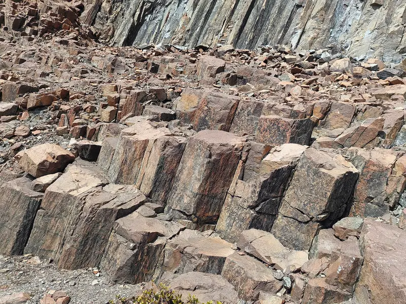
    At the East Dam of High Island Reservoir, the Hong Kong UNESCO Global Geopark showcases its most famous hexagonal columns of volcanic tuff, formed approximately 140 million years ago. The Geopark was inaugurated in 2009 and admitted to the UNESCO Global Geoparks Network in 2011. The approximately 3.3-kilometer-long High Island Geo Trail starts at a blue anchor-shaped monument on the dam; allow around three hours. The easiest way to get there is by taxi from Sai Kung Town; for the return trip, take Minibus 9A to Pak Tam Chung and then Bus 94. Minibuses and buses operate only in the afternoons on Sundays and public holidays.

    Open in Google Maps
    Park

    2Sharp Island (Kiu Tsui Chau)

    A short Kaito ride from Sai Kung, the island is roughly 2.5 km long. Small boats leave Sai Kung New Public Pier and the promenade for Kiu Tsui Pier. The island offers beaches, interesting geology, mountain and island views, and a coral reef where calm, shallow waters suit beginner snorkelers. Keep your return ticket and look for your operator's flag at the pier.
    Open in Google Maps

    Tours & experiences in Sai Kung

    Search tours for Sai Kung on GetYourGuide* (Affiliate link)On GetYourGuide, with reviews from other travellers

    * Affiliate link: if you book through it, we earn a small commission. The price stays the same for you.

    Restaurants in Sai Kung

    1

    Loaf On

    Seafood restaurant on the Sai Kung waterfront promenade, 49 See Cheung Street, awarded one star in the 2026 Michelin Guide. The cuisine features traditional house recipes; inspectors highlight steamed zebra mantis shrimp on egg custard, mantis shrimp with chili and garlic, and fish steamed in sea salt. Some seafood items must be pre-ordered when reserving. Mid-range price category.
    Show on Google Maps

    Port, Islands and Volcanic Rock

    A Waterfront DestinationSai Kung Town is located on Sai Kung Hoi bay, also known as Inner Port Shelter. The harbor is home to motorized junks and small boats, used for excursions, fishing, and swimming. Ferries and Kaitos connect the town with islands and remote coastal villages.Fish and SeafoodAlong the waterfront promenade, restaurants with aquariums out front line the street. The seafood restaurant Loaf On holds a Michelin star and serves traditional homemade recipes.The GeoparkThe peninsula is part of the Hong Kong UNESCO Global Geopark, inaugurated in 2009 and a member of UNESCO's global geopark network since 2011. The Sai Kung volcanic rock region covers around 100 square kilometers, partly submerged; the hexagonal columns at High Island Reservoir formed approximately 140 million years ago.

    Sai Kung: Arrival & Excursions

    Getting ThereMinibus 101M from MTR Hang Hau (Exit B1)Minibus 1A or Bus 92 from MTR Choi Hung; Bus 92 also stops at MTR Diamond Hill (Exit C2), per the Hong Kong Tourism Board.red minibus from Mong KokTo the East DamThe easiest option is a taxi from Sai Kung Town to the High Island Reservoir's East Dam. For your return, take Minibus 9A to Pak Tam Chung, then Bus 94. On Sundays and public holidays, services on this route are afternoon-only.To the IslandsKaitos (local ferries) depart from Sai Kung New Public Pier and the promenade, for destinations like Sharp Island. Keep your return ticket and look for your boat operator's flag at the pier.

    Accommodations in Sai Kung

    Find perfect stay in Sai Kung

    Booking.com* (Affiliate link)
    Search Hotels
    Agoda* (Affiliate link)
    Search Hotels
    Airbnb
    Vacation Rentals

    * Affiliate link: if you book through it, we earn a small commission. The price stays the same for you.

    Plan your trip to Sai Kung

    Save places, build a route and plan your city trip, all in one place.

    1. 1
      Sunrise over alpine peaks and a sea of clouds
      1234

      Round trip

      12 days · 4 stops

      Saved

      Pick a route

      Pick a ready-made one or save places and plan your own.

      Open bookmarks
    2. 2

      Trip to Sai Kung

      Live
      • 1High Island Reservoir East Dam (Hong Kong UNESCO Global Geopark)3 days
      • 2Sharp Island (Kiu Tsui Chau)4 days
      Budget

      Plan your trip

      The planner sorts stops, days and budget. Plan together in real time.

      Start trip planning
    3. 3
      9:41 No signal
      Sai Kung
      Available offline

      Photo by Kamus Cheung on Pexels

      Use it on the road

      Download the guide to your phone and use it on site, even offline.

    Nearby

    Kowloon

    Kowloon

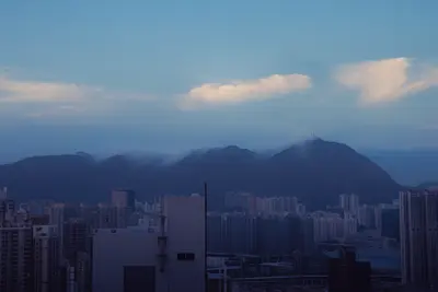
    Kowloon is the peninsula north of Victoria Harbour, opposite Hong Kong Island. With over two million people living on approximately 67 square kilometers, it is Hong Kong's smallest yet most densely populated of its three main territories.For travelers, many attractions are just a few MTR stations apart: the Tsim Sha Tsui waterfront promenade with views of the Hong Kong Island skyline, the M+ and Hong Kong Palace Museum in the West Kowloon Cultural District, the street markets of Yau Ma Tei, Jordan, and Mong Kok, and the electronics and fabric streets of Sham Shui Po. Further north are the Wong Tai Sin Temple and the Chi Lin Nunnery with its Nan Lian Garden, overlooked by Lion Rock.

    Alex M·Pexels

    Mong Kok

    Mong Kok

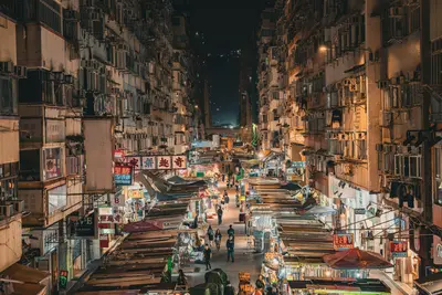
    Mong Kok is considered one of the most densely populated districts in the world, with around 130,000 people per square kilometer. Its Chinese name roughly translates to 'prosperous corner'. Amidst neon signs, high-rises, and street stalls, you'll experience everyday Hong Kong in its most concentrated form here.The markets are sorted by goods: Ladies' Market in the south of Tung Choi Street, Goldfish Market in the north of the same street, sneaker shops in Fa Yuen Street, florists on Flower Market Road, and finally, the Yuen Po Street Bird Garden with songbirds in ornate cages. Towering above it all is Langham Place, the district's tallest building.

    Ehsan Haque·Pexels

    Sham Shui Po

    Sham Shui Po

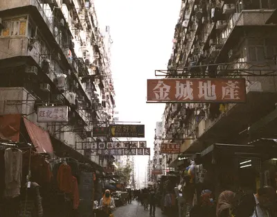
    Sham Shui Po, in northwest Kowloon, is a working-class and commercial district where many streets are still named after their wares: electronics and used goods on Apliu Street, buttons on Ki Lung Street, ribbons on Nam Cheong Street, beads on Yu Chau Street, and toys on Fuk Wing Street. Around Tai Nan Street, cafés and designers have settled in former leather and fabric shops.The district is also a destination for affordable food, featuring several establishments from the Michelin Guide's Bib Gourmand selection. At Mei Ho House, one of the first resettlement blocks built after the devastating Shek Kip Mei fire in 1953, a small museum recounts the history of public housing.

    sl wong·Pexels

    Yau Ma Tei and Jordan

    Yau Ma Tei and Jordan

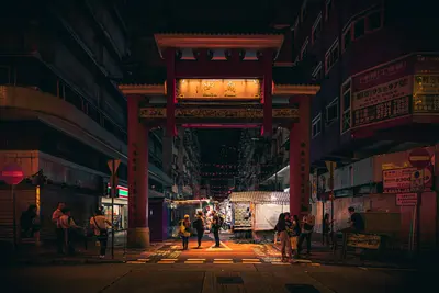
    Yau Ma Tei and Jordan immediately south form one of Kowloon's oldest districts. Where Tanka fishermen worked on a beach before 1860, a residential and commercial area grew on reclaimed land, with ground-floor shops, a wholesale fruit market, a cinema-theater, and a typhoon shelter.In the evenings, everything revolves around Temple Street: The night market stretches from Jordan to the Tin Hau Temple Complex, which gave the street its name. Additionally, there are street food stalls, fortune tellers, and occasional open-air Cantonese opera. During the day, the Jade Market, the wholesale fruit market on Waterloo Road, and old Cha Chaan Tengs like Mido Café are worth visiting.

    Aleksandar Pasaric·Pexels

    Tsim Sha Tsui

    Tsim Sha Tsui

    Tsim Sha Tsui, or TST for short, is the southern tip of the Kowloon Peninsula and for many travellers, the first glimpse of Hong Kong. From the promenade with the Avenue of Stars, you look across Victoria Harbour to the Hong Kong Island skyline, which is particularly impressively lit up in the evenings.Along the waterfront are the Clock Tower of the former Kowloon Station, the Star Ferry Pier, the Hong Kong Museum of Art, and the Hong Kong Space Museum. Inland, Nathan Road leads northwards, with shopping malls, hotels, and the Chungking Mansions, next to which lies Kowloon Park. To the west, the West Kowloon Cultural District adjoins, featuring M+ and the Hong Kong Palace Museum.

    Water White·Pexels

    Your next steps

    Sai Kung is in Hong Kong. Ways to carry on from here.

    • More in Hong Kong

      Highlights, areas, routes and the best time to travel for all of Hong Kong.

      Hong Kong travel guide
    • Round trips in Hong Kong

      Ready-made routes through Hong Kong, with stops, nights and a map.

      See the routes

    Sources & method

    • Photos: Wikimedia Commons, Pexels. Each photo carries its credit.
    • Place data such as addresses and ratings comes from Google Maps.
    • The content is based on web research from public, traceable sources. How the content is made · The role of AI