Fernweh: Home
    ExploreTravel GuidesPlan a tripMy tripLast visited
    de|en
    All Places & RegionsAll highlightsAbout FernwehFAQPrivacy PolicyImprint
    ExploreTravel GuidesPlan a tripMy tripLast visited
    • Neighborhoods & highlights
    • Eat & drink
    • Getting around
    • Accommodation
    • Plan trip
    • Nearby

    Peru

    City

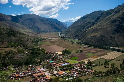
    Ollantaytambo is situated at approximately 2,800 meters at the western end of the Sacred Valley.

    by Felix Gillen

    1. Home
    2. Destinations
    3. Peru
    4. Cusco and Sacred Valley
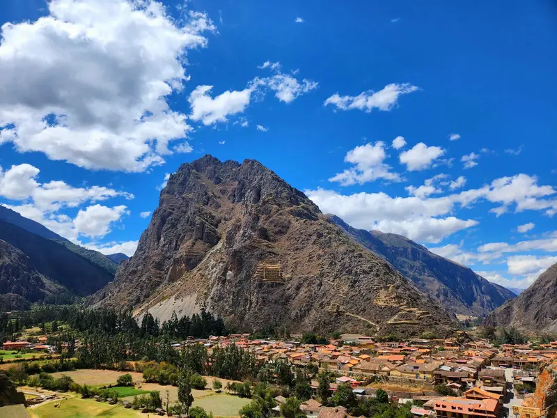
    Ollantaytambo is situated at approximately 2,800 meters at the western end of the Sacred Valley. The town is often referred to as a living Inca village: Its old town still follows the rectilinear street grid of the Inca, water flows through the alleys in stone channels, and many houses stand on Inca walls.Above the town rise the Inca terraces and temple complexes, which were expanded under Pachacútec. During the Spanish conquest, Ollantaytambo served as a fortress for Manco Inca. On the opposite slope lie ancient storage structures.From the station, PeruRail and Inca Rail run several times daily to Aguas Calientes; the journey takes about two hours.The Inca site is included in Cusco's Boleto Turístico.

    Sights in

    Discover the most important sights and attractions

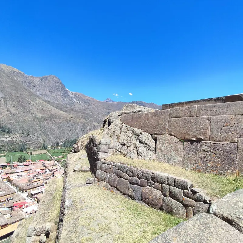
    Ollantaytambo Fortress

    1Ollantaytambo Fortress

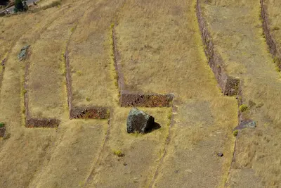
    Steep terraces ascend to the Temple of the Sun, its wall formed by six massive pink granite monoliths. The stones were transported from a quarry on the opposite side of the valley. In 1537, Manco Inca retreated here after the failed siege of Cusco, repelling the Spanish in a battle. Allow two to three hours and come early before the day groups arrive.
    Open in Google Maps
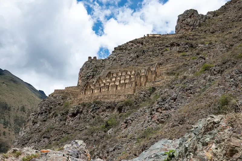
    Pinkuylluna

    2Pinkuylluna

    Opposite the fortress, the Inca storehouses, the Qollqas, cling to the mountainside. Here, the Inca stored grain, preserved long by the slope's cool, windy climate. The steep ascent takes about 20 to 30 minutes and is free. The top rewards you with the best view over the village and fortress.
    Open in Google Maps

    Restaurants in

    Exploring on-site

    Getting ThereFrom Cusco, you travel by shared taxi, minibus, or taxi through the Sacred Valley to Ollantaytambo. Many combine the journey with stops in Pisac, Chinchero, or Moray.In the VillageThe old village center, with its Inca walls and narrow water channels, is best explored on foot. The fortress is right at the village's edge; the Pinkuylluna granaries opposite are reached via a steep path.Onward to Machu PicchuFrom the train station at the lower edge of the village, PeruRail and Inca Rail trains go to Aguas Calientes in about one and a half to two hours. Tickets sell out quickly during high season, so book them together with your Machu Picchu entrance.

    Accommodations in

    Find perfect stay in

    Booking.com* (Affiliate link)
    Search Hotels
    Agoda* (Affiliate link)
    Search Hotels
    Airbnb
    Vacation Rentals

    * Affiliate link: if you book through it, we earn a small commission. The price stays the same for you.

    Plan your trip to

    Save places, build a route and plan your city trip, all in one place.

    1. 1
      Sunrise over alpine peaks and a sea of clouds
      1234

      Round trip

      12 days · 4 stops

      Saved

      Pick a route

      Pick a ready-made one or save places and plan your own.

      Open bookmarks
    2. 2

      Trip to

      Live
      • 1Ollantaytambo Fortress3 days
      • 2Pinkuylluna4 days
      Budget

      Plan your trip

      The planner sorts stops, days and budget. Plan together in real time.

      Start trip planning
    3. 3
      9:41 No signal
      Available offline

      Use it on the road

      Download the guide to your phone and use it on site, even offline.

    Nearby

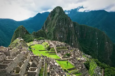
    Machu Picchu is the most famous Inca site and the reason most travelers come to Peru. The complex lies at around 2,430 meters on a mountain ridge between the peaks of Machu Picchu and Huayna Picchu high above the Urubamba River, approximately 80 kilometers northwest of Cusco. Most archaeologists consider it an estate of the Inca ruler Pachacútec, built around 1450. It remained hidden from the Spanish, becoming internationally known in 1911 through Hiram Bingham. It has been a UNESCO World Heritage site since 1983.Tickets: Entry is organized into three circuits with a total of ten routes and fixed entry times. The daily capacity is 4,500 visitors, increasing to 5,600 on designated high-season days. Tickets are sold online by the Ministry of Culture; a small contingent for the next day is available locally in Aguas Calientes. For June to October, book well in advance.Getting there: By train from Cusco or Ollantaytambo to Aguas Calientes, then by Consettur bus or on foot via stairs up to the entrance.Inca Trail: The classic trail requires a permit and is closed every February.
    Cusco

    Cusco

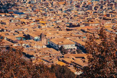
    Cusco was the capital of the Inca Empire and is now the starting point for almost every trip to Machu Picchu. Under Pachacútec, a planned city with religious and administrative areas emerged. The Spanish retained the layout and built their churches and palaces on the Inca walls. Since 1983, the city has been a UNESCO World Heritage site.The heart of the city is the Plaza de Armas with its Cathedral and arcades. The Santo Domingo Monastery stands on Qorikancha, the Inca Sun Temple, whose walls are still visible. On Calle Hatun Rumiyoc is the famous twelve-angled stone, above it the artisan quarter San Blas. The Mercado San Pedro is the city's main market. Above the city lies the Inca site of Sacsayhuamán with its mighty stone walls, the venue for Inti Raymi on June 24.Cusco is located at around 3,500 meters: Take it easy for the first few days.For Sacsayhuamán and the Inca sites in the Sacred Valley, you'll need the Boleto Turístico, available as a ten-day general ticket or as partial tickets. Qorikancha and the Cathedral are not included.
    Cusco and Sacred Valley

    Cusco and Sacred Valley

    The region around Cusco is the heartland of the Incas and Peru's most important travel destination. The former Inca capital, Cusco, is situated at around 3,500 meters, its center has been a UNESCO World Heritage site since 1983. Northwest lies the Sacred Valley of the Urubamba with the ruins and markets of Pisac, the Inca town of Ollantaytambo, and the terraces of Moray and Maras. At the end of the valley is Machu Picchu, accessible by train to Aguas Calientes.

    The Sacred Valley follows the Río Urubamba northwest of Cusco and was an important agricultural region for the Inca. The town of Pisac is located about 30 kilometers from Cusco, known for its handicraft market, especially on Sundays, and the terraces and temples of the Inca site on the mountain above the town.On the high plateau above the valley are the circular terraces of Moray, which the Inca presumably used for agricultural experiments, and the salt pans of Maras, where salt still evaporates from a spring today. At the western end of the valley lies Ollantaytambo, with the train station to Machu Picchu.Pisac, Ollantaytambo, Moray, and Chinchero are included in Cusco's Boleto Turístico.The valley lies lower than Cusco and is well-suited for the first days of acclimatization.
    Colca Canyon

    Colca Canyon

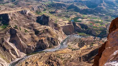
    The Colca Canyon is located approximately 160 kilometers northwest of Arequipa and is one of the deepest canyons in the world. Along the valley, villages still cultivate ancient agricultural terraces, some of which date back to pre-Incan times. At the Cruz del Cóndor viewpoint, where the canyon floor lies approximately 1,200 meters deeper, Andean condors circle, best observed in the morning.The starting point is the town of Chivay, about a four-hour drive from Arequipa, with thermal baths in the surrounding area.To visit the viewpoints, you need the Colca Tourist Ticket, which you can purchase in Chivay or at the checkpoints.The road leads over high altitudes; plan for acclimatization.

    Sources & method

    • Photos: Wikimedia Commons, Pexels. Each photo carries its credit.
    • Place data such as addresses and ratings comes from Google Maps.
    • The content is based on web research from public, traceable sources. How the content is made · The role of AI