Fernweh: Home
ExploreGuideDestinationsMy tripsMy trip
de|en
All Places & RegionsRound tripsNight trains in EuropeAll highlightsAbout FernwehFAQPrivacy PolicyImprint
Download on the App StoreGet it on Google Play
ExploreGuideDestinationsMy tripsMy trip
    • Places in the region
    • Recommendations
    • Culture
    • Getting around
    • Nearby
    Panama Canal and Gatun Lake

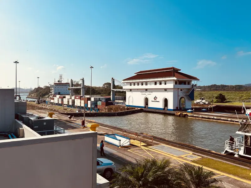
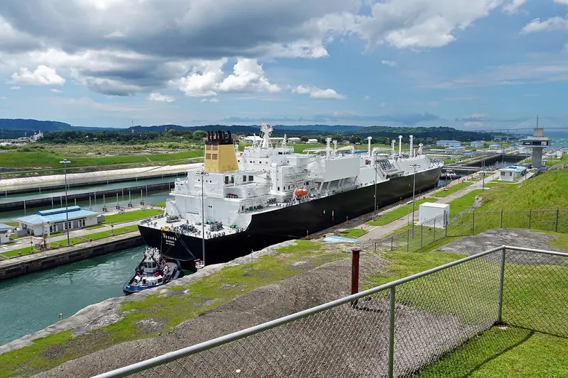
    Photo by Kevin Alvarez on Pexels

    Panama

    Panama Canal and Gatun Lake

    Region

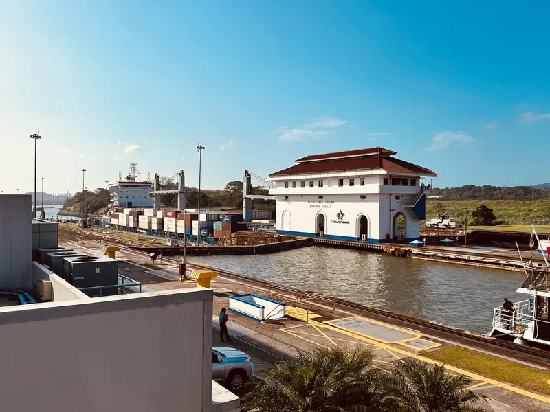
    The Panama Canal connects the Pacific and Caribbean, starting right at the edge of Panama City. At the visitor centers of Miraflores on the Pacific side and Agua Clara near Colón, you can watch ships navigate the locks.

    by Felix Gillen

    1. Home
    2. Destinations
    3. Panama
    4. Panama Canal and Gatun Lake
    The Panama Canal connects the Pacific and Caribbean, starting right at the edge of Panama City. At the visitor centers of Miraflores on the Pacific side and Agua Clara near Colón, you can watch ships navigate the locks.The heart of the canal route is Gatun Lake, a reservoir formed by the damming of the Río Chagres. Its largest island, Barro Colorado, has been a protected area since 1923; a research station opened there in 1924, operated by the Smithsonian since 1946. On the east bank lies Soberanía National Park with Pipeline Road, one of the country's most famous birdwatching trails.Two bridges cross the canal on the Pacific side: the Puente de las Américas from 1962 and the cable-stayed bridge Puente Centenario, inaugurated in 2004 and open to traffic since 2005.
    Panama travel guideRound trips in PanamaPlan a trip with Panama Canal and Gatun Lake

    Contents

    • Places in the region
    • Recommendations
    • Culture
    • Getting around
    • Nearby

    Sights in Panama Canal and Gatun Lake

    Discover the most important sights and attractions

    Visitor Center of the Agua Clara

    Mariordo (Mario Roberto Durán Ortiz) / Wikimedia Commons / CC BY-SA 4.0, mod.

    Attraction

    Visitor Center of the Agua Clara

    On the Caribbean side near Colón, you'll see the expanded locks opened in 2016 and Gatun Lake. There's a film room and two short paths; the ticket includes the viewpoint at the new Gatun Locks. Daily 8 AM to 4 PM. Non-residents pay B/. 10 (as of November 2026).
    Open in Google Maps
    Miraflores Tourist Information Center

    Photo by Kevin Alvarez on Pexels

    Museum

    Miraflores Tourist Information Center

    Miraflores Locks Visitor Center (Pacific side) has observation terraces directly over the lock chambers, a museum on construction & operation, and an IMAX 3D cinema. Daily 8 AM-6 PM, tickets till 5 PM. Non-residents pay B/. 17.22 (Nov 2026). Under renovation until late 2026; expect delays at 8 AM & 2 PM.
    Open in Google Maps
    Isla Barro Colorado

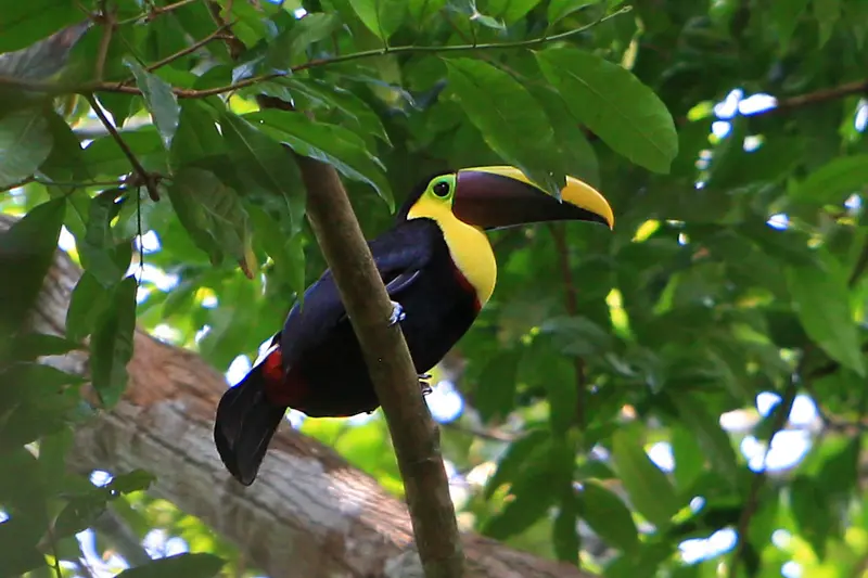
    “Ramphastos swainsonii -Barro Colorado Island, Panama Canal-8a” by Steve Ryan / Wikimedia Commons / CC BY-SA 2.0, mod.

    Natural Feature

    Isla Barro Colorado

    The largest island in Gatun Lake has been a research station of the Smithsonian Tropical Research Institute since 1923. The day tour includes a 2 to 3-hour guided hike covering approximately 3 km and lunch at the station; boats depart from Gamboa. Visits require prior booking and prepayment; foreign adults pay 125 US dollars, minimum age 12 years (as of November 2026, stri.si.edu).
    Open in Google Maps
    Point of Interest

    Bridge of the Americas

    The steel bridge over the Pacific Canal entrance opened in 1962, originally known as the Thatcher Ferry Bridge, and is 1,654 meters long. You get good views of it from the Calzada de Amador and Cerro Ancón.
    Open in Google Maps
    Attraction

    Pipeline Road (Camino del Oleoducto)

    This approximately 17 km trail near Gamboa winds through old-growth and regenerating rainforest within Soberanía National Park and is known as one of Panama's premier birdwatching destinations. It has repeatedly set records during the Audubon Society's Christmas Bird Counts.
    Open in Google Maps
    Attraction

    Centennial Bridge

    The cable-stayed bridge crosses the canal north of the Miraflores Locks and was inaugurated on August 15, 2004, on the 90th anniversary of the canal's opening.
    Open in Google Maps

    Canal, Locks and Rainforest

    LocksMiraflores is located on the Pacific side. The visitor center offers observation decks and a 3D film in the IMAX cinema. At Agua Clara on the Caribbean side, you'll see the expanded locks, opened in 2016, and Gatún Lake.Research at Gatún LakeBarro Colorado is the largest island in Gatún Lake. The Smithsonian research station was established in 1923 and began operations in 1924.Paths Through the ForestThe Pipeline Road (Camino del Oleoducto) leads through old-growth and regenerating forest in Soberanía National Park. The Camino de Cruces is a Spanish cobblestone path that once connected Old Panama with a port on the Río Chagres.

    Plan a canal visit

    Getting ThereMiraflores is on the outskirts of Panama City, accessible by taxi or tour. Agua Clara is on the Caribbean side near Colón. Soberanía National Park is 30 to 45 minutes from Panama City. Boats to Barro Colorado depart from the Smithsonian pier in Gamboa; the trip takes 30 to 45 minutes each way.Opening Hours and PricesMiraflores is open daily 8 AM to 6 PM, ticket office until 5 PM. Non-residents B/. 17.22, children 6-12 years B/. 7.22. Agua Clara is open daily 8 AM to 4 PM, costing B/. 10 or B/. 5. Children under 6 have free admission (as of Nov 2026, Canal Authority ACP).Practical TipsAllow about 1.5 hours for Miraflores, 3 hours for Agua Clara. Due to renovations until late 2026, longer waits are expected at Miraflores at 8 AM and 2 PM. Ship transit times are on visitcanaldepanama.com. Barro Colorado requires prior reservation and prepayment for visits.

    Nearby

    Panama City

    Panama City

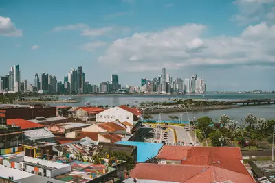
    Panama City is Panama's capital, situated at the Pacific entrance of the Panama Canal. Within a small area, you'll discover the colonial Old Town Casco Viejo, the ruins of the original city, a museum by Frank Gehry, and the Miraflores Locks.The city was founded on August 15, 1519, by Pedro Arias Dávila. After its destruction by Henry Morgan in 1671, it was rebuilt a few kilometers further west, from which today's Casco Viejo emerged. UNESCO inscribed it as a World Heritage Site in 1997 and expanded it in 2003 to include the ruins of Panamá Viejo.West of the Old Town begins the former Canal Zone around Balboa. From there, the Calzada de Amador with the Biomuseo extends into the bay. The Federal Foreign Office provides information on crime in individual districts.

    Eliécer Gómez·Pexels

    Casco Viejo

    Casco Viejo

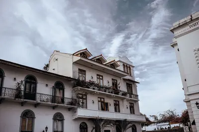
    Casco Viejo is the old town of Panama City, located on a peninsula on the Pacific and a UNESCO World Heritage site since 1997. Amidst churches, squares, and the old city walls, you have views of the skyline and the ships at the canal entrance.The city was rebuilt after Henry Morgan destroyed the original city of Panamá Viejo in 1671. UNESCO listed the district as “Historic District of Panamá, with the Salón Bolívar”; since 2025, it has been part of the Colonial Transisthmian Route. The Pan-American Congress, convened by Simón Bolívar, met in the Salón Bolívar.Around the Plaza de la Independencia stand the Cathedral and the Museo del Canal. At the tip of the peninsula, the Plaza de Francia commemorates the workers who died during the French canal project.

    Luis Quintero·Pexels

    Panamá Viejo

    Panamá Viejo

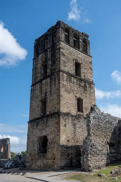
    Panamá Viejo are the ruins of the first Spanish city on the Pacific coast of the Americas, on the eastern edge of Panama City. Since 2003, they have been a UNESCO World Heritage site, and from the tower of the old cathedral, you can overlook the grounds and the bay.Pedro Arias Dávila founded the city on August 15, 1519. In 1671, the Welsh privateer Henry Morgan attacked the city, and the subsequent fire destroyed it. Afterward, it was refounded a few kilometers further west.The Patronato Panamá Viejo operates the site as an open-air museum. Inside the museum, a model shows the city as it looked before 1671.

    xiquinhosilva·CC BY 4.0

    Portobelo

    Portobelo

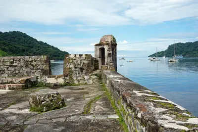
    Portobelo is a small town on a Caribbean bay in the province of Colón, about one and a half to two hours' drive from Panama City. On both sides of the bay lie Spanish fortresses that are part of the UNESCO World Heritage, and the town is a center of Afro-Caribbean Congo culture.The gold and silver of the Spanish crown passed through the Real Aduana, the royal custom house. The fortresses were attacked multiple times, including by Henry Morgan and later by Admiral Edward Vernon. In 2012, UNESCO placed the Portobelo-San Lorenzo World Heritage site on the List of World Heritage in Danger due to its poor state of preservation and kept it there in July 2026. Since 2025, the fortresses have been part of the Colonial Transisthmian Route.The Iglesia de San Felipe houses the Cristo Negro, to whose festival on October 21st pilgrims arrive in violet robes. At the mouth of the Río Chagres lies Fuerte San Lorenzo, the second part of the World Heritage site.

    Mariordo (Mario Roberto Durán Ortiz)·CC BY-SA 4.0

    The Valley of Antón

    The Valley of Antón

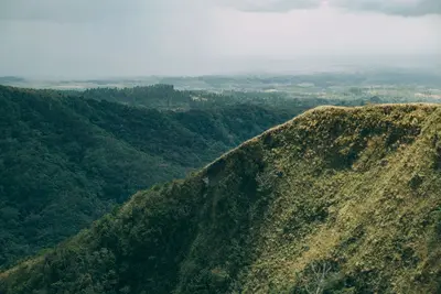
    El Valle de Antón is a mountain village in the Coclé province, nestled in the crater of an extinct volcano, about two hours west of Panama City. Visitors are drawn by the hiking trails to India Dormida, the waterfalls, ancient rock carvings, and the mild climate.The iconic La India Dormida mountain ridge is a major landmark. Along its ascent lies La Piedra Pintada, the valley's most renowned rock featuring pre-Columbian petroglyphs. In the village center, you'll find a market selling handicrafts, fruits, and vegetables.El Níspero Zoo hosts an amphibian conservation center. The EVACC foundation is dedicated to protecting the endangered Panamanian golden frog, a species endemic to Panama. For information on the regional situation, consult the Federal Foreign Office.
    Luis Quintero·Pexels

    Your next steps

    Panama Canal and Gatun Lake is in Panama. Ways to carry on from here.

    • More in Panama

      Highlights, areas, routes and the best time to travel for all of Panama.

      Panama travel guide
    • Round trips in Panama

      Ready-made routes through Panama, with stops, nights and a map.

      See the routes
    • Plan a trip with Panama Canal and Gatun Lake

      The Guide asks about season, length and who is coming, and suggests a trip with Panama Canal and Gatun Lake.

      Plan the trip

    Sources & method

    • Photos: Wikimedia Commons, Pexels. Each photo carries its credit.
    • Place data such as addresses and ratings comes from Google Maps.
    • The content is based on web research from public, traceable sources. How the content is made · The role of AI