Fernweh: Home
ExploreGuideDestinationsMy tripsMy trip
de|en
All Places & RegionsRound tripsNight trains in EuropeAll highlightsAbout FernwehFAQPrivacy PolicyImprint
Download on the App StoreGet it on Google Play
ExploreGuideDestinationsMy tripsMy trip
    • Places & highlights
    • Tours
    • Eat & drink
    • Getting around
    • Accommodation
    • Nearby
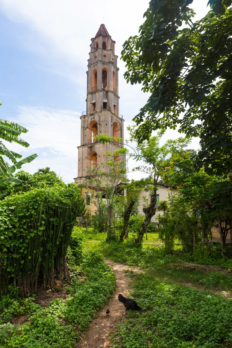
    Valle de los Ingenios

    Photo by Mehmet Turgut Kirkgoz on Pexels

    Cuba

    Valle de los Ingenios

    Point of InterestCultureUNESCONature

    The Valle de los Ingenios (Sugar Mill Valley) lies east of Trinidad and, with the city, became a UNESCO World Heritage site in 1988.

    by Felix Gillen

    1. Home
    2. Destinations
    3. Cuba
    4. Valle de los Ingenios
    The Valle de los Ingenios (Sugar Mill Valley) lies east of Trinidad and, with the city, became a UNESCO World Heritage site in 1988. In its San Luis, Santa Rosa, and Meyer valleys, 18th and 19th-century sugar mills operated, their wealth derived from enslaved labor. Manor houses, mill ruins, and enslaved quarters remain.Its emblem is the 45-meter-high tower of Hacienda Manaca Iznaga, from which field work was supervised. Other stops include Hacienda Guáimaro (with murals) and the ruins of San Isidro de los Destiladeros.
    Cuba travel guideRound trips in CubaPlan a trip with Valle de los Ingenios

    Contents

    • Places & highlights
    • Tours
    • Eat & drink
    • Getting around
    • Accommodation
    • Nearby

    Sights in Valle de los Ingenios

    Discover the most important sights and attractions

    Tower and Hacienda Manaca Iznaga

    Baldo Simone / Wikimedia Commons / CC BY-SA 4.0, mod.

    1Tower and Hacienda Manaca Iznaga

    The tower of Hacienda Manaca Iznaga is approximately 45 m high (EcuRed states 45 m with seven levels and 184 steps, Lonely Planet 44 m) and was built around 1816. From here, according to Lonely Planet, the work of the enslaved people in the fields was monitored. The hacienda was founded in 1750 and bought by Pedro Iznaga in 1795; it is located approximately 15 km northeast of Trinidad.
    Open in Google Maps
    Point of Interest

    2Hacienda Guáimaro

    The manor house of a former sugar mill in the valley's east is, according to Lonely Planet, renowned for its murals.
    Open in Google Maps
    Museum

    3San Isidro de los Destiladeros

    The ruins of the former sugar mill San Isidro de los Destiladeros are, according to Lonely Planet, among the stops in the Valle de los Ingenios.
    Open in Google Maps

    Tours & experiences in Valle de los Ingenios

    Search tours for Valle de los Ingenios on GetYourGuide* (Affiliate link)On GetYourGuide, with reviews from other travellers

    * Affiliate link: if you book through it, we earn a small commission. The price stays the same for you.

    Restaurants in Valle de los Ingenios

    Travel

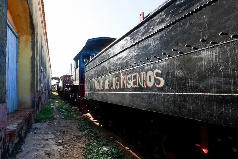
    From TrinidadManaca Iznaga lies 16 km (Lonely Planet) or 14 km (EcuRed) northeast of Trinidad. A restored tourist train ran in 2024 from Trinidad station, stopping at Manaca Iznaga, to Hacienda Guachinango; whether it will operate in 2026 is not confirmed. Due to fuel shortages, taxi rides are also currently difficult to organize.

    Accommodations in Valle de los Ingenios

    Find perfect stay in Valle de los Ingenios

    Booking.com* (Affiliate link)
    Search Hotels
    Agoda* (Affiliate link)
    Search Hotels
    Airbnb
    Vacation Rentals

    * Affiliate link: if you book through it, we earn a small commission. The price stays the same for you.

    Nearby

    Trinidad

    Trinidad

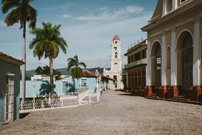
    Trinidad, in south-central Cuba, was founded by Diego Velázquez on December 23, 1514. The city grew wealthy in the 18th and 19th centuries from the sugar trade; most of the single-story, brightly painted houses with verandas lining the cobblestone streets date from this period. Together with the nearby Valle de los Ingenios, Trinidad has been a UNESCO World Heritage site since 1988.The focal point is the Plaza Mayor, featuring palaces of the sugar barons, which are now museums. In the evenings, salsa is danced on the steps next to the church. South of the city lies Playa Ancón beach, and to the north are the mountains of Topes de Collantes.

    Mehmet Turgut Kirkgoz·Pexels

    Santa Clara

    Santa Clara

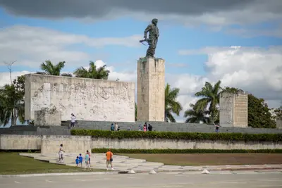
    Santa Clara, in the heart of the island, is closely linked to Ernesto Che Guevara: In December 1958, rebels under his leadership stopped an armored train of government troops here. The memorial at the train, and the monument with Che's statue, mausoleum, and museum, are today the city's most important attractions.The center around Parque Vidal has been a national monument and pedestrian zone since 1996. Nearby lies Remedios, where the Parrandas are celebrated on the night of December 24th, and on the north coast, the island chain around Cayo Santa María.

    Mehmet Turgut Kirkgoz·Pexels

    Cienfuegos

    Cienfuegos

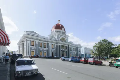
    Cienfuegos on the south coast was founded on April 22, 1819, by French settlers from Bordeaux and Louisiana under Don Luis De Clouet, initially named Fernandina de Jagua. Its historic center, with its regular street grid and 19th-century neoclassical buildings, has been a UNESCO World Heritage site since 2005.The centerpiece is the Parque José Martí, featuring a Cathedral and the Teatro Tomás Terry from 1890. South of the old town, the Punta Gorda peninsula stretches into the bay, home to the Moorish-decorated Palacio de Valle. Excursions lead to Castillo de Jagua at the harbor entrance, the Soledad Botanical Garden, and the El Nicho waterfalls in the Escambray Mountains.

    Mehmet Turgut Kirkgoz·Pexels

    Cayo Santa María

    Cayo Santa María

    Cayo Santa María belongs to an island chain off the north coast of central Cuba, in the Bay of Buenavista, which is protected as a Biosphere Reserve. It can be reached via a 48 km long causeway (Pedraplén) from Caibarién, construction of which began in 1989. The island's beaches stretch for a total of approximately 11 km.The island is purely a beach destination with large hotel complexes and no established town. For culture, head to Remedios or Santa Clara on the mainland.

    Nelvega·CC BY-SA 4.0

    Varadero

    Varadero

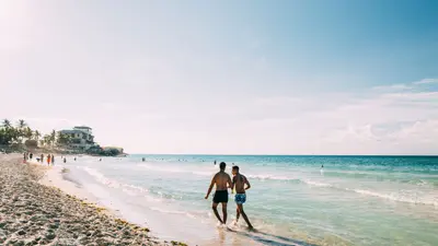
    Varadero is located on the Hicacos Peninsula east of Havana, about two hours' drive from the capital. The peninsula is approximately 25 km long and rarely wider than half a kilometer; a sandy beach stretches along almost its entire northern side.Varadero is primarily a beach resort with large hotel complexes. Diversions include the Villa Xanadú, which US industrialist Irénée Dupont had built between 1926 and 1929, and the Varahicacos Nature Reserve with the Cueva de Ambrosio and its pre-Columbian rock paintings.

    Yuting Gao·Pexels

    Your next steps

    Valle de los Ingenios is in Cuba. Ways to carry on from here.

    • More in Cuba

      Highlights, areas, routes and the best time to travel for all of Cuba.

      Cuba travel guide
    • Round trips in Cuba

      Ready-made routes through Cuba, with stops, nights and a map.

      See the routes
    • Plan a trip with Valle de los Ingenios

      The Guide asks about season, length and who is coming, and suggests a trip with Valle de los Ingenios.

      Plan the trip

    Sources & method

    • Photos: Wikimedia Commons, Pexels. Each photo carries its credit.
    • Place data such as addresses and ratings comes from Google Maps.
    • The content is based on web research from public, traceable sources. How the content is made · The role of AI