Fernweh: Home
    ExploreTravel GuidesPlan a tripMy tripLast visited
    de|en
    All Places & RegionsAll highlightsAbout FernwehFAQPrivacy PolicyImprint
    ExploreTravel GuidesPlan a tripMy tripLast visited
    • Neighborhoods & highlights
    • Eat & drink
    • Culture
    • Getting around
    • Accommodation
    • Plan trip
    • Nearby
    Nuwara Eliya

    Sri Lanka

    Nuwara Eliya

    City

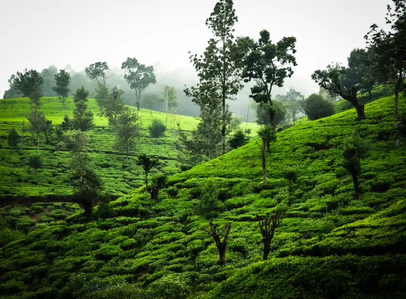
    Nuwara Eliya is located at 1,868 meters in the heart of the tea country and is the most important center for Sri Lankan tea production.

    by Felix Gillen

    1. Home
    2. Destinations
    3. Sri Lanka
    4. Kandy & Highlands
    5. Nuwara Eliya
    Nuwara Eliya is located at 1,868 meters in the heart of the tea country and is the most important center for Sri Lankan tea production. Founded by Samuel Baker in 1846, the city, with its British villas, is nicknamed "Little England" and serves as a base for tea factories, Horton Plains National Park, and onward train journeys to Ella.The city center is built around Victoria Park and the red-brick post office building from 1894. To its south is Gregory Lake with its park, and colonial hotels like the Grand Hotel and the Hill Club line Grand Hotel Road.The city's train station is Nanu Oya, approximately 10 kilometers west of the center. Since June 2026, trains have again run from there to Ella and Badulla.

    Sights in Nuwara Eliya

    Discover the most important sights and attractions

    Lake Gregory
    Natural Feature

    1Lake Gregory

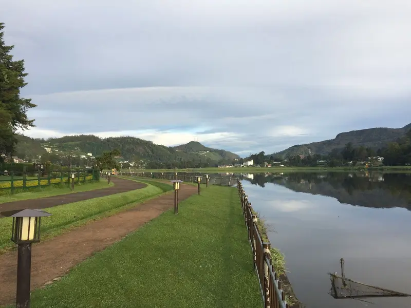
    The lake was created in 1873 under British Governor Sir William Gregory. The lakeside park is open daily from 8 AM to 6 PM according to a local guide; foreigners pay approximately 200 LKR entrance (as of October 2026).
    Open in Google Maps
    Hakgala Botanical Garden
    Attraction

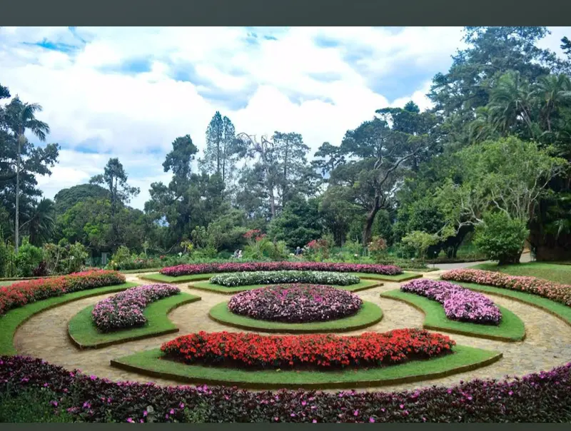
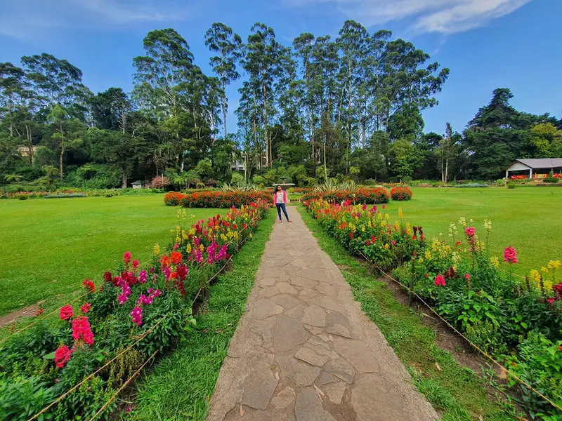
    2Hakgala Botanical Garden

    Founded in 1861, the garden is considered Sri Lanka's second-largest botanical garden. Travel reports indicate an entrance fee of around 12 US dollars for foreigners (as of October 2026, not officially confirmed).
    Open in Google Maps
    Victoria Park
    Park

    3Victoria Park

    The roughly 11-hectare park next to the Post Office was originally Hakgala Botanical Garden's experimental field. It was named in 1897 for Queen Victoria's Diamond Jubilee, the Nanu Oya River flows through it.
    Open in Google Maps
    Pedro Tea Estate
    Point of Interest

    4Pedro Tea Estate

    The tea factory on the outskirts offers brief production tours followed by a cup of tea. Open 8 AM to 5 PM (closed for lunch 12-2 PM). Photography is prohibited inside.
    Open in Google Maps

    Restaurants in Nuwara Eliya

    1

    Grand Indian

    Indian restaurant in the Grand Hotel, described by Lonely Planet as the city's favourite eatery. Evenings often mean a wait for a table; prices are above the local average.
    Show on Google Maps
    2

    Indian Summer

    Upscale restaurant with lake view, primarily known for North Indian curries.
    Show on Google Maps

    Tea Culture & Colonial Heritage

    Tea FactoriesAt the Pedro Tea Estate, you can join an approximately half-hour guided tour without prior booking. Reports indicate the fee is 200 to 300 LKR, including a cup of tea (as of October 2026). Photography is prohibited inside the factory.Colonial EraBritish officials built villas and cottages here, hence the nickname "Little England". The Hill Club maintains this tradition to this day: formal attire is required for dinner, and non-resident guests pay a small temporary membership fee.Gregory Lake and Victoria Park charge a small entrance fee.Evenings get cool, so pack warm clothing.

    Getting there & around

    Train from Nanu OyaTrain Status (as of October 2026): The highland railway line was damaged in numerous places by Cyclone Ditwah at the end of 2025. The section from Nanu Oya to Badulla via Ella has been back in operation since June 20, 2026. Between Kandy and Nanu Oya, there are no continuous trains yet: The Hatton to Nanu Oya section is still undergoing repairs, and there is no confirmed completion date. Check the current status with Sri Lanka Railways before your trip.Nanu Oya to Ella: approx. 64.5 kilometres, journey time about 2 to 2.5 hours.Departure times according to travel reports include 9:20 AM, 1 PM, 3 PM and 4:30 PM, plus a morning tourist train (except Tuesdays). Information varies, check the current timetable.Reserved seats are released one month in advance and sell out quickly on this route; unreserved tickets are available at the counter on the day of travel.Reserved 2nd class has openable windows; the air-conditioned 1st class does not.Bus and CarFrom Kandy: 75 kilometres, bus approx. four hours, taxi about 2 hours 45 minutes.To Ella by shared minivan: approx. 1.5 hours.Nanu Oya to Centre: Bus or tuk-tuk in approx. 20 minutes; the tuk-tuk costs around 1,000 LKR.

    Accommodations in Nuwara Eliya

    Find perfect stay in Nuwara Eliya

    Booking.com* (Affiliate link)
    Search Hotels
    Agoda* (Affiliate link)
    Search Hotels
    Airbnb
    Vacation Rentals

    * Affiliate link: if you book through it, we earn a small commission. The price stays the same for you.

    Plan your trip to Nuwara Eliya

    Save places, build a route and plan your city trip, all in one place.

    1. 1
      Sunrise over alpine peaks and a sea of clouds
      1234

      Round trip

      12 days · 4 stops

      Saved

      Pick a route

      Pick a ready-made one or save places and plan your own.

      Open bookmarks
    2. 2

      Trip to Nuwara Eliya

      Live
      • 1Lake Gregory3 days
      • 2Hakgala Botanical Garden4 days
      • 3Victoria Park5 days
      Budget

      Plan your trip

      The planner sorts stops, days and budget. Plan together in real time.

      Start trip planning
    3. 3
      9:41 No signal
      Nuwara Eliya
      Available offline

      Use it on the road

      Download the guide to your phone and use it on site, even offline.

    Nearby

    Horton Plains National Park

    Horton Plains National Park

    Horton Plains National Park is a high plateau at around 2,000 meters, approximately 20 kilometers south of Nuwara Eliya and 20 kilometers west of Haputale. It is known for its circular trail to World's End cliff and Baker's Falls, the only national park trail in Sri Lanka you are allowed to hike without a guide.The 3,160-hectare park lies between Kirigalpotta and Totapola, the island's second and third highest peaks. Highland forest and wet grassland characterize the landscape, with an average temperature of about 16 degrees. Sambar deer are most frequently encountered, but wild boars and leopards also live here.It’s worth setting off early: From late morning onwards, clouds often roll in and obscure the view from World’s End.
    Haputale

    Haputale

    Haputale is a mountain town on the southern edge of the Highlands, west of Ella, situated on a narrow ridge above tea slopes. You come for Lipton's Seat, the Dambatenne tea factory, and Adisham Monastery, all reachable on day trips.The small town center, with its train station, bus stand, and simple eateries, stretches along the ridge. To the east, the road leads through the Dambatenne plantations up to Lipton's Seat; to the west, Adisham Monastery lies in the forests.Haputale is located on the Highland Line, where trains have been running again between Nanu Oya and Badulla since June 2026.
    Ella

    Ella

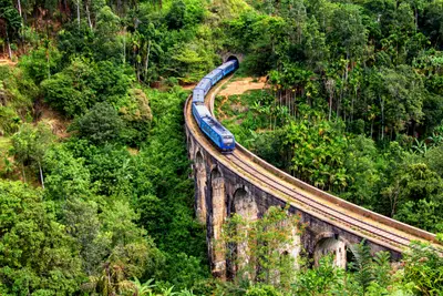
    Ella is a small town on the southeastern edge of the highlands and the region's most popular hiking base. From here, you can reach the Nine Arches Bridge, Little Adam's Peak, and Ella Rock on foot; the railway line from Nanu Oya ends here for many travelers.Life revolves around the main street between the train station and bus stop, where cafés, restaurants, and bars line up. East of the town lies the area around the Nine Arches Bridge near Demodara, while to the south, the road leads down to the Ravana Falls towards Wellawaya.Since June 20, 2026, trains have been stopping in Ella again, after the Nanu Oya to Badulla section was closed for about seven months due to cyclone damage.
    Adam's Peak (Sri Pada)

    Adam's Peak (Sri Pada)

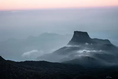
    Adam's Peak, in Sinhalese Sri Pada, is a 2,243-meter high conical mountain in the western highlands and one of the island's holiest sites. Between December and May, pilgrims and travelers ascend at night via around 5,500 steps to reach the summit by sunrise.Near the summit lies a 1.8-meter long rock imprint, revered by Buddhists as the footprint of Buddha, by Hindus as that of Shiva, by Christians as that of Saint Thomas, and by Muslims as Adam's. At sunrise, the mountain casts a triangular shadow over the surrounding area, which rapidly shortens as the sun rises higher.Six paths lead up, with the ascent from Dalhousie (Nallathanni) near Hatton being the most frequently used, alongside the path from Ratnapura via Palabaddala.
    Kandy

    Kandy

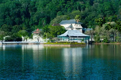
    Kandy is the last royal city of Sri Lanka and the country's religious center, nestled in the hills at the northern edge of the highlands. You come here for the Temple of the Tooth, the Esala Perahera in August, and as a starting point for tea country and train journeys south.The center is situated around Kandy Lake, which King Sri Wickrama Rajasinghe had built between 1807 and 1812 next to the Temple of the Tooth. North of the lake lies the Udawattakele forest slope, while in the west of the old town, a white Buddha statue rises above the city on Bahirawakanda Hill. The commercial streets around Dalada Veediya and Raja Veediya (Kings Street) form the bazaar area.Outside the city are the Peradeniya Botanical Garden and the Tea Museum in the Hanthana Hills. Kandy train station is currently cut off from the highland section; destinations in the south you reach by bus or car (as of October 2026).

    Sources & method

    • Photos: Unsplash, Google Maps. Each photo carries its credit.
    • Place data such as addresses and ratings comes from Google Maps.
    • The content is based on web research from public, traceable sources. How the content is made · The role of AI