Fernweh: Home
    ExploreTravel GuidesPlan a tripMy tripLast visited
    de|en
    All Places & RegionsAll highlightsAbout FernwehFAQPrivacy PolicyImprint
    ExploreTravel GuidesPlan a tripMy tripLast visited
    • Overview
    • Places in the region
    • Round trips
    • Nearby
    Kandy & Highlands

    Sri Lanka

    Kandy & Highlands

    Region

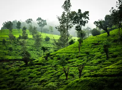
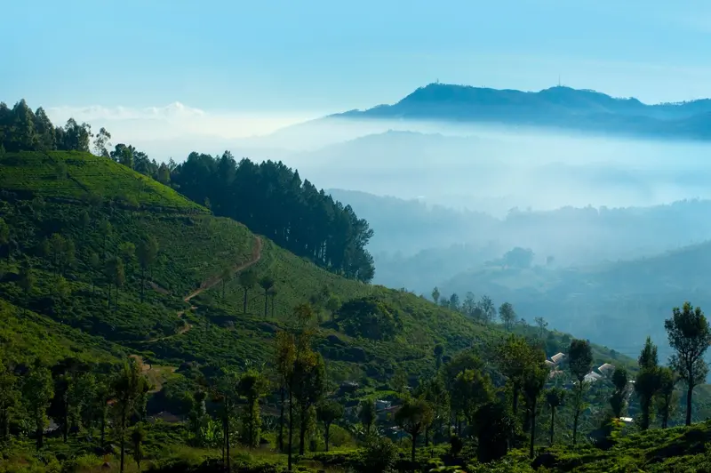
    The central highlands are Sri Lanka's cool heart: From the ancient royal city of Kandy, roads and railway lines ascend into tea country, cloud forests, and plateaus at around 2,000 meters.

    by Felix Gillen

    1. Home
    2. Destinations
    3. Sri Lanka
    4. Kandy & Highlands
    The central highlands are Sri Lanka's cool heart: From the ancient royal city of Kandy, roads and railway lines ascend into tea country, cloud forests, and plateaus at around 2,000 meters. For those seeking a change from beaches and the Cultural Triangle, this area offers hiking trails, tea factories, and one of Asia's most famous railway lines.Kandy, with its Temple of the Tooth, is the religious center of Sinhalese Buddhism. Further south are colonial Nuwara Eliya, the hiking towns of Ella and Haputale, Horton Plains National Park with World's End cliff, and the pilgrim mountain Adam's Peak.The railway connection through the highlands was interrupted for months after Cyclone Ditwah. Since June 2026, trains have been running again between Nanu Oya and Badulla, but from Kandy, the journey currently still goes by road (as of October 2026).
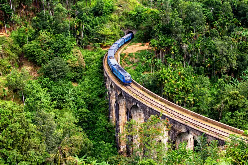
    The region stretches from Kandy in the north to the southern edge of the Highlands near Haputale. Kandy is the starting point for the Temple of the Tooth, the Esala Perahera, and the Peradeniya Botanical Garden. Nuwara Eliya lies at 1,868 meters and is considered the country's most important tea production center. The city was founded in 1846 by Samuel Baker and is nicknamed "Little England" due to its British villas.Ella is the hiking hub, featuring the Nine Arches Bridge, Little Adam's Peak, and Ella Rock. Haputale offers some of the most expansive views over the tea plantations from Lipton's Seat. Horton Plains National Park, at around 2,000 meters, is the island's only protected area where you are permitted to walk the marked trails without a guide. Adam's Peak (2,243 m) is the destination for nocturnal pilgrim ascents between December and May.For travel between these places, it's best to plan a combination of train and road: Kandy to Nuwara Eliya is 75 kilometers, and the bus takes about four hours. From Nanu Oya, Nuwara Eliya's train station, the train continues to Ella (approximately 2 to 2.5 hours).
    Adam's Peak (Sri Pada)

    Place 1 of 4

    Adam's Peak (Sri Pada)

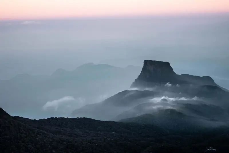
    Adam's Peak, in Sinhalese Sri Pada, is a 2,243-meter high conical mountain in the western highlands and one of the island's holiest sites. Between December and May, pilgrims and travelers ascend at night via around 5,500 steps to reach the summit by sunrise.

    Discover
    Ella

    Place 2 of 4

    Ella

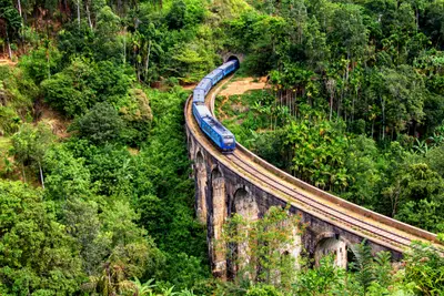
    Ella is a small town on the southeastern edge of the highlands and the region's most popular hiking base. From here, you can reach the Nine Arches Bridge, Little Adam's Peak, and Ella Rock on foot; the railway line from Nanu Oya ends here for many travelers.

    Discover
    Nuwara Eliya

    Place 3 of 4

    Nuwara Eliya

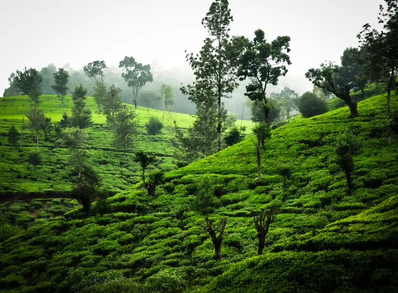
    Nuwara Eliya is located at 1,868 meters in the heart of the tea country and is the most important center for Sri Lankan tea production.

    Discover
    Horton Plains National Park
    A.Savin / Wikimedia Commons / FAL

    Place 4 of 4

    Horton Plains National Park

    Horton Plains National Park is a high plateau at around 2,000 meters, approximately 20 kilometers south of Nuwara Eliya and 20 kilometers west of Haputale.

    Discover

    More places in Kandy & Highlands

    Kandy

    Kandy

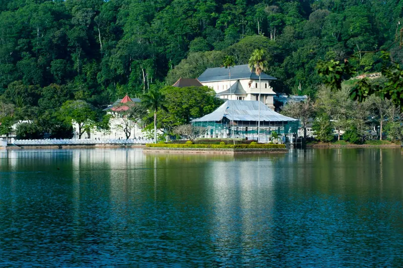
    Kandy is the last royal city of Sri Lanka and the country's religious center, nestled in the hills at the northern edge of the highlands. You come here for the Temple of the Tooth, the Esala Perahera in August, and as a starting point for tea country and train journeys south.The center is situated around Kandy Lake, which King Sri Wickrama Rajasinghe had built between 1807 and 1812 next to the Temple of the Tooth. North of the lake lies the Udawattakele forest slope, while in the west of the old town, a white Buddha statue rises above the city on Bahirawakanda Hill. The commercial streets around Dalada Veediya and Raja Veediya (Kings Street) form the bazaar area.Outside the city are the Peradeniya Botanical Garden and the Tea Museum in the Hanthana Hills. Kandy train station is currently cut off from the highland section; destinations in the south you reach by bus or car (as of October 2026).
    Haputale

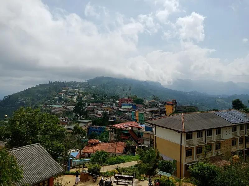
    Haputale

    Haputale is a mountain town on the southern edge of the Highlands, west of Ella, situated on a narrow ridge above tea slopes. You come for Lipton's Seat, the Dambatenne tea factory, and Adisham Monastery, all reachable on day trips.The small town center, with its train station, bus stand, and simple eateries, stretches along the ridge. To the east, the road leads through the Dambatenne plantations up to Lipton's Seat; to the west, Adisham Monastery lies in the forests.Haputale is located on the Highland Line, where trains have been running again between Nanu Oya and Badulla since June 2026.
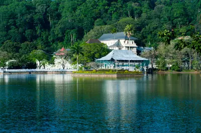
    Round trips through this region

    Classic Tour: Culture Triangle, Highlands and South Coast

    Classic Tour: Culture Triangle, Highlands and South Coast

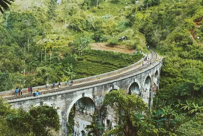
    The classic route connects the old royal cities in the north of the island's center with Kandy, the tea mountains around Nuwara Eliya and Ella, a national park in the south, and the beaches between Mirissa and Galle. It is best suited from December to March.

    15 Days
    9 stops

    Nearby

    Kandy

    Kandy

    Kandy is the last royal city of Sri Lanka and the country's religious center, nestled in the hills at the northern edge of the highlands. You come here for the Temple of the Tooth, the Esala Perahera in August, and as a starting point for tea country and train journeys south.The center is situated around Kandy Lake, which King Sri Wickrama Rajasinghe had built between 1807 and 1812 next to the Temple of the Tooth. North of the lake lies the Udawattakele forest slope, while in the west of the old town, a white Buddha statue rises above the city on Bahirawakanda Hill. The commercial streets around Dalada Veediya and Raja Veediya (Kings Street) form the bazaar area.Outside the city are the Peradeniya Botanical Garden and the Tea Museum in the Hanthana Hills. Kandy train station is currently cut off from the highland section; destinations in the south you reach by bus or car (as of October 2026).
    Nuwara Eliya

    Nuwara Eliya

    Nuwara Eliya is located at 1,868 meters in the heart of the tea country and is the most important center for Sri Lankan tea production. Founded by Samuel Baker in 1846, the city, with its British villas, is nicknamed "Little England" and serves as a base for tea factories, Horton Plains National Park, and onward train journeys to Ella.The city center is built around Victoria Park and the red-brick post office building from 1894. To its south is Gregory Lake with its park, and colonial hotels like the Grand Hotel and the Hill Club line Grand Hotel Road.The city's train station is Nanu Oya, approximately 10 kilometers west of the center. Since June 2026, trains have again run from there to Ella and Badulla.
    Dambulla

    Dambulla

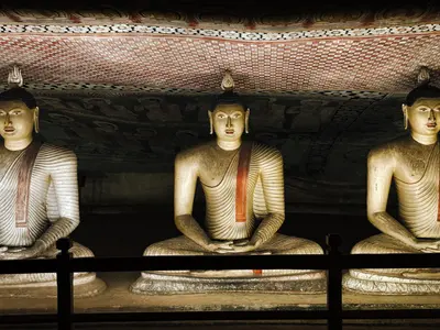
    Dambulla is a market town in the heart of the Cultural Triangle, renowned for its cave temple featuring 153 Buddha statues and approximately 2,100 square meters of wall paintings. Situated on the main road to Anuradhapura and close to Sigiriya, the town also serves as a convenient transport hub for the region.The cave temple is located at the foot and on the flank of a rock that rises 150 to 160 meters above the plain. Below it stands the golden Buddha statue of the newer temple and museum complex, separate from the historic site. The town center, with its bus station and shops, stretches along the main thoroughfares, while to the southwest, on the road to Kurunegala, lie the megalithic tombs of Ibbankatuwa.According to tradition, King Valagamba found refuge in the caves for 15 years in the 1st century BCE and later had them converted into a temple. Since 1991, the complex has been a UNESCO World Heritage site.
    Horton Plains National Park

    Horton Plains National Park

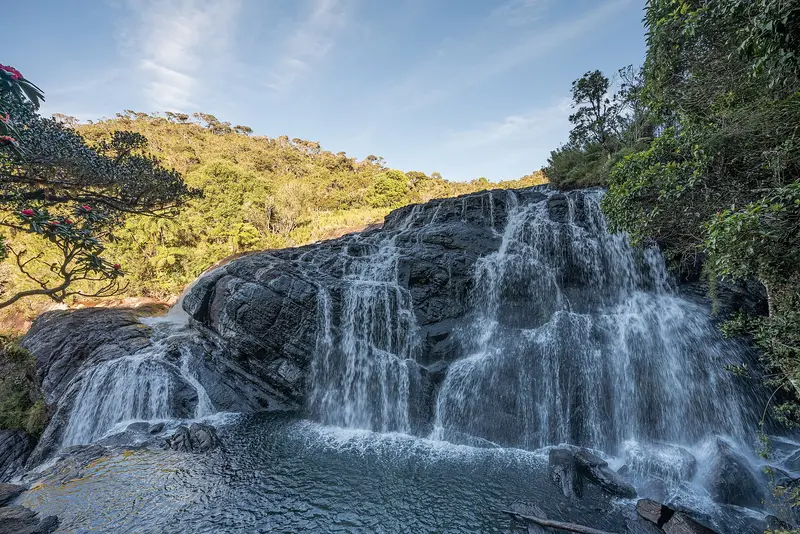
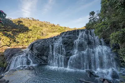
    Horton Plains National Park is a high plateau at around 2,000 meters, approximately 20 kilometers south of Nuwara Eliya and 20 kilometers west of Haputale. It is known for its circular trail to World's End cliff and Baker's Falls, the only national park trail in Sri Lanka you are allowed to hike without a guide.The 3,160-hectare park lies between Kirigalpotta and Totapola, the island's second and third highest peaks. Highland forest and wet grassland characterize the landscape, with an average temperature of about 16 degrees. Sambar deer are most frequently encountered, but wild boars and leopards also live here.It’s worth setting off early: From late morning onwards, clouds often roll in and obscure the view from World’s End.
    Ella

    Ella

    Ella is a small town on the southeastern edge of the highlands and the region's most popular hiking base. From here, you can reach the Nine Arches Bridge, Little Adam's Peak, and Ella Rock on foot; the railway line from Nanu Oya ends here for many travelers.Life revolves around the main street between the train station and bus stop, where cafés, restaurants, and bars line up. East of the town lies the area around the Nine Arches Bridge near Demodara, while to the south, the road leads down to the Ravana Falls towards Wellawaya.Since June 20, 2026, trains have been stopping in Ella again, after the Nanu Oya to Badulla section was closed for about seven months due to cyclone damage.

    Sources & method

    • Photos: Pexels. Each photo carries its credit.
    • The content is based on web research from public, traceable sources. How the content is made · The role of AI