Fernweh: Home
ExploreGuideDestinationsMy tripsMy trip
de|en
All Places & RegionsRound tripsNight trains in EuropeAll highlightsAbout FernwehFAQPrivacy PolicyImprint
Download on the App StoreGet it on Google Play
ExploreGuideDestinationsMy tripsMy trip
    • Places in the region
    • Culture
    • Getting around
    • Nearby
    Volcano, Rainforest and Coasts of St. Vincent

    DavidMPyle / Wikimedia Commons / CC BY-SA 4.0, mod.

    St. Vincent and the Grenadines

    Volcano, Rainforest and Coasts of St. Vincent

    Region

    Outside Kingstown, St. Vincent is mountainous and green.

    by Felix Gillen

    1. Home
    2. Destinations
    3. St. Vincent and the Grenadines
    4. Volcano, Rainforest and Coasts of St. Vincent
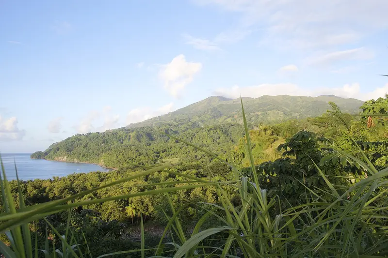
    Outside Kingstown, St. Vincent is mountainous and green. To the north rises the La Soufrière volcano, which last erupted in April 2021, the island's interior is rainforest, while the Leeward Coast in the west and the Windward Coast in the east feature fishing villages and black lava beaches.What to ExpectThe Windward Trail from Rabacca reopened in December 2024 and leads to the crater rim in about two hours. On the Vermont Nature Trail, with some luck, you might spot the St. Vincent Amazon parrot; on the Leeward Coast, the Dark View Falls plunge down in two stages; and at the northern tip, the Owia Salt Pond lies behind a lava reef.
    St. Vincent and the Grenadines travel guideRound trips in St. Vincent and the GrenadinesPlan a trip with Volcano, Rainforest and Coasts of St. Vincent

    Contents

    • Places in the region
    • Culture
    • Getting around
    • Nearby

    Sights in Volcano, Rainforest and Coasts of St. Vincent

    Discover the most important sights and attractions

    Natural Feature

    La Soufrière

    The active volcano in the north, approximately 1,220 to 1,234 m high, last erupted in April 2021, and almost 20,000 people were evacuated. Since March 2022, the alert level has been green. The Windward Trail from Rabacca has been open again since December 16, 2024; the ascent takes approximately two hours. The National Park Authority requires a guide, and international visitors pay US$5 since February 2025.
    Open in Google Maps
    Park

    Dark View Falls

    Two tiered waterfalls on a tributary of the Richmond River on the Leeward Coast, approximately 38 km or 1.5 hours drive from Kingstown. Access the pools via a bamboo bridge; a visitor centre and National Park Authority ticket booth are available on site.
    Open in Google Maps
    Park

    Owia Salt Pond

    Natural saltwater pool at the northern tip of the island, separated from the open Atlantic by a lava reef. 217 steps lead down to the bathing pools. The National Park Authority charges an entrance fee.
    Open in Google Maps
    National Park

    Layou Petroglyph Park

    Rock carvings from around 300 to 600 AD on the Leeward Coast, about 30 minutes north of Kingstown. The site is on the UNESCO Tentative List.
    Open in Google Maps
    Point of Interest

    Vermont Nature Trail

    A roughly 3.5 km loop trail through the island's interior rainforest, north of Kingstown, with a viewpoint. According to park officials, you'll likely see the St. Vincent Amazon parrot here, its national bird.
    Open in Google Maps
    Garden

    Montreal Gardens

    A 3-hectare garden in Mesopotamia Valley, approx. 19 km from Kingstown, redesigned by landscape architect Timothy Vaughn. Fodor's: closed weekends.
    Open in Google Maps

    Nature and History

    The 2021 EruptionFrom late December 2020, a lava dome grew in the crater, and on April 9, 2021, the explosive phase began. Nearly 20,000 people were evacuated, some onto cruise ships. Since March 2022, the lowest alert level, Green, has been in effect.Traces of the PastIn Layou Petroglyph Park, rock carvings dating from around 300 to 600 AD are preserved. Wallilabou Bay on the Leeward Coast was the filming location for "Pirates of the Caribbean" in 2003.

    On the Go and Practice

    Getting ThereFrom Kingstown, the Leeward Coast (featuring Layou and Dark View Falls, approx. 1.5 hours) and the Windward Coast (with Rabacca) are accessible by rental car, taxi, or minibus. Be aware of left-hand traffic on narrow, winding roads.Volcano HikeLa Soufrière is an active volcano. Before ascending, check the status with NEMO and the UWI Seismic Research Centre.Windward Trail from Rabacca: open since Dec 16, 2024, approx. two hours ascent, guide mandatory per National Park Authority.Fee (effective February 1, 2025): international visitors US$5, payable at National Park Office, Stoney Ground, or Black Point.The longer Leeward Trail from Richmond has no official re-opening; check with the National Parks Authority.

    Nearby

    Kingstown

    Kingstown is the capital of St. Vincent and the Grenadines and is located on a bay in the southwest of the main island. This is where ferries depart for the Grenadines, and the market and cathedrals define its center.What to expectOn the outskirts lies the Botanical Garden, founded in 1765, which is considered the oldest in the Western Hemisphere. From Fort Charlotte on Berkshire Hill, approximately 180 m above sea level, you can look out over the city to the Grenadines.
    Bequia

    Bequia

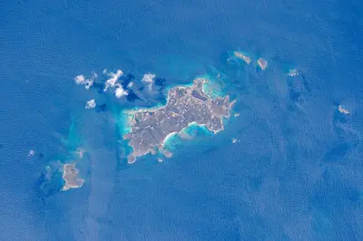
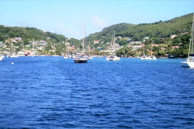
    Bequia is the largest of the Grenadines of St. Vincent, located approximately 14 km south of the main island, about an hour by ferry from Kingstown. Around 4,500 people live here; its main town is Port Elizabeth on Admiralty Bay, where yachts from across the region anchor.What to expectCafes, restaurants, and workshops for model sailboats line the Belmont Walkway; the tourism authority calls Bequia the capital of model boats. South of Port Elizabeth are Princess Margaret Beach and Lower Bay. Bequia is one of the few communities in the world permitted to conduct small-scale traditional whaling, using hand-thrown harpoons from open sailboats.

    Ulises Icardi·CC BY-SA 4.0

    Mustique

    Mustique

    Mustique is a private island of approximately 570 ha, located south of Bequia. Colin Tennant bought it in 1958. Since 1968, it has been owned and managed by the Mustique Company, which has an agreement with the government limiting private homes to a maximum of 140.What to expectThe island is primarily known for its villas and celebrity guests. In 1960, Tennant gifted Princess Margaret a plot for her wedding; Mustique has had a small airport since 1969. The Mustique Blues Festival is held in January.

    NASA/Tim Kopra·public domain

    Vieux Fort and South Coast

    Vieux Fort and South Coast

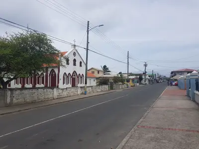
    Vieux Fort on St. Lucia's southern tip is the location of Hewanorra International Airport, which developed from a US World War II airfield. In the 18th and 19th centuries, the area was a hub for sugar production; today, it's where island beer Piton is brewed.Above the town, the lighthouse on Moule à Chique offers views over the south coast. Offshore lies the Maria Islands Nature Reserve, and Kitesurfers gather at Sandy Beach.

    Enrevseluj·CC BY-SA 4.0

    Soufrière and the Pitons

    Soufrière and the Pitons

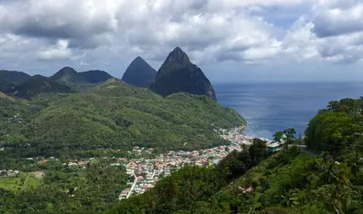
    Soufrière is why most people travel to St. Lucia: This town on the west coast lies at the foot of the two Pitons, which, along with Sulphur Springs, rainforest, and reefs, form the Pitons Management Area, a UNESCO World Heritage site since 2004. All around, you'll find hot springs, waterfalls, old plantations, and bathing coves like Anse Chastanet and Sugar Beach.You can climb Gros Piton with a certified guide; Sulphur Springs are described by the tourism office as a “drive-in volcano.”

    Simon Hurry·Pexels

    Your next steps

    Volcano, Rainforest and Coasts of St. Vincent is in St. Vincent and the Grenadines. Ways to carry on from here.

    • More in St. Vincent and the Grenadines

      Highlights, areas, routes and the best time to travel for all of St. Vincent and the Grenadines.

      St. Vincent and the Grenadines travel guide
    • Round trips in St. Vincent and the Grenadines

      Ready-made routes through St. Vincent and the Grenadines, with stops, nights and a map.

      See the routes
    • Plan a trip with Volcano, Rainforest and Coasts of St. Vincent

      The Guide asks about season, length and who is coming, and suggests a trip with Volcano, Rainforest and Coasts of St. Vincent.

      Plan the trip

    Sources & method

    • Photos: Wikimedia Commons. Each photo carries its credit.
    • Place data such as addresses and ratings comes from Google Maps.
    • The content is based on web research from public, traceable sources. How the content is made · The role of AI