Fernweh: Home
ExploreGuideDestinationsMy tripsMy trip
de|en
All Places & RegionsRound tripsNight trains in EuropeAll highlightsAbout FernwehFAQPrivacy PolicyImprint
Download on the App StoreGet it on Google Play
ExploreGuideDestinationsMy tripsMy trip
    • Places in the region
    • Getting around
    • Nearby
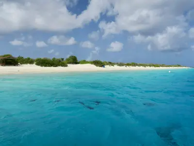
    Morrocoy National Park

    “Cayo Sombrero Morrocoy” by Hector Henriquez / Wikimedia Commons / CC BY-SA 3.0, mod.

    Venezuela

    Morrocoy National Park

    Region

    For this area, the FCDO advises against travel unless it is essential. Check the FCDO travel advice, linked on the country page, before planning.

    by Felix Gillen

    1. Home
    2. Destinations
    3. Venezuela
    4. Morrocoy National Park
    For this area, the FCDO advises against travel unless it is essential. Check the FCDO travel advice, linked on the country page, before planning.Morrocoy National Park on the Caribbean coast of Falcón state has protected cays, mangroves and coral reefs since 1974. It is about four hours by car from Caracas, which makes it the classic beach destination on the mainland.The gateways are Tucacas and Chichiriviche, from where boats run to cays such as Cayo Sombrero and Cayo Sal. Since February 2026 visitors have had to register via an app.
    Venezuela travel guideRound trips in VenezuelaPlan a trip with Morrocoy National Park

    Contents

    • Places in the region
    • Getting around
    • Nearby

    Sights in Morrocoy National Park

    Discover the most important sights and attractions

    Natural Feature

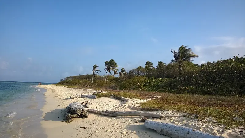
    Cayo Sal

    Besides Cayo Sombrero, it's the park's most famous Cayo, accessible by boat from Tucacas or Chichiriviche. As of February 2026, visitors must register via an app, and strict anchoring rules apply to boats.
    Open in Google Maps
    Attraction

    Cayo Sombrero

    One of the National Park's best-known cayos, with sand beaches and reefs; boats from Tucacas and Chichiriviche. Bring water, sun protection, leave no trash, and don't touch corals.
    Open in Google Maps
    Park

    Wildlife Conservation Refuge Cuare

    The wildlife sanctuary at Chichiriviche, bordering the National Park, has been designated a Ramsar Wetland since 1988. Its lagoons are home to American Flamingos.
    Open in Google Maps
    Attraction

    Cueva del Indio

    The rock overhang at Cerro Chichiriviche above the Golfete de Cuare is the remnant of a karst cave and features rock carvings. You reach it by boat from Chichiriviche, then via a wooden boardwalk and a marked path. Nearby is the Cueva de la Virgen, a pilgrimage site.
    Open in Google Maps
    Natural Feature

    Cayo Punta Brava

    The Cayo is closest to the coast near Tucacas and is the only one accessible by car via a bridge. This makes it the easiest swimming option in the park if you don't want to take a boat.
    Open in Google Maps

    Getting Here and Around

    Getting ThereDriving from Caracas to Tucacas takes 3.5 to 4 hours. Tucacas and Chichiriviche are the departure points; boats to the Cayos leave from both.Rules and Travel SeasonFrom February 2026, visitors must register via an app; strict anchoring rules apply to boats.The dry season (December-April) is most favorable.Bring sunscreen and water, leave no trash, and do not touch corals.

    Nearby

    Nationalpark Henri Pittier und Choroní

    For this area, the FCDO advises against travel unless it is essential. Check the FCDO travel advice, linked on the country page, before planning.Henri Pittier National Park in Aragua state was established in 1937 as Venezuela's first national park and covers around 1,078 km², from the cloud forests of the coastal range down to the Caribbean. With around 580 recorded bird species, it is regarded as one of the richest birding areas in the country.Roads cross the mountains from Maracay to the coast: to Choroní with its colonial village and the fishing village of Puerto Colombia, and to Bahía de Cata.
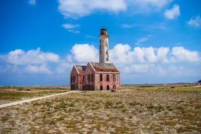
    Little Curaçao

    Little Curaçao

    The uninhabited island of Klein Curaçao lies, according to Lonely Planet, about 24 km off the southeast coast and is only accessible by excursion boats. The open-sea crossing is often rough, Lonely Planet states.

    Timon Cornelissen·Pexels

    The South: Salt Pans and Lac Bay

    The South: Salt Pans and Lac Bay

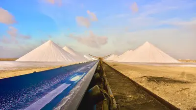
    Bonaire's flat south is characterized by salt pans. Along the coast stand small stone huts from the mid-19th century, where enslaved salt workers were housed. On the east coast lies the shallow Lac Bay with Sorobon Beach, known to windsurfers.

    Pascal Ingelrest·Pexels

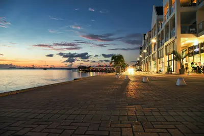
    Kralendijk

    Kralendijk

    Kralendijk is Bonaire's capital and is located on the sheltered west coast, opposite the uninhabited island of Klein Bonaire. Most of the island's restaurants, dive shops, and stores are found here.From the shore, water taxis depart for Klein Bonaire; the crossing takes about ten minutes. The marine park's dive sites along the coast are recognizable by yellow stones at the roadside.

    Steve Phillips·Unsplash

    Klein Bonaire

    Klein Bonaire

    The uninhabited island is located approximately 800 meters off Kralendijk and is part of Bonaire's Marine Park. A water taxi will take you across in about ten minutes, for snorkeling and diving on the reefs around the island. You'll need the STINAPA Nature Fee for your visit.

    Stephan van de Schootbrugge·Unsplash

    Your next steps

    Morrocoy National Park is in Venezuela. Ways to carry on from here.

    • More in Venezuela

      Highlights, areas, routes and the best time to travel for all of Venezuela.

      Venezuela travel guide
    • Round trips in Venezuela

      Ready-made routes through Venezuela, with stops, nights and a map.

      See the routes
    • Plan a trip with Morrocoy National Park

      The Guide asks about season, length and who is coming, and suggests a trip with Morrocoy National Park.

      Plan the trip
    Sources & method

    • Photos: Wikimedia Commons. Each photo carries its credit.
    • Place data such as addresses and ratings comes from Google Maps.
    • The content is based on web research from public, traceable sources. How the content is made · The role of AI